
Williamsburg
200 W Galbraith Rd,
Cincinnati, OH 45215
$843 - $2,765
Studio - 3 Beds

Bedrooms
1 bd
Bathrooms
1 ba
Square Feet
450 sq ft
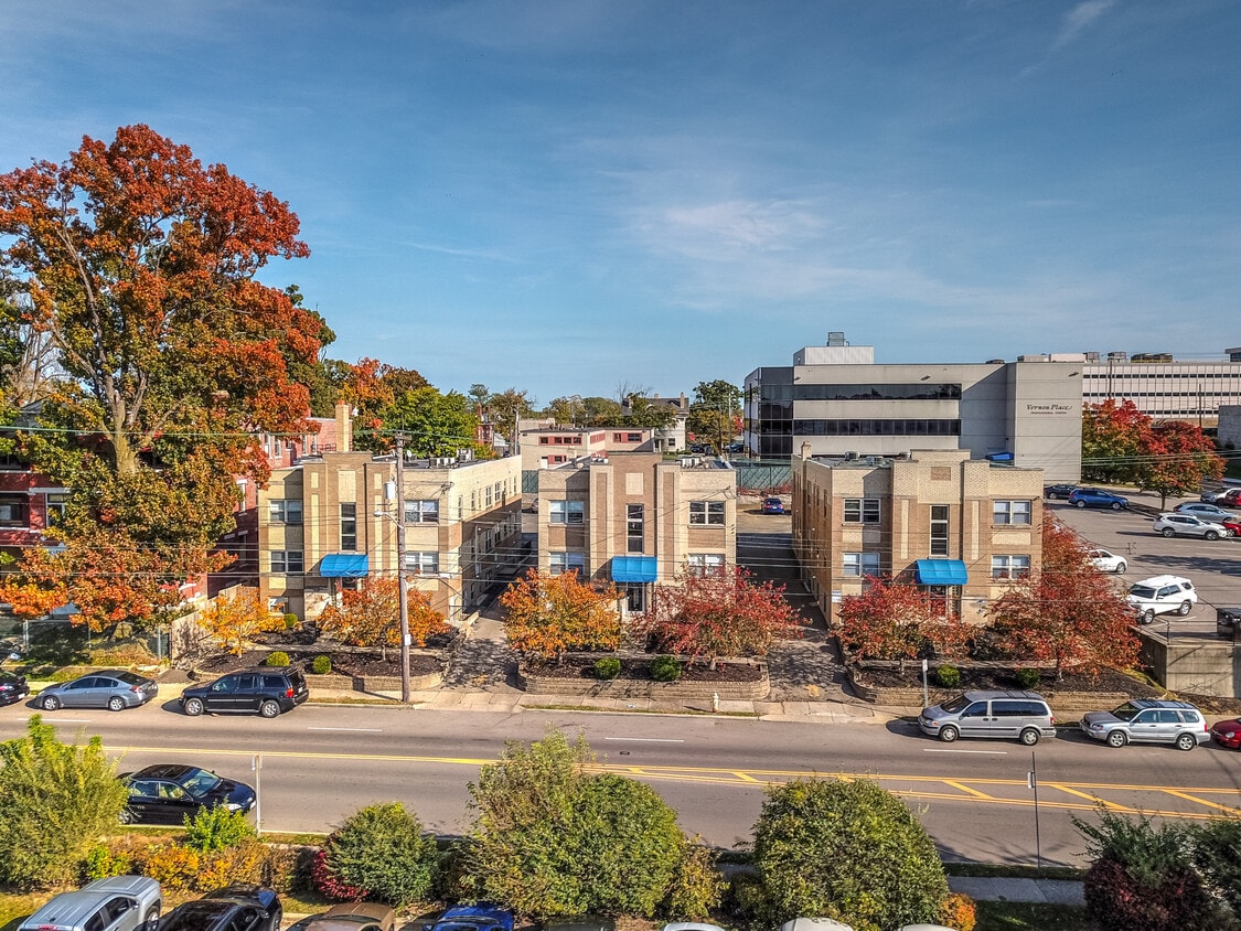
Welcome to comfortable living! These apartments at 2920-2928 Burnet feature dual kitchen sinks, dishwasher, extra storage and reserved parking. Located just 2-5 blocks from University Hospital, Children's Hospital, and The University of Cincinnati's medical campus. All units are 1 bedroom.
Welcome to comfortable living! These apartments at 2920-2928 Burnet feature dual kitchen sinks, dishwasher, extra storage and reserved parking. Located just 2-5 blocks from University Hospital, Children's Hospital, and The University of Cincinnati's medical campus. All units are 1 bedroom.
2920-2928 Burnet Avenue is an apartment community located in Hamilton County and the 45219 ZIP Code. This area is served by the Cincinnati Public Schools attendance zone.
Unique Features
Air Conditioning
Dishwasher
High Speed Internet Access
Refrigerator
If you’re looking for a rental with all the conveniences of the city but could do without the hustle and bustle, look no further than Uptown Cincinnati. Stretching along I-71 from East McMillan St. up towards Blair Ave., Uptown Cincy is home to venerable apartment complexes that are full of character, and newer developments offering plenty of amenities.
Uptown Cincinnati remains a very walkable locale. Check out eclectic spots like Mecklenburg Gardens, serving traditional German food complete with a beer garden, or the Video Archive, an old-school video rental shop with a craft bar attached.
The University of Cincinnati sits just west of Uptown, making it a perfect fit for students. With I-71 nearby, the center of the city is just a few minutes away.
Learn more about living in Uptown CincinnatiCompare neighborhood and city base rent averages by bedroom.
| Uptown Cincinnati | Cincinnati, OH | |
|---|---|---|
| Studio | - | $1,073 |
| 1 Bedroom | $767 | $1,135 |
| 2 Bedrooms | - | $1,424 |
| 3 Bedrooms | - | $1,731 |
| Colleges & Universities | Distance | ||
|---|---|---|---|
| Colleges & Universities | Distance | ||
| Walk: | 12 min | 0.6 mi | |
| Walk: | 14 min | 0.7 mi | |
| Drive: | 7 min | 2.3 mi | |
| Drive: | 10 min | 3.4 mi |


Transportation options available in Cincinnati include Findlay Market-Race Station - Race & Elder, located 1.9 miles from 2920-2928 Burnet Avenue. 2920-2928 Burnet Avenue is near Cincinnati/Northern Kentucky International, located 16.7 miles or 31 minutes away.
| Transit / Subway | Distance | ||
|---|---|---|---|
| Transit / Subway | Distance | ||
| Drive: | 5 min | 1.9 mi | |
| Drive: | 6 min | 2.0 mi | |
| Drive: | 6 min | 2.0 mi | |
| Drive: | 6 min | 2.1 mi | |
| Drive: | 7 min | 2.4 mi |
| Commuter Rail | Distance | ||
|---|---|---|---|
| Commuter Rail | Distance | ||
|
|
Drive: | 10 min | 3.3 mi |
| Airports | Distance | ||
|---|---|---|---|
| Airports | Distance | ||
|
Cincinnati/Northern Kentucky International
|
Drive: | 31 min | 16.7 mi |
Scores provided by
Traffic
-Airport
-Businesses
-Scores provided by
HowLoud What is a Sound Score Rating? A Sound Score Rating aggregates noise caused by vehicle traffic, airplane traffic and local sources. How It WorksTime and distance from 2920-2928 Burnet Avenue.
| Shopping Centers | Distance | ||
|---|---|---|---|
| Shopping Centers | Distance | ||
| Drive: | 5 min | 2.1 mi | |
| Drive: | 6 min | 2.4 mi | |
| Drive: | 8 min | 2.6 mi |
| Parks and Recreation | Distance | ||
|---|---|---|---|
| Parks and Recreation | Distance | ||
|
Cincinnati Zoo and Botanical Garden
|
Walk: | 19 min | 1.0 mi |
|
Trailside Nature Center
|
Drive: | 3 min | 1.1 mi |
|
Burnet Woods
|
Drive: | 4 min | 1.3 mi |
|
William H. Taft National Historic Site
|
Drive: | 4 min | 1.4 mi |
|
Eden Park
|
Drive: | 6 min | 2.2 mi |
| Hospitals | Distance | ||
|---|---|---|---|
| Hospitals | Distance | ||
| Walk: | 6 min | 0.3 mi | |
| Walk: | 6 min | 0.3 mi | |
| Walk: | 10 min | 0.5 mi |
| Military Bases | Distance | ||
|---|---|---|---|
| Military Bases | Distance | ||
| Drive: | 69 min | 51.8 mi | |
| Drive: | 75 min | 56.9 mi | |
| Drive: | 78 min | 60.2 mi |
What Are Walk Score®, Transit Score®, and Bike Score® Ratings?
Walk Score® measures the walkability of any address. Transit Score® measures access to public transit. Bike Score® measures the bikeability of any address.
What is a Sound Score Rating?
A Sound Score Rating aggregates noise caused by vehicle traffic, airplane traffic and local sources.
2920-2928 Burnet Ave
Cincinnati, OH 45219


