
$3,000 / Month
29 Freeman St Unit 7
Stoughton, MA 02072
Today
Favorites
617-645-7000
-
Bedrooms
3
-
Bathrooms
1
-
Square Feet
1,118 sq ft
-
Available
Available Now
Highlights
- Medical Services
- Property is near public transit
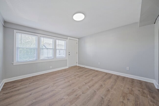
- Wood Flooring
- Cooling Available
- Shops
- Forced Air Heating System
29 Freeman St Unit 7

Favorites
About This Home
$3,000 deposit,
Available Now
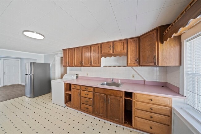
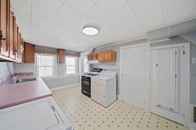
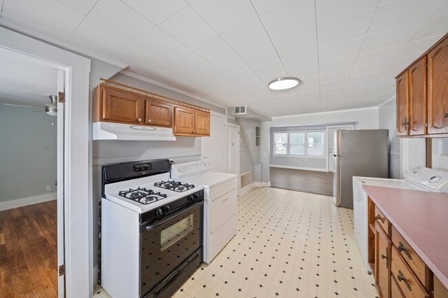
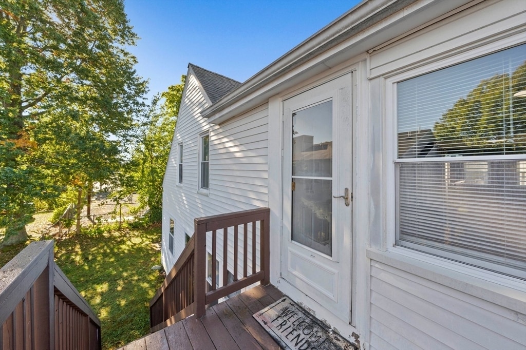
Location! Location! Location! Prime downtown location. This 2nd floor 3 bedroom apartment is two minutes from the train station,local transit,post office,and downtown shopping. On site security cameras. Central air conditioning. Gas stove and dryer. Two reserved off street parking spots. An 8’x8’ deck. Newly renovated hardwood flooring in all 3 bedrooms. Fully tiled tub-shower. Onsite maintenance including trash removal,landscaping and snow removal. Much much more. Don't miss out. No Pets. No Smoking. MLS# 73384948
29 Freeman St is an apartment community located in Norfolk County and the 02072 ZIP Code.
* Price shown is base rent and may not include non-optional fees and utilities.
Price, availability, fees, and any applicable rent special are subject to change without notice.
* Square footage definitions vary. Displayed square footage is approximate.
Home Details
Year Built
Built in 1930
Accessible Home Design
Entry on the 2nd floor
Bedrooms and Bathrooms
Primary bedroom located on second floor
1 Full Bathroom
3 Bedrooms
Flooring
Wood
Vinyl
Home Design
Apartment
Interior Spaces
Ceiling Fan
1,118 Sq Ft Home
Kitchen
Range<<rangeHoodToken>>
Laundry
Dryer
Laundry on upper level
Washer
Listing and Financial Details
Security Deposit $3,000
12 Month Lease Term
Assessor Parcel Number 234573
Rent includes water, sewer, trash collection, snow removal, gardener
Location
Property is near public transit
Property is near schools
Parking
2 Car Parking Spaces
Utilities
Cooling Available
Forced Air Heating System
Heating System Uses Natural Gas
Community Details
Amenities
Medical Services
Shops
Overview
No Home Owners Association
Pet Policy
No Pets Allowed
Fees and Policies
The fees below are based on community-supplied data and may exclude additional fees and utilities.
Contact
- Listed by Eliot VanDam | Coldwell Banker Realty - Sharon
- Phone Number
-
Source
 MLS Property Information Network
The property listing data and information set forth herein were provided to MLS Property Information Network, Inc. from third party sources, including sellers, lessors and public records, and were compiled by MLS Property Information Network, Inc. The property listing data and information are for the personal, non-commercial use of consumers having a good faith interest in purchasing or leasing listed properties of the type displayed to them and may not be used for any purpose other than to identify prospective properties which such consumers may have a good faith interest in purchasing or leasing. MLS Property Information Network, Inc. and its subscribers disclaim any and all representations and warranties as to the accuracy of the property listing data and information set forth herein. All properties are subject to prior sale, change or withdrawal. Copyright © 2025 MLS Property Information Network, Inc. All rights reserved.
Location
Get Directions
Amenities
- Range
- Refrigerator
Education
| Colleges & Universities | Distance | ||
|---|---|---|---|
| Colleges & Universities | Distance | ||
| Drive: | 9 min | 5.1 mi | |
| Drive: | 10 min | 5.4 mi | |
| Drive: | 15 min | 7.7 mi | |
| Drive: | 16 min | 8.4 mi |
29 Freeman St Unit 7 is within 9 minutes or 5.1 miles from Massasoit C.C., Canton Campus. It is also near Stonehill College and Massasoit C.C., Brockton.
Transportation options available in Stoughton include Braintree Station, located 9.5 miles from 29 Freeman St Unit 7. 29 Freeman St Unit 7 is near General Edward Lawrence Logan International, located 20.4 miles or 36 minutes away, and Rhode Island Tf Green International, located 39.8 miles or 60 minutes away.
| Transit / Subway | Distance | ||
|---|---|---|---|
| Transit / Subway | Distance | ||
|
|
Drive: | 20 min | 9.5 mi |
|
|
Drive: | 18 min | 10.6 mi |
|
|
Drive: | 19 min | 11.0 mi |
|
|
Drive: | 19 min | 11.1 mi |
|
|
Drive: | 19 min | 11.4 mi |
| Commuter Rail | Distance | ||
|---|---|---|---|
| Commuter Rail | Distance | ||
|
|
Walk: | 5 min | 0.3 mi |
|
|
Drive: | 7 min | 3.8 mi |
|
|
Drive: | 9 min | 4.5 mi |
|
|
Drive: | 10 min | 5.3 mi |
|
|
Drive: | 10 min | 5.3 mi |
| Airports | Distance | ||
|---|---|---|---|
| Airports | Distance | ||
|
General Edward Lawrence Logan International
|
Drive: | 36 min | 20.4 mi |
|
Rhode Island Tf Green International
|
Drive: | 60 min | 39.8 mi |
Time and distance from 29 Freeman St Unit 7.
| Shopping Centers | Distance | ||
|---|---|---|---|
| Shopping Centers | Distance | ||
| Walk: | 7 min | 0.4 mi | |
| Walk: | 11 min | 0.6 mi | |
| Walk: | 15 min | 0.8 mi |
29 Freeman St Unit 7 has 3 shopping centers within 0.8 mile, which is about a 15-minute walk. The miles and minutes will be for the farthest away property.
| Parks and Recreation | Distance | ||
|---|---|---|---|
| Parks and Recreation | Distance | ||
|
Museum of American Bird Art at Mass Audubon
|
Drive: | 8 min | 4.1 mi |
|
Mass Audubon's Mildred Morse Allen Wildlife Sanctuary
|
Drive: | 8 min | 4.1 mi |
|
The Children's Museum in Easton
|
Drive: | 8 min | 5.1 mi |
|
Mass Audubon's Moose Hill Wildlife Sanctuary
|
Drive: | 15 min | 6.9 mi |
|
Borderland State Park
|
Drive: | 19 min | 8.4 mi |
29 Freeman St Unit 7 has 5 parks within 8.4 miles, including Museum of American Bird Art at Mass Audubon, Mass Audubon's Mildred Morse Allen Wildlife Sanctuary, and The Children's Museum in Easton.
| Hospitals | Distance | ||
|---|---|---|---|
| Hospitals | Distance | ||
| Drive: | 6 min | 3.1 mi | |
| Drive: | 14 min | 7.2 mi | |
| Drive: | 15 min | 8.4 mi |
29 Freeman St Unit 7 has 3 hospitals within 8.4 miles, the nearest is Good Samaritan Medical Center which is 3.1 miles away and a 6 minute drive.
You May Also Like
Similar Rentals Nearby


What Are Walk Score®, Transit Score®, and Bike Score® Ratings?
Walk Score® measures the walkability of any address. Transit Score® measures access to public transit. Bike Score® measures the bikeability of any address.
What is a Sound Score Rating?
A Sound Score Rating aggregates noise caused by vehicle traffic, airplane traffic and local sources
29 Freeman St
Stoughton, MA 02072