
-
AIRLINE OAKS - BLAIR AVE

-
-
$1,125
/ Month
29 E Airline Hwy
Kenner, LA 70062
2 Weeks Ago
Favorites
29 E Airline Hwy

Favorites
Check Back Soon for Upcoming Availability
| Beds | Baths | Average SF |
|---|---|---|
| 3 Bedrooms 3 Bedrooms 3 Br | 1 Bath 1 Bath 1 Ba | 840 SF |
About This Property
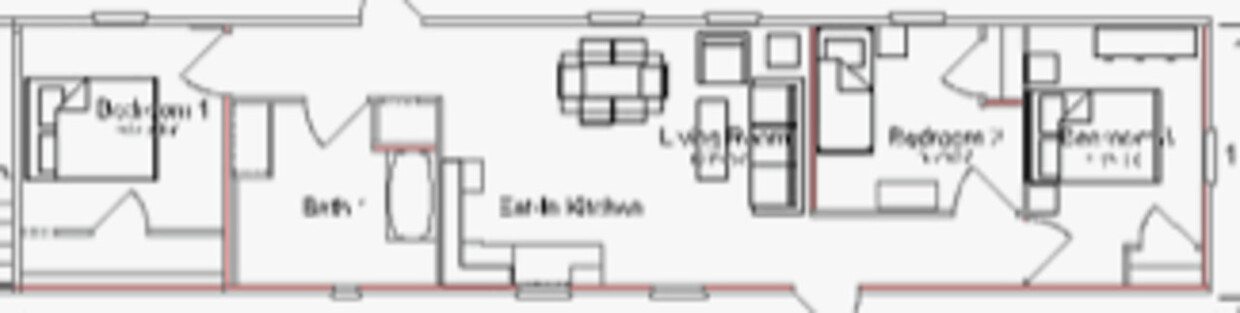
Three bedroom, one bath mobile home. Water, sewer & garbage are included in rental rate. Electric can be included for an increased rental rate of $1400.00 (deposit would also increase to $1400.00) Washer & dryer rentals available for an additional $50.00 per month.
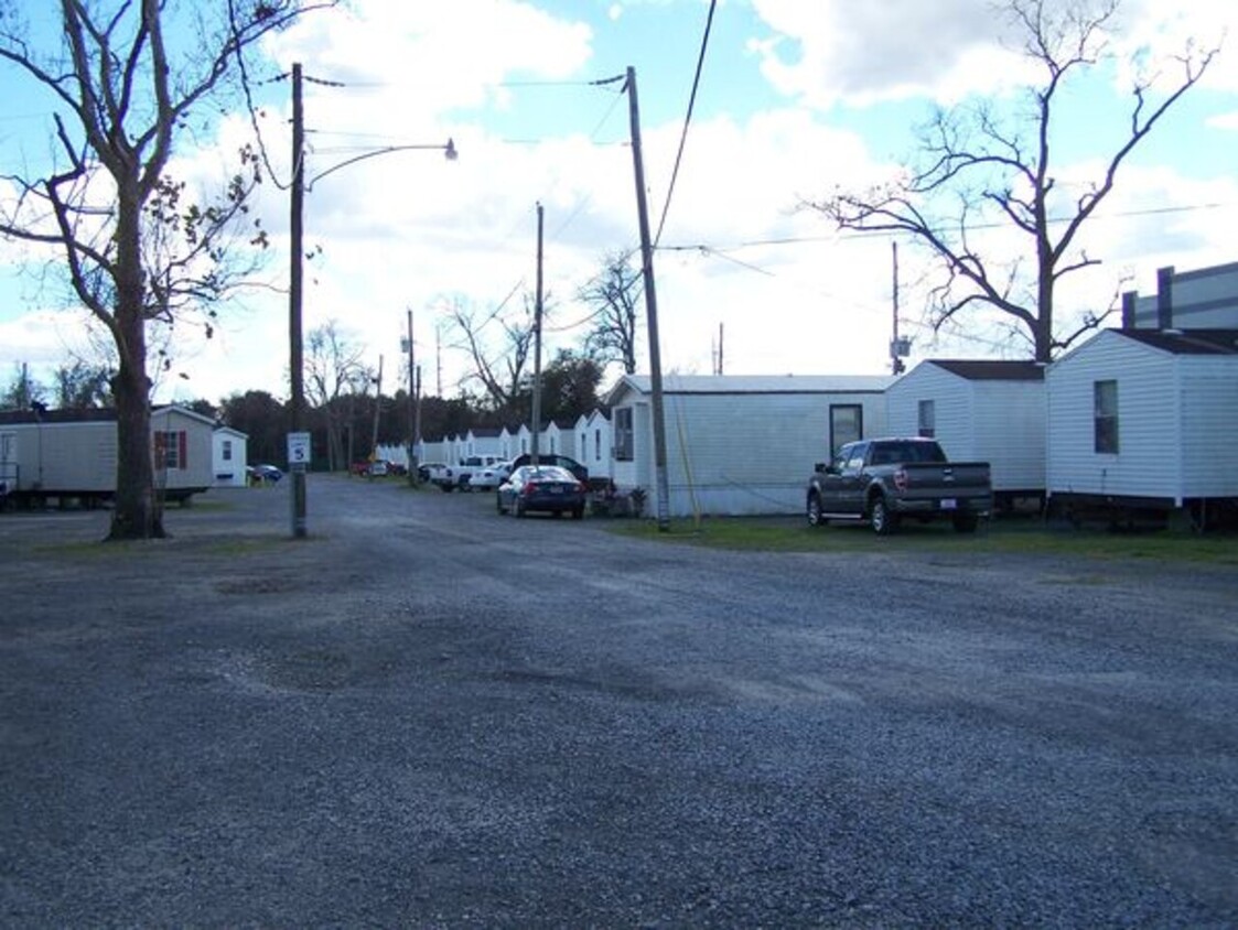
29 E Airline Hwy is a house located in Jefferson County and the 70062 ZIP Code. This area is served by the Jefferson Parish attendance zone.
Location
Get Directions
Located just 12 miles west of New Orleans, Kenner is a vibrant suburb bordering Lake Pontchartrain and the Mississippi River. Because of the city’s unique location, Kenner offers residents to both Laketown and Rivertown, where locals enjoy an array of special events and recreational activities.
Kenner provides abundant shopping opportunities at numerous suburban strip malls strewn throughout the city in addition to the expansive Esplanade Mall. You’ll find that getting around from Kenner is a breeze with direct access to I-10 and the Louis Armstrong New Orleans International Airport.
Learn more about living in Kenner
Education
| Colleges & Universities | Distance | ||
|---|---|---|---|
| Colleges & Universities | Distance | ||
| Drive: | 17 min | 10.2 mi | |
| Drive: | 23 min | 11.3 mi | |
| Drive: | 23 min | 12.0 mi | |
| Drive: | 27 min | 12.5 mi |
29 E Airline Hwy is within 17 minutes or 10.2 miles from Univ. New Orleans, Jefferson. It is also near Loyola University, New Orleans and Tulane University, New Orleans.
Schools

Public Elementary School
Grades PK-5
257 Students
Attendance Zone
Public Middle School
Grades 6-8
707 Students
Attendance Zone
Public High School
Grades 9-12
1,478 Students
Attendance Zone
Private Elementary, Middle & High School
Grades PK-12
796 Students
Nearby
Private Elementary & Middle School
Grades PK-7
214 Students
Nearby
School data provided by
 The GreatSchools Rating helps parents compare schools within a state based on a variety of school quality indicators and provides a helpful picture of how effectively each school serves all of its students. Ratings are on a scale of 1 (below average) to 10 (above average) and can include test scores, college readiness, academic progress, advanced courses, equity, discipline and attendance data. We also advise parents to visit schools, consider other information on school performance and programs, and consider family needs as part of the school selection process.
View GreatSchools Rating Methodology
Data provided by GreatSchools.org © 2025. All rights reserved.
View GreatSchools Rating Methodology
Data provided by GreatSchools.org © 2025. All rights reserved.
Transportation options available in Kenner include Carrollton And Freret, located 10.2 miles from 29 E Airline Hwy. 29 E Airline Hwy is near Louis Armstrong New Orleans International, located 5.7 miles or 12 minutes away.
| Transit / Subway | Distance | ||
|---|---|---|---|
| Transit / Subway | Distance | ||
|
|
Drive: | 20 min | 10.2 mi |
|
|
Drive: | 20 min | 10.3 mi |
|
|
Drive: | 21 min | 10.5 mi |
|
|
Drive: | 20 min | 10.5 mi |
|
|
Drive: | 21 min | 10.5 mi |
| Commuter Rail | Distance | ||
|---|---|---|---|
| Commuter Rail | Distance | ||
|
|
Drive: | 24 min | 15.8 mi |
| Airports | Distance | ||
|---|---|---|---|
| Airports | Distance | ||
|
Louis Armstrong New Orleans International
|
Drive: | 12 min | 5.7 mi |
Time and distance from 29 E Airline Hwy.
| Shopping Centers | Distance | ||
|---|---|---|---|
| Shopping Centers | Distance | ||
| Drive: | 5 min | 2.5 mi | |
| Drive: | 5 min | 2.9 mi | |
| Drive: | 7 min | 3.5 mi |
29 E Airline Hwy has 3 shopping centers within 3.5 miles, which is about a 7-minute drive. The miles and minutes will be for the farthest away property.
| Parks and Recreation | Distance | ||
|---|---|---|---|
| Parks and Recreation | Distance | ||
|
Kenner Planetarium & MegaDome Cinema
|
Drive: | 4 min | 2.3 mi |
|
Audubon Insectarium
|
Drive: | 24 min | 11.7 mi |
|
Audubon Zoo
|
Drive: | 26 min | 12.3 mi |
|
Longue Vue House and Gardens
|
Drive: | 20 min | 12.8 mi |
|
Bayou Segnette State Park
|
Drive: | 24 min | 12.8 mi |
29 E Airline Hwy has 5 parks within 12.8 miles, including Kenner Planetarium & MegaDome Cinema, Longue Vue House and Gardens, and Audubon Insectarium.
| Hospitals | Distance | ||
|---|---|---|---|
| Hospitals | Distance | ||
| Drive: | 10 min | 5.2 mi | |
| Drive: | 11 min | 5.6 mi | |
| Drive: | 13 min | 6.1 mi |
29 E Airline Hwy has 3 hospitals within 6.1 miles, the nearest is River Oaks Hospital which is 5.2 miles away and a 10 minute drive.
| Military Bases | Distance | ||
|---|---|---|---|
| Military Bases | Distance | ||
| Drive: | 31 min | 20.3 mi |
29 E Airline Hwy is 20.3 miles and a 31 minute drive from New Orleans Naval Support.
You May Also Like
Similar Rentals Nearby


What Are Walk Score®, Transit Score®, and Bike Score® Ratings?
Walk Score® measures the walkability of any address. Transit Score® measures access to public transit. Bike Score® measures the bikeability of any address.
What is a Sound Score Rating?
A Sound Score Rating aggregates noise caused by vehicle traffic, airplane traffic and local sources
29 E Airline Hwy
Kenner, LA 70062