
$1,250 / Month
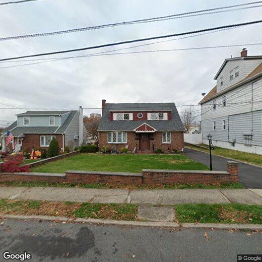
289 Mt Pleasant Ave
Wallington, NJ 07057
2 Weeks Ago
Favorites
289 Mt Pleasant Ave

Favorites
Check Back Soon for Upcoming Availability
| Beds | Baths | Average SF |
|---|---|---|
| 1 Bedroom 1 Bedroom 1 Br | 1 Bath 1 Bath 1 Ba | — |
About This Property
Spacious 1 bedroom, EIK with new SS appliances, king size bedroom, large living room, plenty of windows for natural light, lots of closet space and new Central AC. Uphill section of town in a NO FLOOD ZONE. Ample on street parking. No laundry, pets, smoking or use of yard. Close to all major transportation, stores and houses of worship. (Listing 6926202 Confirmed 9/24/2019)
289 Mt Pleasant Ave is a house located in Bergen County and the 07057 ZIP Code. This area is served by the Wallington Boro attendance zone.
Location
Get Directions
Wallington is a small, heart-shaped town located about 15 miles northwest of New York City. The Passaic and Saddle rivers traverse the town’s northwestern boundaries, providing plenty of options for outdoor recreation and appreciating natural beauty. Wallington is also home to numerous scenic parks, like Samuel Nelkin County Park, Centennial Field, and Hathaway Park.
Just one square mile in size, Wallington touts a small-town atmosphere with a pervasive sense of community pride and a host of locally owned shops and eateries strewn along Main Avenue. Several area attractions are within minutes of Wallington, including the Meadowlands Sports Complex, the Outlets at Bergen Town Center, and Garrett Mountain Reservation. Getting around from Wallington is easy with access to major roadways and the Wesmont NJ Transit rail station.
Learn more about living in Wallington
Education
| Colleges & Universities | Distance | ||
|---|---|---|---|
| Colleges & Universities | Distance | ||
| Drive: | 4 min | 1.5 mi | |
| Drive: | 7 min | 2.0 mi | |
| Drive: | 7 min | 2.9 mi | |
| Drive: | 10 min | 4.6 mi |
289 Mt Pleasant Ave is within 4 minutes or 1.5 miles from Passaic County C.C., Passaic. It is also near Felician College, Lodi Campus and Felician College, Rutherford.
Schools


Public Elementary & Middle School
Grades PK-8
520 Students
Nearby
Public Elementary School
Grades K-6
350 Students
Nearby
Public Elementary School
Grades K-3
251 Students
Nearby
Public Middle & High School
Grades 7-12
571 Students
Attendance Zone
Private Elementary, Middle & High School
Grades 4-12
51 Students
Nearby
Private Elementary, Middle & High School
Grades PK-11
Nearby
School data provided by
 The GreatSchools Rating helps parents compare schools within a state based on a variety of school quality indicators and provides a helpful picture of how effectively each school serves all of its students. Ratings are on a scale of 1 (below average) to 10 (above average) and can include test scores, college readiness, academic progress, advanced courses, equity, discipline and attendance data. We also advise parents to visit schools, consider other information on school performance and programs, and consider family needs as part of the school selection process.
View GreatSchools Rating Methodology
Data provided by GreatSchools.org © 2025. All rights reserved.
View GreatSchools Rating Methodology
Data provided by GreatSchools.org © 2025. All rights reserved.
Transportation options available in Wallington include Tonnelle Avenue, located 8.3 miles from 289 Mt Pleasant Ave. 289 Mt Pleasant Ave is near Newark Liberty International, located 14.5 miles or 20 minutes away, and LaGuardia, located 23.1 miles or 37 minutes away.
| Transit / Subway | Distance | ||
|---|---|---|---|
| Transit / Subway | Distance | ||
|
|
Drive: | 13 min | 8.3 mi |
|
|
Drive: | 15 min | 9.1 mi |
|
|
Drive: | 16 min | 9.6 mi |
|
|
Drive: | 17 min | 9.9 mi |
|
|
Drive: | 18 min | 11.7 mi |
| Commuter Rail | Distance | ||
|---|---|---|---|
| Commuter Rail | Distance | ||
|
|
Drive: | 4 min | 1.5 mi |
|
|
Drive: | 6 min | 2.2 mi |
| Drive: | 8 min | 2.3 mi | |
|
|
Drive: | 6 min | 2.4 mi |
|
|
Drive: | 6 min | 3.3 mi |
| Airports | Distance | ||
|---|---|---|---|
| Airports | Distance | ||
|
Newark Liberty International
|
Drive: | 20 min | 14.5 mi |
|
LaGuardia
|
Drive: | 37 min | 23.1 mi |
Time and distance from 289 Mt Pleasant Ave.
| Shopping Centers | Distance | ||
|---|---|---|---|
| Shopping Centers | Distance | ||
| Walk: | 16 min | 0.8 mi | |
| Walk: | 18 min | 1.0 mi | |
| Walk: | 21 min | 1.1 mi |
289 Mt Pleasant Ave has 3 shopping centers within 1.1 miles, which is about a 21-minute walk. The miles and minutes will be for the farthest away property.
| Parks and Recreation | Distance | ||
|---|---|---|---|
| Parks and Recreation | Distance | ||
|
Meadowlands Environment Center
|
Drive: | 17 min | 6.5 mi |
|
McDowell Observatory
|
Drive: | 17 min | 6.5 mi |
|
Richard W. DeKorte Park
|
Drive: | 17 min | 8.4 mi |
|
Teaneck Creek Conservancy
|
Drive: | 15 min | 9.1 mi |
|
Overpeck County Park
|
Drive: | 16 min | 10.1 mi |
289 Mt Pleasant Ave has 5 parks within 10.1 miles, including Meadowlands Environment Center, McDowell Observatory, and Teaneck Creek Conservancy.
| Hospitals | Distance | ||
|---|---|---|---|
| Hospitals | Distance | ||
| Drive: | 6 min | 2.4 mi | |
| Drive: | 10 min | 5.3 mi | |
| Drive: | 11 min | 6.5 mi |
289 Mt Pleasant Ave has 3 hospitals within 6.5 miles, the nearest is St. Mary's General Hospital which is 2.4 miles away and a 6 minute drive.
| Military Bases | Distance | ||
|---|---|---|---|
| Military Bases | Distance | ||
| Drive: | 29 min | 16.4 mi | |
| Drive: | 28 min | 18.6 mi |
289 Mt Pleasant Ave is 16.4 miles from Governors Island Support Center, and is convenient to other military bases, including Military Ocean Terminal.
You May Also Like
Similar Rentals Nearby


What Are Walk Score®, Transit Score®, and Bike Score® Ratings?
Walk Score® measures the walkability of any address. Transit Score® measures access to public transit. Bike Score® measures the bikeability of any address.
What is a Sound Score Rating?
A Sound Score Rating aggregates noise caused by vehicle traffic, airplane traffic and local sources

289 Mt Pleasant Ave
Wallington, NJ 07057