
Williamsburg
200 W Galbraith Rd,
Cincinnati, OH 45215
$658 - $2,879
Studio - 3 Beds

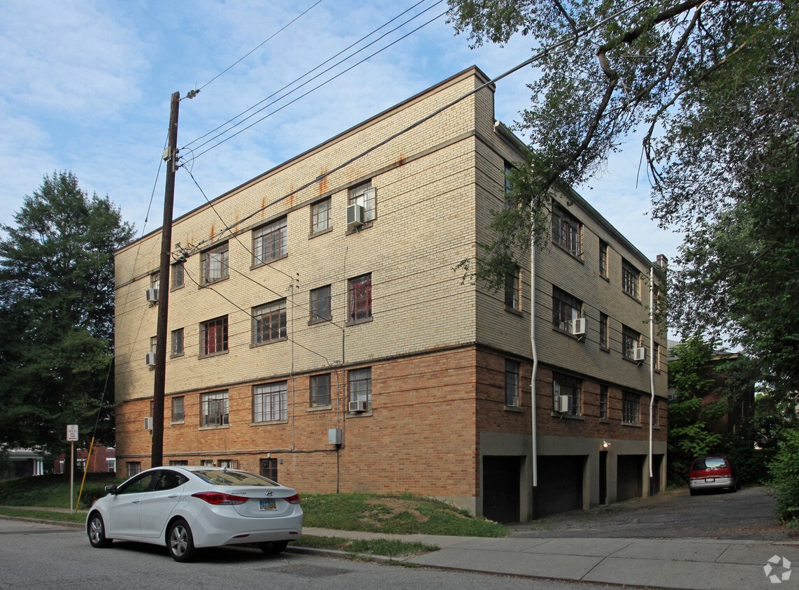

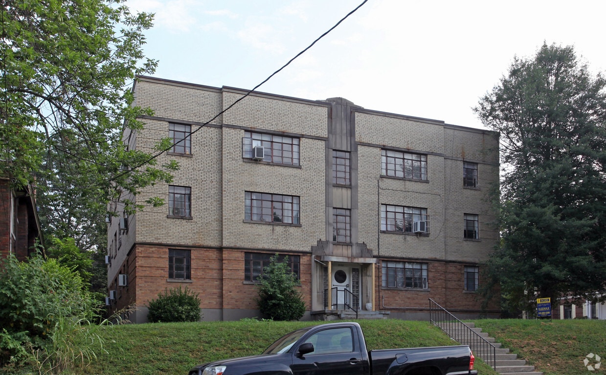
At 2860 Observatory Ave, you've discovered your new home. Situated in the 45208 area of Cincinnati on Observatory Ave, you have a quick connection to a number of enjoyable points of interest. Here at this community, the professional leasing staff will assist you in finding the perfect place. Come by to view the available floorplans. It's time to love where you live. Stop by for a visit today.
2860 Observatory Ave is an apartment community located in Hamilton County and the 45208 ZIP Code. This area is served by the Cincinnati Public Schools attendance zone.
Air Conditioning
Refrigerator
Tub/Shower
Heating
Often regarded as Cincinnati’s most desirable neighborhood, Hyde Park is picturesque with charming historic homes and spacious tree-lined streets. At the center of the neighborhood lies Hyde Park Square, teeming with more than 175 unique shops, galleries, and restaurants for residents and visitors to explore.
In addition to Hyde Park Square, the neighborhood is known for containing the Cincinnati Observatory, a National Historic Landmark (and fully functional observatory) that’s home to the world’s oldest telescope. Hyde Park is also convenient to the expansive Ault Park, which is revered for its historic pavilion, lush gardens, and scenic trails.
Hyde Park fosters a sense of community with an array of exciting events, such as the annual Hyde Park Art Show, Hyde Park Blast, and the seasonal Hyde Park Farmers’ Market. Located just five miles from the heart of Downtown Cincinnati, Hyde Park offers residents easy access to all that the city has to offer.
Learn more about living in Hyde ParkCompare neighborhood and city base rent averages by bedroom.
| Hyde Park | Cincinnati, OH | |
|---|---|---|
| Studio | $880 | $1,068 |
| 1 Bedroom | $1,123 | $1,143 |
| 2 Bedrooms | $1,604 | $1,436 |
| 3 Bedrooms | $1,804 | $1,750 |
| Colleges & Universities | Distance | ||
|---|---|---|---|
| Colleges & Universities | Distance | ||
| Drive: | 8 min | 2.9 mi | |
| Drive: | 10 min | 4.9 mi | |
| Drive: | 10 min | 5.0 mi | |
| Drive: | 18 min | 7.7 mi |


Transportation options available in Cincinnati include Richter & Phillips Station - 6Th & Main, located 5.4 miles from 2860 Observatory Ave. 2860 Observatory Ave is near Cincinnati/Northern Kentucky International, located 19.4 miles or 36 minutes away.
| Transit / Subway | Distance | ||
|---|---|---|---|
| Transit / Subway | Distance | ||
| Drive: | 11 min | 5.4 mi | |
| Drive: | 12 min | 5.6 mi | |
| Drive: | 11 min | 6.2 mi | |
| Drive: | 11 min | 6.4 mi | |
| Drive: | 12 min | 6.5 mi |
| Commuter Rail | Distance | ||
|---|---|---|---|
| Commuter Rail | Distance | ||
|
|
Drive: | 15 min | 7.4 mi |
| Airports | Distance | ||
|---|---|---|---|
| Airports | Distance | ||
|
Cincinnati/Northern Kentucky International
|
Drive: | 36 min | 19.4 mi |
Scores provided by
Traffic
-Airport
-Businesses
-Scores provided by
HowLoud What is a Sound Score Rating? A Sound Score Rating aggregates noise caused by vehicle traffic, airplane traffic and local sources. How It WorksTime and distance from 2860 Observatory Ave.
| Shopping Centers | Distance | ||
|---|---|---|---|
| Shopping Centers | Distance | ||
| Walk: | 15 min | 0.8 mi | |
| Walk: | 19 min | 1.0 mi | |
| Drive: | 3 min | 1.2 mi |
| Parks and Recreation | Distance | ||
|---|---|---|---|
| Parks and Recreation | Distance | ||
|
Cincinnati Observatory
|
Walk: | 16 min | 0.9 mi |
|
Ault Park
|
Drive: | 2 min | 1.1 mi |
|
Otto Armleder Park
|
Drive: | 8 min | 3.2 mi |
|
Eden Park
|
Drive: | 9 min | 3.8 mi |
|
Avon Woods Natural Area/Preserve
|
Drive: | 10 min | 4.0 mi |
| Hospitals | Distance | ||
|---|---|---|---|
| Hospitals | Distance | ||
| Drive: | 9 min | 3.4 mi | |
| Drive: | 9 min | 4.6 mi | |
| Drive: | 9 min | 4.6 mi |
| Military Bases | Distance | ||
|---|---|---|---|
| Military Bases | Distance | ||
| Drive: | 71 min | 52.4 mi | |
| Drive: | 77 min | 57.4 mi | |
| Drive: | 79 min | 60.7 mi |
What Are Walk Score®, Transit Score®, and Bike Score® Ratings?
Walk Score® measures the walkability of any address. Transit Score® measures access to public transit. Bike Score® measures the bikeability of any address.
What is a Sound Score Rating?
A Sound Score Rating aggregates noise caused by vehicle traffic, airplane traffic and local sources.
2860 Observatory Ave
Cincinnati, OH 45208


