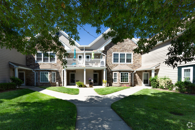
284 William Floyd Pkwy

284 William Floyd Pkwy, Shirley, NY 11967

2 Weeks Ago
Share Listing
Favorites
284 William Floyd Pkwy
Share Listing
Favorites

Check Back Soon for Upcoming Availability

Fees and Policies

The fees below are based on community-supplied data and may exclude additional fees and utilities.

Details

Lease Options

  • 12 Months

About 284 William Floyd Pkwy Shirley, NY 11967

Rent This Stunning Updated Upper Level Of A High Ranch. Features 3 Bedrooms, 1 Bath, Dining Room And Beautiful Kitchen! Tile Floors In Living Room And Dining Room. Driveway Parking. No Pets.

284 William Floyd Pkwy is an apartment community located in Suffolk County and the 11967 ZIP Code.

Apartment Features

  • Smoke Free
City - Shirley

Nestled on the South Shore of Long Island, Shirley is a peaceful hamlet lush with natural beauty. Residents enjoy the best of rural and suburban living in Shirley, boasting vast stretches of green space along with a slew of national retailers and chain restaurants largely clustered on Montauk Highway and William Floyd Parkway.

Residents delight in their surrounding environment’s beauty at expansive parks like Smith Point Park and Wertheim National Wildlife Refuge. Convenience to the Montauk Branch of the Long Island Rail Road, as well as the Sunrise Highway and Long Island Expressway, connects Shirley to NYC and all that Long Island has to offer.

Learn more about living in Shirley 
Amenities
  • Smoke Free
Education
Colleges & Universities Distance
Drive: 20 min 12.5 mi
Drive: 26 min 15.5 mi
Drive: 26 min 16.0 mi
Drive: 35 min 22.8 mi
284 William Floyd Pkwy is within 20 minutes or 12.5 miles from St Joseph's Coll., Long Island. It is also near SUNY Suffolk Co., Ammerman and SUNY Suffolk Co., Eastern.
Transportation

284 William Floyd Pkwy is near Long Island MacArthur, located 16.7 miles or 27 minutes away, and Tweed/New Haven, located 60.1 miles or 148 minutes away.

Commuter Rail Distance
Drive: 5 min 2.8 mi
Drive: 13 min 7.8 mi
Drive: 13 min 7.9 mi
Drive: 18 min 11.2 mi
Drive: 19 min 11.8 mi
Airports Distance
Airports Distance
Long Island MacArthur
Drive: 27 min 16.7 mi
Tweed/New Haven
Drive: 148 min 60.1 mi

Walkability Near 284 William Floyd Pkwy Shirley, NY 11967

Car-Dependent
32
Walk Score®
Out of 100
This area is considered a car-dependent area and most errands will require a car.
Minimal Transit
0
Transit Score®
Out of 100
Somewhat Bikeable
35
Bike Score®
Out of 100
You might be able to find places to ride your bike in this area, but you’ll most likely want your car for most errands.
-
-
Soundscore
Out of 100

Traffic:

-

Airport:

-

Businesses:

-

Score provided by

Scores provided by  and

Score provided by

Points of Interest

Time and distance from 284 William Floyd Pkwy.

Shopping Centers Distance
Drive: 4 min 1.8 mi
Drive: 6 min 2.3 mi
Drive: 5 min 2.7 mi
284 William Floyd Pkwy has 3 shopping centers within 2.7 miles, which is about a 5-minute drive. The miles and minutes will be for the farthest away property.
Parks and Recreation Distance
Fire Island National Seashore
Drive: 5 min 1.8 mi
Smith Point County Park
Drive: 5 min 2.3 mi
Wertheim National Wildlife Refuge
Drive: 6 min 2.5 mi
Southaven County Park
Drive: 8 min 4.5 mi
Suffolk County Farm and Education Center
Drive: 12 min 7.2 mi
284 William Floyd Pkwy has 5 parks within 7.2 miles, including Fire Island National Seashore, Wertheim National Wildlife Refuge, and Smith Point County Park.
Hospitals Distance
Hospitals Distance
Drive: 15 min 9.6 mi
284 William Floyd Pkwy is 9.6 miles and a 15 minute drive from Long Island Community Hospital.
Military Bases Distance
Drive: 68 min 41.3 mi
Drive: 78 min 55.2 mi
284 William Floyd Pkwy is 41.3 miles from Eatons Neck CG Station North, and is convenient to other military bases, including Fort Totten US Govt Reservation.

You May Also Like

Similar Rentals Nearby