$725
/ Month
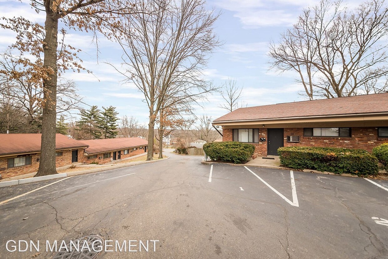
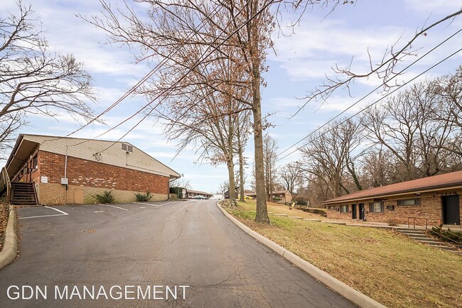
2839-2857 Cypress Way
Cincinnati, OH 45212
Favorites
2839-2857 Cypress Way

Favorites
Check Back Soon for Upcoming Availability
| Beds | Baths | Average SF |
|---|---|---|
| 1 Bedroom 1 Bedroom 1 Br | 1 Bath 1 Bath 1 Ba | 459 SF |
Fees and Policies
The fees listed below are community-provided and may exclude utilities or add-ons. All payments are made directly to the property and are non-refundable unless otherwise specified.
- Dogs Allowed
-
Fees not specified
-
Weight limit--
-
Pet Limit--
About This Property
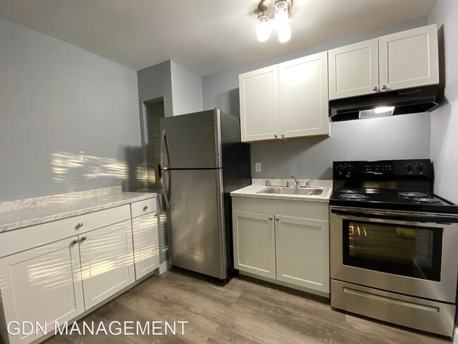
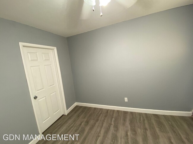
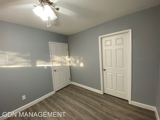
(937) 694-7066 - Newly Renovated - Excellent Location in Pleasant Ridge Near Norwood/Hyde Park/Oakley! Very Close To Rookwood Commons, the Interstates & Norwood Towne Centre. Newly Remodeled Spacious One Bedroom Apartments with Off Street Parking. Heat & Water Paid Multiple units available. Convenient location to Oakley, Rookwood Hyde Park! Easy access to I-71, I-75. Walking distance to Paycor HQ, Mercy Health HQ and Christ Hospital Physicians. Minutes away to Xavier University & University of Cincinnati. 2 blocks from Montgomery Rd & Ross Ave Metro bus line. Plenty of street parking. Laundry onsite. 24 Hour Video Surveillance Call or Text Direct for a showing 937-694-7066 (RLNE5610747) Other Amenities: Other (stainless steel appliances). Pet policies: Small Dogs Allowed, Cats Allowed, Large Dogs Allowed.
2839-2857 Cypress Way is an apartment community located in Hamilton County and the 45212 ZIP Code.
Unique Features
- Amenities - stainless steel appliances
2839-2857 Cypress Way,
Cincinnati,
OH
45212
Cincinnati sits on the northern bank of the Ohio River, where rolling hills meet a city that helped establish the Midwest long before other major metros existed. Settled in 1788, the Queen City sits west of the Appalachian Mountains and combines historic culture with urban living.
Today, neighborhoods like Over-the-Rhine, Hyde Park, and Mount Adams each bring a distinct character to city life. Over-the-Rhine is packed with restored 19th-century architecture, Findlay Market, and Music Hall. Mount Adams perches beside Eden Park with stunning river views, while Hyde Park Square draws locals and tourists alike with local cafes and walkable streets.
Renters will find a wide range of housing options across the city, from converted lofts and townhouses in Over-the-Rhine to sleek high-rise apartment communities along the riverfront at The Banks. Clifton and Oakley offer everything from charming older buildings to newer developments with modern amenities.
Learn more about living in Cincinnati
Amenities
- Amenities - stainless steel appliances
Education
| Colleges & Universities | Distance | ||
|---|---|---|---|
| Colleges & Universities | Distance | ||
| Drive: | 12 min | 3.5 mi | |
| Drive: | 17 min | 6.7 mi | |
| Drive: | 15 min | 7.1 mi | |
| Drive: | 15 min | 7.2 mi |
2839-2857 Cypress Way is within 12 minutes or 3.5 miles from Xavier University. It is also near Univ. of Cincinnati, Medical and University of Cincinnati.
Transportation options available in Cincinnati include Hanke Exchange Station - 12Th & Main, located 8.5 miles from 2839-2857 Cypress Way. 2839-2857 Cypress Way is near Cincinnati/Northern Kentucky International, located 23.1 miles or 42 minutes away.
| Transit / Subway | Distance | ||
|---|---|---|---|
| Transit / Subway | Distance | ||
| Drive: | 17 min | 8.5 mi | |
| Drive: | 18 min | 8.7 mi | |
| Drive: | 18 min | 9.0 mi | |
| Drive: | 19 min | 9.1 mi | |
| Drive: | 19 min | 9.2 mi |
| Commuter Rail | Distance | ||
|---|---|---|---|
| Commuter Rail | Distance | ||
|
|
Drive: | 19 min | 10.4 mi |
| Airports | Distance | ||
|---|---|---|---|
| Airports | Distance | ||
|
Cincinnati/Northern Kentucky International
|
Drive: | 42 min | 23.1 mi |
Walkability Near 2839-2857 Cypress Way Cincinnati, OH 45212
Getting Around
 What do Walkability, Transit, Drivability, and Bikeability mean?
Walkability measures the walking distance to day-to-day needs.
Transit measures access to public transportation.
Drivability measures congestion, parking availability, and access to major roads.
Bikeability measures the suitability for cycling.
How It Works
What do Walkability, Transit, Drivability, and Bikeability mean?
Walkability measures the walking distance to day-to-day needs.
Transit measures access to public transportation.
Drivability measures congestion, parking availability, and access to major roads.
Bikeability measures the suitability for cycling.
How It Works
Fairly Walkable
Walkability
40
/ 100
Limited Public Transit
Transit
20
/ 100
Exceptionally Drivable
Drivability
90
/ 100
Somewhat Bikeable
Bikeability
30
/ 100
Scores provided by
-
Soundscore™
-
/ 100
Traffic
-Airport
-Businesses
-Scores provided by
HowLoud What is a Sound Score Rating? A Sound Score Rating aggregates noise caused by vehicle traffic, airplane traffic and local sources. How It WorksTime and distance from 2839-2857 Cypress Way.
| Shopping Centers | Distance | ||
|---|---|---|---|
| Shopping Centers | Distance | ||
| Drive: | 7 min | 1.9 mi | |
| Drive: | 8 min | 2.0 mi | |
| Drive: | 8 min | 2.1 mi |
2839-2857 Cypress Way has 3 shopping centers within 2.1 miles, which is about a 8-minute drive. The miles and minutes will be for the farthest away property.
| Parks and Recreation | Distance | ||
|---|---|---|---|
| Parks and Recreation | Distance | ||
|
French Park
|
Drive: | 8 min | 2.6 mi |
|
Avon Woods Natural Area/Preserve
|
Drive: | 9 min | 3.0 mi |
|
Caldwell Preserve
|
Drive: | 12 min | 4.3 mi |
|
Ault Park
|
Drive: | 14 min | 4.7 mi |
|
Cincinnati Observatory
|
Drive: | 14 min | 4.7 mi |
2839-2857 Cypress Way has 5 parks within 4.7 miles, including French Park, Avon Woods Natural Area/Preserve, and Caldwell Preserve.
| Hospitals | Distance | ||
|---|---|---|---|
| Hospitals | Distance | ||
| Drive: | 5 min | 1.4 mi | |
| Drive: | 9 min | 3.2 mi | |
| Drive: | 14 min | 4.9 mi |
2839-2857 Cypress Way has 3 hospitals within 4.9 miles, the nearest is Blueridge Vista Health and Wellness which is 1.4 miles away and a 5 minute drive.
| Military Bases | Distance | ||
|---|---|---|---|
| Military Bases | Distance | ||
| Drive: | 68 min | 49.2 mi | |
| Drive: | 74 min | 54.3 mi | |
| Drive: | 76 min | 57.5 mi |
2839-2857 Cypress Way has 3 military bases within 57.5 miles, the nearest is Gentile Air Force Station which is 49.2 miles away and a 68 minute drive.
You May Also Like
Similar Rentals Nearby


What Are Walk Score®, Transit Score®, and Bike Score® Ratings?
Walk Score® measures the walkability of any address. Transit Score® measures access to public transit. Bike Score® measures the bikeability of any address.
What is a Sound Score Rating?
A Sound Score Rating aggregates noise caused by vehicle traffic, airplane traffic and local sources.

2839-2857 Cypress Way
Cincinnati, OH 45212