
$2,000 / Month
28 Westgate Rd
Boston, MA 02467
2 Weeks Ago
Favorites
28 Westgate Rd

Favorites
Check Back Soon for Upcoming Availability
| Beds | Baths | Average SF |
|---|---|---|
| 1 Bedroom 1 Bedroom 1 Br | 1 Bath 1 Bath 1 Ba | 700 SF |
About This Property
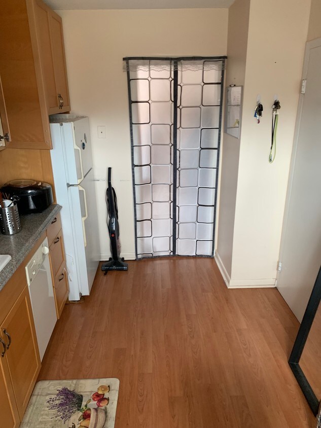
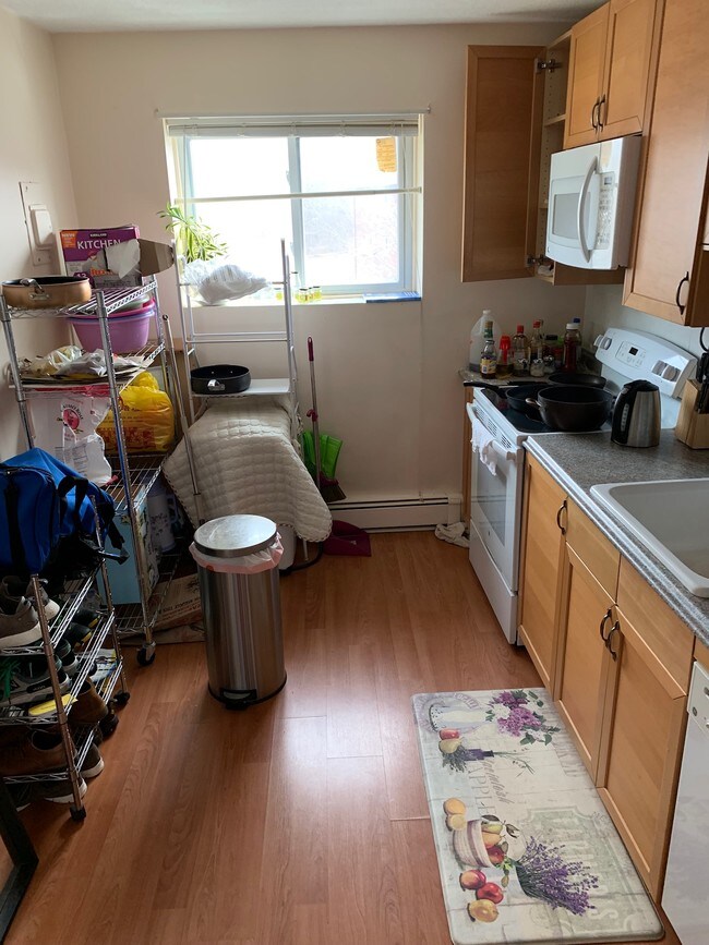
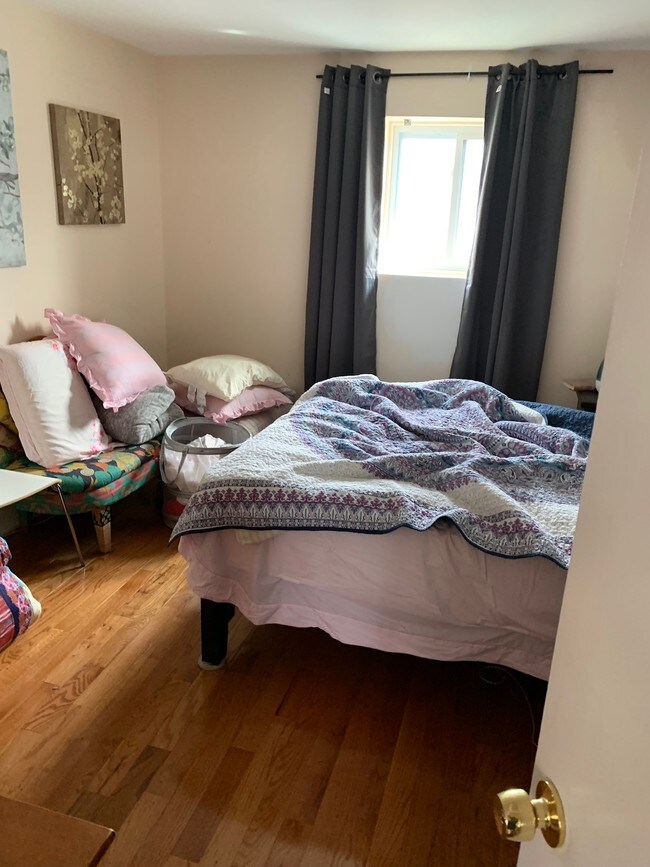
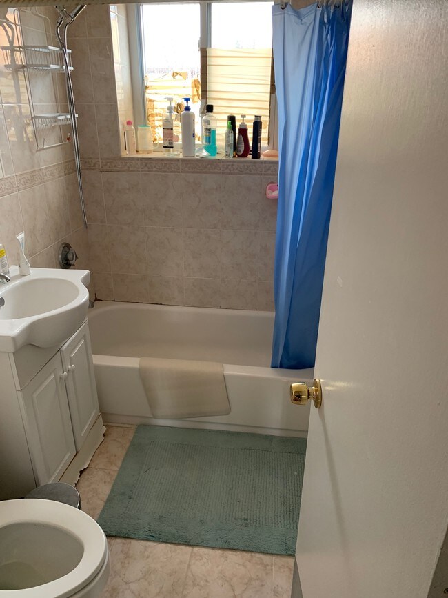
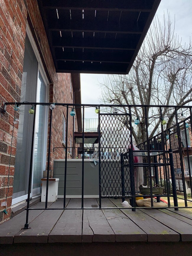
Available September 1st A beautiful 1BD/1BTH located at the Chestnut Village Condominiums. Unit features fully applianced kitchen with disposal, hardwood floors throughout offering lots of natural light, a good size bedroom with lots of closet space and balcony off the living area. Included Heat & Hot Water, two assigned off street parking. Minutes away to Brigham and Women's Faulkner Hospital, Harvard Vanguard Medical, Highland Needham T-Station, Highway I-95, Boston Sports Club, Star Market, The Shops at Chestnut Hill, Restaurants, Shops etc. Available September 1st
28 Westgate Rd is a house located in Suffolk County and the 02467 ZIP Code. This area is served by the Boston Public Schools attendance zone.
Location
Get Directions
Boston is the iconic capital and largest city of Massachusetts, known for its historical significance, top-notch culinary scene, and beautiful Bayfront views. Nestled on Massachusetts Bay, Boston is home to numerous universities including Harvard University, Boston College, Northeastern University, the University of Massachusetts-Boston, the Berklee College of Music, and the Benjamin Franklin Institute of Technology. In fact, there are 54 colleges and universities in the Boston area, dating all the way back to 1636 when Harvard was established.
Boston played a crucial role in the American Revolution, being the site of major events like the Boston Massacre and the Boston Tea Party. This city is filled with historic sites, landmarks, and architecture like the Boston Common, the first park in the country, dating back to 1624. Locals frequent Freedom Trail for its walking park that begins at the park and leads past several historic sites, including Paul Revere’s House and Faneuil Hall.
Learn more about living in Boston
Education
| Colleges & Universities | Distance | ||
|---|---|---|---|
| Colleges & Universities | Distance | ||
| Drive: | 9 min | 4.1 mi | |
| Drive: | 10 min | 4.5 mi | |
| Drive: | 11 min | 5.2 mi | |
| Drive: | 12 min | 5.6 mi |
28 Westgate Rd is within 9 minutes or 4.1 miles from Boston College. It is also near Boston College, Brighton and MCPHS University, Boston.
Schools


Public Elementary & Middle School
Grades PK-8
586 Students
Nearby
Public Elementary & Middle School
Grades K-8
672 Students
Nearby
Public High School
Grades 9-12
1,837 Students
Nearby
Private Elementary School
Grades PK-6
314 Students
Nearby
Private Middle & High School
Grades 6-12
489 Students
Nearby
School data provided by
 The GreatSchools Rating helps parents compare schools within a state based on a variety of school quality indicators and provides a helpful picture of how effectively each school serves all of its students. Ratings are on a scale of 1 (below average) to 10 (above average) and can include test scores, college readiness, academic progress, advanced courses, equity, discipline and attendance data. We also advise parents to visit schools, consider other information on school performance and programs, and consider family needs as part of the school selection process.
View GreatSchools Rating Methodology
Data provided by GreatSchools.org © 2025. All rights reserved.
View GreatSchools Rating Methodology
Data provided by GreatSchools.org © 2025. All rights reserved.
Transportation options available in Boston include Chestnut Hill Station, located 2.0 miles from 28 Westgate Rd. 28 Westgate Rd is near General Edward Lawrence Logan International, located 11.8 miles or 24 minutes away.
| Transit / Subway | Distance | ||
|---|---|---|---|
| Transit / Subway | Distance | ||
|
|
Drive: | 5 min | 2.0 mi |
|
|
Drive: | 7 min | 3.5 mi |
|
|
Drive: | 8 min | 3.5 mi |
|
|
Drive: | 7 min | 3.6 mi |
|
|
Drive: | 8 min | 3.7 mi |
| Commuter Rail | Distance | ||
|---|---|---|---|
| Commuter Rail | Distance | ||
|
|
Drive: | 4 min | 1.7 mi |
|
|
Drive: | 5 min | 2.0 mi |
|
|
Drive: | 6 min | 2.2 mi |
|
|
Drive: | 8 min | 3.0 mi |
|
|
Drive: | 8 min | 4.2 mi |
| Airports | Distance | ||
|---|---|---|---|
| Airports | Distance | ||
|
General Edward Lawrence Logan International
|
Drive: | 24 min | 11.8 mi |
Time and distance from 28 Westgate Rd.
| Shopping Centers | Distance | ||
|---|---|---|---|
| Shopping Centers | Distance | ||
| Drive: | 4 min | 1.5 mi | |
| Drive: | 4 min | 2.0 mi | |
| Drive: | 5 min | 2.1 mi |
28 Westgate Rd has 3 shopping centers within 2.1 miles, which is about a 5-minute drive. The miles and minutes will be for the farthest away property.
| Parks and Recreation | Distance | ||
|---|---|---|---|
| Parks and Recreation | Distance | ||
|
Brook Farm Historic Site
|
Drive: | 4 min | 1.7 mi |
|
Hammond Pond Reservation
|
Drive: | 5 min | 2.4 mi |
|
Cutler Park Reservation
|
Drive: | 6 min | 2.7 mi |
|
Arnold Arboretum of Harvard University
|
Drive: | 6 min | 2.8 mi |
|
Frederick Law Olmsted National Historic Site
|
Drive: | 7 min | 3.5 mi |
28 Westgate Rd has 5 parks within 3.5 miles, including Brook Farm Historic Site, Hammond Pond Reservation, and Cutler Park Reservation.
| Hospitals | Distance | ||
|---|---|---|---|
| Hospitals | Distance | ||
| Drive: | 4 min | 1.9 mi | |
| Drive: | 7 min | 3.2 mi | |
| Drive: | 9 min | 3.9 mi |
28 Westgate Rd has 3 hospitals within 3.9 miles, the nearest is Bournewood Hospital which is 1.9 miles away and a 4 minute drive.
| Military Bases | Distance | ||
|---|---|---|---|
| Military Bases | Distance | ||
| Drive: | 23 min | 12.7 mi | |
| Drive: | 29 min | 16.5 mi |
28 Westgate Rd is 12.7 miles from US Military Reservation, and is convenient to other military bases, including Hanscom Air Force Base.
You May Also Like
Similar Rentals Nearby


What Are Walk Score®, Transit Score®, and Bike Score® Ratings?
Walk Score® measures the walkability of any address. Transit Score® measures access to public transit. Bike Score® measures the bikeability of any address.
What is a Sound Score Rating?
A Sound Score Rating aggregates noise caused by vehicle traffic, airplane traffic and local sources

28 Westgate Rd
Boston, MA 02467