

$3,000 Total Monthly Price

28 Olive St

,

Ashland, MA 01721

Share Listing
Favorites
617-846-1900
  • Bedrooms

    3

  • Bathrooms

    1

  • Square Feet

    1,200 sq ft

  • Available

    Available Sep 1

Highlights

  • Property is near golf course, public transit, and schools
  • Tennis Courts
  • No Cooling
  • Park
  • Shops
  • Laundry Facilities
28 Olive St
Share Listing
Favorites

About This Home

$3,000 deposit, Available Sep 1

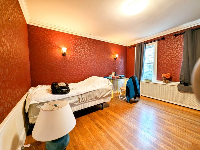
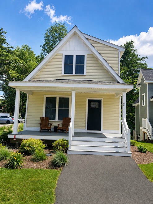
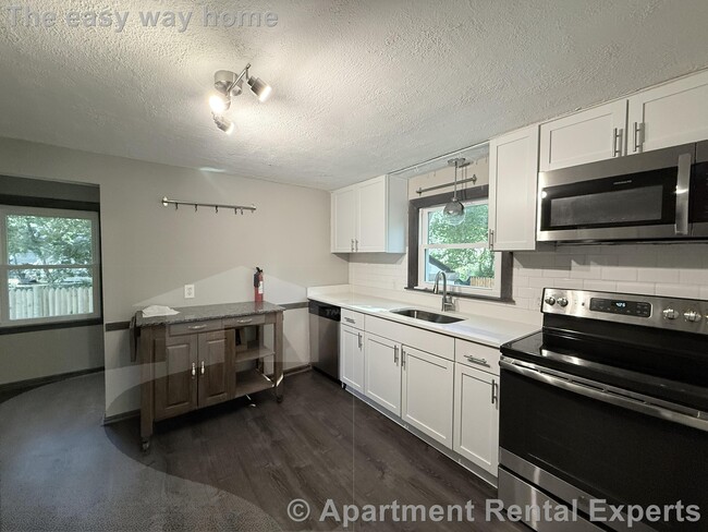
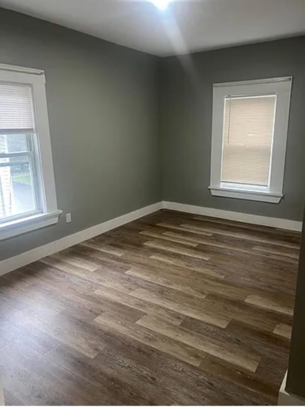
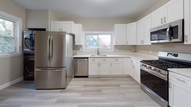
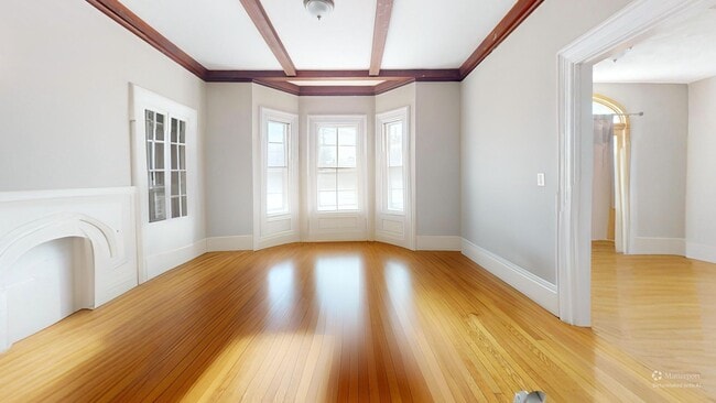
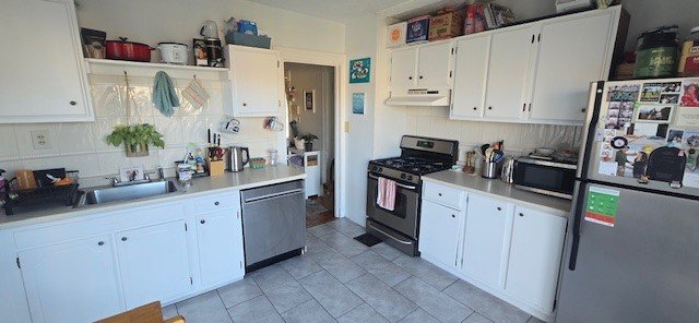
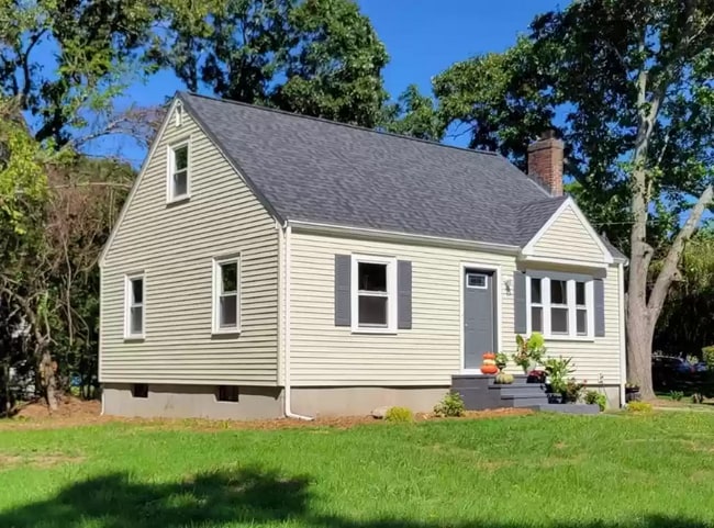
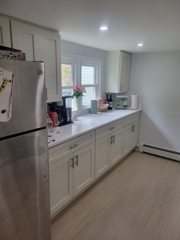
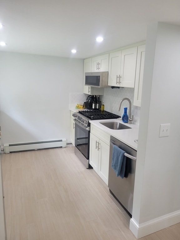
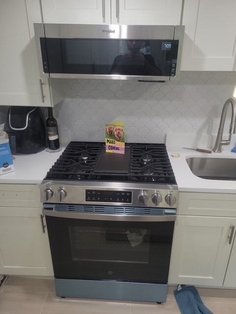
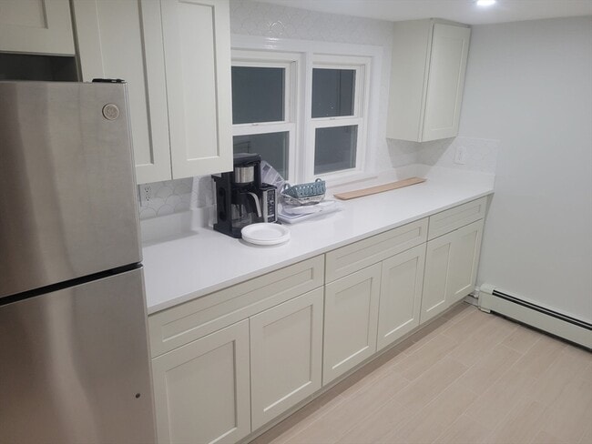
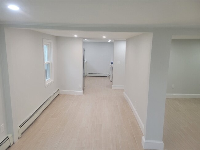
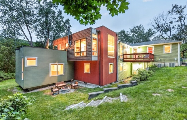
Newly renovated 6 room 3 bedroom single family in outstanding location. Short distance to town center,community center,Ashland State Park,blocks from commuter rail,parks,trails,tennis and close to golf course. New kitchen,new floors,well insulated,private parking,lots of storage space with small deck off of bedroom. MLS ID 73555322

28 Olive St is a house located in Middlesex County and the 01721 ZIP Code.

* Price shown is total price based on community-supplied monthly required fees. Excludes user-selected optional fees and variable or usage-based fees and required charges due at or prior to move-in or at move-out. Price, availability, fees, and any applicable rent special are subject to change without notice.
* Square footage definitions vary. Displayed square footage is approximate.

Home Details

Home Type

Single Family Detached Home

Year Built

Built in 1940

Bedrooms and Bathrooms

1 Full Bathroom 3 Bedrooms

Home Design

Entry on the 1st floor

Interior Spaces

1,200 Sq Ft Home

Kitchen

Range Oven Freezer Microwave Dishwasher

Laundry

Dryer Washer

Listing and Financial Details

Security Deposit $3,000 Property Available on 9/1/26 12 Month Lease Term Assessor Parcel Number 3295171 Rent includes trash collection, gardener, extra storage, garden area, laundry facilities

Location

Property is near golf course, public transit, and schools

Lot Details

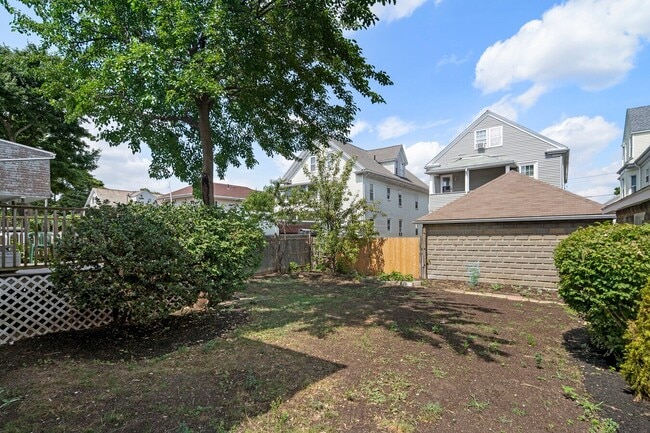
7,000 Sq Ft Lot

Parking

3 Open Parking Spaces 3 Car Parking Spaces

Utilities

No Cooling Heating System Uses Oil

Community Details

Amenities

Shops Laundry Facilities

Overview

Near Conservation Area No Home Owners Association

Pet Policy

Cats Allowed

Recreation

Tennis Courts Park

Fees and Policies

The fees listed below are community-provided and may exclude utilities or add-ons. All payments are made directly to the property and are non-refundable unless otherwise specified. Use the Cost Calculator to determine costs based on your needs.

  • One-Time Basics
    • Security Deposit - Refundable
      $3,000

Property Fee Disclaimer: Based on community-supplied data and independent market research. Subject to change without notice. May exclude fees for mandatory or optional services and usage-based utilities.

Details

Utilities Included

  • Trash Removal

Contact

  • Listed by Paul Caruccio | M. Celata Real Estate
  • Phone Number
  • Source
    MLS Property Information Network
The property listing data and information set forth herein were provided to MLS Property Information Network, Inc. from third party sources, including sellers, lessors and public records, and were compiled by MLS Property Information Network, Inc. The property listing data and information are for the personal, non-commercial use of consumers having a good faith interest in purchasing or leasing listed properties of the type displayed to them and may not be used for any purpose other than to identify prospective properties which such consumers may have a good faith interest in purchasing or leasing. MLS Property Information Network, Inc. and its subscribers disclaim any and all representations and warranties as to the accuracy of the property listing data and information set forth herein. All properties are subject to prior sale, change or withdrawal. Copyright © 2026 MLS Property Information Network, Inc. All rights reserved.
| Edit

Under 30 minutes

Commute Time is calculated at rush hour.
Neighborhood

495-South is a large area surrounding Interstate 495 about 20 miles south of Boston. This suburban town features peaceful neighborhoods nestled in forested areas paired with commercial developments. Renters have the choice of moderately priced to luxury apartments, condos, and single-family homes. An abundance of shopping and dining choices are scattered along the town’s major thoroughfares. Ponds, creeks, and large natural areas like Franklin State Forest and DelCarte Conservation Area provide relaxing outdoor activities. Residents have access to big-city amenities by driving a bit north into Boston, and the eclectic downtown districts of Worcester and Framingham are situated outside of the western and eastern corners of town.

Learn more about living in 495-South 
Amenities
  • Heating
  • Microwave
  • Oven
  • Freezer
  • Basement
Expenses
Utilities Included
Trash Removal Included
Education
Colleges & Universities Distance
Drive: 12 min 5.2 mi
Drive: 25 min 10.8 mi
Drive: 27 min 12.7 mi
Drive: 26 min 13.2 mi
28 Olive St is within 12 minutes or 5.2 miles from Framingham State College. It is also near Wellesley College and Babson College.
Transportation

28 Olive St is near Worcester Regional, located 25.6 miles or 44 minutes away, and General Edward Lawrence Logan International, located 29.3 miles or 48 minutes away.

Commuter Rail Distance
Drive: 8 min 1.8 mi
Drive: 9 min 4.3 mi
Drive: 9 min 4.3 mi
Drive: 9 min 4.7 mi
Drive: 14 min 5.9 mi
Airports Distance
Airports Distance
Worcester Regional
Drive: 44 min 25.6 mi
General Edward Lawrence Logan International
Drive: 48 min 29.3 mi
Getting Around
Somewhat Walkable
Walkability
30 / 100
Minimal Public Transit
Transit
10 / 100
Exceptionally Drivable
Drivability
90 / 100
Moderately Bikeable
Bikeability
60 / 100

Scores provided by

What do Walkability, Transit, Drivability, and Bikeability mean? Walkability measures the walking distance to day-to-day needs. Transit measures access to public transportation. Drivability measures congestion, parking availability, and access to major roads. Bikeability measures the suitability for cycling. How It Works
-
Soundscore
- / 100

Traffic

-

Airport

-

Businesses

-

Scores provided by

HowLoud What is a Sound Score Rating? A Sound Score Rating aggregates noise caused by vehicle traffic, airplane traffic and local sources. How It Works
Points of Interest

Time and distance from 28 Olive St.

Shopping Centers Distance
Walk: 18 min 1.0 mi
Walk: 19 min 1.0 mi
Walk: 20 min 1.1 mi
28 Olive St has 3 shopping centers within 1.1 miles, which is about a 20-minute walk. The miles and minutes will be for the farthest away property.
Parks and Recreation Distance
Ashland State Park
Walk: 16 min 0.9 mi
Mass Audubon's Waseeka Wildlife Sanctuary
Drive: 9 min 2.4 mi
Cowassock Woods and Ashland Town Forest
Drive: 10 min 4.4 mi
Wilfred J. Turenne Wildlife Habitat
Drive: 9 min 4.8 mi
Hopkinton State Park
Drive: 17 min 6.6 mi
28 Olive St has 5 parks within 6.6 miles, including Ashland State Park, Mass Audubon's Waseeka Wildlife Sanctuary, and Hopkinton State Park.
Hospitals Distance
Hospitals Distance
Drive: 11 min 5.0 mi
Drive: 19 min 10.4 mi
Drive: 19 min 11.8 mi
28 Olive St has 3 hospitals within 11.8 miles, the nearest is MetroWest Medical Center which is 5.0 miles away and a 11 minute drive.
Military Bases Distance
Drive: 18 min 8.3 mi
Drive: 44 min 21.8 mi
Drive: 73 min 42.2 mi
28 Olive St has 3 military bases within 42.2 miles, the nearest is US Military Reservation which is 8.3 miles away and a 18 minute drive.

You May Also Like

Similar Rentals Nearby