
The Drexel at Oakley
3827 Paxton Ave,
Cincinnati, OH 45209
$1,595 - $2,595
1-3 Beds
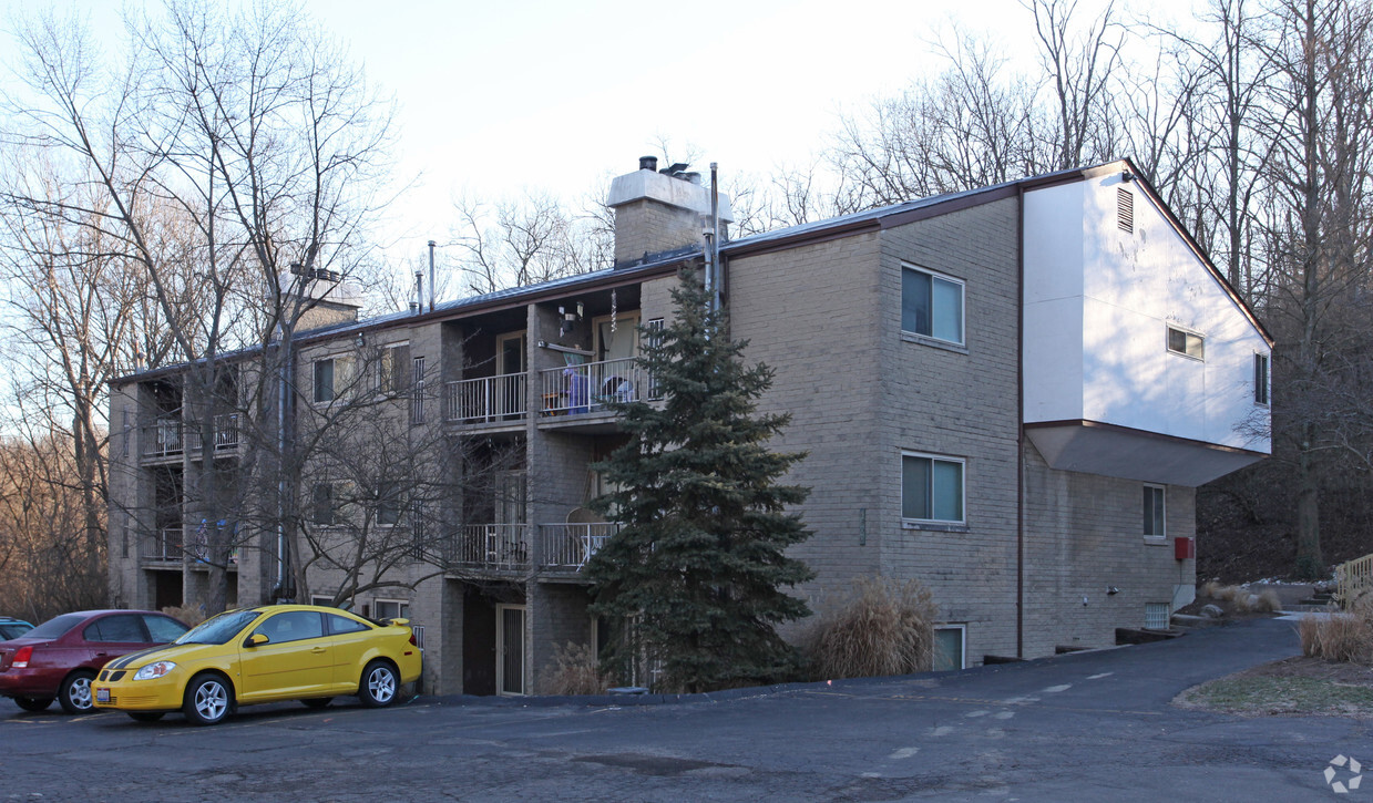
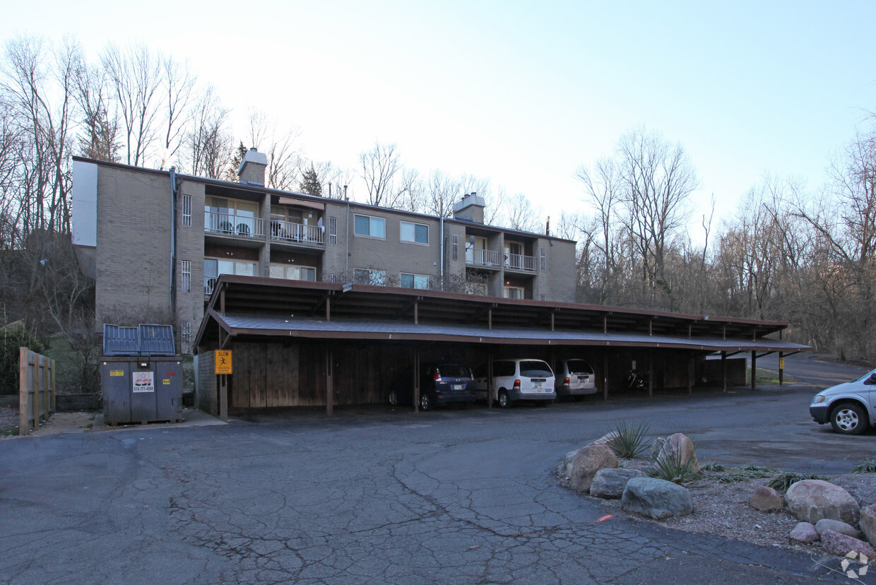
Meet your new apartment at 2798-2800 Temple Ave. Located at 2798-2800 Temple Ave in Cincinnati, this community has so much to offer its residents. From location to floorplan options, the professional leasing staff is ready to help you find the perfect new place. Be sure to check out the apartment floorplan options. Drop by to talk about leasing your new apartment.
2798-2800 Temple Ave is an apartment community located in Hamilton County and the 45211 ZIP Code. This area is served by the Cincinnati Public Schools attendance zone.
Situated about five miles northwest of Downtown Cincinnati, Westwood is the largest neighborhood in the city. Residents flock to Westwood for its many affordable historic homes and modern apartments available for rent in addition to its close proximity to I-74, I-75, and all that Downtown Cincinnati has to offer.
While Westwood is a predominantly residential neighborhood, it is also home to a slew of convenient stores and restaurants. Shopping opportunities abound in Westwood, with plenty of national retailers in Western Hills Plaza and local shops in the growing Town Hall District. Numerous neighborhood parks provide ample space to enjoy the outdoors in town as well as the sprawling 1,400-acre Mount Airy Forest, which is partially located in Westwood.
Learn more about living in Westwood| Colleges & Universities | Distance | ||
|---|---|---|---|
| Colleges & Universities | Distance | ||
| Drive: | 15 min | 5.7 mi | |
| Drive: | 14 min | 6.0 mi | |
| Drive: | 15 min | 6.2 mi | |
| Drive: | 15 min | 6.4 mi |


Transportation options available in Cincinnati include Brewery District Station, Elm & Henry, located 5.8 miles from 2798-2800 Temple Ave. 2798-2800 Temple Ave is near Cincinnati/Northern Kentucky International, located 20.7 miles or 39 minutes away.
| Transit / Subway | Distance | ||
|---|---|---|---|
| Transit / Subway | Distance | ||
| Drive: | 14 min | 5.8 mi | |
| Drive: | 15 min | 6.0 mi | |
| Drive: | 15 min | 6.1 mi | |
| Drive: | 15 min | 6.2 mi | |
| Drive: | 15 min | 6.3 mi |
| Commuter Rail | Distance | ||
|---|---|---|---|
| Commuter Rail | Distance | ||
|
|
Drive: | 15 min | 6.7 mi |
| Airports | Distance | ||
|---|---|---|---|
| Airports | Distance | ||
|
Cincinnati/Northern Kentucky International
|
Drive: | 39 min | 20.7 mi |
Time and distance from 2798-2800 Temple Ave.
| Shopping Centers | Distance | ||
|---|---|---|---|
| Shopping Centers | Distance | ||
| Drive: | 7 min | 1.9 mi | |
| Drive: | 7 min | 2.3 mi | |
| Drive: | 7 min | 2.6 mi |
| Parks and Recreation | Distance | ||
|---|---|---|---|
| Parks and Recreation | Distance | ||
|
Mt. Airy Forest
|
Drive: | 8 min | 2.9 mi |
|
Buttercup Valley
|
Drive: | 12 min | 4.7 mi |
|
Imago Earth Center
|
Drive: | 14 min | 5.3 mi |
|
LaBoiteaux Woods
|
Drive: | 15 min | 5.9 mi |
|
Wilson Commons
|
Drive: | 16 min | 6.1 mi |
| Hospitals | Distance | ||
|---|---|---|---|
| Hospitals | Distance | ||
| Drive: | 9 min | 3.0 mi | |
| Drive: | 12 min | 5.3 mi | |
| Drive: | 15 min | 6.5 mi |
| Military Bases | Distance | ||
|---|---|---|---|
| Military Bases | Distance | ||
| Drive: | 75 min | 55.5 mi | |
| Drive: | 81 min | 60.5 mi | |
| Drive: | 83 min | 63.8 mi |
What Are Walk Score®, Transit Score®, and Bike Score® Ratings?
Walk Score® measures the walkability of any address. Transit Score® measures access to public transit. Bike Score® measures the bikeability of any address.
What is a Sound Score Rating?
A Sound Score Rating aggregates noise caused by vehicle traffic, airplane traffic and local sources

2798-2800 Temple Ave
Cincinnati, OH 45211


