

$2,500
/ Month
2750 Johnson Ave
Bronx, NY 10463
2 Weeks Ago
Favorites
2750 Johnson Ave

Favorites
Check Back Soon for Upcoming Availability
| Beds | Baths | Average SF |
|---|---|---|
| 3 Bedrooms 3 Bedrooms 3 Br | 1.5 Baths 1.5 Baths 1.5 Ba | — |
Fees and Policies
Details
Utilities Included
-
Water
-
Heat
About This Property
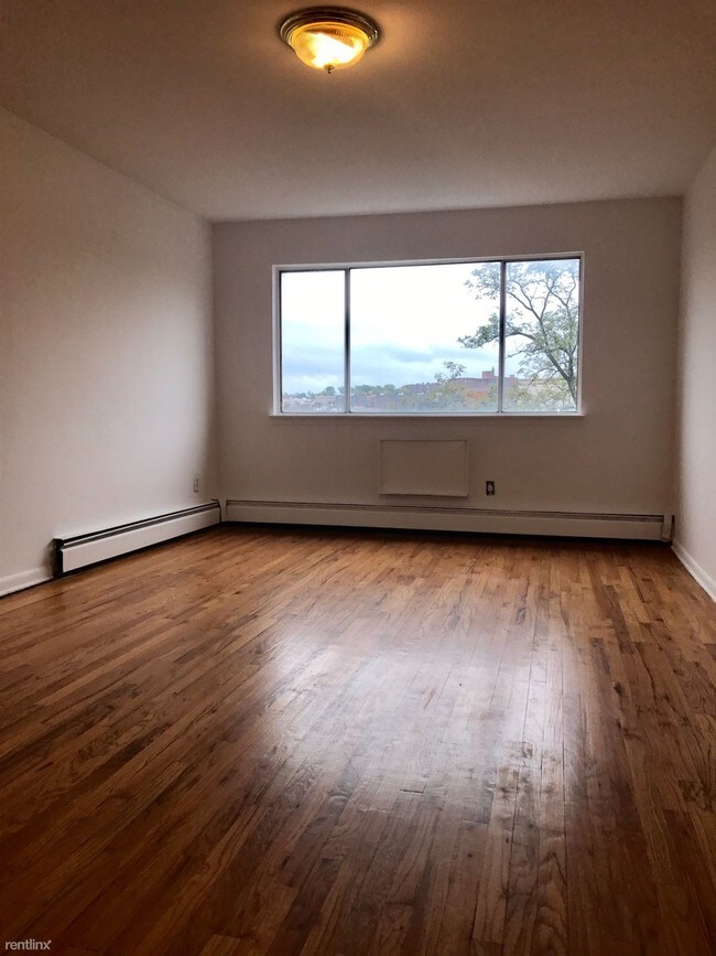
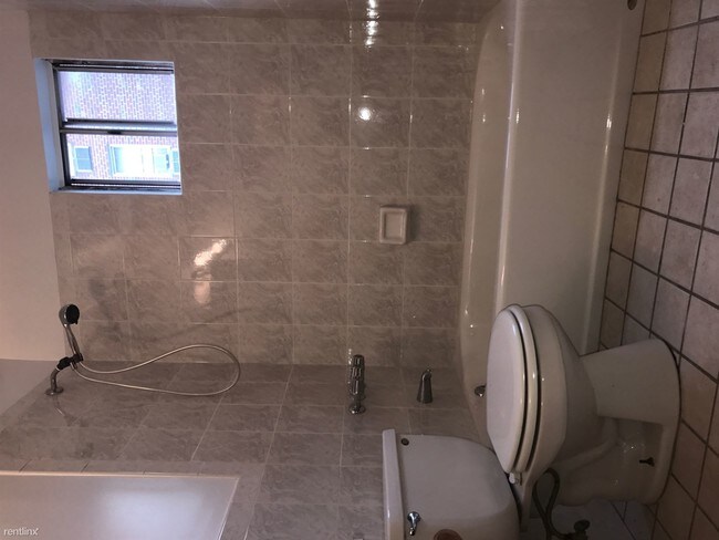
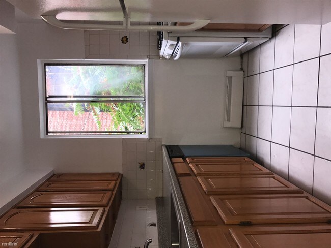
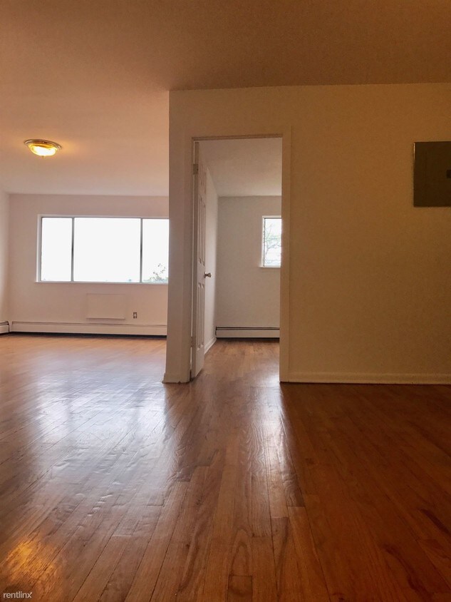
(917) 903-1966 - Big, New 3br With Beautiful Bath & Kitchen. 5 Closets In Apartment. Walking Distance to Johnson Avenue, #1 train, Close to West side Highway. Call or text Chris at 917-903-1966 (RLNE3616422) Lease lengths: 12 Months. Utilities: Heat Included, Water Included, High-Speed Internet Available. Pet policies: Small Dogs Allowed, Cats Allowed.
2750 Johnson Ave is a condo located in New York County and the 10463 ZIP Code. This area is served by the New York City Geographic District #10 attendance zone.
Unique Features
- High-Speed Internet Available
Location
Get Directions
This bustling neighborhood houses New York City landmarks and offers unbeatable views of the Hudson River. Diversity, culture, and cuisine run deep in Washington Heights. Residents enjoy Washington Height’s variety of people and personalities, as well as the neighborly feel that accompanies this urban area.
Washington Heights offers lively streets where there is always something going on, from family-friendly festivals and live music to street vendors and more. Public parks are a valued part of the community, such as Fort Washington Park and Highbridge Park, located on opposite sides of the neighborhood. Discover the site of the Little Red Lighthouse, Manhattan’s only lighthouse, at Fort Washington Park, along with views of the Hudson River, the New Jersey Palisades, and the George Washington Bridge. Enjoy sports fields, playgrounds, greenways paths, and waterfront access.
Learn more about living in Washington HeightsBelow are rent ranges for similar nearby apartments
Amenities
- High-Speed Internet Available
Expenses
Utilities Included
Water, Heat
Included
Education
| Colleges & Universities | Distance | ||
|---|---|---|---|
| Colleges & Universities | Distance | ||
| Walk: | 8 min | 0.4 mi | |
| Drive: | 6 min | 2.2 mi | |
| Drive: | 7 min | 2.8 mi | |
| Drive: | 7 min | 3.2 mi |
2750 Johnson Ave is within 8 minutes or 0.4 mile from Yeshiva University, Wilf. It is also near Bronx Community College and Monroe College, Bronx Campus.
Schools


Public Elementary School
Grades PK-5
336 Students
Nearby
Public Elementary School
Grades K-5
731 Students
Attendance Zone
Public Middle & High School
Grades 6-12
1,417 Students
Attendance Zone
Private Elementary & Middle School
Grades PK-8
216 Students
Nearby
Private High School
Grades 9-12
60 Students
Nearby
School data provided by
 The GreatSchools Rating helps parents compare schools within a state based on a variety of school quality indicators and provides a helpful picture of how effectively each school serves all of its students. Ratings are on a scale of 1 (below average) to 10 (above average) and can include test scores, college readiness, academic progress, advanced courses, equity, discipline and attendance data. We also advise parents to visit schools, consider other information on school performance and programs, and consider family needs as part of the school selection process.
View GreatSchools Rating Methodology
Data provided by GreatSchools.org © 2025. All rights reserved.
View GreatSchools Rating Methodology
Data provided by GreatSchools.org © 2025. All rights reserved.
Transportation options available in Bronx include 181 Street (1 Line), located 0.3 mile from 2750 Johnson Ave. 2750 Johnson Ave is near LaGuardia, located 9.0 miles or 18 minutes away, and Newark Liberty International, located 20.4 miles or 24 minutes away.
| Transit / Subway | Distance | ||
|---|---|---|---|
| Transit / Subway | Distance | ||
|
|
Walk: | 5 min | 0.3 mi |
|
|
Walk: | 8 min | 0.4 mi |
|
|
Walk: | 9 min | 0.5 mi |
|
|
Walk: | 10 min | 0.5 mi |
|
|
Walk: | 14 min | 0.7 mi |
| Commuter Rail | Distance | ||
|---|---|---|---|
| Commuter Rail | Distance | ||
| Drive: | 4 min | 1.6 mi | |
|
|
Drive: | 6 min | 2.1 mi |
|
|
Drive: | 6 min | 2.4 mi |
|
|
Drive: | 7 min | 2.5 mi |
|
|
Drive: | 8 min | 4.0 mi |
| Airports | Distance | ||
|---|---|---|---|
| Airports | Distance | ||
|
LaGuardia
|
Drive: | 18 min | 9.0 mi |
|
Newark Liberty International
|
Drive: | 24 min | 20.4 mi |
Time and distance from 2750 Johnson Ave.
| Shopping Centers | Distance | ||
|---|---|---|---|
| Shopping Centers | Distance | ||
| Drive: | 5 min | 2.0 mi | |
| Drive: | 6 min | 2.4 mi | |
| Drive: | 5 min | 2.4 mi |
2750 Johnson Ave has 3 shopping centers within 2.4 miles, which is about a 5-minute drive. The miles and minutes will be for the farthest away property.
| Parks and Recreation | Distance | ||
|---|---|---|---|
| Parks and Recreation | Distance | ||
|
J Hood Wright Park
|
Walk: | 9 min | 0.5 mi |
|
Roger Morris Park
|
Walk: | 19 min | 1.0 mi |
|
Roberto Clemente State Park
|
Drive: | 6 min | 2.2 mi |
|
Highbridge Park
|
Drive: | 6 min | 3.0 mi |
|
Fort Washington Park
|
Drive: | 6 min | 3.4 mi |
2750 Johnson Ave has 5 parks within 3.4 miles, including J Hood Wright Park, Highbridge Park, and Roger Morris Park.
| Hospitals | Distance | ||
|---|---|---|---|
| Hospitals | Distance | ||
| Walk: | 13 min | 0.7 mi | |
| Drive: | 6 min | 2.8 mi | |
| Drive: | 7 min | 3.1 mi |
2750 Johnson Ave has 3 hospitals within 3.1 miles, the nearest is New York State Psychiatric Institute which is 0.7 mile away and a 13 minute walk.
| Military Bases | Distance | ||
|---|---|---|---|
| Military Bases | Distance | ||
| Drive: | 20 min | 11.0 mi | |
| Drive: | 27 min | 14.3 mi |
2750 Johnson Ave is 11.0 miles from Fort Totten US Govt Reservation, and is convenient to other military bases, including Governors Island Support Center.
You May Also Like
Similar Rentals Nearby


What Are Walk Score®, Transit Score®, and Bike Score® Ratings?
Walk Score® measures the walkability of any address. Transit Score® measures access to public transit. Bike Score® measures the bikeability of any address.
What is a Sound Score Rating?
A Sound Score Rating aggregates noise caused by vehicle traffic, airplane traffic and local sources
2750 Johnson Ave
Bronx, NY 10463