
$1,600
/ Month
275 Main St
Paterson, NJ 07505
Today
|
Edit
Favorites
866-201-6210
-
Bedrooms
1
-
Bathrooms
1
-
Square Feet
--
-
Available
Available Now
Highlight
- Historic Home
275 Main St

Favorites
About This Home
Available Now
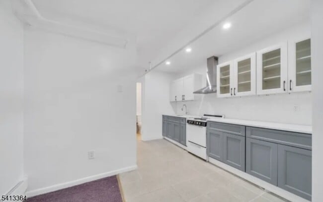
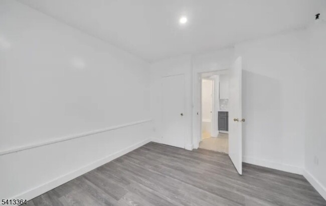
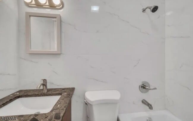
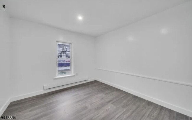
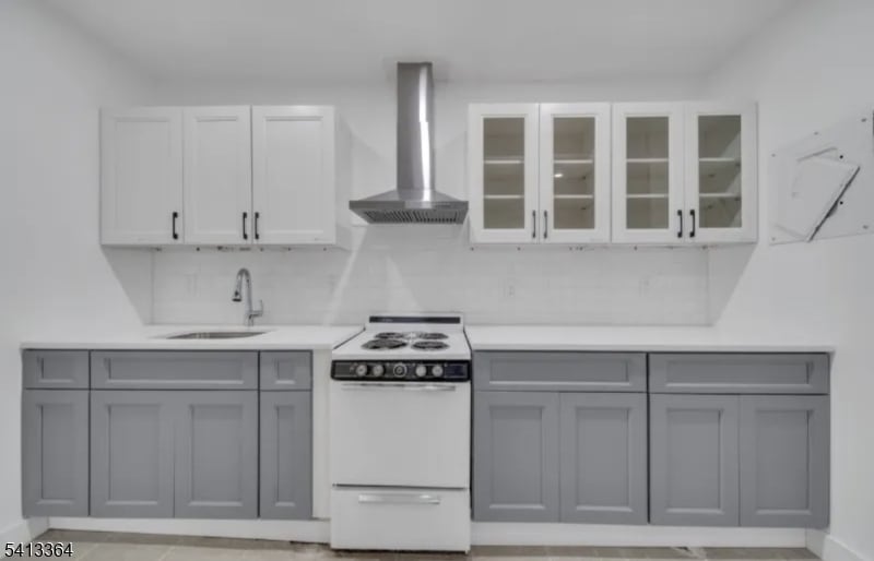
Fully renovated 1-bedroom home located in the heart of Downtown Paterson! This move-in ready property offers unbeatable convenience, just steps from local restaurants, shopping, and public transportation. Easy access to NYC-bound buses and the nearby train station makes commuting a breeze. Simply unpack and start enjoying everything this vibrant location has to offer!
275 Main St is an apartment community located in Passaic County and the 07505 ZIP Code.
* Price shown is base rent. Excludes user-selected optional fees and variable or usage-based fees and required charges due at or prior to move-in or at move-out. Price, availability, fees, and any applicable rent special are subject to change without notice.
* Square footage definitions vary. Displayed square footage is approximate.
Home Details
Year Built
Built in 1931
Bedrooms and Bathrooms
1 Full Bathroom
1 Bedroom
Interior Spaces
3-Story Property
Listing and Financial Details
Assessor Parcel Number 2508-06201-0000-00015-0000-
Tenant pays for electric, gas, heat
Lot Details
6,970 Sq Ft Lot
Historic Home
Parking
On-Street Parking
Utilities
Window Unit Cooling System
Community Details
Pet Policy
Pet Size Limit
Contact
- Listed by DAVID H VANEGAS | GardenStateMLS#NJ
- Phone Number
- Contact
-
Source
Garden State Multiple Listing Service, LLC
Copyright © 2026 Garden State MLS, LLC. All rights reserved. All information provided by the listing agent/broker is deemed reliable but is not guaranteed and should be independently verified.
Location
Get Directions
Nestled along the Passaic River, Downtown Paterson is the heart of Paterson and the city’s oldest district. Downtown Paterson is filled with government offices, restaurants, thrift shops, specialty stores, and more. This commercial hub also hosts several events throughout the year like sidewalk sales and holiday celebrations. Living in Downtown Paterson will also place you near several waterfront parks like the Paterson Great Falls National Historic Park, which boasts a 77-foot waterfall. Downtown Paterson offers a variety of rental options including studios and traditional apartments and triple-decker houses.
Learn more about living in Downtown Paterson
Amenities
- Air Conditioning
Education
| Colleges & Universities | Distance | ||
|---|---|---|---|
| Colleges & Universities | Distance | ||
| Walk: | 8 min | 0.4 mi | |
| Drive: | 5 min | 2.0 mi | |
| Drive: | 8 min | 3.5 mi | |
| Drive: | 9 min | 4.7 mi |
275 Main St is within 8 minutes or 0.4 mile from Passaic County C.C., Paterson. It is also near Berkeley College and William Paterson University.
Transportation options available in Paterson include Grove Street, located 10.5 miles from 275 Main St. 275 Main St is near Newark Liberty International, located 21.1 miles or 25 minutes away, and LaGuardia, located 25.8 miles or 38 minutes away.
| Transit / Subway | Distance | ||
|---|---|---|---|
| Transit / Subway | Distance | ||
|
|
Drive: | 15 min | 10.5 mi |
|
|
Drive: | 16 min | 10.8 mi |
|
|
Drive: | 16 min | 11.0 mi |
|
|
Drive: | 17 min | 11.3 mi |
| Commuter Rail | Distance | ||
|---|---|---|---|
| Commuter Rail | Distance | ||
|
|
Walk: | 7 min | 0.4 mi |
|
|
Drive: | 6 min | 2.8 mi |
|
|
Drive: | 7 min | 3.6 mi |
|
|
Drive: | 8 min | 4.4 mi |
|
|
Drive: | 9 min | 4.5 mi |
| Airports | Distance | ||
|---|---|---|---|
| Airports | Distance | ||
|
Newark Liberty International
|
Drive: | 25 min | 21.1 mi |
|
LaGuardia
|
Drive: | 38 min | 25.8 mi |
Time and distance from 275 Main St.
| Shopping Centers | Distance | ||
|---|---|---|---|
| Shopping Centers | Distance | ||
| Walk: | 12 min | 0.6 mi | |
| Drive: | 5 min | 2.4 mi | |
| Drive: | 5 min | 2.5 mi |
275 Main St has 3 shopping centers within 2.5 miles, which is about a 5-minute drive. The miles and minutes will be for the farthest away property.
| Parks and Recreation | Distance | ||
|---|---|---|---|
| Parks and Recreation | Distance | ||
|
Rifle Camp Park Observatory
|
Drive: | 6 min | 3.3 mi |
|
Presby Memorial Iris Gardens
|
Drive: | 9 min | 5.7 mi |
|
NJ Audubon Lorrimer Sanctuary
|
Drive: | 11 min | 6.2 mi |
|
McFaul Environmental Center
|
Drive: | 20 min | 8.7 mi |
|
Saddle River County Park
|
Drive: | 18 min | 9.0 mi |
275 Main St has 5 parks within 9.0 miles, including Rifle Camp Park Observatory, Presby Memorial Iris Gardens, and NJ Audubon Lorrimer Sanctuary.
| Hospitals | Distance | ||
|---|---|---|---|
| Hospitals | Distance | ||
| Drive: | 2 min | 1.2 mi | |
| Drive: | 10 min | 5.6 mi | |
| Drive: | 9 min | 6.0 mi |
275 Main St has 3 hospitals within 6.0 miles, the nearest is St. Joseph's Hospital and Medical Center which is 1.2 miles away and a 2 minute drive.
| Military Bases | Distance | ||
|---|---|---|---|
| Military Bases | Distance | ||
| Drive: | 35 min | 23.4 mi | |
| Drive: | 33 min | 25.6 mi |
275 Main St is 23.4 miles from Governors Island Support Center, and is convenient to other military bases, including Military Ocean Terminal.
You May Also Like
How do I access Social Services in New Jersey?
Statewide service is free, confidential, multilingual and always open. Three easy ways to reach Social Services in NJ: Dial 2-1-1; text your zip code to 898-211; or chat at https://www.nj211.org
Similar Rentals Nearby


What Are Walk Score®, Transit Score®, and Bike Score® Ratings?
Walk Score® measures the walkability of any address. Transit Score® measures access to public transit. Bike Score® measures the bikeability of any address.
What is a Sound Score Rating?
A Sound Score Rating aggregates noise caused by vehicle traffic, airplane traffic and local sources
275 Main St
Paterson, NJ 07505