$1,499
/ Month
2743 Cranston Rd Unit 2
Philadelphia, PA 19131
Today
|
Edit
Favorites
267-417-6819
-
Bedrooms
2
-
Bathrooms
1
-
Square Feet
1,100 sq ft
-
Available
Available Now
2743 Cranston Rd Unit 2

Favorites
About This Home
12 Month Lease,
$1,499 deposit,
Available Now
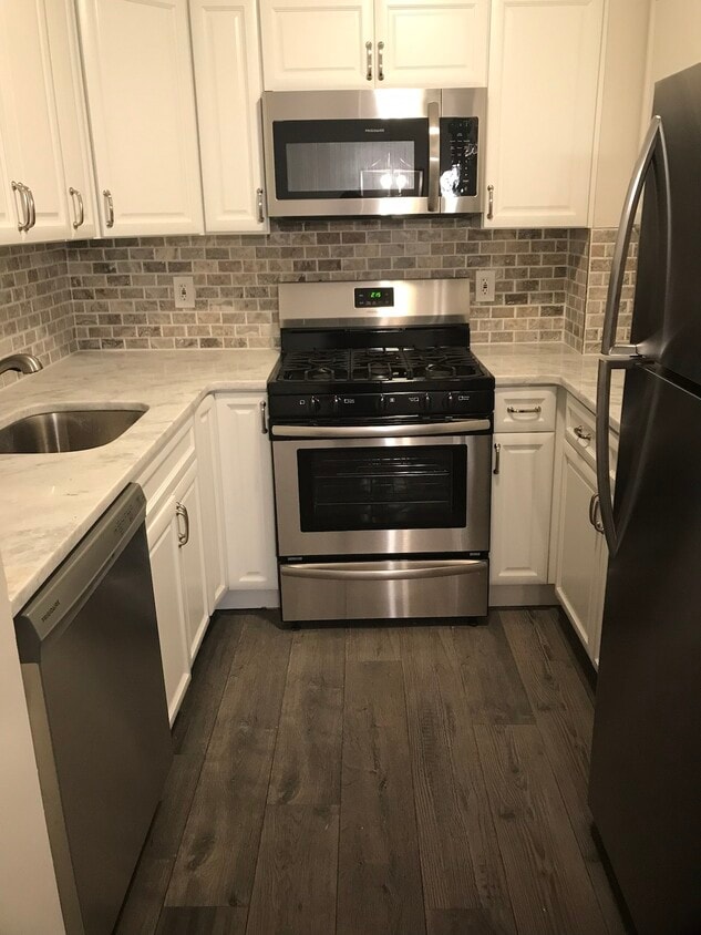
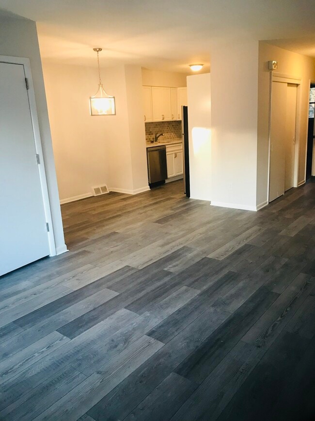
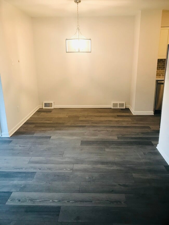
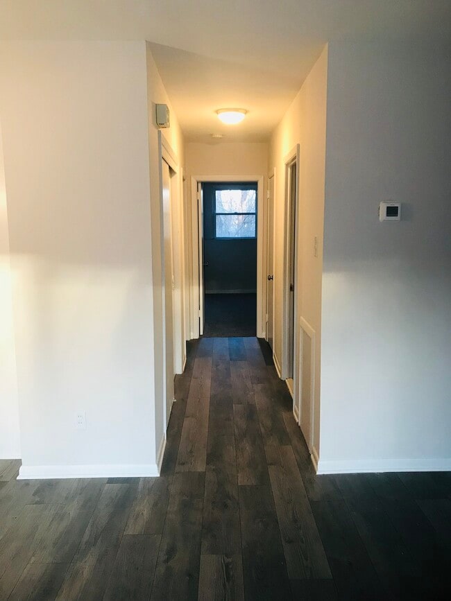
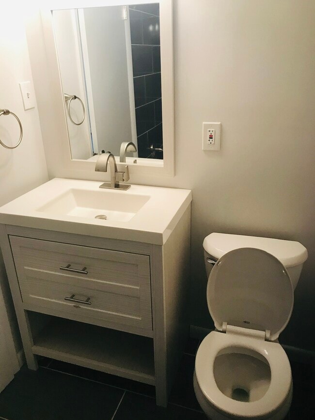
Welcome to this charming apartment unit located in Wynnefield Heights. This 2 Bedroom 1 Bathroom unit features a beautiful kitchen with granite countertops and stainless steel appliances, an updated bathroom, and new flooring. The property is conveniently located near public transportation and major roadways. Minutes from City Line Avenue. Target, PCOM, Fairmount Park, and the Schuylkill River Trail are all within walking distance. Don't miss the opportunity to make this apartment your new home. Schedule your showing today!
2743 Cranston Rd is an apartment community located in Philadelphia County and the 19131 ZIP Code.
* Price shown is base rent. Excludes user-selected optional fees and variable or usage-based fees and required charges due at or prior to move-in or at move-out. Price, availability, fees, and any applicable rent special are subject to change without notice.
* Square footage definitions vary. Displayed square footage is approximate.
Features
Washer/Dryer
Dishwasher
Granite Countertops
Microwave
- Washer/Dryer
- Dishwasher
- Disposal
- Granite Countertops
- Stainless Steel Appliances
- Kitchen
- Microwave
- Range
- Refrigerator
- Walking/Biking Trails
Fees and Policies
The fees listed below are community-provided and may exclude utilities or add-ons. All payments are made directly to the property and are non-refundable unless otherwise specified.
Details
Lease Options
-
12 Months
Contact
- Listed by JW Investments
- Phone Number
- Contact
Location
Get Directions
Located in the outer stretches of West Philadelphia, about six miles northwest of Center City, Wynnefield Heights offers residents a laidback atmosphere. Dense with tree-lined streets and lush green spaces, the neighborhood is teeming with recreational opportunities. Wynnefield Heights is also convenient to the sprawling West Fairmount Park, where outdoor delights abound.
Historic brick buildings and a diverse population contribute to the unique character of Wynnefield Heights as well. The Philadelphia College of Osteopathic Medicine is situated in the neighborhood, making Wynnefield Heights a top choice for many students, faculty, and staff.
Convenience to the Bala Cynwyd Shopping Center provides residents with plenty of shopping opportunities nearby, while the SEPTA Cynwyd Line and I-76 connects the neighborhood to the rest of the Greater Philadelphia Area.
Learn more about living in Wynnefield Heights
Amenities
- Washer/Dryer
- Dishwasher
- Disposal
- Granite Countertops
- Stainless Steel Appliances
- Kitchen
- Microwave
- Range
- Refrigerator
- Walking/Biking Trails
Education
| Colleges & Universities | Distance | ||
|---|---|---|---|
| Colleges & Universities | Distance | ||
| Walk: | 12 min | 0.6 mi | |
| Drive: | 6 min | 2.1 mi | |
| Drive: | 8 min | 2.5 mi | |
| Drive: | 9 min | 2.8 mi |
2743 Cranston Rd Unit 2 is within 12 minutes or 0.6 mile from Philadelphia Osteopathic. It is also near St Joseph's Univ., Phila. and Philadelphia University.
Transportation options available in Philadelphia include Lancaster Avenue And 52Nd Street, located 2.3 miles from 2743 Cranston Rd Unit 2. 2743 Cranston Rd Unit 2 is near Philadelphia International, located 13.8 miles or 27 minutes away, and Trenton Mercer, located 33.1 miles or 57 minutes away.
| Transit / Subway | Distance | ||
|---|---|---|---|
| Transit / Subway | Distance | ||
|
|
Drive: | 6 min | 2.3 mi |
| Drive: | 6 min | 2.5 mi | |
|
|
Drive: | 6 min | 2.5 mi |
|
|
Drive: | 6 min | 2.5 mi |
| Drive: | 7 min | 2.6 mi |
| Commuter Rail | Distance | ||
|---|---|---|---|
| Commuter Rail | Distance | ||
|
|
Drive: | 4 min | 1.2 mi |
|
|
Drive: | 4 min | 1.5 mi |
|
|
Drive: | 4 min | 1.6 mi |
|
|
Drive: | 7 min | 1.9 mi |
|
|
Drive: | 6 min | 2.0 mi |
| Airports | Distance | ||
|---|---|---|---|
| Airports | Distance | ||
|
Philadelphia International
|
Drive: | 27 min | 13.8 mi |
|
Trenton Mercer
|
Drive: | 57 min | 33.1 mi |
Time and distance from 2743 Cranston Rd Unit 2.
| Shopping Centers | Distance | ||
|---|---|---|---|
| Shopping Centers | Distance | ||
| Walk: | 3 min | 0.2 mi | |
| Walk: | 5 min | 0.3 mi | |
| Walk: | 12 min | 0.7 mi |
2743 Cranston Rd Unit 2 has 3 shopping centers within 0.7 mile, which is about a 12-minute walk. The miles and minutes will be for the farthest away property.
| Parks and Recreation | Distance | ||
|---|---|---|---|
| Parks and Recreation | Distance | ||
|
Fairmount Park
|
Drive: | 6 min | 1.9 mi |
|
Please Touch Museum
|
Drive: | 5 min | 2.1 mi |
|
Arboretum of the Barnes Foundation
|
Drive: | 6 min | 2.1 mi |
|
Shofuso - Japanese House and Garden
|
Drive: | 6 min | 2.1 mi |
|
Merion Botanical Park
|
Drive: | 7 min | 2.7 mi |
2743 Cranston Rd Unit 2 has 5 parks within 2.7 miles, including Shofuso - Japanese House and Garden, Fairmount Park, and Please Touch Museum.
| Hospitals | Distance | ||
|---|---|---|---|
| Hospitals | Distance | ||
| Drive: | 8 min | 2.7 mi | |
| Drive: | 10 min | 3.8 mi | |
| Drive: | 10 min | 4.5 mi |
2743 Cranston Rd Unit 2 has 3 hospitals within 4.5 miles, the nearest is Roxborough Memorial Hospital which is 2.7 miles away and a 8 minute drive.
| Military Bases | Distance | ||
|---|---|---|---|
| Military Bases | Distance | ||
| Drive: | 19 min | 10.6 mi |
2743 Cranston Rd Unit 2 is 10.6 miles and a 19 minute drive from Philadelphia Naval Busi Center.
You May Also Like
Similar Rentals Nearby


What Are Walk Score®, Transit Score®, and Bike Score® Ratings?
Walk Score® measures the walkability of any address. Transit Score® measures access to public transit. Bike Score® measures the bikeability of any address.
What is a Sound Score Rating?
A Sound Score Rating aggregates noise caused by vehicle traffic, airplane traffic and local sources.

2743 Cranston Rd
Philadelphia, PA 19131