
$950
/ Month
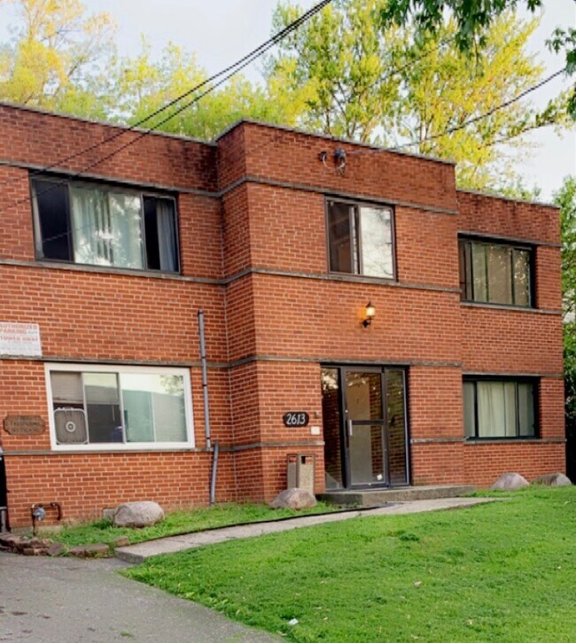
2613 Chesterfield Ct
Cincinnati, OH 45239
Favorites
513-535-4461
-
Bedrooms
1
-
Bathrooms
1
-
Square Feet
700 sq ft
-
Available
Available Now
2613 Chesterfield Ct

Favorites
About This Home
Available Now
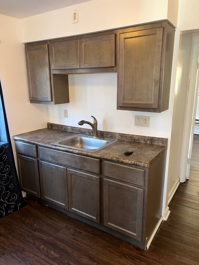
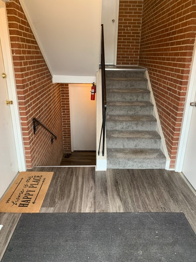
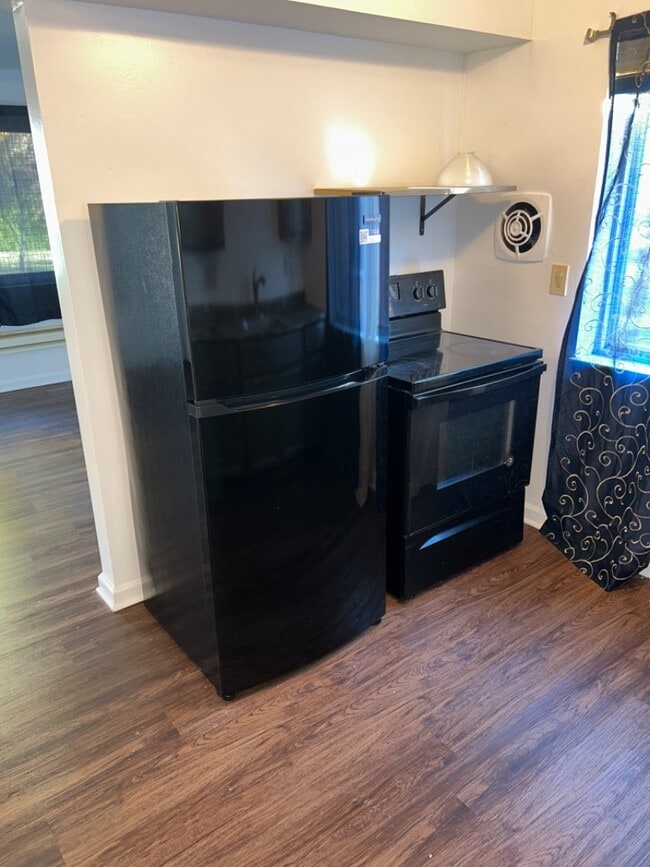
Newly Renovated 1 Bed / 1 Bath Apartment – Mt. AiryNewly renovated, spacious 1-bedroom, 1-bath first-floor unit located on a quiet cul-de-sac in Mt. Airy.This unit features luxury vinyl plank flooring, secure entry, security cameras, coin laundry, off-street parking, and convenient access to the bus line.Tenant pays: Gas & ElectricOwner pays: Water & TrashRequirements:No evictionsIncome must be 2x monthly rentNo pets$50 rental application fee$950 security depositGreat for someone looking for a clean, quiet, and well-maintained home.Application Link Below Spacious, newly renovated 1-bedroom, 1-bath first-floor unit located on a quiet cul-de-sac in Mt. Airy. Features modern luxury vinyl plank flooring, secure building entry, and on-site security cameras for added peace of mind. Enjoy convenient amenities including coin laundry, off-street parking, and easy a...
2613 Chesterfield Ct is an apartment community located in Hamilton County and the 45239 ZIP Code.
* Price shown is base rent. Excludes user-selected optional fees and variable or usage-based fees and required charges due at or prior to move-in or at move-out. Price, availability, fees, and any applicable rent special are subject to change without notice.
* Square footage definitions vary. Displayed square footage is approximate.
Contact
- Listed by Building | Building Realities LLC
- Phone Number
- Contact
Location
Get Directions
Mount Airy is a classic suburban neighborhood with peaceful streets lined with single-family homes. Interstate 74 and Highway 22 makes the seven mile drive into Downtown Cincinnati and beyond accessible, but Mount Airy has a lot to offer from within. Its southern border encompasses Mount Airy Forest, which provides residents with outdoor fun. There are also a few fast food restaurants within the neighborhood, but residents can easily travel to the surrounding areas or into downtown for a diverse selection of restaurants. Renters will find that they have a few affordable options of apartments in longstanding brick buildings to choose from.
Learn more about living in Mount Airy
Education
| Colleges & Universities | Distance | ||
|---|---|---|---|
| Colleges & Universities | Distance | ||
| Drive: | 15 min | 5.4 mi | |
| Drive: | 16 min | 7.1 mi | |
| Drive: | 17 min | 7.5 mi | |
| Drive: | 21 min | 9.1 mi |
2613 Chesterfield Ct is within 15 minutes or 5.4 miles from Cincinnati State. It is also near University of Cincinnati and Univ. of Cincinnati, Medical.
Transportation options available in Cincinnati include Brewery District Station - Elm & Henry, located 7.8 miles from 2613 Chesterfield Ct. 2613 Chesterfield Ct is near Cincinnati/Northern Kentucky International, located 21.8 miles or 40 minutes away.
| Transit / Subway | Distance | ||
|---|---|---|---|
| Transit / Subway | Distance | ||
| Drive: | 16 min | 7.8 mi | |
| Drive: | 17 min | 7.9 mi | |
| Drive: | 17 min | 8.0 mi | |
| Drive: | 17 min | 8.0 mi | |
| Drive: | 17 min | 8.1 mi |
| Commuter Rail | Distance | ||
|---|---|---|---|
| Commuter Rail | Distance | ||
|
|
Drive: | 16 min | 7.7 mi |
| Airports | Distance | ||
|---|---|---|---|
| Airports | Distance | ||
|
Cincinnati/Northern Kentucky International
|
Drive: | 40 min | 21.8 mi |
Getting Around
 What do Walkability, Transit, Drivability, and Bikeability mean?
Walkability measures the walking distance to day-to-day needs.
Transit measures access to public transportation.
Drivability measures congestion, parking availability, and access to major roads.
Bikeability measures the suitability for cycling.
How It Works
What do Walkability, Transit, Drivability, and Bikeability mean?
Walkability measures the walking distance to day-to-day needs.
Transit measures access to public transportation.
Drivability measures congestion, parking availability, and access to major roads.
Bikeability measures the suitability for cycling.
How It Works
Fairly Walkable
Walkability
40
/ 100
Limited Public Transit
Transit
30
/ 100
Very Drivable
Drivability
80
/ 100
Somewhat Bikeable
Bikeability
30
/ 100
Scores provided by
-
Soundscore™
-
/ 100
Traffic
-Airport
-Businesses
-Scores provided by
HowLoud What is a Sound Score Rating? A Sound Score Rating aggregates noise caused by vehicle traffic, airplane traffic and local sources. How It WorksTime and distance from 2613 Chesterfield Ct.
| Shopping Centers | Distance | ||
|---|---|---|---|
| Shopping Centers | Distance | ||
| Walk: | 7 min | 0.4 mi | |
| Walk: | 8 min | 0.4 mi | |
| Drive: | 4 min | 1.6 mi |
2613 Chesterfield Ct has 3 shopping centers within 1.6 miles, which is about a 4-minute drive. The miles and minutes will be for the farthest away property.
| Parks and Recreation | Distance | ||
|---|---|---|---|
| Parks and Recreation | Distance | ||
|
LaBoiteaux Woods
|
Drive: | 6 min | 2.5 mi |
|
Mt. Airy Forest
|
Drive: | 7 min | 2.7 mi |
|
Farbach-Werner Nature Preserve
|
Drive: | 7 min | 2.8 mi |
|
Buttercup Valley
|
Drive: | 9 min | 3.5 mi |
|
Caldwell Preserve
|
Drive: | 11 min | 5.2 mi |
2613 Chesterfield Ct has 5 parks within 5.2 miles, including LaBoiteaux Woods, Mt. Airy Forest, and Farbach-Werner Nature Preserve.
| Hospitals | Distance | ||
|---|---|---|---|
| Hospitals | Distance | ||
| Drive: | 9 min | 3.4 mi | |
| Drive: | 14 min | 6.3 mi | |
| Drive: | 14 min | 6.4 mi |
2613 Chesterfield Ct has 3 hospitals within 6.4 miles, the nearest is Mercy Health - West Hospital which is 3.4 miles away and a 9 minute drive.
| Military Bases | Distance | ||
|---|---|---|---|
| Military Bases | Distance | ||
| Drive: | 70 min | 54.0 mi | |
| Drive: | 76 min | 59.1 mi | |
| Drive: | 78 min | 62.4 mi |
2613 Chesterfield Ct has 3 military bases within 62.4 miles, the nearest is Gentile Air Force Station which is 54.0 miles away and a 70 minute drive.
You May Also Like
Similar Rentals Nearby


What Are Walk Score®, Transit Score®, and Bike Score® Ratings?
Walk Score® measures the walkability of any address. Transit Score® measures access to public transit. Bike Score® measures the bikeability of any address.
What is a Sound Score Rating?
A Sound Score Rating aggregates noise caused by vehicle traffic, airplane traffic and local sources.

2613 Chesterfield Ct
Cincinnati, OH 45239