
52 TEN
5210 N Lamar Blvd,
Austin, TX 78751
Call for Rent
Studio - 3 Beds

Bedrooms
1 bd
Bathrooms
1 ba
Square Feet
500 sq ft
Pet Fee: $500 refundable pet deposit per pet. $25 monthly pet rent per pet. Admin. Fee due upon lease signing: $295
Pet Fee: $500 refundable pet deposit per pet. $25 monthly pet rent per pet. Admin. Fee due upon lease signing: $295
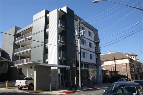
2608/2606 Salado St is an apartment community located in Travis County and the 78705 ZIP Code. This area is served by the Austin Independent School District attendance zone.
Colorful, active, dynamic, energetic, diverse – all of these apply to West Campus, and with its large amount of students in the neighborhood, it’s easy to see why. The brightly-painted buildings, the trendy little pizza joints, and even the amount of bicycles in the area help define this neighborhood as a haven for University of Texas-Austin students. But even if you aren’t a student, this neighborhood is terrific – there are plenty of apartments to choose from, the housing stock is diverse, and the location is ideal.
West Campus extends from Lamar Boulevard to “the Drag,” or Guadalupe Street. The Drag is where you’ll find a wide selection of shops, restaurants, and bars. These include local favorites like Cabo Bob’s, Halal Bros, the Spider House Café and Ballroom, and Kerbey Lane Café. On the west side, things are a little quieter with Pease Park and the Shoal Creek Greenbelt framing the area.
Learn more about living in West Campus AustinCompare neighborhood and city base rent averages by bedroom.
| West Campus Austin | Austin, TX | |
|---|---|---|
| Studio | $906 | $1,209 |
| 1 Bedroom | $1,010 | $1,410 |
| 2 Bedrooms | $2,132 | $1,840 |
| 3 Bedrooms | $3,554 | $2,438 |
| Colleges & Universities | Distance | ||
|---|---|---|---|
| Colleges & Universities | Distance | ||
| Drive: | 4 min | 1.3 mi | |
| Drive: | 4 min | 1.4 mi | |
| Drive: | 9 min | 3.9 mi | |
| Drive: | 12 min | 6.0 mi |


Transportation options available in Austin include Downtown Station, located 2.5 miles from 2608/2606 Salado St. 2608/2606 Salado St is near Austin-Bergstrom International, located 13.3 miles or 27 minutes away.
| Transit / Subway | Distance | ||
|---|---|---|---|
| Transit / Subway | Distance | ||
| Drive: | 6 min | 2.5 mi | |
| Drive: | 7 min | 3.1 mi | |
| Drive: | 7 min | 3.2 mi | |
| Drive: | 9 min | 3.8 mi | |
| Drive: | 10 min | 4.1 mi |
| Commuter Rail | Distance | ||
|---|---|---|---|
| Commuter Rail | Distance | ||
|
|
Drive: | 7 min | 2.4 mi |
|
|
Drive: | 42 min | 33.3 mi |
|
|
Drive: | 46 min | 36.9 mi |
| Airports | Distance | ||
|---|---|---|---|
| Airports | Distance | ||
|
Austin-Bergstrom International
|
Drive: | 27 min | 13.3 mi |
Scores provided by
Traffic
ActiveAirport
CalmBusinesses
ActiveScores provided by
HowLoud What is a Sound Score Rating? A Sound Score Rating aggregates noise caused by vehicle traffic, airplane traffic and local sources. How It WorksTime and distance from 2608/2606 Salado St.
| Shopping Centers | Distance | ||
|---|---|---|---|
| Shopping Centers | Distance | ||
| Walk: | 6 min | 0.4 mi | |
| Walk: | 7 min | 0.4 mi | |
| Walk: | 8 min | 0.4 mi |
| Parks and Recreation | Distance | ||
|---|---|---|---|
| Parks and Recreation | Distance | ||
|
Shoal Creek Greenbelt Park
|
Walk: | 14 min | 0.8 mi |
|
Texas Memorial Museum
|
Drive: | 4 min | 1.3 mi |
|
Elisabet Ney Museum
|
Drive: | 6 min | 2.4 mi |
|
Mayfield Park and Preserve
|
Drive: | 7 min | 3.4 mi |
|
Austin Nature and Science Center
|
Drive: | 10 min | 4.9 mi |
| Hospitals | Distance | ||
|---|---|---|---|
| Hospitals | Distance | ||
| Drive: | 4 min | 1.5 mi | |
| Drive: | 4 min | 1.5 mi | |
| Drive: | 5 min | 1.6 mi |
| Military Bases | Distance | ||
|---|---|---|---|
| Military Bases | Distance | ||
| Drive: | 84 min | 68.3 mi | |
| Drive: | 92 min | 73.6 mi | |
| Drive: | 110 min | 85.0 mi |
What Are Walk Score®, Transit Score®, and Bike Score® Ratings?
Walk Score® measures the walkability of any address. Transit Score® measures access to public transit. Bike Score® measures the bikeability of any address.
What is a Sound Score Rating?
A Sound Score Rating aggregates noise caused by vehicle traffic, airplane traffic and local sources.
2608/2606 Salado St
Austin, TX 78705


