
$2,400 / Month
2600 Wintergreen Ave
District Heights, MD 20747
2 Weeks Ago
Favorites
2600 Wintergreen Ave

Favorites
Check Back Soon for Upcoming Availability
| Beds | Baths | Average SF |
|---|---|---|
| 4 Bedrooms 4 Bedrooms 4 Br | 2 Baths 2 Baths 2 Ba | 962 SF |
About This Property
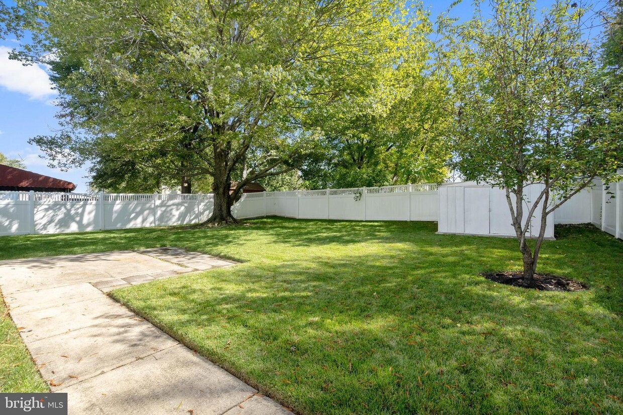
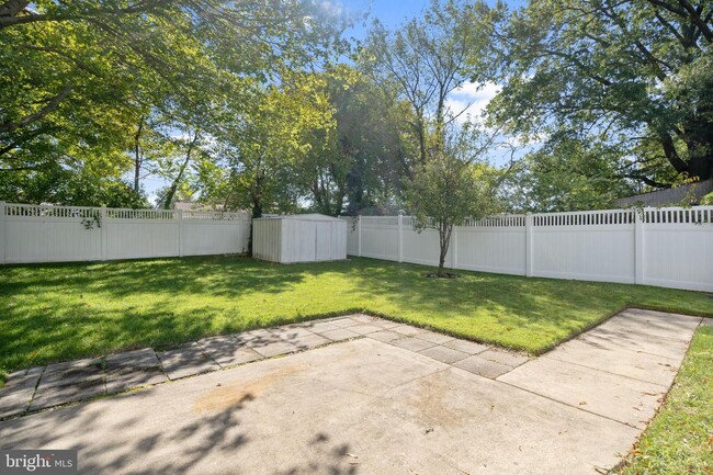
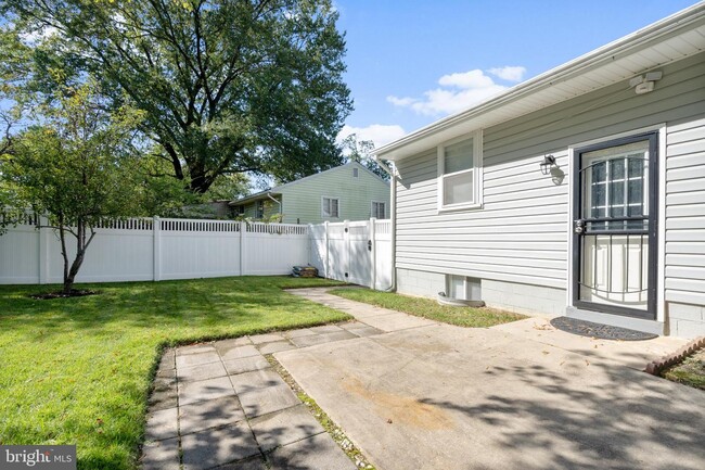
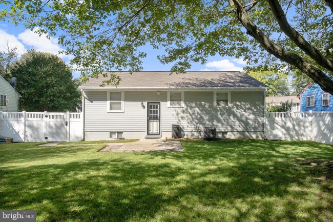
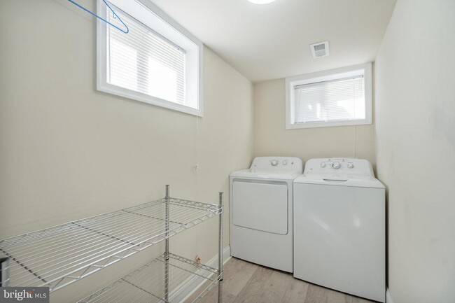
Oversized single family house for rent! Much bigger inside than it looks! No detail left undone! Gleaming hardwood floors on the main level! Freshly painted throughout! Renovated kitchen features white cabinets and stainless steel appliances! Fully finished basement with bedroom and a full bathroom! Bonus room in basement can be a possible fifth bedroom! Backyard is perfect for entertaining with a fully fenced in yard! Come visit today! Minutes to shopping, National Harbor & DC!
2600 Wintergreen Ave is a house located in Prince George's County and the 20747 ZIP Code. This area is served by the Prince George's County Public Schools attendance zone.
House Features
- Basement
Location
Get Directions
As far as distance goes, District Heights is less than 10 miles from the heart of DC. But the landscape couldn't be more different -- instead of monuments, there are trees. In place of politicians in suits, there are kids riding bicycles. District Heights is southeast of Washington, DC -- just follow Pennsylvania Avenue toward I-495.
Sports lovers will appreciate District Heights apartments for the proximity they'll enjoy to FedEx Field, which is only about three miles north. In addition to being the home field of the NFL's Washington Redskins, FedEx Field also hosts concerts and other events. District Heights residents enjoy easy access to nearby Joint Base Andrews, located just south of the city.
Learn more about living in District Heights
Amenities
- Basement
Education
| Colleges & Universities | Distance | ||
|---|---|---|---|
| Colleges & Universities | Distance | ||
| Drive: | 13 min | 6.4 mi | |
| Drive: | 13 min | 8.2 mi | |
| Drive: | 18 min | 8.4 mi | |
| Drive: | 18 min | 9.5 mi |
2600 Wintergreen Ave is within 13 minutes or 6.4 miles from Prince George's Comm. Coll.. It is also near Univ. of Md. Univ. Coll. and Gallaudet University.
Schools


Public Elementary School
Grades PK-6
295 Students
Attendance Zone
Public High School
Grades 9-12
2,257 Students
Attendance Zone
Private Elementary & Middle School
Grades PK-8
184 Students
Nearby
Private High School
Grades 9-12
858 Students
Nearby
School data provided by
 The GreatSchools Rating helps parents compare schools within a state based on a variety of school quality indicators and provides a helpful picture of how effectively each school serves all of its students. Ratings are on a scale of 1 (below average) to 10 (above average) and can include test scores, college readiness, academic progress, advanced courses, equity, discipline and attendance data. We also advise parents to visit schools, consider other information on school performance and programs, and consider family needs as part of the school selection process.
View GreatSchools Rating Methodology
Data provided by GreatSchools.org © 2025. All rights reserved.
View GreatSchools Rating Methodology
Data provided by GreatSchools.org © 2025. All rights reserved.
Transportation options available in District Heights include Addison Road-Seat Pleasant, located 3.4 miles from 2600 Wintergreen Ave. 2600 Wintergreen Ave is near Ronald Reagan Washington Ntl, located 13.2 miles or 25 minutes away, and Baltimore/Washington International Thurgood Marshall, located 33.2 miles or 49 minutes away.
| Transit / Subway | Distance | ||
|---|---|---|---|
| Transit / Subway | Distance | ||
|
|
Drive: | 7 min | 3.4 mi |
|
|
Drive: | 10 min | 3.9 mi |
|
Capitol Heights, Blue/Silver Line Center Platform
|
Drive: | 9 min | 4.0 mi |
|
|
Drive: | 10 min | 4.5 mi |
|
|
Drive: | 11 min | 5.7 mi |
| Commuter Rail | Distance | ||
|---|---|---|---|
| Commuter Rail | Distance | ||
|
|
Drive: | 17 min | 8.7 mi |
|
|
Drive: | 18 min | 8.8 mi |
|
|
Drive: | 18 min | 9.1 mi |
| Drive: | 19 min | 12.0 mi | |
|
|
Drive: | 19 min | 12.0 mi |
| Airports | Distance | ||
|---|---|---|---|
| Airports | Distance | ||
|
Ronald Reagan Washington Ntl
|
Drive: | 25 min | 13.2 mi |
|
Baltimore/Washington International Thurgood Marshall
|
Drive: | 49 min | 33.2 mi |
Time and distance from 2600 Wintergreen Ave.
| Shopping Centers | Distance | ||
|---|---|---|---|
| Shopping Centers | Distance | ||
| Walk: | 13 min | 0.7 mi | |
| Walk: | 15 min | 0.8 mi | |
| Walk: | 15 min | 0.8 mi |
2600 Wintergreen Ave has 3 shopping centers within 0.8 mile, which is about a 15-minute walk. The miles and minutes will be for the farthest away property.
| Parks and Recreation | Distance | ||
|---|---|---|---|
| Parks and Recreation | Distance | ||
|
Walker Mill Regional Park
|
Drive: | 6 min | 3.1 mi |
|
Suitland Bog
|
Drive: | 7 min | 3.4 mi |
|
Fort Dupont Park
|
Drive: | 11 min | 5.3 mi |
|
Oxon Cove Park
|
Drive: | 13 min | 6.3 mi |
|
Watkins Regional Park
|
Drive: | 18 min | 9.2 mi |
2600 Wintergreen Ave has 5 parks within 9.2 miles, including Walker Mill Regional Park, Suitland Bog, and Fort Dupont Park.
| Hospitals | Distance | ||
|---|---|---|---|
| Hospitals | Distance | ||
| Drive: | 15 min | 7.2 mi | |
| Drive: | 16 min | 7.6 mi | |
| Drive: | 16 min | 7.9 mi |
2600 Wintergreen Ave has 3 hospitals within 7.9 miles, the nearest is United Medical Center which is 7.2 miles away and a 15 minute drive.
| Military Bases | Distance | ||
|---|---|---|---|
| Military Bases | Distance | ||
| Drive: | 8 min | 3.7 mi | |
| Drive: | 16 min | 8.0 mi |
2600 Wintergreen Ave is 3.7 miles from Andrews Airforce Base, and is convenient to other military bases, including Washington Navy Yard.
You May Also Like
Similar Rentals Nearby


What Are Walk Score®, Transit Score®, and Bike Score® Ratings?
Walk Score® measures the walkability of any address. Transit Score® measures access to public transit. Bike Score® measures the bikeability of any address.
What is a Sound Score Rating?
A Sound Score Rating aggregates noise caused by vehicle traffic, airplane traffic and local sources

2600 Wintergreen Ave
District Heights, MD 20747