
sageLA - Brand New
200 N Vermont Ave,
Los Angeles, CA 90004
Studio - 2 Beds $2,345 - $5,017
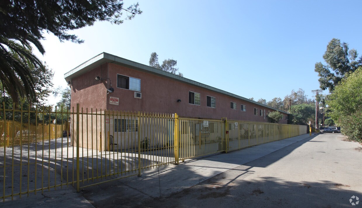
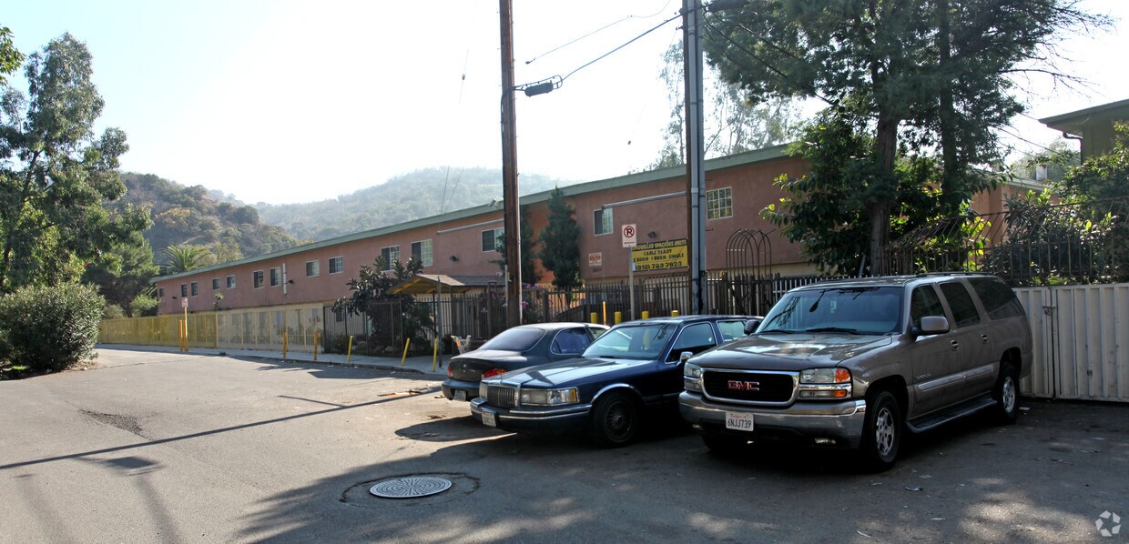
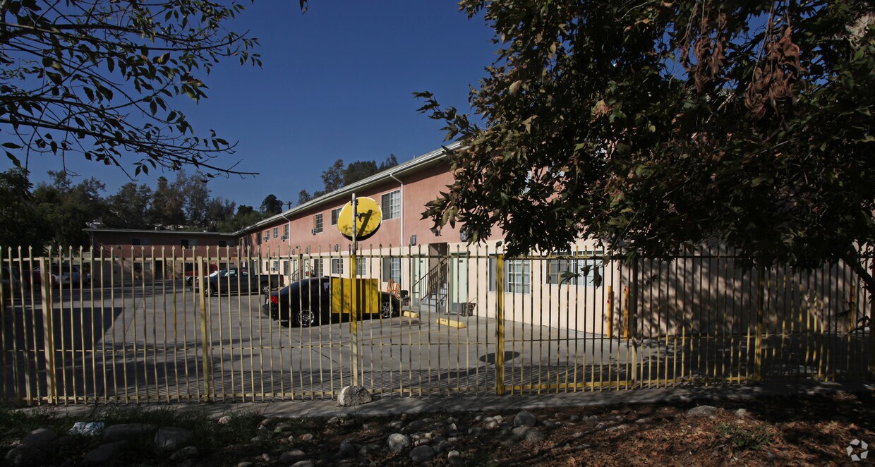

260 S Avenue 50 in Los Angeles, CA is ready for you to visit. Based in Los Angeles's 90042 area, living at this community gives you a number of nearby attractions to enjoy. Be sure to come for a visit to check out the apartment floorplan options. Here at this community, the professional leasing team will assist you in finding the perfect floorplan. Drop by 260 S Avenue 50 today.
260 S Avenue 50 is an apartment community located in Los Angeles County and the 90042 ZIP Code. This area is served by the Los Angeles Unified attendance zone.
A large sector of the city, Northeast Los Angeles encompasses neighborhoods like Echo Park and Highland Park. This expansive LA area offers rentals for every type of renter and every budget. Abundant apartments, houses, condos, and townhomes can be found in Northeast Los Angeles, ranging from affordable to upscale. Residents of this area can enjoy the great outdoors at locales like Ernest E. Debs Regional Park, Hermon Park, Rio De Los Angeles State Park, and Elysian Park. Although Northeast LA offers an escape from big-city living, residents can easily travel into downtown for work or leisure. Amenities and attractions like Dodger Stadium, Los Angeles State Historic Park, and Chinatown are all within reach of this sprawling district.
Learn more about living in Northeast Los Angeles| Colleges & Universities | Distance | ||
|---|---|---|---|
| Colleges & Universities | Distance | ||
| Drive: | 7 min | 2.2 mi | |
| Drive: | 9 min | 3.8 mi | |
| Drive: | 8 min | 4.5 mi | |
| Drive: | 14 min | 6.8 mi |


Transportation options available in Los Angeles include Southwest Museum Station, located 1.1 miles from 260 S Avenue 50. 260 S Avenue 50 is near Bob Hope, located 17.1 miles or 24 minutes away, and Los Angeles International, located 20.1 miles or 32 minutes away.
| Transit / Subway | Distance | ||
|---|---|---|---|
| Transit / Subway | Distance | ||
|
|
Drive: | 3 min | 1.1 mi |
|
|
Drive: | 3 min | 1.2 mi |
|
|
Drive: | 4 min | 1.6 mi |
|
|
Drive: | 5 min | 2.3 mi |
|
|
Drive: | 6 min | 3.5 mi |
| Commuter Rail | Distance | ||
|---|---|---|---|
| Commuter Rail | Distance | ||
|
|
Drive: | 10 min | 4.7 mi |
|
|
Drive: | 9 min | 5.0 mi |
|
|
Drive: | 11 min | 5.1 mi |
| Drive: | 13 min | 9.2 mi | |
|
|
Drive: | 21 min | 12.9 mi |
| Airports | Distance | ||
|---|---|---|---|
| Airports | Distance | ||
|
Bob Hope
|
Drive: | 24 min | 17.1 mi |
|
Los Angeles International
|
Drive: | 32 min | 20.1 mi |
Time and distance from 260 S Avenue 50.
| Shopping Centers | Distance | ||
|---|---|---|---|
| Shopping Centers | Distance | ||
| Walk: | 13 min | 0.7 mi | |
| Walk: | 15 min | 0.8 mi | |
| Drive: | 3 min | 1.2 mi |
| Parks and Recreation | Distance | ||
|---|---|---|---|
| Parks and Recreation | Distance | ||
|
Audubon Center at Debs Park
|
Drive: | 3 min | 1.1 mi |
|
Elyria Canyon Park
|
Drive: | 9 min | 2.8 mi |
|
Chavez Ravine Arboretum
|
Drive: | 8 min | 4.8 mi |
|
Elysian Park
|
Drive: | 11 min | 4.8 mi |
|
Marsh Park
|
Drive: | 11 min | 5.4 mi |
| Hospitals | Distance | ||
|---|---|---|---|
| Hospitals | Distance | ||
| Drive: | 8 min | 3.9 mi | |
| Drive: | 9 min | 4.0 mi | |
| Drive: | 8 min | 4.9 mi |
| Military Bases | Distance | ||
|---|---|---|---|
| Military Bases | Distance | ||
| Drive: | 29 min | 21.7 mi | |
| Drive: | 42 min | 28.7 mi |
What Are Walk Score®, Transit Score®, and Bike Score® Ratings?
Walk Score® measures the walkability of any address. Transit Score® measures access to public transit. Bike Score® measures the bikeability of any address.
What is a Sound Score Rating?
A Sound Score Rating aggregates noise caused by vehicle traffic, airplane traffic and local sources

260 S Avenue 50
Los Angeles, CA 90042


")
 - Violet on Virgil")


 - AVA Burbank")
