
The Vitagraph
1277 E 14th St,
Brooklyn, NY 11230
$2,770 - $4,308
1-3 Beds

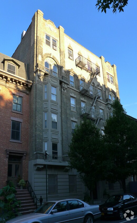
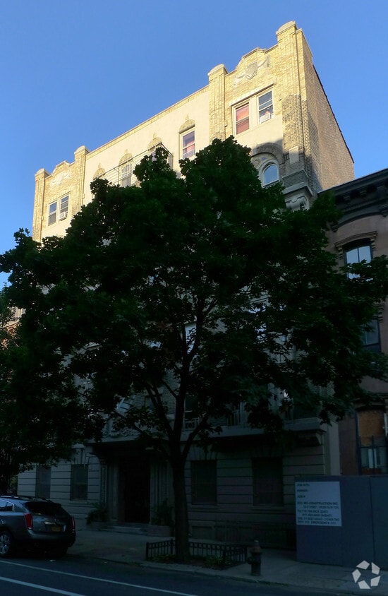
At 260 Cumberland Street, you've discovered your new place. Located in Brooklyn's 11205 Zip code, living here gives you a variety of nearby highlights to enjoy. Here at this community, the professional leasing team is ready to help you in finding the perfect new home. Be sure to come for a visit to check out the current floorplan options. Experience a better way of living at 260 Cumberland Street. Contact or drop by to find out current pricing.
260 Cumberland Street is an apartment community located in Kings County and the 11205 ZIP Code. This area is served by the New York City Geographic District #13 attendance zone.
Unique Features
Located just east of Downtown Brooklyn, Fort Greene is famous for its historic brownstones, vibrant cultural offerings, and close-knit community. Residents often come to Fort Greene seeking a slower pace of life without losing the multifaceted animation of urban living.
Fort Greene provides a vast array of shopping opportunities, from national retailers at Atlantic Terminal Mall to local artisans at the many flea markets and farmers markets held in the neighborhood. Residents enjoy a broad range of diverse eateries, stylish coffeehouses, and independent boutiques in Fort Greene.
Numerous venues contribute to Fort Greene’s status as a cultural hub, including the Brooklyn Academy of Music, BRIC, and the Mark Morris Dance Group. The scenic Fort Greene Park offers a lush respite from city living, while the pervasive sense of inclusivity makes Fort Greene one of a kind.
Learn more about living in Fort GreeneCompare neighborhood and city base rent averages by bedroom.
| Fort Greene | Brooklyn, NY | |
|---|---|---|
| Studio | $3,497 | $2,701 |
| 1 Bedroom | $4,291 | $3,050 |
| 2 Bedrooms | $6,184 | $3,984 |
| 3 Bedrooms | $7,560 | $4,933 |
| Colleges & Universities | Distance | ||
|---|---|---|---|
| Colleges & Universities | Distance | ||
| Walk: | 9 min | 0.5 mi | |
| Walk: | 12 min | 0.6 mi | |
| Walk: | 14 min | 0.7 mi | |
| Drive: | 4 min | 1.2 mi |


Transportation options available in Brooklyn include Fulton Street (G Line), located 0.2 mile from 260 Cumberland Street. 260 Cumberland Street is near LaGuardia, located 9.5 miles or 19 minutes away, and Newark Liberty International, located 15.2 miles or 27 minutes away.
| Transit / Subway | Distance | ||
|---|---|---|---|
| Transit / Subway | Distance | ||
|
|
Walk: | 3 min | 0.2 mi |
|
|
Walk: | 4 min | 0.2 mi |
|
|
Walk: | 7 min | 0.4 mi |
|
|
Walk: | 9 min | 0.5 mi |
|
|
Walk: | 9 min | 0.5 mi |
| Commuter Rail | Distance | ||
|---|---|---|---|
| Commuter Rail | Distance | ||
|
|
Walk: | 9 min | 0.5 mi |
|
|
Drive: | 4 min | 1.8 mi |
|
|
Drive: | 12 min | 4.2 mi |
|
|
Drive: | 12 min | 4.3 mi |
|
|
Drive: | 13 min | 4.5 mi |
| Airports | Distance | ||
|---|---|---|---|
| Airports | Distance | ||
|
LaGuardia
|
Drive: | 19 min | 9.5 mi |
|
Newark Liberty International
|
Drive: | 27 min | 15.2 mi |
Scores provided by
Traffic
BusyAirport
CalmBusinesses
BusyScores provided by
HowLoud What is a Sound Score Rating? A Sound Score Rating aggregates noise caused by vehicle traffic, airplane traffic and local sources. How It WorksTime and distance from 260 Cumberland Street.
| Shopping Centers | Distance | ||
|---|---|---|---|
| Shopping Centers | Distance | ||
| Walk: | 7 min | 0.4 mi | |
| Drive: | 4 min | 1.3 mi |
| Parks and Recreation | Distance | ||
|---|---|---|---|
| Parks and Recreation | Distance | ||
|
Fort Greene Park
|
Walk: | 7 min | 0.4 mi |
|
Commodore Barry Park
|
Walk: | 15 min | 0.8 mi |
|
Crispus Attucks Playground
|
Walk: | 18 min | 0.9 mi |
|
Cadman Plaza Park
|
Drive: | 5 min | 1.7 mi |
|
Gowanus Canal
|
Drive: | 8 min | 2.3 mi |
| Hospitals | Distance | ||
|---|---|---|---|
| Hospitals | Distance | ||
| Walk: | 6 min | 0.3 mi | |
| Drive: | 7 min | 2.1 mi | |
| Drive: | 7 min | 2.5 mi |
| Military Bases | Distance | ||
|---|---|---|---|
| Military Bases | Distance | ||
| Drive: | 15 min | 5.3 mi | |
| Drive: | 18 min | 7.7 mi | |
| Drive: | 25 min | 12.5 mi |


Pets Allowed
What Are Walk Score®, Transit Score®, and Bike Score® Ratings?
Walk Score® measures the walkability of any address. Transit Score® measures access to public transit. Bike Score® measures the bikeability of any address.
What is a Sound Score Rating?
A Sound Score Rating aggregates noise caused by vehicle traffic, airplane traffic and local sources.
260 Cumberland St
Brooklyn, NY 11205


