

$2,000
/ Month
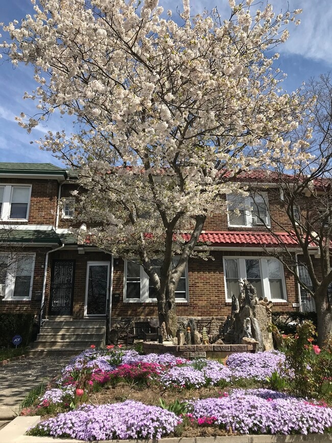
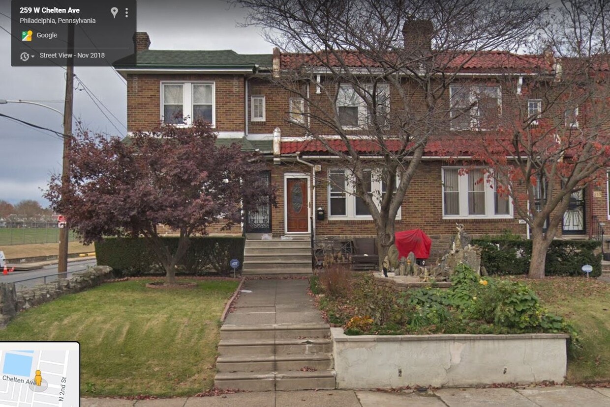
257 Chelten Ave
Philadelphia, PA 19120
2 Weeks Ago
|
Edit
Favorites
257 Chelten Ave

Favorites
Check Back Soon for Upcoming Availability
| Beds | Baths | Average SF |
|---|---|---|
| 3 Bedrooms 3 Bedrooms 3 Br | 2 Baths 2 Baths 2 Ba | 1,480 SF |
Fees and Policies
The fees below are based on community-supplied data and may exclude additional fees and utilities.
- Parking
-
Other--
Details
Utilities Included
-
Water
About This Property
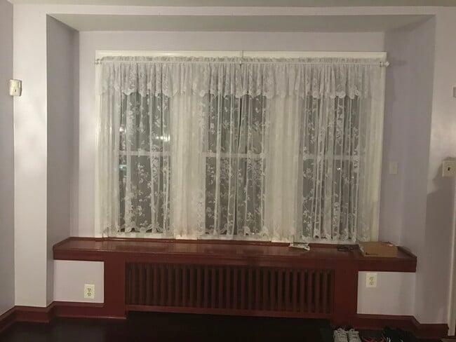
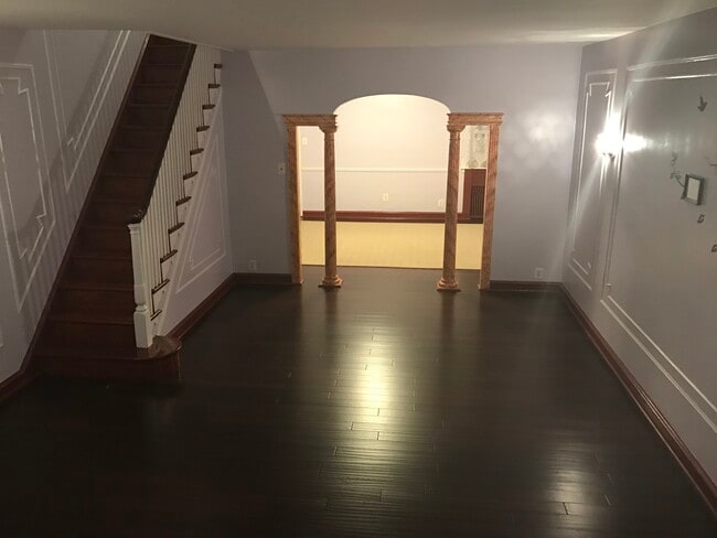
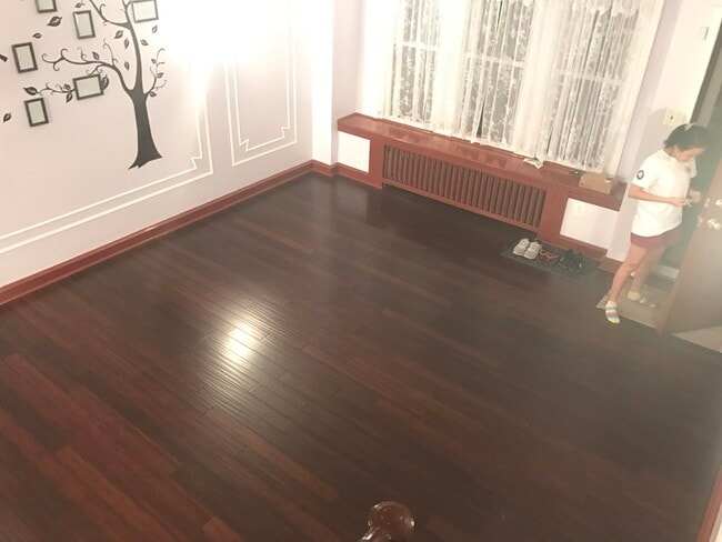
3 bedrooms, 2 full bathrooms, finished basement with large space that can be converted into game room, home gym, etc. Large closet spaces in all rooms, including basement and laundry room. Tile flooring in laundry room and kitchen. Hardwood flooring throughout house. Private parking behind house and plenty of street parking space at any time of day/night. In walking distance to St. Helena church, Sturgis Park. Nearby schools include Lowell James R School, Washington Grover Jr School and Fels Samuel High School.
257 Chelten Ave is a house located in Philadelphia County and the 19120 ZIP Code.
House Features
Washer/Dryer
Air Conditioning
Dishwasher
Hardwood Floors
- Washer/Dryer
- Air Conditioning
- Heating
- Cable Ready
- Storage Space
- Tub/Shower
- Dishwasher
- Kitchen
- Hardwood Floors
- Tile Floors
- Basement
- Laundry Facilities
- Storage Space
- Gameroom
- Yard
Location
Get Directions
Oak Lane-East Oak Lane is a quaint suburb that sits approximately eight miles north of Downtown Philadelphia via State Route 611. The neighborhood’s residential streets are lined with historic, stately homes and mature trees. Residents of Oak Lane-East Oak Lane enjoy a relaxed lifestyle in the suburbs within the city limits of Philly. The majority of existing houses and churches in the area were constructed in the late 1800s when builders created magnificent Victorian architecture. Large yards, Victorian estates, and Philadelphia-style double homes characterize the neighborhood, although there are affordable apartments and condos within the neighborhood as well. Public transit is available in Oak Lane-East Oak Lane, and the streets are fairly pedestrian- and bike-friendly.
Learn more about living in Oak Lane-East Oak LaneBelow are rent ranges for similar nearby apartments
Amenities
- Washer/Dryer
- Air Conditioning
- Heating
- Cable Ready
- Storage Space
- Tub/Shower
- Dishwasher
- Kitchen
- Hardwood Floors
- Tile Floors
- Basement
- Laundry Facilities
- Storage Space
- Yard
- Gameroom
Expenses
Utilities Included
Water
Included
Education
| Colleges & Universities | Distance | ||
|---|---|---|---|
| Colleges & Universities | Distance | ||
| Walk: | 19 min | 1.0 mi | |
| Drive: | 7 min | 2.5 mi | |
| Drive: | 7 min | 3.5 mi | |
| Drive: | 10 min | 3.9 mi |
257 Chelten Ave is within 19 minutes or 1.0 miles from C.C. of Philadelphia, NW Ctr. It is also near La Salle University and Salus University.
Transportation options available in Philadelphia include Fern Rock Transportation Center, located 1.3 miles from 257 Chelten Ave. 257 Chelten Ave is near Philadelphia International, located 20.4 miles or 34 minutes away, and Trenton Mercer, located 27.2 miles or 45 minutes away.
| Transit / Subway | Distance | ||
|---|---|---|---|
| Transit / Subway | Distance | ||
|
|
Drive: | 4 min | 1.3 mi |
|
|
Drive: | 4 min | 1.7 mi |
|
|
Drive: | 5 min | 2.3 mi |
|
|
Drive: | 6 min | 2.7 mi |
|
|
Drive: | 7 min | 2.9 mi |
| Commuter Rail | Distance | ||
|---|---|---|---|
| Commuter Rail | Distance | ||
|
|
Walk: | 21 min | 1.1 mi |
|
|
Walk: | 25 min | 1.3 mi |
|
|
Drive: | 3 min | 1.5 mi |
|
|
Drive: | 4 min | 2.3 mi |
|
|
Drive: | 6 min | 2.7 mi |
| Airports | Distance | ||
|---|---|---|---|
| Airports | Distance | ||
|
Philadelphia International
|
Drive: | 34 min | 20.4 mi |
|
Trenton Mercer
|
Drive: | 45 min | 27.2 mi |
Time and distance from 257 Chelten Ave.
| Shopping Centers | Distance | ||
|---|---|---|---|
| Shopping Centers | Distance | ||
| Walk: | 10 min | 0.5 mi | |
| Walk: | 13 min | 0.7 mi | |
| Drive: | 3 min | 1.2 mi |
257 Chelten Ave has 3 shopping centers within 1.2 miles, which is about a 3-minute drive. The miles and minutes will be for the farthest away property.
| Parks and Recreation | Distance | ||
|---|---|---|---|
| Parks and Recreation | Distance | ||
|
Tacony Creek Park
|
Drive: | 6 min | 3.0 mi |
|
Awbury Arboretum
|
Drive: | 7 min | 3.1 mi |
|
Lorimer Park
|
Drive: | 13 min | 5.8 mi |
|
Wagner Free Institute of Science
|
Drive: | 16 min | 5.9 mi |
|
Pennypack Park
|
Drive: | 13 min | 6.2 mi |
257 Chelten Ave has 5 parks within 6.2 miles, including Awbury Arboretum, Tacony Creek Park, and Lorimer Park.
| Hospitals | Distance | ||
|---|---|---|---|
| Hospitals | Distance | ||
| Drive: | 4 min | 1.8 mi | |
| Drive: | 3 min | 2.1 mi | |
| Drive: | 7 min | 3.8 mi |
257 Chelten Ave has 3 hospitals within 3.8 miles, the nearest is Albert Einstein Medical Center which is 1.8 miles away and a 4 minute drive.
| Military Bases | Distance | ||
|---|---|---|---|
| Military Bases | Distance | ||
| Drive: | 26 min | 12.6 mi |
257 Chelten Ave is 12.6 miles and a 26 minute drive from Willow Grove Naval Air Station.
You May Also Like
Similar Rentals Nearby


What Are Walk Score®, Transit Score®, and Bike Score® Ratings?
Walk Score® measures the walkability of any address. Transit Score® measures access to public transit. Bike Score® measures the bikeability of any address.
What is a Sound Score Rating?
A Sound Score Rating aggregates noise caused by vehicle traffic, airplane traffic and local sources
257 Chelten Ave
Philadelphia, PA 19120