$1,300
/ Month
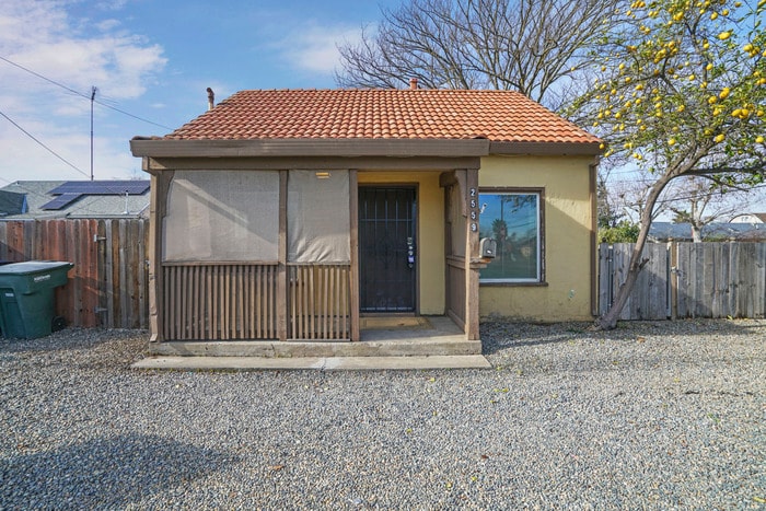
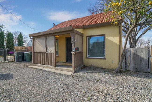
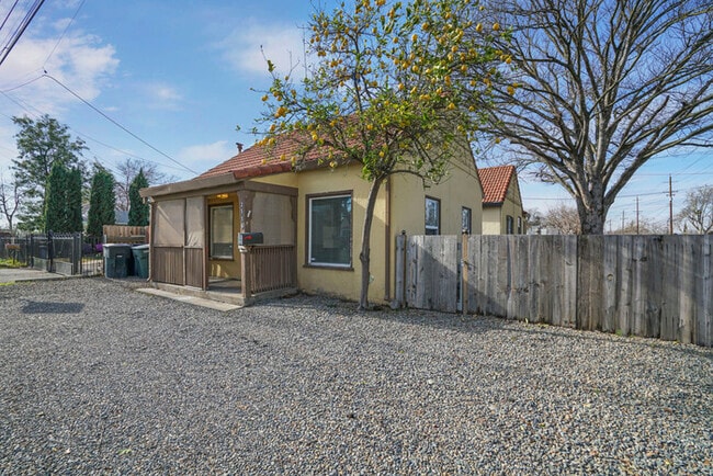
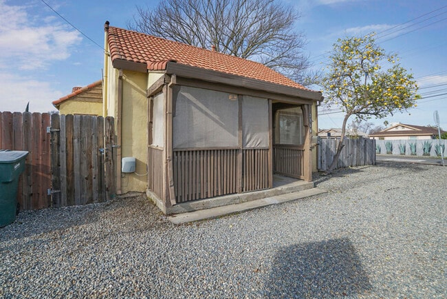
2559 Clay St
Sacramento, CA 95815
Today
|
Edit
Favorites
2559 Clay St

Favorites
Check Back Soon for Upcoming Availability
| Beds | Baths | Average SF |
|---|---|---|
| 1 Bedroom 1 Bedroom 1 Br | 1 Bath 1 Bath 1 Ba | 690 SF |
Fees and Policies
The fees below are based on community-supplied data and may exclude additional fees and utilities.
-
Utilities Monthly FeeCharged per unit.$125
-
Lawn Maintenance FeeCharged per unit.$75
Property Fee Disclaimer: Based on community-supplied data and independent market research. Subject to change without notice. May exclude fees for mandatory or optional services and usage-based utilities.
About This Property
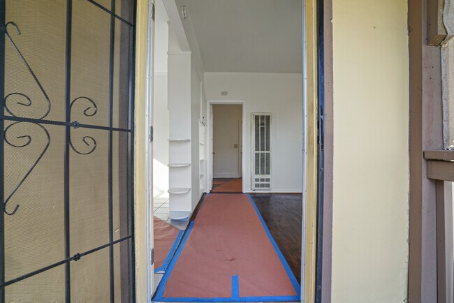
Address: 2559 Clay St, Sacramento, CA 95815 This cozy one-bedroom, one-bath home is tucked away in the Del Paso Heights area, offering peace and privacy away from busy streets - your own little oasis in the city! Rental Details Rent: $1,300/month Security Deposit: $1,300 Utilities: $125/month (Water, Sewer, Trash) Landscaping: Landscaping maintenance by the tenant Move-In Amount Today: $2,725 (Rent + Deposit + Utilities + Landscaping) Requirements: Minimum 650 credit score Income must be 3 times the monthly rent Neighborhood The property is located in South Hagginwood, a residential area in North Sacramento. Nearby streets include Frienza Ave, El Camino Ave, and Clay Street, which is primarily lined with single-family homes and duplexes. The area is known for its quiet residential vibe with easy access to major roads like El Camino Avenue and Highway 160. Nearby Landmarks California State Capitol Museum - A historic and iconic landmark in downtown Sacramento Tower Bridge - Sacramento's most recognizable landmark connecting West Sacramento and downtown Old Sacramento Waterfront - A popular historic district with shops and museums Sutter's Fort State Historic Park - A well-known historical site in Midtown Sacramento Leland Stanford Mansion State Historic Park - A beautiful historic estate offering free tours Local Amenities Northwood Elementary School is just 0.2 miles away, making it convenient for families Grocery stores, small eateries, and local businesses are within a short drive along El Camino Ave and Del Paso Blvd Apply or schedule a tour today: Call us: Contact us to schedule a showing.
2559 Clay St is a townhome located in Sacramento County and the 95815 ZIP Code. This area is served by the Twin Rivers Unified attendance zone.
Townhome Features
- Washer/Dryer
- Air Conditioning
- Range
Location
Get Directions
South Hagginwood is a mostly-residential suburban community in northeast Sacramento. Several elementary schools can be found in the area, giving parents lots of options for their children’s education. Numerous public parks of every size all around the neighborhood provide residents with excellent grounds for staying active and enjoying the sunshine.
The neighborhood is just a few blocks from Arden Fair shopping mall, Raging Waters Water Park, and the Cal-Expo Race Track. Less than fifteen minutes from downtown Sacramento, folks in South Hagginwood are easily able to reach the city center, whether for work or for fun.
Learn more about living in South HagginwoodBelow are rent ranges for similar nearby apartments
Amenities
- Washer/Dryer
- Air Conditioning
- Range
Education
| Colleges & Universities | Distance | ||
|---|---|---|---|
| Colleges & Universities | Distance | ||
| Drive: | 11 min | 5.6 mi | |
| Drive: | 13 min | 6.9 mi | |
| Drive: | 11 min | 7.5 mi | |
| Drive: | 20 min | 14.2 mi |
2559 Clay St is within 11 minutes or 5.6 miles from Sacramento State. It is also near American River College and Sacramento City College.
Schools


Public Elementary School
Grades K-3
372 Students
Nearby
Public Elementary School
Grades K-6
382 Students
Attendance Zone
Public Middle School
Grades 7-8
469 Students
Attendance Zone
Public High School
Grades 9-12
2,040 Students
Attendance Zone
Private Elementary & Middle School
Grades K-8
Nearby
Private Middle & High School
Grades 6-12
Nearby
School data provided by
 The GreatSchools Rating helps parents compare schools within a state based on a variety of school quality indicators and provides a helpful picture of how effectively each school serves all of its students. Ratings are on a scale of 1 (below average) to 10 (above average) and can include test scores, college readiness, academic progress, advanced courses, equity, discipline and attendance data. We also advise parents to visit schools, consider other information on school performance and programs, and consider family needs as part of the school selection process.
View GreatSchools Rating Methodology
Data provided by GreatSchools.org © 2026. All rights reserved.
View GreatSchools Rating Methodology
Data provided by GreatSchools.org © 2026. All rights reserved.
Transportation options available in Sacramento include Swanston, located 0.6 mile from 2559 Clay St. 2559 Clay St is near Sacramento International, located 12.9 miles or 20 minutes away.
| Transit / Subway | Distance | ||
|---|---|---|---|
| Transit / Subway | Distance | ||
|
|
Walk: | 11 min | 0.6 mi |
|
|
Drive: | 3 min | 1.1 mi |
|
|
Drive: | 2 min | 1.3 mi |
|
|
Drive: | 4 min | 1.4 mi |
| Walk: | 38 min | 2.0 mi |
| Commuter Rail | Distance | ||
|---|---|---|---|
| Commuter Rail | Distance | ||
| Drive: | 8 min | 4.5 mi | |
|
|
Drive: | 22 min | 15.6 mi |
|
|
Drive: | 23 min | 17.7 mi |
|
|
Drive: | 25 min | 20.7 mi |
|
|
Drive: | 36 min | 30.0 mi |
| Airports | Distance | ||
|---|---|---|---|
| Airports | Distance | ||
|
Sacramento International
|
Drive: | 20 min | 12.9 mi |
Time and distance from 2559 Clay St.
| Shopping Centers | Distance | ||
|---|---|---|---|
| Shopping Centers | Distance | ||
| Walk: | 10 min | 0.5 mi | |
| Drive: | 4 min | 1.7 mi | |
| Drive: | 4 min | 1.9 mi |
2559 Clay St has 3 shopping centers within 1.9 miles, which is about a 4-minute drive. The miles and minutes will be for the farthest away property.
| Parks and Recreation | Distance | ||
|---|---|---|---|
| Parks and Recreation | Distance | ||
|
Discovery County Park
|
Drive: | 5 min | 3.4 mi |
|
Governor's Mansion State Historic Park
|
Drive: | 8 min | 4.2 mi |
|
Sutter's Fort State Historical Monument
|
Drive: | 6 min | 4.7 mi |
|
Paradise Beach County Recreation Area
|
Drive: | 10 min | 5.0 mi |
|
River City Paddlers
|
Drive: | 8 min | 5.3 mi |
2559 Clay St has 5 parks within 5.3 miles, including Discovery County Park, River City Paddlers, and Governor's Mansion State Historic Park.
| Hospitals | Distance | ||
|---|---|---|---|
| Hospitals | Distance | ||
| Drive: | 7 min | 3.3 mi | |
| Drive: | 7 min | 5.2 mi | |
| Drive: | 10 min | 6.2 mi |
2559 Clay St has 3 hospitals within 6.2 miles, the nearest is Kaiser Foundation Hospital - Sacramento which is 3.3 miles away and a 7 minute drive.
| Military Bases | Distance | ||
|---|---|---|---|
| Military Bases | Distance | ||
| Drive: | 17 min | 6.2 mi |
2559 Clay St is 6.2 miles and a 17 minute drive from McClellan Air Force Base.
You May Also Like
Similar Rentals Nearby


What Are Walk Score®, Transit Score®, and Bike Score® Ratings?
Walk Score® measures the walkability of any address. Transit Score® measures access to public transit. Bike Score® measures the bikeability of any address.
What is a Sound Score Rating?
A Sound Score Rating aggregates noise caused by vehicle traffic, airplane traffic and local sources

2559 Clay St
Sacramento, CA 95815