1 / 15


Bedrooms
2
Bathrooms
1
Square Feet
913 sq ft
Available
Available Now

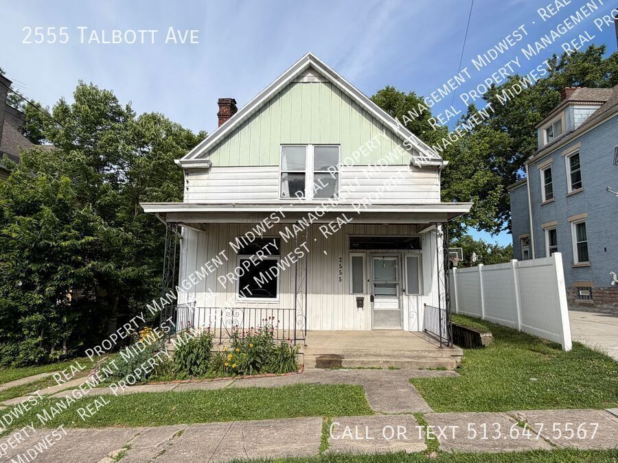
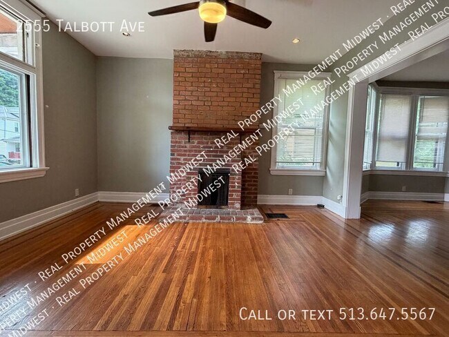
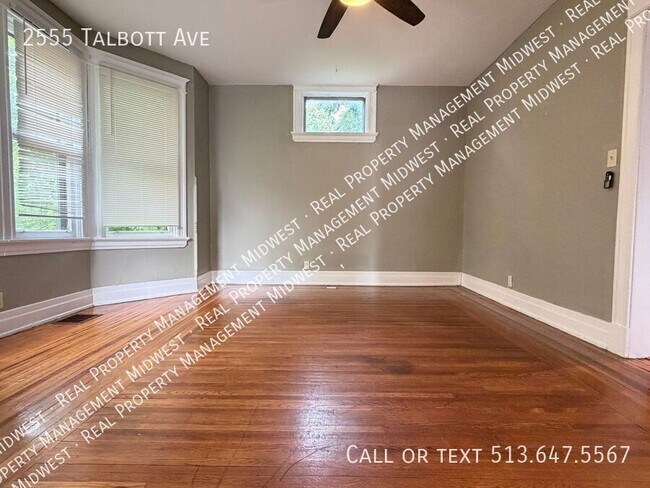
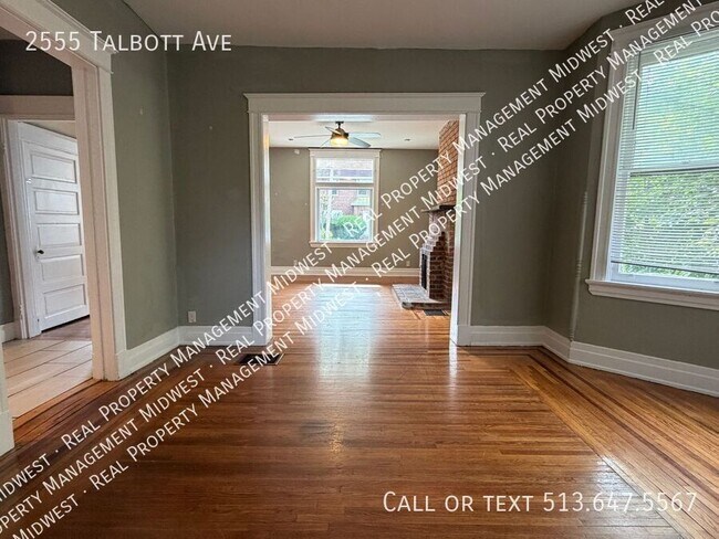
2555 Talbott is a two-bedroom, one-bath home in Cincinnati offering classic hardwood floors throughout and a functional layout. The property includes a basement and an attic for extra storage, a central heating system, and a full kitchen equipped with a refrigerator, stove, and dishwasher. Enjoy outdoor space with a porch, a deck area, and a yard—ideal for relaxing or entertaining. Practical features and straightforward design make this house easy to personalize. Deck/Patio Area Stove
Unique Features
2555 Talbott Ave is a house located in Hamilton County and the 45211 ZIP Code. This area is served by the Cincinnati Public Schools attendance zone.
Filled with historic shotgun houses, South Fairmount was first settled in the early 1800s. This large neighborhood is bordered by Mill Creek, directly west of Downtown Cincinnati and minutes from the University of Cincinnati. With just two miles to downtown, residents of South Fairmount enjoy fast access to all of Cincinnati's attractions, including the Cincinnati Zoo, Paul Brown Stadium (home of the Cincinnati Bengals), and the Cincinnati Music Hall.
Apartments in South Fairmount are near the Ohio River and several riverfront parks, including Embshoff Woods and Nature Preserve and the popular Eden Park, home of the Cincinnati Playhouse and the Cincinnati Art Museum.
Learn more about living in South Fairmount| Colleges & Universities | Distance | ||
|---|---|---|---|
| Colleges & Universities | Distance | ||
| Drive: | 10 min | 4.4 mi | |
| Drive: | 12 min | 4.6 mi | |
| Drive: | 12 min | 4.8 mi | |
| Drive: | 16 min | 6.6 mi |


Transportation options available in Cincinnati include Brewery District Station - Elm & Henry, located 3.3 miles from 2555 Talbott Ave. 2555 Talbott Ave is near Cincinnati/Northern Kentucky International, located 17.6 miles or 32 minutes away.
| Transit / Subway | Distance | ||
|---|---|---|---|
| Transit / Subway | Distance | ||
| Drive: | 8 min | 3.3 mi | |
| Drive: | 8 min | 3.5 mi | |
| Drive: | 8 min | 3.6 mi | |
| Drive: | 8 min | 3.7 mi | |
| Drive: | 9 min | 3.8 mi |
| Commuter Rail | Distance | ||
|---|---|---|---|
| Commuter Rail | Distance | ||
|
|
Drive: | 8 min | 3.6 mi |
| Airports | Distance | ||
|---|---|---|---|
| Airports | Distance | ||
|
Cincinnati/Northern Kentucky International
|
Drive: | 32 min | 17.6 mi |
Scores provided by
Traffic
-Airport
-Businesses
-Scores provided by
HowLoud What is a Sound Score Rating? A Sound Score Rating aggregates noise caused by vehicle traffic, airplane traffic and local sources. How It WorksTime and distance from 2555 Talbott Ave.
| Shopping Centers | Distance | ||
|---|---|---|---|
| Shopping Centers | Distance | ||
| Drive: | 4 min | 1.5 mi | |
| Drive: | 4 min | 1.8 mi | |
| Drive: | 8 min | 3.0 mi |
| Parks and Recreation | Distance | ||
|---|---|---|---|
| Parks and Recreation | Distance | ||
|
Imago Earth Center
|
Drive: | 9 min | 3.2 mi |
|
Wilson Commons
|
Drive: | 9 min | 3.5 mi |
|
Museum of Natural History and Science
|
Drive: | 8 min | 3.6 mi |
|
Duke Energy Children's Museum
|
Drive: | 8 min | 3.6 mi |
|
Cincinnati History Museum
|
Drive: | 8 min | 3.6 mi |
| Hospitals | Distance | ||
|---|---|---|---|
| Hospitals | Distance | ||
| Drive: | 10 min | 4.4 mi | |
| Drive: | 9 min | 4.4 mi | |
| Drive: | 12 min | 4.9 mi |
| Military Bases | Distance | ||
|---|---|---|---|
| Military Bases | Distance | ||
| Drive: | 73 min | 55.6 mi | |
| Drive: | 79 min | 60.6 mi | |
| Drive: | 82 min | 63.9 mi |


What Are Walk Score®, Transit Score®, and Bike Score® Ratings?
Walk Score® measures the walkability of any address. Transit Score® measures access to public transit. Bike Score® measures the bikeability of any address.
What is a Sound Score Rating?
A Sound Score Rating aggregates noise caused by vehicle traffic, airplane traffic and local sources.

2555 Talbott Ave
Cincinnati, OH 45211
