
The Westlyn Apartments
240 Thompson Ave E,
West Saint Paul, MN 55118
$1,532 - $2,592 Total Monthly Price
Studio - 3 Beds
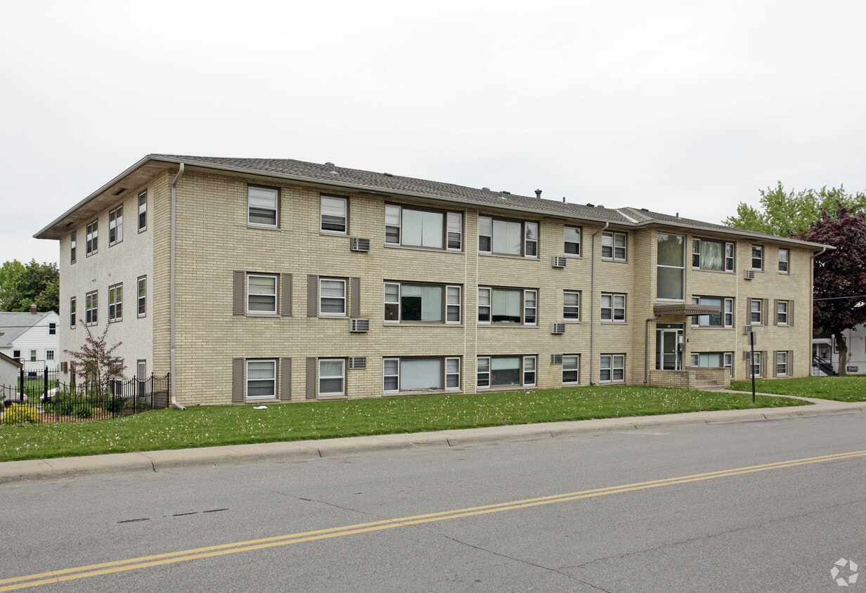
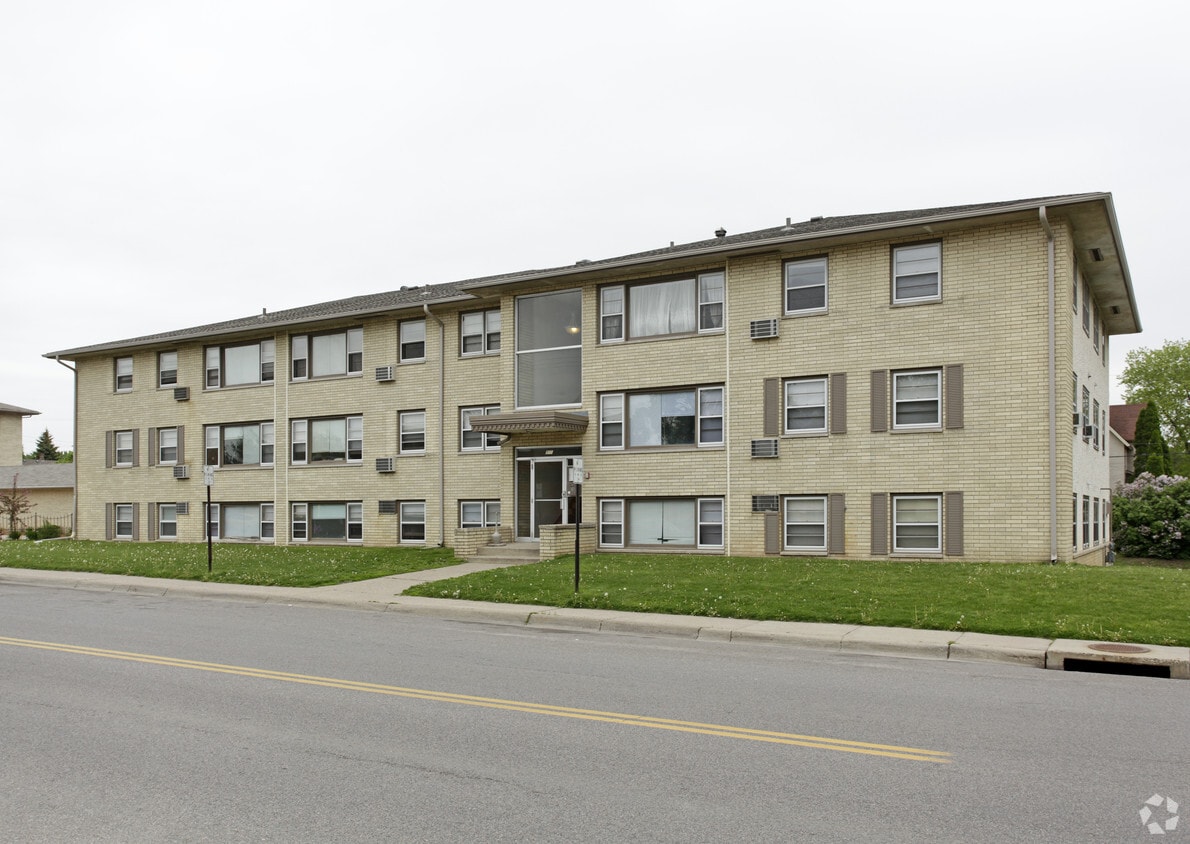

255 12th Ave S in South St. Paul is ready to be your home. In a convenient location on 12th Ave S. in South St. Paul's 55075 Zip code, local residents can easily connect with a number of entertainment options within a few miles. Be sure to see the current floorplan options. Here at this community, the professional leasing staff is excited to help you find your new apartment. It's time to get moving on finding your next place. Contact or stop by 255 12th Ave S to check the current floorplan availability!
255 12th Ave S is an apartment community located in Dakota County and the 55075 ZIP Code. This area is served by the South St. Paul Public School Dist. attendance zone.
Situated directly south of Saint Paul, South Saint Paul is a small community on the cusp of the big city. South Saint Paul residents enjoy the tranquil comfort of small-town living in a scenic environment with access to the many metropolitan amenities of the Twin Cities.
South Saint Paul offers a wide variety of outdoor activities, with multi-use trails along the banks of the Mississippi River, an archery range, a disc golf course at Kaposia Park, and much more. A close-knit community calls Saint Paul home, coming together for special events such as Kaposia Days and On the Road Again celebrations. Convenient access to U.S. 52, I-494, and multiple airports makes getting around from South Saint Paul simple.
Learn more about living in South Saint PaulCompare neighborhood and city base rent averages by bedroom.
| South St Paul | South Saint Paul, MN | |
|---|---|---|
| Studio | $1,205 | $1,226 |
| 1 Bedroom | $1,254 | $1,360 |
| 2 Bedrooms | $1,481 | $1,425 |
| 3 Bedrooms | $2,190 | $1,777 |
| Colleges & Universities | Distance | ||
|---|---|---|---|
| Colleges & Universities | Distance | ||
| Drive: | 11 min | 5.4 mi | |
| Drive: | 12 min | 6.9 mi | |
| Drive: | 14 min | 7.4 mi | |
| Drive: | 16 min | 10.3 mi |


Transportation options available in South Saint Paul include Central Station, located 6.2 miles from 255 12th Ave S. 255 12th Ave S is near Minneapolis-St Paul International/Wold-Chamberlain, located 10.2 miles or 18 minutes away.
| Transit / Subway | Distance | ||
|---|---|---|---|
| Transit / Subway | Distance | ||
| Drive: | 11 min | 6.2 mi | |
| Drive: | 11 min | 6.3 mi | |
| Drive: | 11 min | 6.5 mi | |
| Drive: | 12 min | 6.7 mi | |
| Drive: | 12 min | 6.9 mi |
| Commuter Rail | Distance | ||
|---|---|---|---|
| Commuter Rail | Distance | ||
|
|
Drive: | 12 min | 6.5 mi |
|
|
Drive: | 29 min | 17.1 mi |
|
|
Drive: | 32 min | 23.0 mi |
|
|
Drive: | 42 min | 31.1 mi |
|
|
Drive: | 44 min | 32.8 mi |
| Airports | Distance | ||
|---|---|---|---|
| Airports | Distance | ||
|
Minneapolis-St Paul International/Wold-Chamberlain
|
Drive: | 18 min | 10.2 mi |
Scores provided by
Traffic
-Airport
-Businesses
-Scores provided by
HowLoud What is a Sound Score Rating? A Sound Score Rating aggregates noise caused by vehicle traffic, airplane traffic and local sources. How It WorksTime and distance from 255 12th Ave S.
| Shopping Centers | Distance | ||
|---|---|---|---|
| Shopping Centers | Distance | ||
| Walk: | 3 min | 0.2 mi | |
| Drive: | 4 min | 1.4 mi | |
| Drive: | 4 min | 1.8 mi |
| Parks and Recreation | Distance | ||
|---|---|---|---|
| Parks and Recreation | Distance | ||
|
Dodge Nature Center
|
Drive: | 8 min | 3.5 mi |
|
Cherokee Regional Park
|
Drive: | 13 min | 5.6 mi |
|
Kellogg Mall Park
|
Drive: | 11 min | 6.2 mi |
|
Science Museum of Minnesota
|
Drive: | 12 min | 7.1 mi |
|
Indian Mounds Park
|
Drive: | 14 min | 8.0 mi |
| Hospitals | Distance | ||
|---|---|---|---|
| Hospitals | Distance | ||
| Drive: | 12 min | 6.8 mi | |
| Drive: | 12 min | 7.1 mi | |
| Drive: | 13 min | 7.2 mi |
| Military Bases | Distance | ||
|---|---|---|---|
| Military Bases | Distance | ||
| Drive: | 16 min | 9.0 mi |
Pets Allowed Fitness Center Pool Dishwasher Refrigerator Clubhouse Maintenance on site
High-Speed Internet Laundry Facilities
Pets Allowed Fitness Center Pool Dishwasher Refrigerator Kitchen In Unit Washer & Dryer
Pets Allowed Fitness Center Pool Dishwasher Refrigerator Kitchen
What Are Walk Score®, Transit Score®, and Bike Score® Ratings?
Walk Score® measures the walkability of any address. Transit Score® measures access to public transit. Bike Score® measures the bikeability of any address.
What is a Sound Score Rating?
A Sound Score Rating aggregates noise caused by vehicle traffic, airplane traffic and local sources.


