
Lux: Wonderland in Crossroads / Katz on Main
1923 Broadway Blvd,
Kansas City, MO 64108
$1,157 - $2,925
Studio - 2 Beds


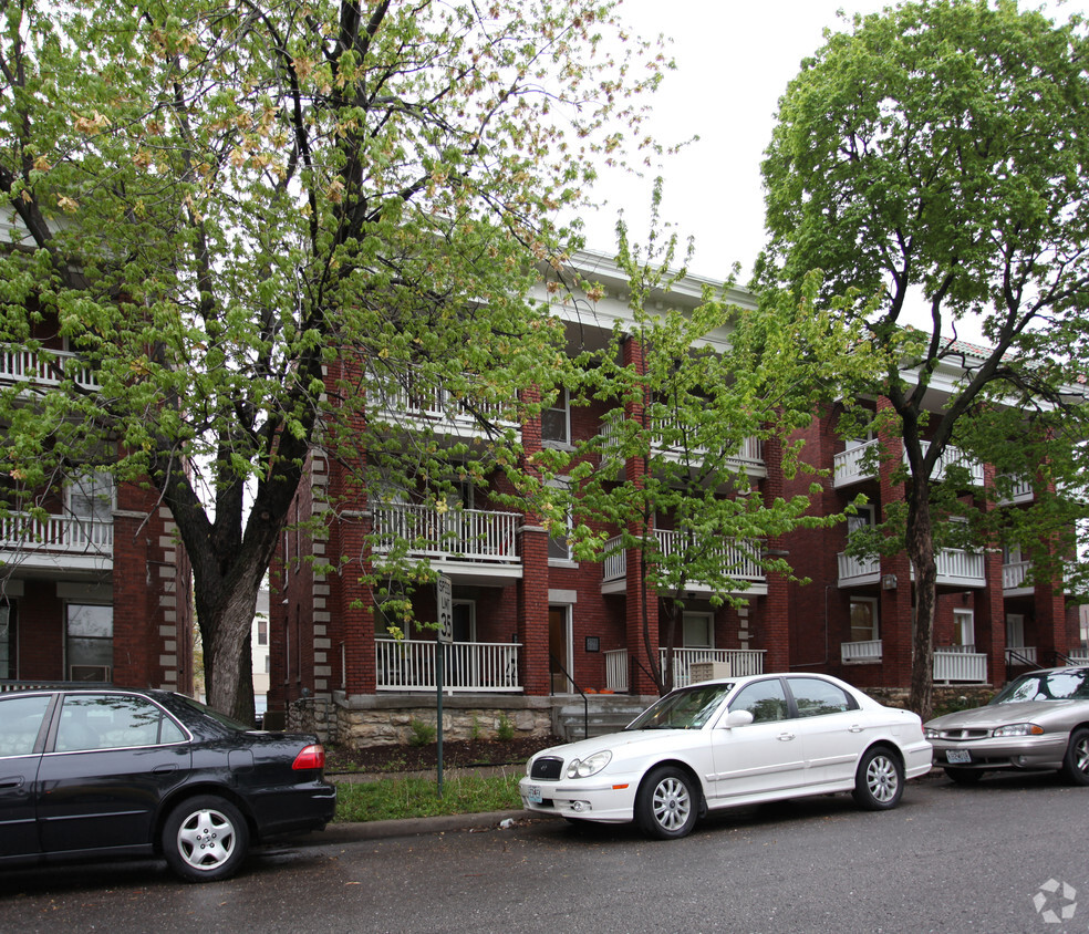
Find your new home at 2543 Cherry St in Kansas City, MO. This community is located in the Longfellow area of Kansas City. From amenities to availability, the professional leasing team is ready to help you find the best floor plan for your lifestyle. It's time to come home to 2543 Cherry St. Contact us or stop by the leasing office to discuss your new apartment.
2543 Cherry St is an apartment community located in Jackson County and the 64108 ZIP Code. This area is served by the Kansas City 33 attendance zone.
Fashionistas will appreciate the Crown Center neighborhood a lot. The shopping center’s anchor retail store is Halls, which is owned by Hallmark Cards. In Crown Center, there’s more to do than just shop ‘til you drop – you’ll also discover numerous entertainment venues, apartments and condominiums, restaurants, and kid-friendly attractions. And speaking of activities suitable for the whole family – be sure to check out Crown Center’s Legoland, Sea Life Aquarium, and Kaleidoscope, a children’s creativity studio.
Pen Valley Park is a large green space, with walking trails leading to WWI monuments and museums. Washington Square Park is on the north end and includes the Missouri Korean War Veterans Memorial. There are many trendy restaurants in Crown Center, like The American Restaurant – Missouri’s only 4-star restaurant by Forbes Travel Guide. Residents and visitors are comforted by direct access to the rail line at Union Station.
Learn more about living in Crown CenterCompare neighborhood and city base rent averages by bedroom.
| Crown Center | Kansas City, MO | |
|---|---|---|
| Studio | $1,519 | $998 |
| 1 Bedroom | $1,720 | $1,206 |
| 2 Bedrooms | $3,766 | $1,441 |
| 3 Bedrooms | $4,317 | $1,738 |
| Colleges & Universities | Distance | ||
|---|---|---|---|
| Colleges & Universities | Distance | ||
| Drive: | 7 min | 2.8 mi | |
| Drive: | 7 min | 3.6 mi | |
| Drive: | 8 min | 3.9 mi | |
| Drive: | 18 min | 9.5 mi |


Transportation options available in Kansas City include Union Station On Main At Pershing Sb, located 0.6 mile from 2543 Cherry St. 2543 Cherry St is near Kansas City International, located 20.9 miles or 30 minutes away.
| Transit / Subway | Distance | ||
|---|---|---|---|
| Transit / Subway | Distance | ||
| Walk: | 12 min | 0.6 mi | |
| Walk: | 12 min | 0.6 mi | |
| Walk: | 19 min | 1.0 mi | |
| Drive: | 3 min | 1.3 mi | |
| Drive: | 3 min | 1.5 mi |
| Commuter Rail | Distance | ||
|---|---|---|---|
| Commuter Rail | Distance | ||
|
|
Walk: | 13 min | 0.7 mi |
|
|
Drive: | 17 min | 9.2 mi |
|
|
Drive: | 30 min | 19.0 mi |
| Airports | Distance | ||
|---|---|---|---|
| Airports | Distance | ||
|
Kansas City International
|
Drive: | 30 min | 20.9 mi |
Time and distance from 2543 Cherry St.
| Shopping Centers | Distance | ||
|---|---|---|---|
| Shopping Centers | Distance | ||
| Walk: | 10 min | 0.6 mi | |
| Walk: | 19 min | 1.0 mi | |
| Drive: | 3 min | 1.5 mi |
| Parks and Recreation | Distance | ||
|---|---|---|---|
| Parks and Recreation | Distance | ||
|
Science City at Union Station
|
Drive: | 4 min | 1.2 mi |
|
Mill Creek Park
|
Drive: | 6 min | 2.5 mi |
|
Donald J. Hall Sculpture Park
|
Drive: | 6 min | 2.9 mi |
|
Theis Park
|
Drive: | 6 min | 3.0 mi |
|
Anita B. Gorman Conservation Discovery Center
|
Drive: | 6 min | 3.1 mi |
| Hospitals | Distance | ||
|---|---|---|---|
| Hospitals | Distance | ||
| Walk: | 4 min | 0.2 mi | |
| Walk: | 7 min | 0.4 mi | |
| Walk: | 9 min | 0.5 mi |
| Military Bases | Distance | ||
|---|---|---|---|
| Military Bases | Distance | ||
| Drive: | 55 min | 32.9 mi |
What Are Walk Score®, Transit Score®, and Bike Score® Ratings?
Walk Score® measures the walkability of any address. Transit Score® measures access to public transit. Bike Score® measures the bikeability of any address.
What is a Sound Score Rating?
A Sound Score Rating aggregates noise caused by vehicle traffic, airplane traffic and local sources
2543 Cherry St
Kansas City, MO 64108


