
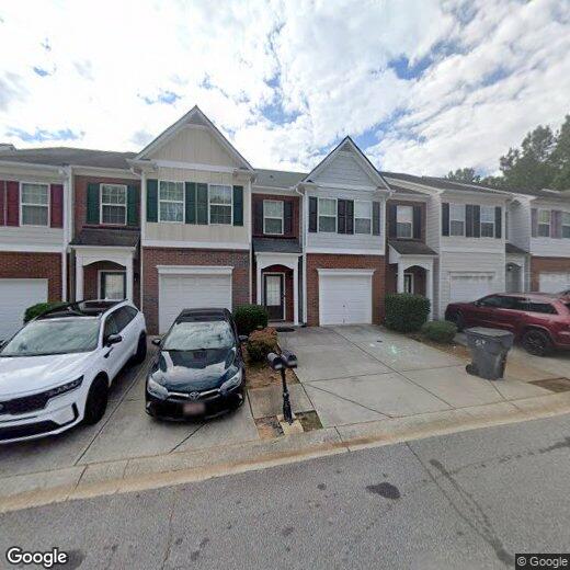
2530 Emma Way
2530 Emma Way
Lawrenceville, GA 30044
Favorites
2530 Emma Way

Favorites
Check Back Soon for Upcoming Availability
| Beds | Baths | Average SF |
|---|---|---|
| 3 Bedrooms 3 Bedrooms 3 Br | 3.5 Baths 3.5 Baths 3.5 Ba | — |
2530 Emma Way,
Lawrenceville,
GA
30044
Welcome to Lawrenceville, a historic gem in the heart of Gwinnett County that combines traditional charm with contemporary living. Known as "The Crepe Myrtle City," this community offers diverse rental options, from downtown apartments to spacious suburban homes, with current average rents ranging from $1,380 for studios to $2,614 for four-bedroom residences. The historic downtown square centers around the Gwinnett County Courthouse and the Lawrenceville Arts Center, which hosts performances and exhibitions throughout the year. Outdoor enthusiasts appreciate Rhodes Jordan Park's 162 acres, featuring a lake and 1.9-mile paved trail, while the Aurora Theatre presents professional performances in its 500-seat venue.
Located 30 miles northeast of downtown Atlanta, Lawrenceville provides convenient access to city amenities while maintaining its distinct character.
Learn more about living in Lawrenceville
Education
| Colleges & Universities | Distance | ||
|---|---|---|---|
| Colleges & Universities | Distance | ||
| Drive: | 7 min | 3.2 mi | |
| Drive: | 14 min | 6.9 mi | |
| Drive: | 27 min | 14.6 mi | |
| Drive: | 26 min | 17.1 mi |
2530 Emma Way is within 7 minutes or 3.2 miles from Gwinnett Technical College. It is also near Georgia Gwinnett College and Georgia Perim., Alpharetta.
Walkability Near 2530 Emma Way Lawrenceville, GA 30044
Getting Around
 What do Walkability, Transit, Drivability, and Bikeability mean?
Walkability measures the walking distance to day-to-day needs.
Transit measures access to public transportation.
Drivability measures congestion, parking availability, and access to major roads.
Bikeability measures the suitability for cycling.
How It Works
What do Walkability, Transit, Drivability, and Bikeability mean?
Walkability measures the walking distance to day-to-day needs.
Transit measures access to public transportation.
Drivability measures congestion, parking availability, and access to major roads.
Bikeability measures the suitability for cycling.
How It Works
Fairly Walkable
Walkability
50
/ 100
Minimal Public Transit
Transit
0
/ 100
Exceptionally Drivable
Drivability
90
/ 100
Fairly Bikeable
Bikeability
40
/ 100
Scores provided by
-
Soundscore™
-
/ 100
Traffic
-Airport
-Businesses
-Scores provided by
HowLoud What is a Sound Score Rating? A Sound Score Rating aggregates noise caused by vehicle traffic, airplane traffic and local sources. How It WorksYou May Also Like
-
Tessa Barrow Crossing Townhomes
116 Dolcetto Dr
Winder, GA 30680
$2,350 - $2,440 Total Monthly Price
3-4 Br 16.6 mi
-
Gables Montclair
100 Ladson Ct
Decatur, GA 30033
$2,883 - $3,073 Total Monthly Price
3 Br 16.7 mi
-
The Collection Clark Farms
6803 Spout Springs Rd
Flowery Branch, GA 30542
$1,940 - $2,315
3 Br 17.7 mi
Similar Rentals Nearby
-
-
-
1 / 36
 3 Beds$2,551+4 Beds$2,900+Total Monthly Price12 Month LeaseTotal Monthly Price NewPrices include base rent and required monthly fees of $100. Variable costs based on usage may apply.Base Rent:3 Beds$2,395+4 Beds$2,799+Specials
Pets Allowed Pool In Unit Washer & Dryer Walk-In Closets Ceiling Fans Hardwood Floors EV Charging
-
-
-
-
-
-
-
3 Beds$3,138+Total Monthly PriceTotal Monthly Price NewPrices include base rent and required monthly fees of $174. Variable costs based on usage may apply.Base Rent:3 Beds$2,963+2 Months Free
Pets Allowed Fitness Center Pool Dishwasher In Unit Washer & Dryer Walk-In Closets Stainless Steel Appliances


What Are Walk Score®, Transit Score®, and Bike Score® Ratings?
Walk Score® measures the walkability of any address. Transit Score® measures access to public transit. Bike Score® measures the bikeability of any address.
What is a Sound Score Rating?
A Sound Score Rating aggregates noise caused by vehicle traffic, airplane traffic and local sources.
2530 Emma Way
Lawrenceville, GA 30044