$1,598
/ Month
25016 Walnut St
Santa Clarita, CA 91321
Favorites
25016 Walnut St

Favorites
Check Back Soon for Upcoming Availability
| Beds | Baths | Average SF |
|---|---|---|
| 1 Bedroom 1 Bedroom 1 Br | 1 Bath 1 Bath 1 Ba | — |
Fees and Policies
The fees listed below are community-provided and may exclude utilities or add-ons. All payments are made directly to the property and are non-refundable unless otherwise specified.
About This Property
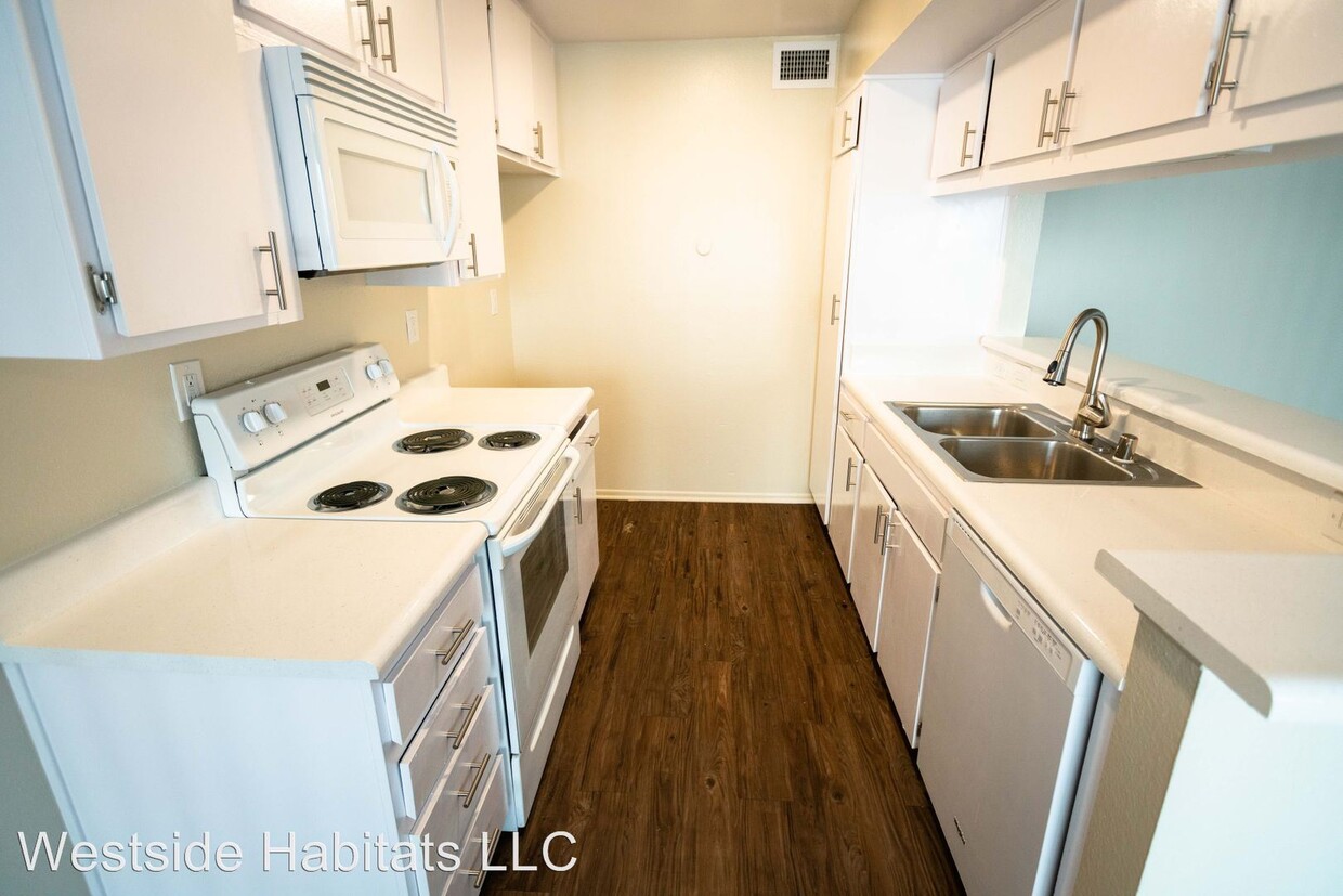
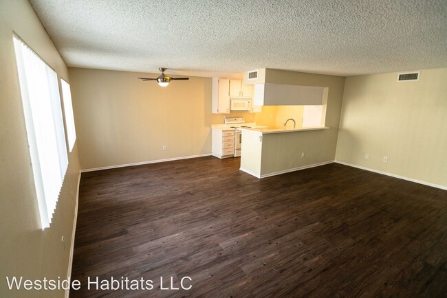
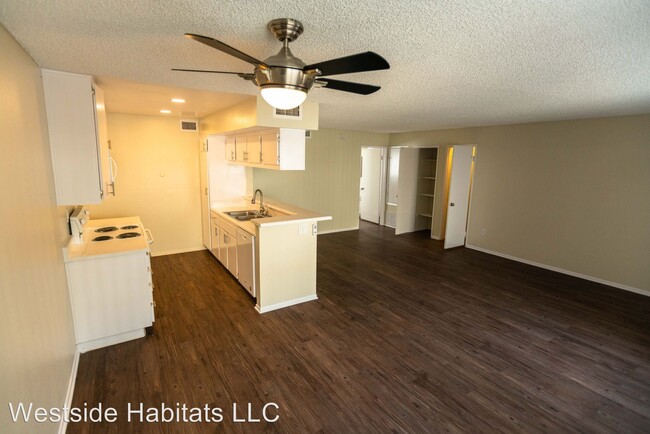
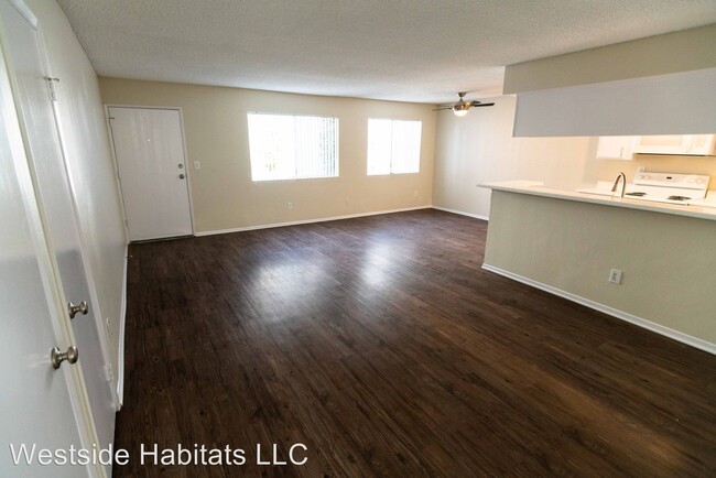
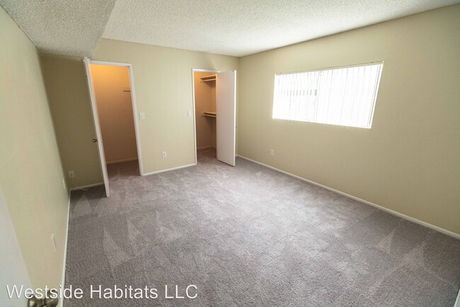
(310) 479-1800 - 1498.00 Large Space for a value big open floor plan - Come see this lovely hidden gem! Very affordable - 1 bed and 1 bath with lots of privacy. Water and trash included. Assigned covered parking in a gated community. Recently updated; large one bed and one bathroom in Newhall. Unlike some singles, this unit has great privacy. The unit includes: a stove, dishwasher, A/C, a community laundry room, a swimming pool, as well as one assigned parking space. Even an on-site manager! There are various nearby attractions, such as: shops and restaurants on Newhall's Main Street, Westfield Valencia Town Center, Six Flags Magic Mountain & Hurricane Harbor, William S. Hart Museum and Park, and much more! Easy freeway access to both the 14 and 5. Surrounding towns include: Valencia, Saugus, Stevenson Ranch, and Canyon Country. Nearby Schools: Very close to Hart High School, Newhall Elementary School, College of the Canyons, & Cal Arts. Great for students! Call today for more information or to schedule a tour. Hurry, this amazing deal will not last! **Pictures are a representation of a similar unit** No Dogs Allowed (RLNE2760954) Other Amenities: Parking, Other (gated perimter, manager onsite.), Pool. Appliances: Washer & Dryer On-Site. Pet policies: Cats Allowed, No Dogs Allowed.
25016 Walnut St is an apartment community located in Los Angeles County and the 91321 ZIP Code.
Unique Features
- No Dogs Allowed, Amenities - gated perimter, manager onsite.
Features
- Laundry Facilities
25016 Walnut St,
Santa Clarita,
CA
91321
Situated in Southern California, Santa Clarita Valley is an opulent suburb surrounded by nature preserves. The northern section of the region encompasses Castaic Lake State Recreation Park, while the eastern and western sides of the area are bordered by the Santa Clarita Woodlands Park and the Golden Valley Ranch Open Space. Also located in the valley are meandering trails that follow along the river and connect to scenic community parks. Located just 35 miles north of Los Angeles, Santa Clarita offers more than the great outdoors. Places like Six Flags Magic Mountain, sprawling golf courses, and premier shopping at plazas like Westfield Valencia Town Center are all located within Santa Clarita Valley. More shopping and retail centers can be found off Lyons Avenue and Soledad Canyon Road, while Main Street’s locally owned cafes, specialty shops, and restaurants provide a nice contrast to large commercial plazas.
Learn more about living in Santa Clarita Valley
Amenities
- Laundry Facilities
- No Dogs Allowed, Amenities - gated perimter, manager onsite.
Education
| Colleges & Universities | Distance | ||
|---|---|---|---|
| Colleges & Universities | Distance | ||
| Drive: | 10 min | 3.9 mi | |
| Drive: | 18 min | 11.6 mi | |
| Drive: | 25 min | 12.9 mi | |
| Drive: | 35 min | 24.8 mi |
25016 Walnut St is within 10 minutes or 3.9 miles from College of the Canyons. It is also near Mission College and Cal State Northridge.
Walkability Near 25016 Walnut St Santa Clarita, CA 91321
Getting Around
 What do Walkability, Transit, Drivability, and Bikeability mean?
Walkability measures the walking distance to day-to-day needs.
Transit measures access to public transportation.
Drivability measures congestion, parking availability, and access to major roads.
Bikeability measures the suitability for cycling.
How It Works
What do Walkability, Transit, Drivability, and Bikeability mean?
Walkability measures the walking distance to day-to-day needs.
Transit measures access to public transportation.
Drivability measures congestion, parking availability, and access to major roads.
Bikeability measures the suitability for cycling.
How It Works
Fairly Walkable
Walkability
40
/ 100
Some Public Transit
Transit
40
/ 100
Exceptionally Drivable
Drivability
90
/ 100
Moderately Bikeable
Bikeability
60
/ 100
Scores provided by
-
Soundscore™
-
/ 100
Traffic
-Airport
-Businesses
-Scores provided by
HowLoud What is a Sound Score Rating? A Sound Score Rating aggregates noise caused by vehicle traffic, airplane traffic and local sources. How It WorksYou May Also Like
Similar Rentals Nearby
-
-
-
-
-
-
-
-
-
1 Bed$3,161+2 Beds$4,611+Total Monthly Price12 Month LeaseTotal Monthly Price NewPrices include base rent and required monthly fees of $15. Variable costs based on usage may apply.Base Rent:1 Bed$3,145+2 Beds$4,595+1 Month Free
Pets Allowed Fitness Center Pool Maintenance on site High-Speed Internet Controlled Access
-
1 Bed$3,002+2 Beds$3,473+3 Beds$4,372Total Monthly PriceTotal Monthly Price NewPrices include base rent and required monthly fees of $6. Variable costs based on usage may apply.Base Rent:1 Bed$2,970+2 Beds$3,466+3 Beds$4,3651 Month Free
Pets Allowed Fitness Center Pool Dishwasher Refrigerator Kitchen


What Are Walk Score®, Transit Score®, and Bike Score® Ratings?
Walk Score® measures the walkability of any address. Transit Score® measures access to public transit. Bike Score® measures the bikeability of any address.
What is a Sound Score Rating?
A Sound Score Rating aggregates noise caused by vehicle traffic, airplane traffic and local sources.

25016 Walnut St
Santa Clarita, CA 91321