
Parkway Lofts
5 Lawrence St,
Bloomfield, NJ 07003
Studio - 2 Beds $1,800 - $3,790

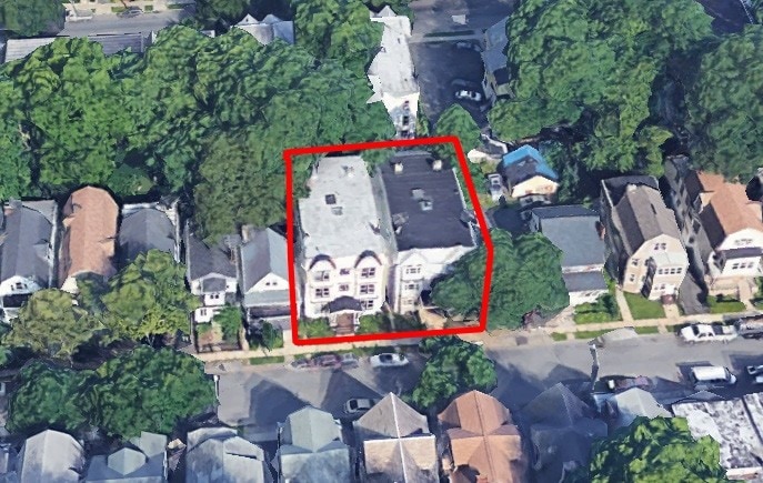

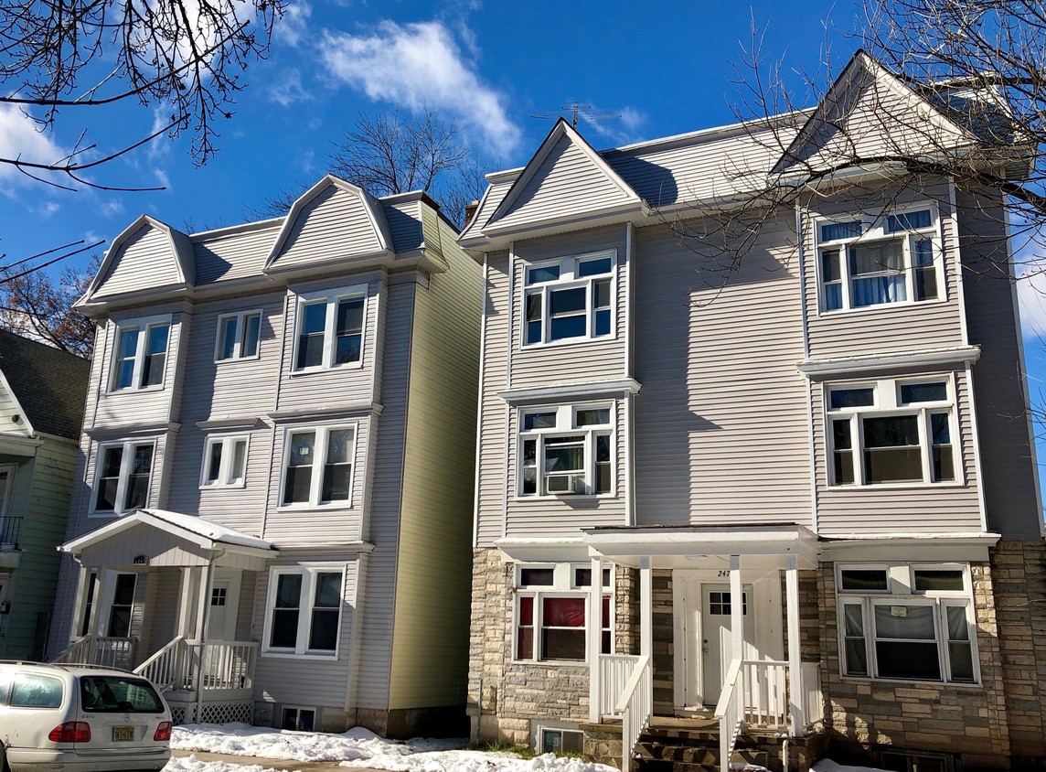
Discover 249 Amherst St. This property is situated in the 7018 area of East Orange. The professional leasing team is eager to show you our community. Give us a call now to schedule your tour.
249 Amherst St is an apartment community located in Essex County and the 07018 ZIP Code. This area is served by the East Orange attendance zone.
Nicknamed “The Crossroads of New Jersey,” East Orange lies just outside of Newark at the intersection of the Garden State Parkway and Interstate 280. Located just seven miles from Newark Liberty International Airport and about 30 minutes’ driving distance from New York City, East Orange is known for its remarkable convenience and accessibility.
East Orange offers the best of urban and suburban living, with spacious homes, a low crime rate, main commercial corridors, distinctive Caribbean and Southern cuisine, transit access, and historic green spaces. Home to a diverse range of people representing countries from around the world, East Orange is the quintessential city for urban renewal. Residents enjoy a host of community festivals and events as well as close proximity to the beautiful Branch Brook Park and South Mountain Reservation.
Learn more about living in East Orange| Colleges & Universities | Distance | ||
|---|---|---|---|
| Colleges & Universities | Distance | ||
| Drive: | 7 min | 2.3 mi | |
| Drive: | 6 min | 2.8 mi | |
| Drive: | 5 min | 3.0 mi | |
| Drive: | 6 min | 3.0 mi |


Transportation options available in East Orange include Norfolk Street, located 2.5 miles from 249 Amherst St. 249 Amherst St is near Newark Liberty International, located 8.4 miles or 15 minutes away, and LaGuardia, located 29.7 miles or 45 minutes away.
| Transit / Subway | Distance | ||
|---|---|---|---|
| Transit / Subway | Distance | ||
|
|
Drive: | 5 min | 2.5 mi |
|
|
Drive: | 5 min | 2.6 mi |
|
|
Drive: | 5 min | 2.8 mi |
|
|
Drive: | 6 min | 3.0 mi |
|
|
Drive: | 7 min | 3.8 mi |
| Commuter Rail | Distance | ||
|---|---|---|---|
| Commuter Rail | Distance | ||
|
|
Walk: | 14 min | 0.7 mi |
|
|
Walk: | 18 min | 1.0 mi |
|
|
Drive: | 5 min | 1.8 mi |
|
|
Drive: | 4 min | 1.8 mi |
|
|
Drive: | 8 min | 2.8 mi |
| Airports | Distance | ||
|---|---|---|---|
| Airports | Distance | ||
|
Newark Liberty International
|
Drive: | 15 min | 8.4 mi |
|
LaGuardia
|
Drive: | 45 min | 29.7 mi |
Time and distance from 249 Amherst St.
| Shopping Centers | Distance | ||
|---|---|---|---|
| Shopping Centers | Distance | ||
| Walk: | 15 min | 0.8 mi | |
| Drive: | 2 min | 1.3 mi | |
| Drive: | 4 min | 1.7 mi |
| Parks and Recreation | Distance | ||
|---|---|---|---|
| Parks and Recreation | Distance | ||
|
Edison National Historic Site
|
Drive: | 7 min | 2.9 mi |
|
Newark Museum and Dreyfuss Planetarium
|
Drive: | 6 min | 3.1 mi |
|
Branch Brook Park
|
Drive: | 9 min | 4.2 mi |
|
Turtle Back Zoo
|
Drive: | 11 min | 4.7 mi |
|
Greenwood Gardens
|
Drive: | 15 min | 6.6 mi |
| Hospitals | Distance | ||
|---|---|---|---|
| Hospitals | Distance | ||
| Walk: | 14 min | 0.7 mi | |
| Drive: | 5 min | 2.5 mi | |
| Drive: | 5 min | 2.9 mi |
| Military Bases | Distance | ||
|---|---|---|---|
| Military Bases | Distance | ||
| Drive: | 20 min | 12.2 mi | |
| Drive: | 26 min | 14.2 mi | |
| Drive: | 31 min | 15.8 mi |
What Are Walk Score®, Transit Score®, and Bike Score® Ratings?
Walk Score® measures the walkability of any address. Transit Score® measures access to public transit. Bike Score® measures the bikeability of any address.
What is a Sound Score Rating?
A Sound Score Rating aggregates noise caused by vehicle traffic, airplane traffic and local sources
249 Amherst St
East Orange, NJ 07018


