
$4,500 / Month

248 Myrtle St

,

San Francisco, CA 94109

Share Listing
Favorites
415-447-2048
  • Bedrooms

    2

  • Bathrooms

    1

  • Square Feet

    975 sq ft

  • Available

    Available Jun 2

248 Myrtle St
Share Listing
Favorites

About This Home

$4,500 deposit, Available Jun 2

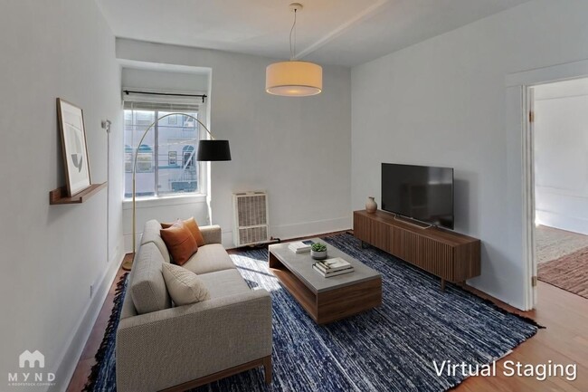
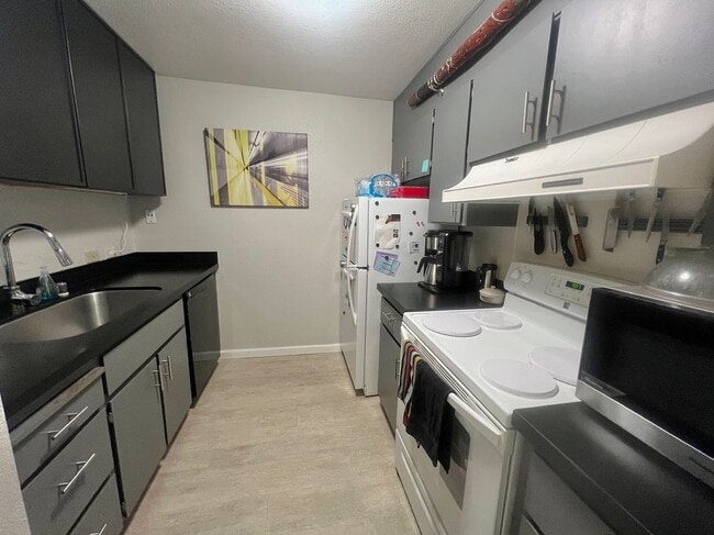
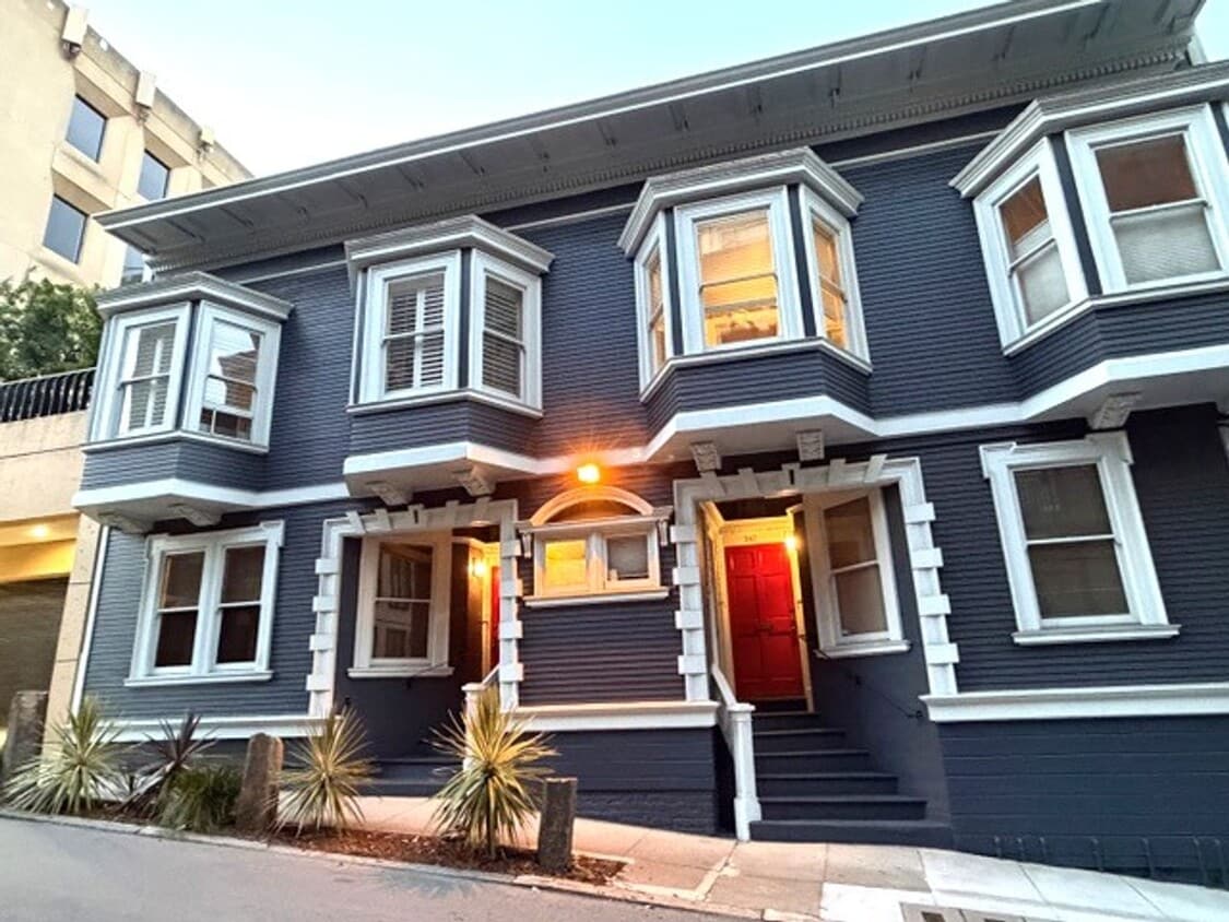
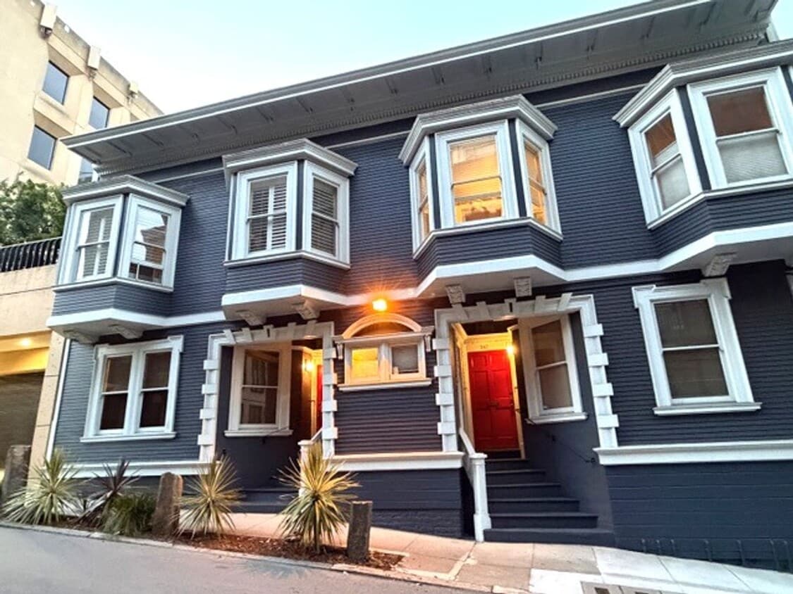
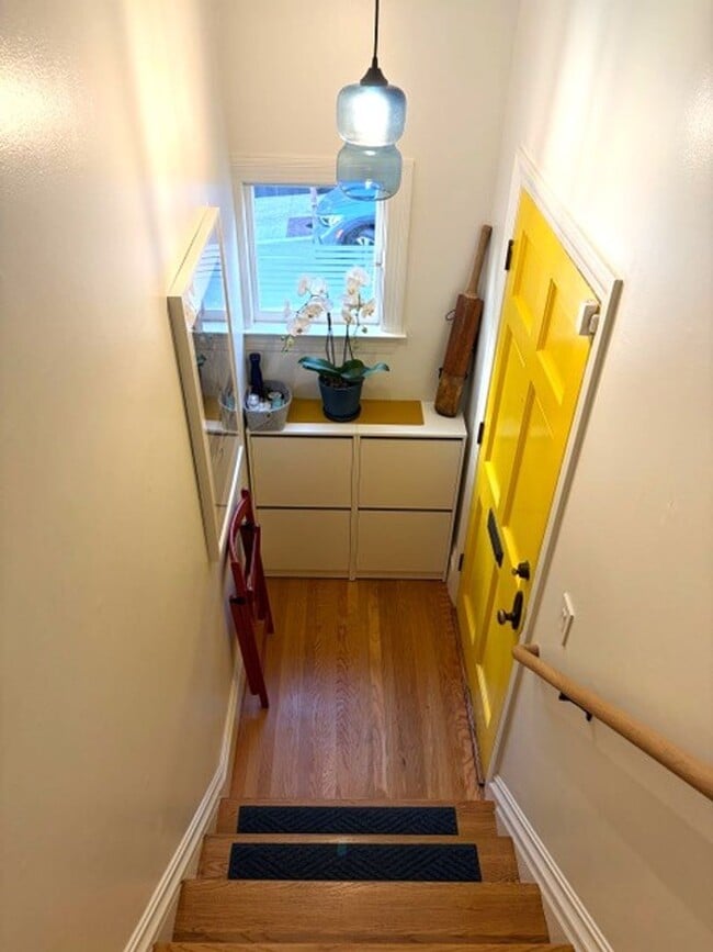
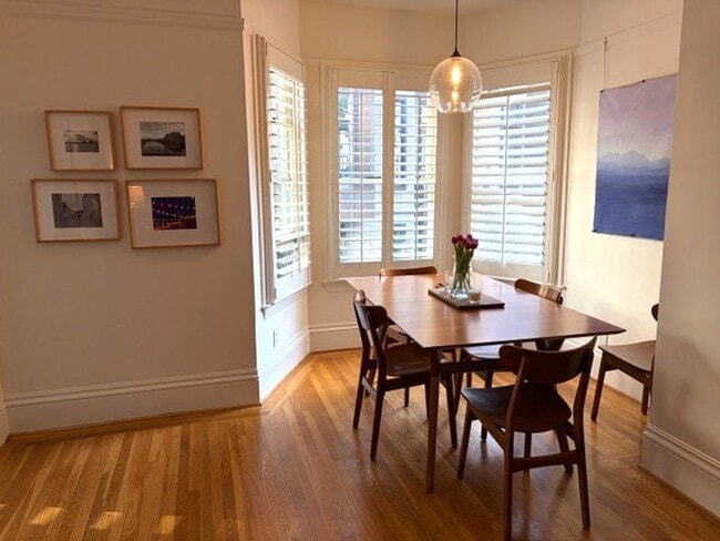
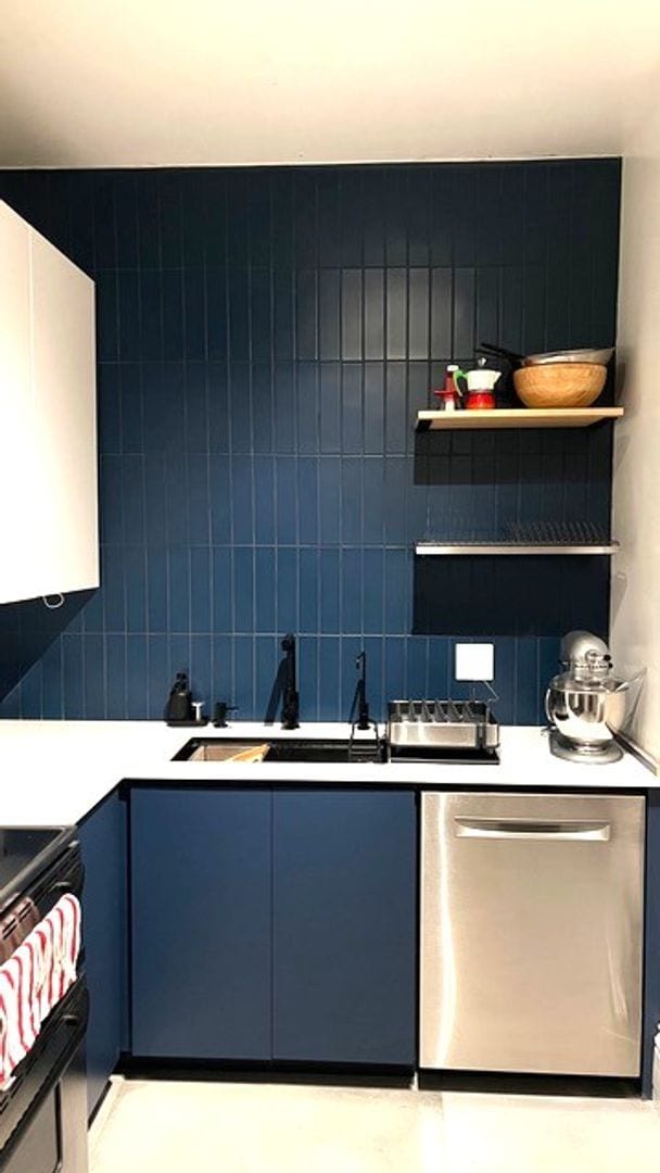
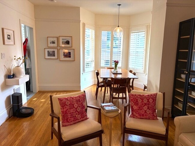
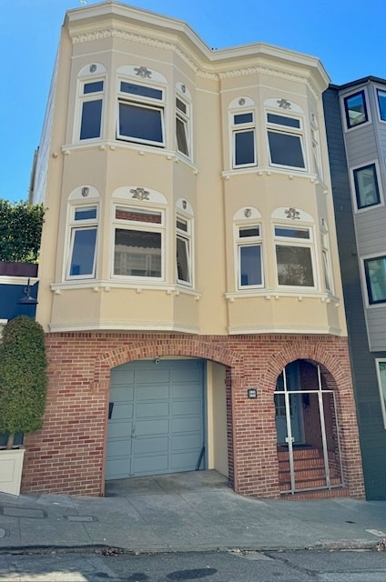
Welcome to this charming, top floor, 2BD/1BA condominium which is part of a historic row of eight elegant Edwardians on a tree-lined byway conveniently located between Franklin and Van Ness. The unit features high ceilings, generously proportioned rooms w/ hardwood floors, plantation shutters, a fireplace, great closets, and lots of period detail. This unique property is not to be missed. Eat-in kitchen features stainless steel appliances, and bedrooms are at the rear. Bathroom has a stacking washer/dryer, an overhead shower and tub. Steps from public transportation and an easy distance to Whole Foods and Polk Street restaurants, shopping, and nightlife. Recently painted and lovingly maintained, this turnkey property is a delightful landmark retreat right in the heart of the city! Shown by appointment only: Maureen "Mo" Couture Realtor AMSI

Unique Features

  • Bright & Sunny
  • Edwardian
  • Hardwood
  • Stove/Refrigerator/Oven
  • Water/Garbage
  • Wood Burning Fireplace

248 Myrtle St is a condo located in San Francisco County and the 94109 ZIP Code.

* Price shown is base rent. Excludes user-selected optional fees and variable or usage-based fees and required charges due at or prior to move-in or at move-out. Price, availability, fees, and any applicable rent special are subject to change without notice.
* Square footage definitions vary. Displayed square footage is approximate.

Contact

  • Listed by AMSI | AMSI
  • Phone Number
  • Contact
| Edit

Under 30 minutes

Commute Time is calculated at rush hour.
Neighborhood

Lower Pacific Heights is a vibrant San Francisco neighborhood situated between Pacific Heights, Japantown, the Fillmore District, and Laurel Heights. Formerly known as Upper Fillmore, Lower Pacific Heights offers residents a wide variety of apartments, condos, and houses available for rent, many of which boast scenic views due to the neighborhood’s hilly environment.

Lower Pacific Heights is regarded for its walkable layout, with many rentals situated within easy walking distance of the diverse restaurants, shops, coffeehouses, and bars that line Fillmore Street, the community’s main commercial thoroughfare. The neighborhood’s central locale is a major part of its allure, providing quick access to Union Square, the University of San Francisco, the Financial District, several prominent medical centers, tech employers, landmarks, and more.

Learn more about living in Lower Pacific Heights 
Amenities
  • Bright & Sunny
  • Edwardian
  • Hardwood
  • Stove/Refrigerator/Oven
  • Water/Garbage
  • Wood Burning Fireplace
Education
Colleges & Universities Distance
Walk: 13 min 0.7 mi
Walk: 21 min 1.1 mi
Drive: 6 min 1.7 mi
Drive: 5 min 2.0 mi
248 Myrtle St is within 13 minutes or 0.7 mile from Academy of Art University. It is also near UC San Francisco, Mount Zion and Golden Gate Univ., San Fran..
Transportation

Transportation options available in San Francisco include Van Ness And California, located 0.4 mile from 248 Myrtle St. 248 Myrtle St is near San Francisco International, located 14.2 miles or 23 minutes away, and Metro Oakland International, located 20.4 miles or 33 minutes away.

Transit / Subway Distance
Walk: 8 min 0.4 mi
Walk: 11 min 0.6 mi
Walk: 12 min 0.7 mi
Walk: 14 min 0.8 mi
Drive: 6 min 1.9 mi
Commuter Rail Distance
Drive: 6 min 2.2 mi
Drive: 13 min 6.4 mi
Drive: 18 min 9.9 mi
Drive: 19 min 11.5 mi
Drive: 22 min 12.0 mi
Airports Distance
Airports Distance
San Francisco International
Drive: 23 min 14.2 mi
Metro Oakland International
Drive: 33 min 20.4 mi
Getting Around
Exceptionally Walkable
Walkability
90 / 100
Exceptional Public Transit
Transit
100 / 100
Moderately Drivable
Drivability
60 / 100
Moderately Bikeable
Bikeability
60 / 100

Scores provided by

What do Walkability, Transit, Drivability, and Bikeability mean? Walkability measures the walking distance to day-to-day needs. Transit measures access to public transportation. Drivability measures congestion, parking availability, and access to major roads. Bikeability measures the suitability for cycling. How It Works
-
Soundscore
- / 100

Traffic

-

Airport

-

Businesses

-

Scores provided by

HowLoud What is a Sound Score Rating? A Sound Score Rating aggregates noise caused by vehicle traffic, airplane traffic and local sources. How It Works
Points of Interest

Time and distance from 248 Myrtle St.

Shopping Centers Distance
Walk: 5 min 0.3 mi
248 Myrtle St has 1 shopping centers within 0.3 mile, which is about a 5-minute walk. The miles and minutes will be for the farthest away property.
Parks and Recreation Distance
Children's Creativity Museum
Drive: 5 min 1.6 mi
San Francisco Maritime National Historical Park
Drive: 6 min 2.0 mi
Buena Vista Park
Drive: 7 min 2.2 mi
Aquarium of The Bay
Drive: 8 min 2.5 mi
Randall Museum
Drive: 8 min 2.7 mi
248 Myrtle St has 5 parks within 2.7 miles, including Children's Creativity Museum, San Francisco Maritime National Historical Park, and Buena Vista Park.
Hospitals Distance
Hospitals Distance
Walk: 2 min 0.1 mi
Walk: 11 min 0.6 mi
Drive: 4 min 1.5 mi
248 Myrtle St has 3 hospitals within 1.5 miles, the nearest is California Pacific Medical Center - Van Ness Campus which is 0.1 mile away and a 2 minute walk.
Military Bases Distance
Drive: 14 min 4.9 mi
Drive: 15 min 5.3 mi
Drive: 15 min 6.5 mi
248 Myrtle St has 3 military bases within 6.5 miles, the nearest is East Fort Miley which is 4.9 miles away and a 14 minute drive.

You May Also Like

Similar Rentals Nearby