
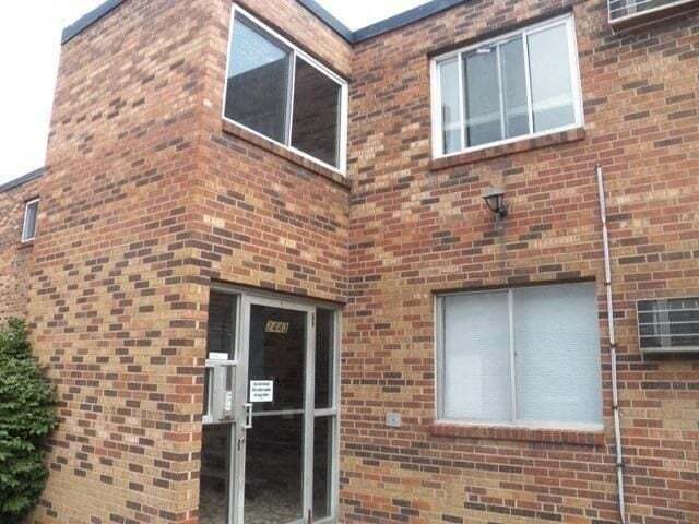
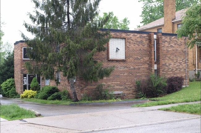
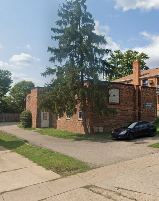
2443 Ferguson Road
2443 Ferguson Rd,
Cincinnati,
OH
45238
Today
|
Edit
Favorites
2443 Ferguson Road
Favorites
No Unit Information Available for this Listing
Fees and Policies
The fees below are based on community-supplied data and may exclude additional fees and utilities.
Property Fee Disclaimer: Based on community-supplied data and independent market research. Subject to change without notice. May exclude fees for mandatory or optional services and usage-based utilities.
Details
Property Information
-
Built in 1974
-
7 units/2 stories
About 2443 Ferguson Road
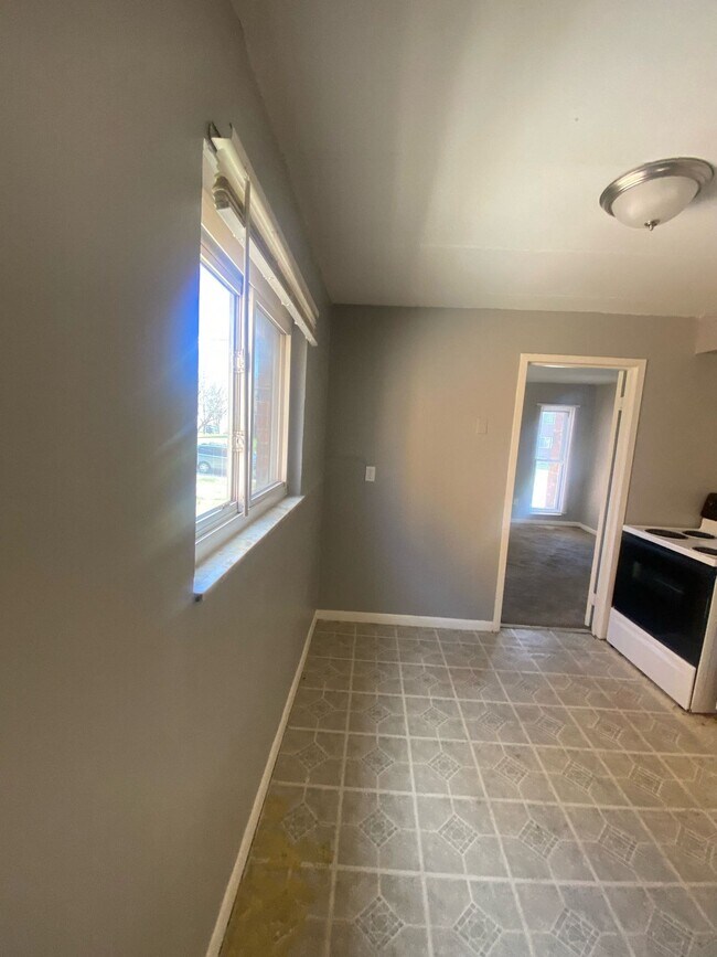
Discover 2443 Ferguson Rd, featuring a 700 sqft unit with 1 bed and 1 bath, with a rent of $795 monthly. You can move in with The Guarantors for a lower security deposit or a 1-month rent deposit. Pets are welcome with a $50 monthly fee per pet. Section 8 housing vouchers are accepted. Applicants need an income of 3x the rent, a clean rental history, and no recent evictions or criminal records. It is ideally located close to schools including Western Hills High School and John P. Parker Elementary and education options like Cincinnati State Technical and Community College and the University of Cincinnati. To Book a showing or apply visit or Call
2443 Ferguson Road is an apartment community located in Hamilton County and the 45238 ZIP Code. This area is served by the Cincinnati Public Schools attendance zone.
Unique Features
- parking
Contact
Language:
English
Open 9am - 6pm Today
Location
Get Directions
Amenities
- parking
Office Hours
| Monday | 9am - 6pm |
|---|---|
| Tuesday | 9am - 6pm |
| Wednesday | 9am - 6pm |
| Thursday | 9am - 6pm |
| Friday | 9am - 6pm |
| Saturday | Closed |
| Sunday | Closed |
Situated about five miles northwest of Downtown Cincinnati, Westwood is the largest neighborhood in the city. Residents flock to Westwood for its many affordable historic homes and modern apartments available for rent in addition to its close proximity to I-74, I-75, and all that Downtown Cincinnati has to offer.
While Westwood is a predominantly residential neighborhood, it is also home to a slew of convenient stores and restaurants. Shopping opportunities abound in Westwood, with plenty of national retailers in Western Hills Plaza and local shops in the growing Town Hall District. Numerous neighborhood parks provide ample space to enjoy the outdoors in town as well as the sprawling 1,400-acre Mount Airy Forest, which is partially located in Westwood.
Learn more about living in Westwood
Education
| Colleges & Universities | Distance | ||
|---|---|---|---|
| Colleges & Universities | Distance | ||
| Drive: | 10 min | 4.5 mi | |
| Drive: | 15 min | 6.2 mi | |
| Drive: | 16 min | 6.4 mi | |
| Drive: | 16 min | 6.6 mi |
2443 Ferguson Road is within 10 minutes or 4.5 miles from College of Mount St. Joseph. It is also near Cincinnati State and University of Cincinnati.
Schools


Public Elementary & Middle School
Grades PK-7 & 9
561 Students
Attendance Zone
Public Middle & High School
Grades 6-12
1,418 Students
Attendance Zone
Public Middle & High School
Grades 7-12
897 Students
Attendance Zone
Private Elementary & Middle School
Grades PK-8
381 Students
Nearby
Private Elementary & Middle School
Grades K-8
308 Students
Nearby
Private High School
Grades 9-12
495 Students
Nearby
School data provided by
 The GreatSchools Rating helps parents compare schools within a state based on a variety of school quality indicators and provides a helpful picture of how effectively each school serves all of its students. Ratings are on a scale of 1 (below average) to 10 (above average) and can include test scores, college readiness, academic progress, advanced courses, equity, discipline and attendance data. We also advise parents to visit schools, consider other information on school performance and programs, and consider family needs as part of the school selection process.
View GreatSchools Rating Methodology
Data provided by GreatSchools.org © 2025. All rights reserved.
View GreatSchools Rating Methodology
Data provided by GreatSchools.org © 2025. All rights reserved.
Transportation options available in Cincinnati include Brewery District Station, Elm & Henry, located 5.1 miles from 2443 Ferguson Road. 2443 Ferguson Road is near Cincinnati/Northern Kentucky International, located 19.4 miles or 37 minutes away.
| Transit / Subway | Distance | ||
|---|---|---|---|
| Transit / Subway | Distance | ||
| Drive: | 12 min | 5.1 mi | |
| Drive: | 12 min | 5.3 mi | |
| Drive: | 13 min | 5.4 mi | |
| Drive: | 13 min | 5.5 mi | |
| Drive: | 13 min | 5.6 mi |
| Commuter Rail | Distance | ||
|---|---|---|---|
| Commuter Rail | Distance | ||
|
|
Drive: | 12 min | 5.4 mi |
| Airports | Distance | ||
|---|---|---|---|
| Airports | Distance | ||
|
Cincinnati/Northern Kentucky International
|
Drive: | 37 min | 19.4 mi |
Time and distance from 2443 Ferguson Road.
| Shopping Centers | Distance | ||
|---|---|---|---|
| Shopping Centers | Distance | ||
| Walk: | 7 min | 0.4 mi | |
| Walk: | 11 min | 0.6 mi | |
| Walk: | 14 min | 0.7 mi |
2443 Ferguson Road has 3 shopping centers within 0.7 mile, which is about a 14-minute walk. The miles and minutes will be for the farthest away property.
| Parks and Recreation | Distance | ||
|---|---|---|---|
| Parks and Recreation | Distance | ||
|
Imago Earth Center
|
Drive: | 8 min | 3.1 mi |
|
Embshoff Woods
|
Drive: | 11 min | 3.6 mi |
|
Wilson Commons
|
Drive: | 10 min | 3.8 mi |
|
Mt. Airy Forest
|
Drive: | 10 min | 4.2 mi |
|
Cincinnati History Museum
|
Drive: | 13 min | 5.4 mi |
2443 Ferguson Road has 5 parks within 5.4 miles, including Imago Earth Center, Embshoff Woods, and Wilson Commons.
| Hospitals | Distance | ||
|---|---|---|---|
| Hospitals | Distance | ||
| Drive: | 10 min | 4.3 mi | |
| Drive: | 13 min | 5.5 mi | |
| Drive: | 15 min | 6.2 mi |
2443 Ferguson Road has 3 hospitals within 6.2 miles, the nearest is Mercy Health - West Hospital which is 4.3 miles away and a 10 minute drive.
| Military Bases | Distance | ||
|---|---|---|---|
| Military Bases | Distance | ||
| Drive: | 76 min | 56.5 mi | |
| Drive: | 82 min | 61.6 mi | |
| Drive: | 85 min | 64.9 mi |
2443 Ferguson Road has 3 military bases within 64.9 miles, the nearest is Gentile Air Force Station which is 56.5 miles away and a 76 minute drive.
You May Also Like
Similar Rentals Nearby


What Are Walk Score®, Transit Score®, and Bike Score® Ratings?
Walk Score® measures the walkability of any address. Transit Score® measures access to public transit. Bike Score® measures the bikeability of any address.
What is a Sound Score Rating?
A Sound Score Rating aggregates noise caused by vehicle traffic, airplane traffic and local sources
2443 Ferguson Rd
Cincinnati, OH 45238