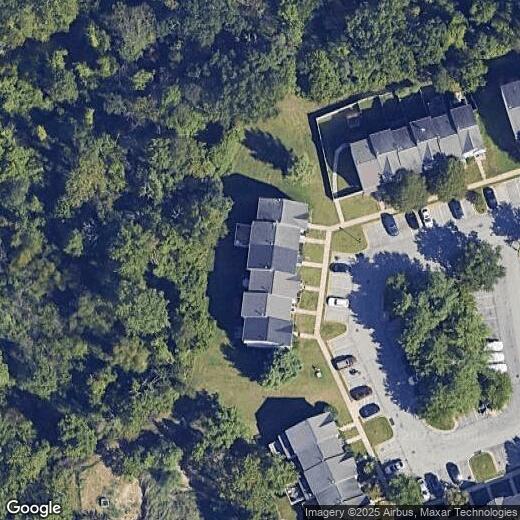
2404 Golders Green Ct
2404 Golders Green Ct
Windsor Mill, MD 21244
2 Weeks Ago
Favorites
2404 Golders Green Ct

Favorites
Check Back Soon for Upcoming Availability
Location
Get Directions
The large community of Windsor Mill sits on the northeast side of Downtown Baltimore, just west of the Baltimore Beltway (I-695). Windsor Mill is considered part of Milford Mill, another large CDP on the north end of Windsor Mill. Other nearby communities include Rockdale and Woodlawn. This popular area is ideal for commuters -- Downtown Baltimore is just eight miles southeast. Those who prefer car-free commuting can take the MARC train directly into the city.
Windsor Mill provides a charming neighborhood complete with large commercial districts, great shops and restaurants, and golfing fun at the Woodlands Golf Course. Other nearby locations include Villa Nova Park and Patapsco Valley Park, located along the Patapsco River. The University of Maryland-Baltimore County is just seven miles southeast.
Learn more about living in Windsor Mill
Education
| Colleges & Universities | Distance | ||
|---|---|---|---|
| Colleges & Universities | Distance | ||
| Drive: | 15 min | 7.0 mi | |
| Drive: | 20 min | 7.1 mi | |
| Drive: | 17 min | 7.5 mi | |
| Drive: | 20 min | 10.0 mi |
2404 Golders Green Ct is within 15 minutes or 7.0 miles from CCBC Cantonsville. It is also near Coppin State University and UMBC.
Transportation options available in Windsor Mill include Old Court, located 4.3 miles from 2404 Golders Green Ct. 2404 Golders Green Ct is near Baltimore/Washington International Thurgood Marshall, located 12.9 miles or 23 minutes away.
| Transit / Subway | Distance | ||
|---|---|---|---|
| Transit / Subway | Distance | ||
| Drive: | 11 min | 4.3 mi | |
| Drive: | 13 min | 5.1 mi | |
| Drive: | 13 min | 5.3 mi | |
| Drive: | 15 min | 5.9 mi | |
| Drive: | 16 min | 6.8 mi |
| Commuter Rail | Distance | ||
|---|---|---|---|
| Commuter Rail | Distance | ||
| Drive: | 15 min | 8.4 mi | |
| Drive: | 15 min | 8.4 mi | |
|
|
Drive: | 15 min | 8.4 mi |
|
|
Drive: | 19 min | 8.6 mi |
| Drive: | 18 min | 10.2 mi |
| Airports | Distance | ||
|---|---|---|---|
| Airports | Distance | ||
|
Baltimore/Washington International Thurgood Marshall
|
Drive: | 23 min | 12.9 mi |
Time and distance from 2404 Golders Green Ct.
| Shopping Centers | Distance | ||
|---|---|---|---|
| Shopping Centers | Distance | ||
| Walk: | 14 min | 0.7 mi | |
| Walk: | 16 min | 0.9 mi | |
| Drive: | 4 min | 1.4 mi |
2404 Golders Green Ct has 3 shopping centers within 1.4 miles, which is about a 4-minute walk. The miles and minutes will be for the farthest away property.
| Parks and Recreation | Distance | ||
|---|---|---|---|
| Parks and Recreation | Distance | ||
|
Carrie Murray Nature Center
|
Drive: | 12 min | 4.6 mi |
|
Gwynns Falls - Leakin Park
|
Drive: | 12 min | 4.6 mi |
|
Benjamin Banneker Historical Park and Museum
|
Drive: | 14 min | 5.2 mi |
|
Gwynns Falls Trail
|
Drive: | 14 min | 5.5 mi |
|
Banneker Planetarium
|
Drive: | 15 min | 6.9 mi |
2404 Golders Green Ct has 5 parks within 6.9 miles, including Carrie Murray Nature Center, Gwynns Falls - Leakin Park, and Gwynns Falls Trail.
| Hospitals | Distance | ||
|---|---|---|---|
| Hospitals | Distance | ||
| Drive: | 9 min | 3.6 mi | |
| Drive: | 9 min | 3.7 mi | |
| Drive: | 11 min | 5.3 mi |
2404 Golders Green Ct has 3 hospitals within 5.3 miles, the nearest is Northwest Hospital Center which is 3.6 miles away and a 9 minute drive.
| Military Bases | Distance | ||
|---|---|---|---|
| Military Bases | Distance | ||
| Drive: | 37 min | 20.9 mi |
2404 Golders Green Ct is 20.9 miles and a 37 minute drive from Fort George Meade.
You May Also Like
Similar Rentals Nearby


What Are Walk Score®, Transit Score®, and Bike Score® Ratings?
Walk Score® measures the walkability of any address. Transit Score® measures access to public transit. Bike Score® measures the bikeability of any address.
What is a Sound Score Rating?
A Sound Score Rating aggregates noise caused by vehicle traffic, airplane traffic and local sources