
$2,000 / Month
2360 Bitternut Way
Jacksonville, FL 32246
2 Weeks Ago
Favorites
2360 Bitternut Way

Favorites
Check Back Soon for Upcoming Availability
| Beds | Baths | Average SF |
|---|---|---|
| 3 Bedrooms 3 Bedrooms 3 Br | 2 Baths 2 Baths 2 Ba | 1,199 SF |
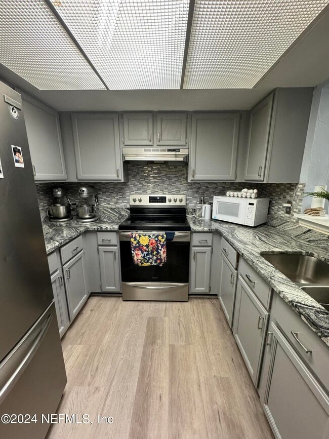
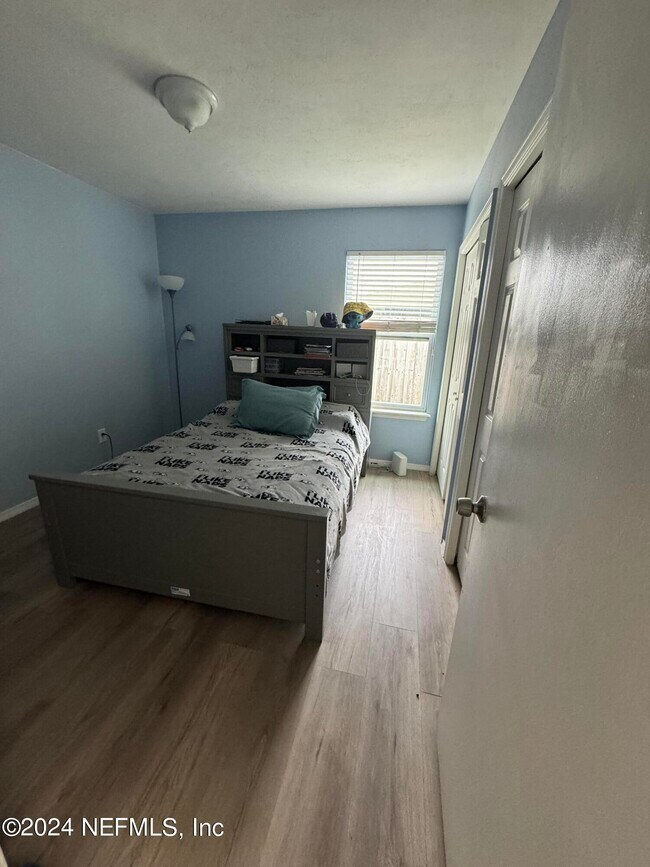
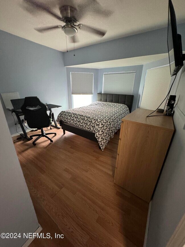
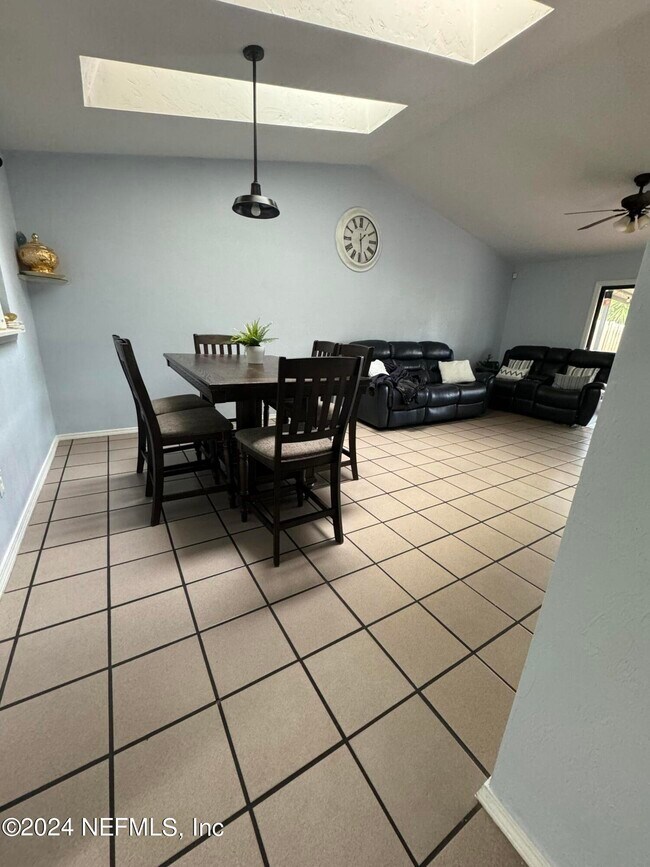
About This Property
3-Bedroom Townhouse for Rent with Enclosed Patio. Discover the perfect blend of comfort and convenience with our meticulously designed 3-bedroom townhouse available for rent. Ideally located in the heart of the city,this residence offers easy access to major highways,including the I-295,putting you just a swift 3-minute drive away. Situated only 7 minutes from the bustling Town Center,our townhouse is also conveniently close to prominent institutions such as the Mayo Clinic,UNF (University of North Florida),and FSCJ (Florida State College at Jacksonville). Embrace the coastal lifestyle with a mere 15-minute drive to the beach,making it a splendid choice for those who relish the sun,sea,and sand. With schools,convenience stores,hospitals,and other amenities in close proximity,this residence provides the perfect balance of urban living and tranquility. Don't miss the opportunity to make this centrally located townhouse your home. Contact us for more info
2360 Bitternut Way is a townhome located in Duval County and the 32246 ZIP Code. This area is served by the Duval County Public Schools attendance zone.
Location
Get Directions
Development on the Sandalwood neighborhood began in the spring of 1960. Designed to provide inhabitants with the ideal balance of work and play, Sandalwood sits approximately half way between Jacksonville city center and its nearest beach, which lies roughly six miles east of the neighborhood.
Developer Pearce-Uible's primary Sandalwood concept contained 500 houses. To give the neighborhood an exotic ambiance, Sandalwood's original streets were all named after Pacific Islands. Mindanao Drive, Hawaii Drive East, and Kusai Drive are three of those original roadways. Two more streets, Majuro Drive and Luana Drive, were added to the neighborhood in 1969.
Nearly half the houses in the modern Sandalwood neighborhood are quite new. The original 1960s properties reside in the northern half of the area, whereas newer houses extend to the southern part of the neighborhood. Several educational establishments call the area home, including Sandalwood High School, established in 1971.
Learn more about living in SandalwoodBelow are rent ranges for similar nearby apartments
Education
| Colleges & Universities | Distance | ||
|---|---|---|---|
| Colleges & Universities | Distance | ||
| Drive: | 9 min | 5.2 mi | |
| Drive: | 16 min | 8.4 mi | |
| Drive: | 19 min | 10.0 mi | |
| Drive: | 19 min | 11.8 mi |
2360 Bitternut Way is within 9 minutes or 5.2 miles from University of North Florida. It is also near Jacksonville University and Florida Coastal School of Law.
Schools


Public Elementary School
Grades PK-5
486 Students
Nearby
Public Elementary School
Grades K-5
426 Students
Attendance Zone
Public Middle School
Grades 6-8
1,136 Students
Attendance Zone
Public High School
Grades 9-12
2,771 Students
Attendance Zone
Private Elementary, Middle & High School
Grades PK-12
221 Students
Nearby
Private Elementary, Middle & High School
Grades PK-11
254 Students
Nearby
School data provided by
 The GreatSchools Rating helps parents compare schools within a state based on a variety of school quality indicators and provides a helpful picture of how effectively each school serves all of its students. Ratings are on a scale of 1 (below average) to 10 (above average) and can include test scores, college readiness, academic progress, advanced courses, equity, discipline and attendance data. We also advise parents to visit schools, consider other information on school performance and programs, and consider family needs as part of the school selection process.
View GreatSchools Rating Methodology
Data provided by GreatSchools.org © 2025. All rights reserved.
View GreatSchools Rating Methodology
Data provided by GreatSchools.org © 2025. All rights reserved.
Transportation options available in Jacksonville include Rosa L. Parks/Fccj, located 9.7 miles from 2360 Bitternut Way. 2360 Bitternut Way is near Jacksonville International, located 19.5 miles or 29 minutes away.
| Transit / Subway | Distance | ||
|---|---|---|---|
| Transit / Subway | Distance | ||
|
|
Drive: | 17 min | 9.7 mi |
| Drive: | 20 min | 10.4 mi | |
|
|
Drive: | 20 min | 10.6 mi |
|
|
Drive: | 20 min | 10.8 mi |
|
|
Drive: | 21 min | 10.9 mi |
| Commuter Rail | Distance | ||
|---|---|---|---|
| Commuter Rail | Distance | ||
|
|
Drive: | 27 min | 15.7 mi |
| Airports | Distance | ||
|---|---|---|---|
| Airports | Distance | ||
|
Jacksonville International
|
Drive: | 29 min | 19.5 mi |
Time and distance from 2360 Bitternut Way.
| Shopping Centers | Distance | ||
|---|---|---|---|
| Shopping Centers | Distance | ||
| Walk: | 9 min | 0.5 mi | |
| Drive: | 3 min | 1.4 mi | |
| Drive: | 3 min | 1.7 mi |
2360 Bitternut Way has 3 shopping centers within 1.7 miles, which is about a 3-minute walk. The miles and minutes will be for the farthest away property.
| Parks and Recreation | Distance | ||
|---|---|---|---|
| Parks and Recreation | Distance | ||
|
Beach and Peach Park
|
Drive: | 8 min | 3.8 mi |
|
Touchton Road Park
|
Drive: | 10 min | 5.0 mi |
|
Ed Austin Regional Park
|
Drive: | 10 min | 5.0 mi |
|
Jacksonville Arboretum and Gardens
|
Drive: | 9 min | 5.3 mi |
|
Tree Hill Nature Center
|
Drive: | 12 min | 5.9 mi |
2360 Bitternut Way has 5 parks within 5.9 miles, including Beach and Peach Park, Jacksonville Arboretum and Gardens, and Touchton Road Park.
| Hospitals | Distance | ||
|---|---|---|---|
| Hospitals | Distance | ||
| Drive: | 11 min | 6.1 mi | |
| Drive: | 13 min | 6.8 mi | |
| Drive: | 13 min | 8.9 mi |
2360 Bitternut Way has 3 hospitals within 8.9 miles, the nearest is River Point Behavioral Health which is 6.1 miles away and a 11 minute drive.
| Military Bases | Distance | ||
|---|---|---|---|
| Military Bases | Distance | ||
| Drive: | 21 min | 11.4 mi | |
| Drive: | 34 min | 25.7 mi |
2360 Bitternut Way is 11.4 miles from Mayport Naval Air Station, and is convenient to other military bases, including Jacksonville Naval Air Station.
You May Also Like
Similar Rentals Nearby


What Are Walk Score®, Transit Score®, and Bike Score® Ratings?
Walk Score® measures the walkability of any address. Transit Score® measures access to public transit. Bike Score® measures the bikeability of any address.
What is a Sound Score Rating?
A Sound Score Rating aggregates noise caused by vehicle traffic, airplane traffic and local sources
2360 Bitternut Way
Jacksonville, FL 32246