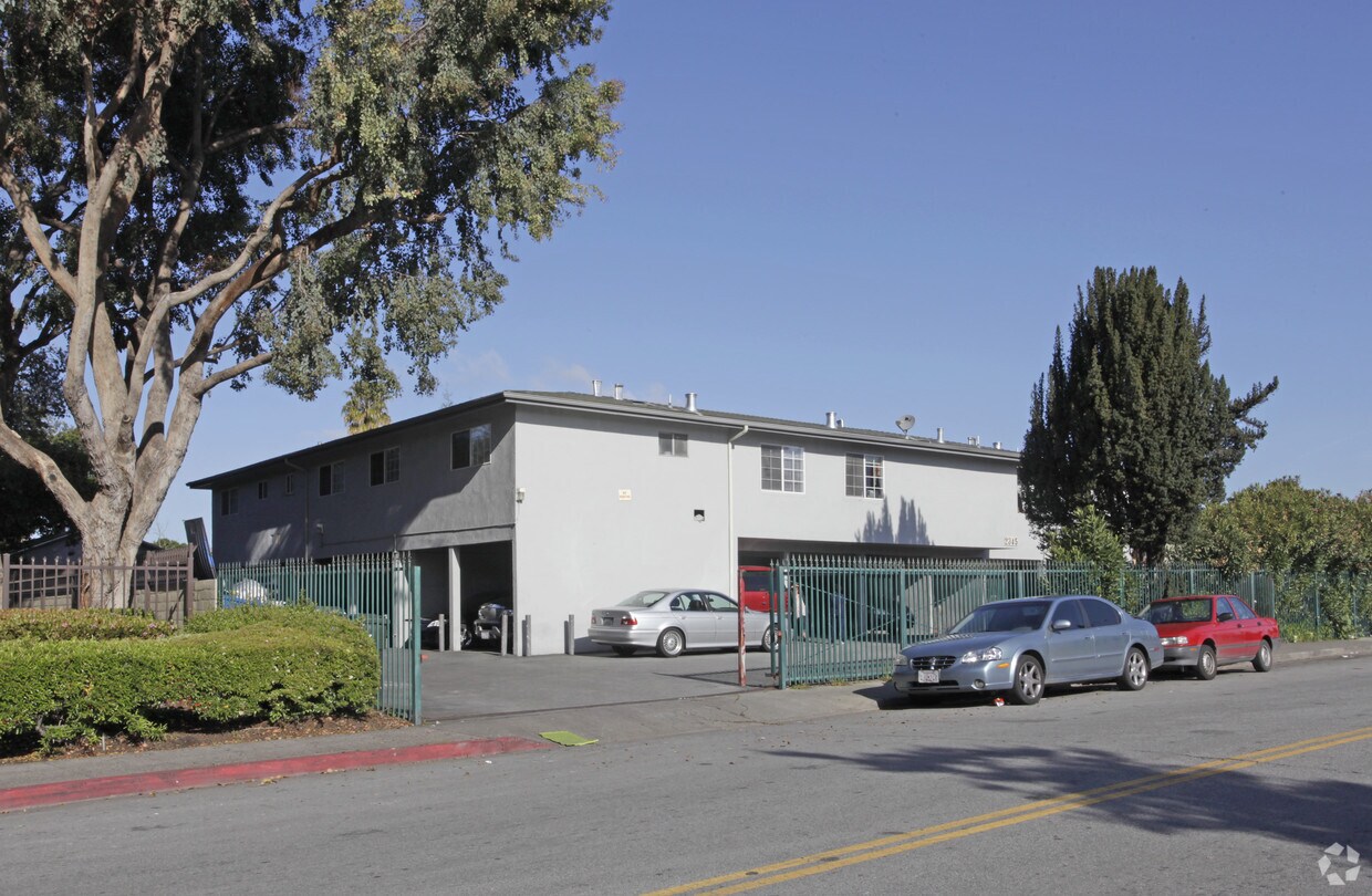
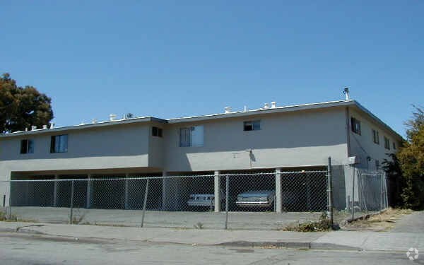
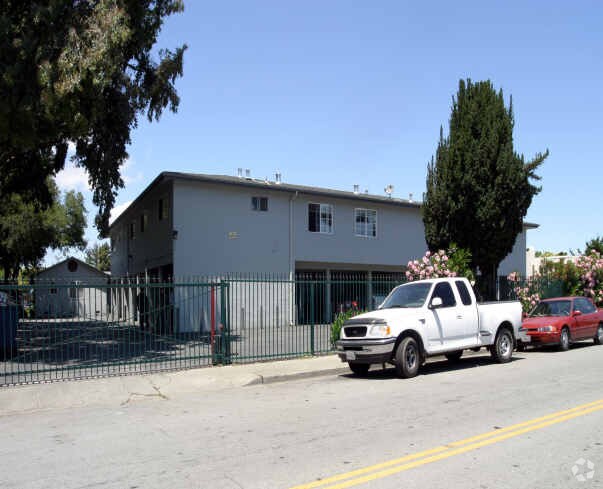
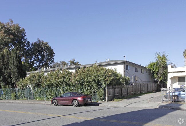
2341-2345 Cooley Ave
2341-2345 Cooley Ave,
East Palo Alto,
CA
94303
2 Weeks Ago
Favorites
2341-2345 Cooley Ave
Favorites
Check Back Soon for Upcoming Availability
| Beds | Baths | Average SF | Availability |
|---|---|---|---|
| 1 Bedroom 1 Bedroom 1 Br | 1 Bath 1 Bath 1 Ba | — | Not Available |
| 2 Bedrooms 2 Bedrooms 2 Br | 1 Bath 1 Bath 1 Ba | — | Not Available |
Fees and Policies
Details
Property Information
-
Built in 1965
-
17 units/2 stories
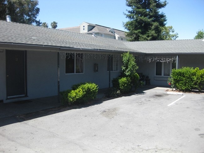
About 2341-2345 Cooley Ave East Palo Alto, CA 94303
2341-2345 Cooley Ave offers a mixture of quality and comfort. Schedule a time to view the available floorplans. Apartments here give you a selection of featured amenities. Some of these include: high-speed internet access, smoke free options, and rentable storage units. The community staff is ready to match you with the perfect floorplan option. Get moving on finding your next place. Contact or stop by 2341-2345 Cooley Ave to check the current floorplan availability!
2341-2345 Cooley Ave is an apartment community located in San Mateo County and the 94303 ZIP Code. This area is served by the Ravenswood City Elementary attendance zone.
Community Amenities
- Laundry Facilities
- Gated
Apartment Features
High Speed Internet Access
Patio
Smoke Free
Heating
- High Speed Internet Access
- Heating
- Smoke Free
- Kitchen
- Patio
Location
Get Directions
Situated on the coast of the San Francisco Bay on the San Francisco Peninsula, East Palo Alto is a bustling city on the rise with the influx of tech companies. Friendly neighbors and distant mountain views define this small coastal town.
With its central location between San Francisco and San Jose, entertainment options are endless. Explore the delicious cuisine and fantastic bars in San Jose, or visit the plentiful museums and waterfront green space in San Francisco. Stanford University is a quick commute for East Palo Alto residents, located just five miles southwest of town, so be sure to check out its beautiful campus in nearby Stanford.
East Palo Alto offers an accessible rocky shoreline overlooking the glistening San Francisco Bay, as well as sports fields, open green space, and playgrounds in its well-kept community parks.
Learn more about living in East Palo Alto
Amenities
- Laundry Facilities
- Gated
- High Speed Internet Access
- Heating
- Smoke Free
- Kitchen
- Patio
Education
| Colleges & Universities | Distance | ||
|---|---|---|---|
| Colleges & Universities | Distance | ||
| Drive: | 13 min | 4.5 mi | |
| Drive: | 10 min | 5.1 mi | |
| Drive: | 12 min | 5.5 mi | |
| Drive: | 20 min | 9.6 mi |
2341-2345 Cooley Ave is within 13 minutes or 4.5 miles from Stanford University. It is also near Menlo College and Foothill College, Middlefield.
Schools


Public Elementary School
Grades K-5
367 Students
Nearby
Public Elementary School
Grades K-5
248 Students
Attendance Zone
Public Elementary School
Grades K-5
270 Students
Nearby
Public Elementary School
Grades K-5
348 Students
Attendance Zone
Public Middle School
Grades 6-8
515 Students
Attendance Zone
Public High School
Grades 9-12
2,125 Students
Attendance Zone
Public High School
Grades 9-12
1,694 Students
Attendance Zone
Private Elementary, Middle & High School
Grades PK-12
247 Students
Nearby
Private Elementary & Middle School
Grades K-7
Nearby
Private High School
Grades 9-12
267 Students
Nearby
School data provided by
 The GreatSchools Rating helps parents compare schools within a state based on a variety of school quality indicators and provides a helpful picture of how effectively each school serves all of its students. Ratings are on a scale of 1 (below average) to 10 (above average) and can include test scores, college readiness, academic progress, advanced courses, equity, discipline and attendance data. We also advise parents to visit schools, consider other information on school performance and programs, and consider family needs as part of the school selection process.
View GreatSchools Rating Methodology
Data provided by GreatSchools.org © 2025. All rights reserved.
View GreatSchools Rating Methodology
Data provided by GreatSchools.org © 2025. All rights reserved.
Transportation options available in East Palo Alto include Bayshore Nasa Station, located 7.5 miles from 2341-2345 Cooley Ave. 2341-2345 Cooley Ave is near Norman Y Mineta San Jose International, located 15.0 miles or 21 minutes away, and San Francisco International, located 19.2 miles or 26 minutes away.
| Transit / Subway | Distance | ||
|---|---|---|---|
| Transit / Subway | Distance | ||
| Drive: | 11 min | 7.5 mi | |
|
|
Drive: | 11 min | 7.6 mi |
| Drive: | 11 min | 7.9 mi | |
|
|
Drive: | 11 min | 7.9 mi |
|
|
Drive: | 12 min | 8.0 mi |
| Commuter Rail | Distance | ||
|---|---|---|---|
| Commuter Rail | Distance | ||
| Drive: | 8 min | 2.7 mi | |
| Drive: | 9 min | 3.8 mi | |
| Drive: | 9 min | 4.0 mi | |
| Drive: | 10 min | 4.4 mi | |
| Drive: | 11 min | 5.9 mi |
| Airports | Distance | ||
|---|---|---|---|
| Airports | Distance | ||
|
Norman Y Mineta San Jose International
|
Drive: | 21 min | 15.0 mi |
|
San Francisco International
|
Drive: | 26 min | 19.2 mi |
Time and distance from 2341-2345 Cooley Ave.
| Shopping Centers | Distance | ||
|---|---|---|---|
| Shopping Centers | Distance | ||
| Walk: | 16 min | 0.8 mi | |
| Drive: | 4 min | 1.6 mi | |
| Drive: | 5 min | 2.3 mi |
2341-2345 Cooley Ave has 3 shopping centers within 2.3 miles, which is about a 5-minute walk. The miles and minutes will be for the farthest away property.
| Parks and Recreation | Distance | ||
|---|---|---|---|
| Parks and Recreation | Distance | ||
|
Ravenswood Open Space Preserve
|
Walk: | 20 min | 1.1 mi |
|
Rinconada Park
|
Drive: | 6 min | 2.0 mi |
|
Junior Museum and Zoo
|
Drive: | 6 min | 2.2 mi |
|
Seminary Oaks Park
|
Drive: | 6 min | 2.2 mi |
|
Hopkins Creekside Park
|
Drive: | 6 min | 2.5 mi |
2341-2345 Cooley Ave has 5 parks within 2.5 miles, including Ravenswood Open Space Preserve, Rinconada Park, and Seminary Oaks Park.
| Hospitals | Distance | ||
|---|---|---|---|
| Hospitals | Distance | ||
| Drive: | 11 min | 3.7 mi | |
| Drive: | 13 min | 4.2 mi | |
| Drive: | 9 min | 5.6 mi |
2341-2345 Cooley Ave has 3 hospitals within 5.6 miles, the nearest is Lucile Salter Packard Children's Hospital at Stanford which is 3.7 miles away and a 11 minute drive.
| Military Bases | Distance | ||
|---|---|---|---|
| Military Bases | Distance | ||
| Drive: | 14 min | 7.9 mi |
2341-2345 Cooley Ave is 7.9 miles and a 14 minute drive from Ames Research Center.
You May Also Like
Similar Rentals Nearby


What Are Walk Score®, Transit Score®, and Bike Score® Ratings?
Walk Score® measures the walkability of any address. Transit Score® measures access to public transit. Bike Score® measures the bikeability of any address.
What is a Sound Score Rating?
A Sound Score Rating aggregates noise caused by vehicle traffic, airplane traffic and local sources

2341-2345 Cooley Ave
East Palo Alto, CA 94303
Responded To This Review