$409
/ Month
233 High St
Butler, IN 46721
Favorites
233 High St

Favorites
Check Back Soon for Upcoming Availability
| Beds | Baths | Average SF |
|---|---|---|
| 1 Bedroom 1 Bedroom 1 Br | 1 Bath 1 Bath 1 Ba | 638 SF |
Fees and Policies
The fees listed below are community-provided and may exclude utilities or add-ons. All payments are made directly to the property and are non-refundable unless otherwise specified.
Details
Utilities Included
-
Water
About This Property
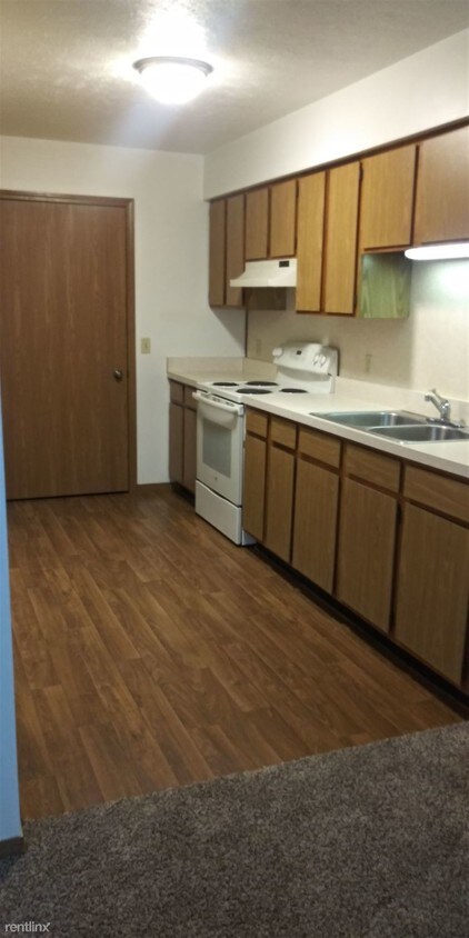
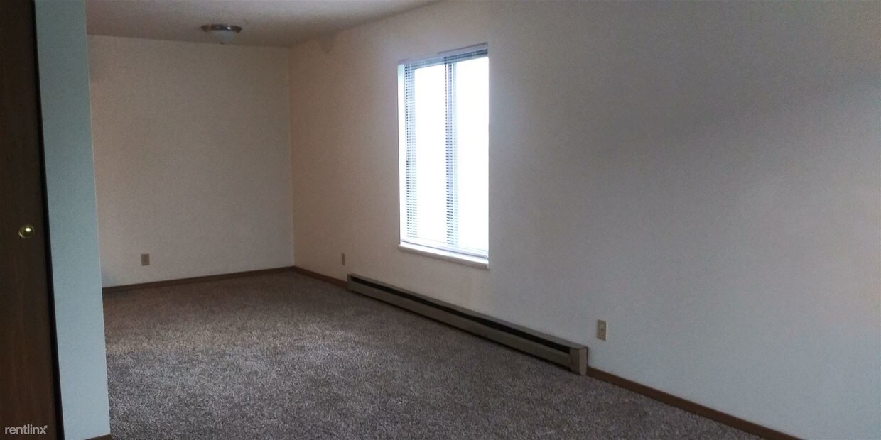
(260) 868-5383 - Spacious 1 and 2 bedroom Low Income apartments right in the heart of Butler, Indiana. Call Today to see what we have to offer you (260) 868 - 5383 TDD #711 Equal Housing Opportunity This institution is an equal opportunity provider Accepts Section 8. No Pets Allowed (RLNE4727989) Other Amenities: Unfurnished, Parking, Patio. Appliances: Refrigerator, Range, Garbage Disposal, Washer & Dryer On-Site. Lease lengths: 12 Months. Utilities: Resident Pays Electricity, Water Included, Trash Pick-up Included. Pet policies: No Pets Allowed.
233 High St is an apartment community located in Dekalb County and the 46721 ZIP Code.
Unique Features
- No Pets Allowed
Features
- Laundry Facilities
233 High St,
Butler,
IN
46721
Amenities
- Laundry Facilities
- No Pets Allowed
Expenses
Utilities Included
Water
Included
Education
| Colleges & Universities | Distance | ||
|---|---|---|---|
| Colleges & Universities | Distance | ||
| Drive: | 34 min | 25.0 mi | |
| Drive: | 46 min | 34.7 mi | |
| Drive: | 47 min | 35.0 mi | |
| Drive: | 46 min | 35.0 mi |
233 High St is within 34 minutes or 25.0 miles from Trine University. It is also near Ivy Tech. C.C., North and Purdue Fort Wayne.
Walkability Near 233 High St Butler, IN 46721
Getting Around
 What do Walkability, Transit, Drivability, and Bikeability mean?
Walkability measures the walking distance to day-to-day needs.
Transit measures access to public transportation.
Drivability measures congestion, parking availability, and access to major roads.
Bikeability measures the suitability for cycling.
How It Works
What do Walkability, Transit, Drivability, and Bikeability mean?
Walkability measures the walking distance to day-to-day needs.
Transit measures access to public transportation.
Drivability measures congestion, parking availability, and access to major roads.
Bikeability measures the suitability for cycling.
How It Works
Somewhat Walkable
Walkability
30
/ 100
Exceptionally Drivable
Drivability
100
/ 100
Somewhat Bikeable
Bikeability
30
/ 100
Scores provided by
-
Soundscore™
-
/ 100
Traffic
-Airport
-Businesses
-Scores provided by
HowLoud What is a Sound Score Rating? A Sound Score Rating aggregates noise caused by vehicle traffic, airplane traffic and local sources. How It WorksYou May Also Like
Similar Rentals Nearby
-
-
-
-
-
-
3 Beds$2,300Total Monthly Price12 Month LeaseTotal Monthly Price NewPrices include all required monthly fees.
-
-
-
-
1 / 18
 2 Beds$1,4503 Beds$1,700Total Monthly Price36 Month LeaseTotal Monthly Price NewPrices include all required monthly fees.Specials


What Are Walk Score®, Transit Score®, and Bike Score® Ratings?
Walk Score® measures the walkability of any address. Transit Score® measures access to public transit. Bike Score® measures the bikeability of any address.
What is a Sound Score Rating?
A Sound Score Rating aggregates noise caused by vehicle traffic, airplane traffic and local sources.

233 High St
Butler, IN 46721