
Presidential Towers
555 W Madison St,
Chicago, IL 60661
$1,637 - $6,547
Studio - 2 Beds
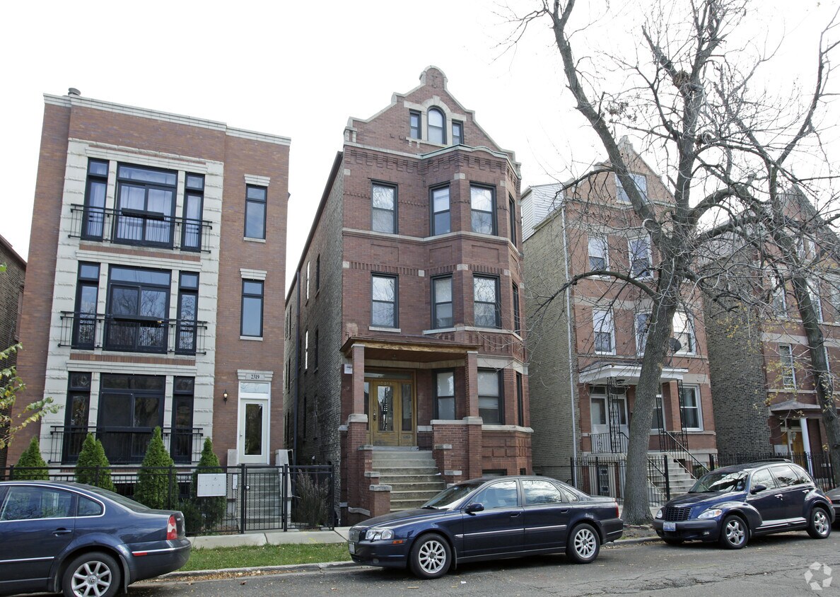
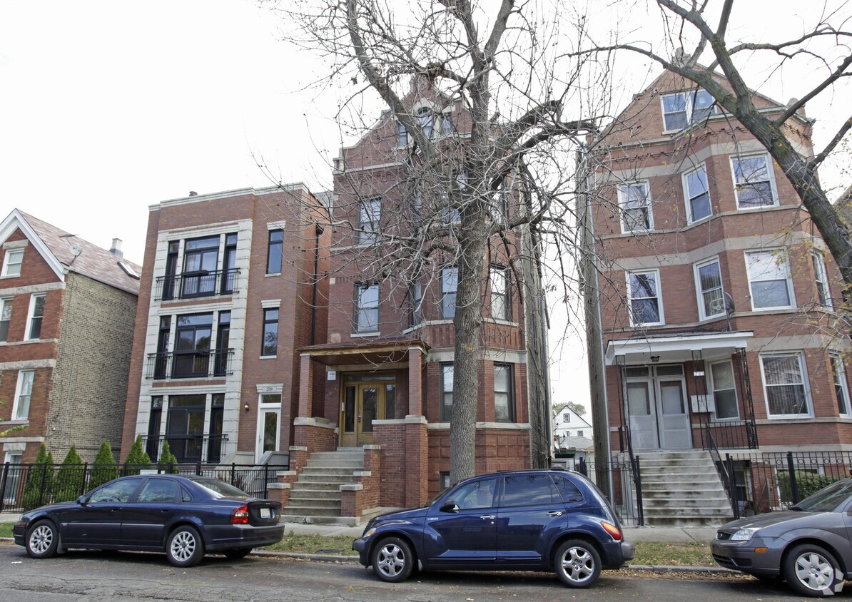
2315 N Leavitt St in Chicago is ready for your visit. This community is located in Chicago on N. Leavitt St.. Make a visit to view the available floorplans. The community staff is excited to help you find the perfect new home. Stop by to find out the current floorplan availability.
2315 N Leavitt St is an apartment community located in Cook County and the 60647 ZIP Code. This area is served by the Chicago Public Schools attendance zone.
Bucktown is one of Chicago’s trendiest neighborhoods, and it’s more affordable than nearby neighborhoods. It’s just a few miles northwest of downtown Chicago and is bordered by the Chicago River on the east. Kennedy Expressway (I-94) runs right through the neighborhood, giving residents easy access to the Chicago area and beyond. Public transportation is extensive, and the neighborhood is walkable and filled with shopping, dining, and artsy entertainment. There’s a great selection of live music, art exhibits, live theater, and themed bars. A ton of restaurants offer a variety of food from different cultures.
If you’re looking for family fun in Bucktown, there are plenty of public parks available for the community, such as Holstein Park, Churchill Park, and Ehrler Park. Amenities include open green space, swimming pools, ball fields, and more.
Learn more about living in BucktownCompare neighborhood and city base rent averages by bedroom.
| Bucktown | Chicago, IL | |
|---|---|---|
| Studio | $2,092 | $1,647 |
| 1 Bedroom | $2,501 | $2,048 |
| 2 Bedrooms | $3,152 | $2,586 |
| 3 Bedrooms | $3,773 | $3,094 |
| Colleges & Universities | Distance | ||
|---|---|---|---|
| Colleges & Universities | Distance | ||
| Drive: | 4 min | 1.9 mi | |
| Drive: | 5 min | 2.0 mi | |
| Drive: | 6 min | 3.1 mi | |
| Drive: | 7 min | 3.5 mi |

Transportation options available in Chicago include Western Station (Blue Line - O'hare Branch), located 0.8 mile from 2315 N Leavitt St. 2315 N Leavitt St is near Chicago O'Hare International, located 13.8 miles or 22 minutes away, and Chicago Midway International, located 14.0 miles or 23 minutes away.
| Transit / Subway | Distance | ||
|---|---|---|---|
| Transit / Subway | Distance | ||
|
|
Walk: | 14 min | 0.8 mi |
|
|
Drive: | 3 min | 1.1 mi |
|
|
Drive: | 3 min | 1.2 mi |
|
|
Drive: | 4 min | 1.6 mi |
|
|
Drive: | 4 min | 1.9 mi |
| Commuter Rail | Distance | ||
|---|---|---|---|
| Commuter Rail | Distance | ||
|
|
Walk: | 19 min | 1.0 mi |
|
|
Drive: | 6 min | 2.6 mi |
|
|
Drive: | 8 min | 3.4 mi |
|
|
Drive: | 8 min | 3.7 mi |
|
|
Drive: | 9 min | 3.8 mi |
| Airports | Distance | ||
|---|---|---|---|
| Airports | Distance | ||
|
Chicago O'Hare International
|
Drive: | 22 min | 13.8 mi |
|
Chicago Midway International
|
Drive: | 23 min | 14.0 mi |
Scores provided by
Traffic
-Airport
-Businesses
-Scores provided by
HowLoud What is a Sound Score Rating? A Sound Score Rating aggregates noise caused by vehicle traffic, airplane traffic and local sources. How It WorksTime and distance from 2315 N Leavitt St.
| Shopping Centers | Distance | ||
|---|---|---|---|
| Shopping Centers | Distance | ||
| Walk: | 12 min | 0.6 mi | |
| Walk: | 15 min | 0.8 mi | |
| Walk: | 18 min | 1.0 mi |
| Parks and Recreation | Distance | ||
|---|---|---|---|
| Parks and Recreation | Distance | ||
|
Wrightwood Park
|
Drive: | 4 min | 1.4 mi |
|
Oz Park
|
Drive: | 6 min | 2.1 mi |
|
Humboldt Park
|
Drive: | 5 min | 2.2 mi |
|
Lincoln Park
|
Drive: | 7 min | 3.0 mi |
|
Lincoln Park Zoo
|
Drive: | 7 min | 3.0 mi |
| Hospitals | Distance | ||
|---|---|---|---|
| Hospitals | Distance | ||
| Drive: | 5 min | 1.9 mi | |
| Drive: | 6 min | 2.5 mi | |
| Drive: | 7 min | 2.7 mi |
| Military Bases | Distance | ||
|---|---|---|---|
| Military Bases | Distance | ||
| Drive: | 30 min | 21.4 mi | |
| Drive: | 46 min | 30.2 mi | |
| Drive: | 43 min | 32.3 mi |
What Are Walk Score®, Transit Score®, and Bike Score® Ratings?
Walk Score® measures the walkability of any address. Transit Score® measures access to public transit. Bike Score® measures the bikeability of any address.
What is a Sound Score Rating?
A Sound Score Rating aggregates noise caused by vehicle traffic, airplane traffic and local sources.

2315 N Leavitt St
Chicago, IL 60647


