$850 / Month
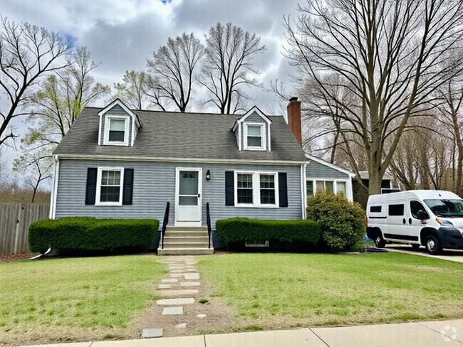
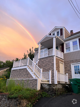
23 Sargent St
Dorchester, MA 01225
2 Weeks Ago
Favorites
23 Sargent St

Favorites
Check Back Soon for Upcoming Availability
| Beds | Baths | Average SF |
|---|---|---|
| 1 Bedroom 1 Bedroom 1 Br | 1 Bath 1 Bath 1 Ba | — |
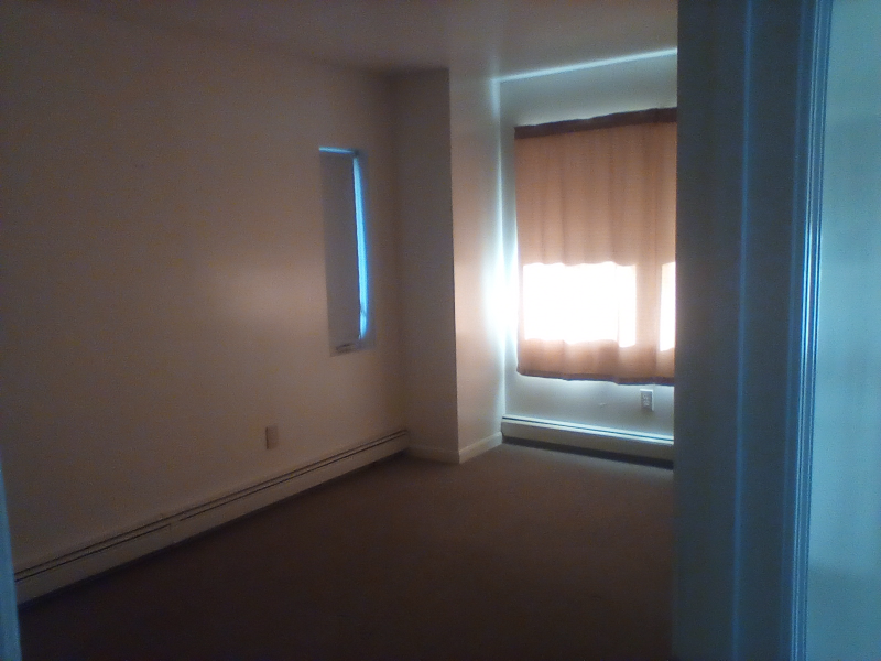
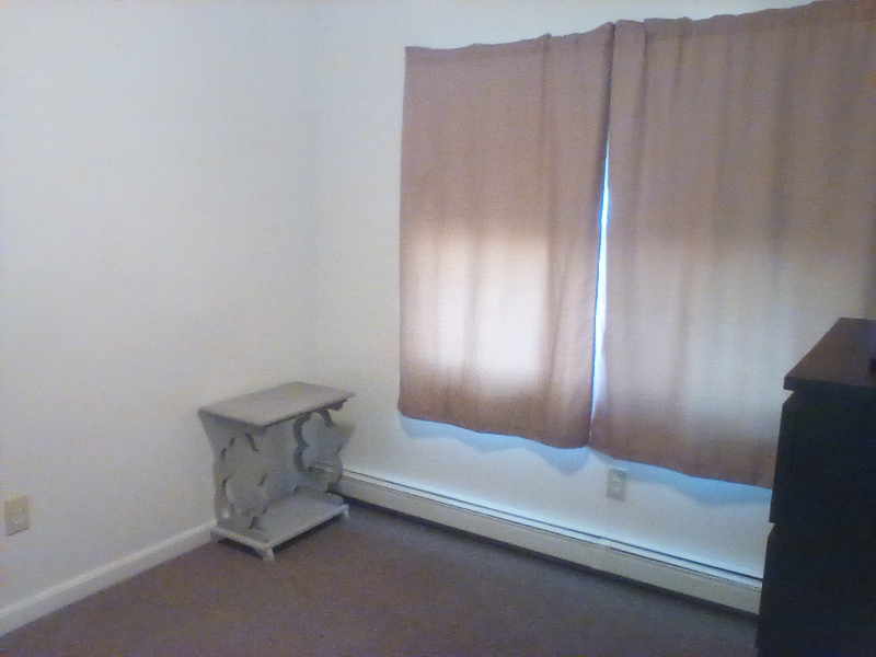
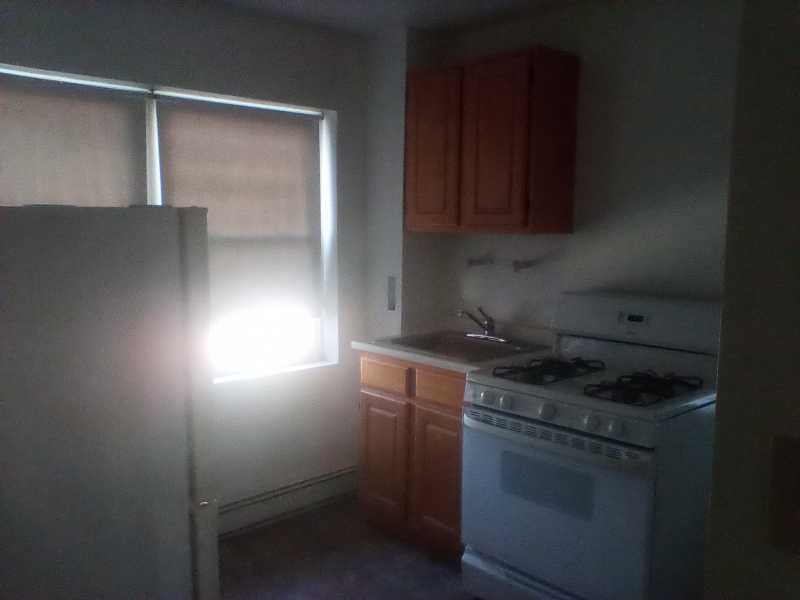
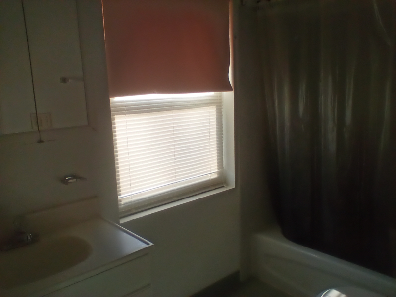
About This Property
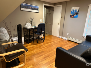
Property Id: 1169188 No drama single person for a roommate split apartment. Need to have a steady job! 3 other males in the house, and looking for a 4th with own private room, sharing kitchen and bathroom. Heat, electric, gas, cable, and Wi-Fi all included! Just pay a monthly rent. There is plenty of street parking, laundromat near by. We are all very busy with work and quiet. Thank you for looking: please be patient will return calls.
23 Sargent St is a house located in Suffolk County and the 01225 ZIP Code. This area is served by the Boston Public Schools attendance zone.
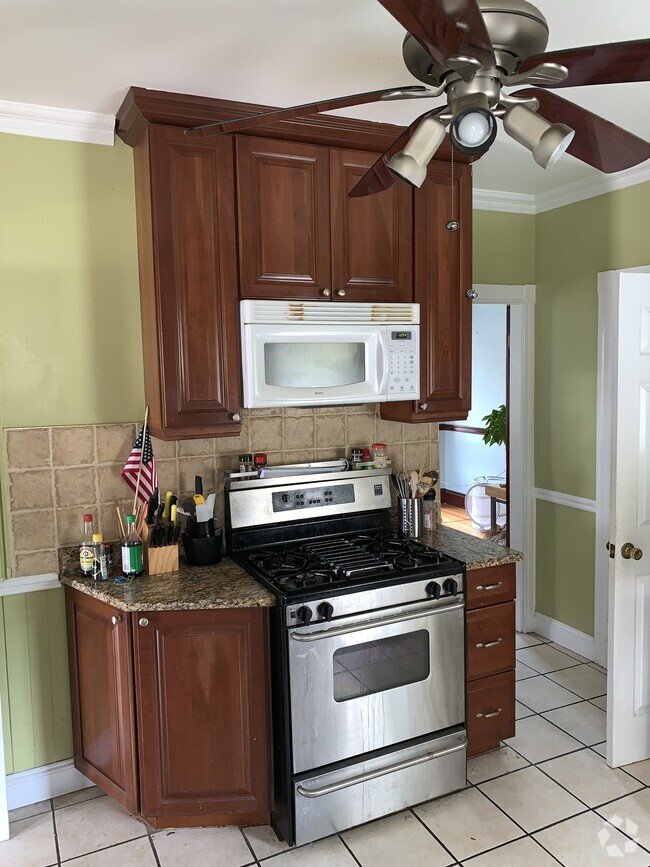
House Features
Microwave
Refrigerator
Oven
Satellite TV
- Satellite TV
- Microwave
- Oven
- Refrigerator
Fees and Policies
The fees below are based on community-supplied data and may exclude additional fees and utilities.
Details
Utilities Included
-
Gas
-
Water
-
Electricity
-
Trash Removal
-
Sewer
Location
Get Directions
Less than four miles outside of Downtown Boston sits Dudley-Brunswick King. Full of non-profit organizations committed to advancing the community, Dudley-Brunswick King is home to the Food Project, CommonWealth Kitchen, Project Hope, and the Dudley Street Neighborhood Initiative.
Dudley-Brunswick King residents enjoy access to cultural and educational venues such as the Boston Public Library and Oodua African Movie Center. There are a number of parks and green spaces in Dudley-Brunswick King including Clifford Playground, Mary Hannon Park, Ceylon Park, Brunswick-King Play Area, Dacia/Woodcliff Streets Garden, and multiple community gardens sponsored by the Food Project. Boston’s biggest park, Franklin Park, is also nearby and contains numerous amenities.
Convenient to the MBTA Commuter Rail, bus routes, and major highways as well as Boston Logan International Airport, Dudley-Brunswick King allows for easy commutes and travels.
Learn more about living in Dudley-Brunswick KingBelow are rent ranges for similar nearby apartments
| Beds | Average Size | Lowest | Typical | Premium |
|---|---|---|---|---|
| Studio Studio Studio | 1849-1850 Sq Ft | $1,800 | $2,260 | $3,240 |
| 1 Bed 1 Bed 1 Bed | 2344 Sq Ft | $2,000 | $2,631 | $3,500 |
| 2 Beds 2 Beds 2 Beds | 2359 Sq Ft | $1,575 | $2,766 | $4,400 |
| 3 Beds 3 Beds 3 Beds | 2925 Sq Ft | $2,345 | $3,270 | $5,550 |
| 4 Beds 4 Beds 4 Beds | 5006 Sq Ft | $975 | $4,030 | $5,500 |
Amenities
- Satellite TV
- Microwave
- Oven
- Refrigerator
Expenses
Utilities Included
Gas, Water, Electricity, Trash Removal, Sewer
Included
Education
| Colleges & Universities | Distance | ||
|---|---|---|---|
| Colleges & Universities | Distance | ||
| Drive: | 5 min | 2.4 mi | |
| Drive: | 7 min | 2.5 mi | |
| Drive: | 7 min | 2.6 mi | |
| Drive: | 6 min | 2.8 mi |
23 Sargent St is within 7 minutes or 2.5 miles from Northeastern University. It is also near Wentworth Inst. of Technology and MassArt.
Schools


Public Elementary School
Grades PK-6
442 Students
Nearby
Public Elementary School
Grades PK-6
237 Students
Nearby
Public Middle & High School
Grades 7-12
1,723 Students
Nearby
Private Elementary, Middle & High School
Grades K-12
68 Students
Nearby
Private Elementary & Middle School
Grades PK-8
Nearby
School data provided by
 The GreatSchools Rating helps parents compare schools within a state based on a variety of school quality indicators and provides a helpful picture of how effectively each school serves all of its students. Ratings are on a scale of 1 (below average) to 10 (above average) and can include test scores, college readiness, academic progress, advanced courses, equity, discipline and attendance data. We also advise parents to visit schools, consider other information on school performance and programs, and consider family needs as part of the school selection process.
View GreatSchools Rating Methodology
View GreatSchools Rating Methodology
Transportation options available in Dorchester include Fields Corner Station, located 1.6 miles from 23 Sargent St. 23 Sargent St is near General Edward Lawrence Logan International, located 6.4 miles or 13 minutes away.
| Transit / Subway | Distance | ||
|---|---|---|---|
| Transit / Subway | Distance | ||
|
|
Drive: | 4 min | 1.6 mi |
|
|
Drive: | 3 min | 1.8 mi |
|
|
Drive: | 5 min | 1.9 mi |
|
|
Drive: | 4 min | 2.0 mi |
|
|
Drive: | 5 min | 2.3 mi |
| Commuter Rail | Distance | ||
|---|---|---|---|
| Commuter Rail | Distance | ||
|
|
Walk: | 14 min | 0.7 mi |
| Walk: | 21 min | 1.1 mi | |
| Drive: | 3 min | 1.1 mi | |
|
|
Drive: | 5 min | 2.0 mi |
|
|
Drive: | 6 min | 2.9 mi |
| Airports | Distance | ||
|---|---|---|---|
| Airports | Distance | ||
|
General Edward Lawrence Logan International
|
Drive: | 13 min | 6.4 mi |
Time and distance from 23 Sargent St.
| Shopping Centers | Distance | ||
|---|---|---|---|
| Shopping Centers | Distance | ||
| Walk: | 12 min | 0.7 mi | |
| Walk: | 18 min | 0.9 mi | |
| Drive: | 4 min | 1.7 mi |
23 Sargent St has 3 shopping centers within 1.7 miles, which is about a 4-minute walk. The miles and minutes will be for the farthest away property.
| Parks and Recreation | Distance | ||
|---|---|---|---|
| Parks and Recreation | Distance | ||
|
Lower Neponset River Trail
|
Drive: | 3 min | 1.2 mi |
|
Franklin Park Zoo
|
Drive: | 3 min | 1.4 mi |
|
Roxbury Heritage State Park
|
Drive: | 4 min | 1.7 mi |
|
Dorchester Shores Reservation
|
Drive: | 6 min | 2.3 mi |
|
Squantum Point Park
|
Drive: | 13 min | 4.9 mi |
23 Sargent St has 5 parks within 4.9 miles, including Lower Neponset River Trail, Franklin Park Zoo, and Roxbury Heritage State Park.
| Hospitals | Distance | ||
|---|---|---|---|
| Hospitals | Distance | ||
| Drive: | 3 min | 1.5 mi | |
| Drive: | 4 min | 1.7 mi | |
| Drive: | 6 min | 2.8 mi |
23 Sargent St has 3 hospitals within 2.8 miles, the nearest is Boston Medical Center which is 1.5 miles away and a 3 minute drive.
You May Also Like
Similar Rentals Nearby
What Are Walk Score®, Transit Score®, and Bike Score® Ratings?
Walk Score® measures the walkability of any address. Transit Score® measures access to public transit. Bike Score® measures the bikeability of any address.
What is a Sound Score Rating?
A Sound Score Rating aggregates noise caused by vehicle traffic, airplane traffic and local sources

23 Sargent St
Dorchester, MA 01225