$2,700
/ Month
23 High St Unit 2nd Floor
Elizabeth, NJ 07202
Today
|
Edit
Favorites
973-476-5286
-
Bedrooms
3
-
Bathrooms
2
-
Square Feet
1,200 sq ft
-
Available
Available Now
23 High St Unit 2nd Floor

Favorites
About This Home
12 Month Lease,
$4,050 deposit,
Available Now
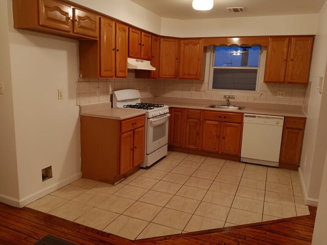
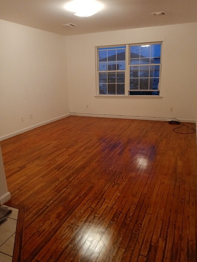
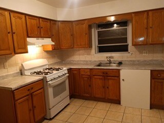
Very spacious apartment very close to downtown and many services/
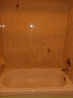
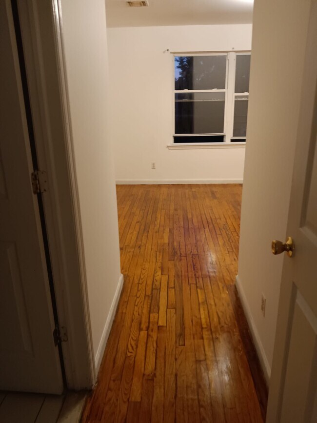
Three bedroom and two full bathrooms. Living room, and dining room. Spacious and near downtown. Central air.
23 High St is an apartment community located in Union County and the 07202 ZIP Code.
* Price shown is base rent. Excludes user-selected optional fees and variable or usage-based fees and required charges due at or prior to move-in or at move-out. Price, availability, fees, and any applicable rent special are subject to change without notice.
* Square footage definitions vary. Displayed square footage is approximate.
Apartment Features
- Air Conditioning
Fees and Policies
The fees below are based on community-supplied data and may exclude additional fees and utilities.
- Parking
-
Street--
Details
Utilities Included
-
Water
-
Trash Removal
-
Sewer
Property Information
-
3 units
Contact
- Phone Number
- Contact
Location
Get Directions
Living in Elizabeth, New Jersey combines metropolitan accessibility with historical significance, just 20 miles from Manhattan. The city offers various housing options, from historic single-family homes to apartments, with average rents ranging from $1,371 for studios to $2,013 for three-bedroom units. Elizabeth's neighborhoods each showcase distinct characteristics - the Midtown district features Art Deco architecture, while the Elizabethport area near the waterfront has experienced recent development. The Elmora and Peterstown areas maintain their established cultural heritage through local markets and architecture.
Elizabeth's position as a transportation hub includes multiple train stations providing direct access to Newark and New York City. The Mills at Jersey Gardens outlet mall and the Port Newark-Elizabeth Marine Terminal contribute to the local economy. For outdoor recreation, Warinanco Park offers boating facilities and seasonal activities.
Learn more about living in Elizabeth
Education
| Colleges & Universities | Distance | ||
|---|---|---|---|
| Colleges & Universities | Distance | ||
| Walk: | 18 min | 1.0 mi | |
| Drive: | 7 min | 2.6 mi | |
| Drive: | 14 min | 6.3 mi | |
| Drive: | 11 min | 6.6 mi |
23 High St Unit 2nd Floor is within 18 minutes or 1.0 mile from Union County Coll., Elizabeth. It is also near Kean University and Coll. of Staten Island, CUNY.
Transportation options available in Elizabeth include Military Park, located 6.4 miles from 23 High St Unit 2nd Floor. 23 High St Unit 2nd Floor is near Newark Liberty International, located 6.9 miles or 12 minutes away, and LaGuardia, located 24.7 miles or 45 minutes away.
| Transit / Subway | Distance | ||
|---|---|---|---|
| Transit / Subway | Distance | ||
|
|
Drive: | 10 min | 6.4 mi |
| Drive: | 15 min | 7.9 mi | |
|
|
Drive: | 17 min | 9.1 mi |
|
|
Drive: | 16 min | 10.1 mi |
|
|
Drive: | 15 min | 10.1 mi |
| Commuter Rail | Distance | ||
|---|---|---|---|
| Commuter Rail | Distance | ||
|
|
Drive: | 3 min | 1.2 mi |
|
|
Drive: | 5 min | 2.5 mi |
|
|
Drive: | 7 min | 2.9 mi |
|
|
Drive: | 9 min | 3.7 mi |
|
|
Drive: | 8 min | 4.3 mi |
| Airports | Distance | ||
|---|---|---|---|
| Airports | Distance | ||
|
Newark Liberty International
|
Drive: | 12 min | 6.9 mi |
|
LaGuardia
|
Drive: | 45 min | 24.7 mi |
Time and distance from 23 High St Unit 2nd Floor.
| Shopping Centers | Distance | ||
|---|---|---|---|
| Shopping Centers | Distance | ||
| Walk: | 8 min | 0.5 mi | |
| Walk: | 16 min | 0.9 mi | |
| Drive: | 4 min | 1.4 mi |
23 High St Unit 2nd Floor has 3 shopping centers within 1.4 miles, which is about a 4-minute walk. The miles and minutes will be for the farthest away property.
| Parks and Recreation | Distance | ||
|---|---|---|---|
| Parks and Recreation | Distance | ||
|
Staten Island Industrial Park
|
Drive: | 11 min | 5.3 mi |
|
Westerleigh Park
|
Drive: | 13 min | 6.2 mi |
|
Faber Park
|
Drive: | 13 min | 6.7 mi |
|
Liberty State Park
|
Drive: | 14 min | 6.9 mi |
|
G. Thomas DiDomenico Park
|
Drive: | 17 min | 8.2 mi |
23 High St Unit 2nd Floor has 5 parks within 8.2 miles, including Staten Island Industrial Park, Westerleigh Park, and Faber Park.
| Hospitals | Distance | ||
|---|---|---|---|
| Hospitals | Distance | ||
| Walk: | 16 min | 0.9 mi | |
| Drive: | 10 min | 5.2 mi | |
| Drive: | 15 min | 7.2 mi |
23 High St Unit 2nd Floor has 3 hospitals within 7.2 miles, the nearest is Trinitas Regional Medical Center which is 0.9 mile away and a 16 minute walk.
| Military Bases | Distance | ||
|---|---|---|---|
| Military Bases | Distance | ||
| Drive: | 24 min | 10.6 mi | |
| Drive: | 17 min | 10.8 mi | |
| Drive: | 22 min | 10.9 mi |
23 High St Unit 2nd Floor has 3 military bases within 10.9 miles, the nearest is Tamdques Reservation which is 10.6 miles away and a 24 minute drive.
Amenities
- Air Conditioning
23 High St Unit 2nd Floor Photos
How do I access Social Services in New Jersey?
Statewide service is free, confidential, multilingual and always open. Three easy ways to reach Social Services in NJ: Dial 2-1-1; text your zip code to 898-211; or chat at https://www.nj211.org
What Are Walk Score®, Transit Score®, and Bike Score® Ratings?
Walk Score® measures the walkability of any address. Transit Score® measures access to public transit. Bike Score® measures the bikeability of any address.
What is a Sound Score Rating?
A Sound Score Rating aggregates noise caused by vehicle traffic, airplane traffic and local sources

23 High St
Elizabeth, NJ 07202