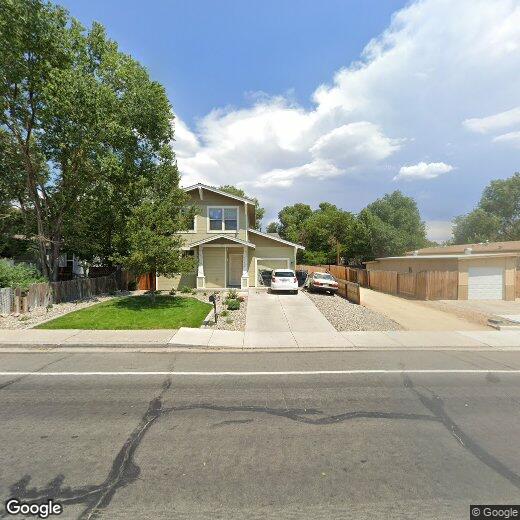
$1,650 Total Monthly Price

2275 Airport Rd

,

Carson City, NV 89706

2 Weeks Ago
| Edit

Under 30 minutes

Commute Time is calculated at rush hour.
Share Listing
Favorites
  • Bedrooms

    3

  • Bathrooms

    3

  • Square Feet

    1,318 sq ft

2275 Airport Rd
Share Listing
Favorites

Contact

  • Listed by Locayt
City - Carson City

Surrounded by the Sierra Nevada mountains in Eagle Valley, Carson City combines frontier heritage with contemporary living. The community offers various rental options, from apartments near the Capitol building to homes throughout the valley. Notable areas include the West Side district, known for its preserved Victorian architecture, and North Carson's residential areas near mountain trails.

Carson City spans 146 square miles, encompassing both city amenities and natural landscapes, including portions of Lake Tahoe. Mills Park, a community centerpiece, features the Carson & Mills Park Railroad, while downtown showcases the Nevada State Capitol building and numerous historic sites. Western Nevada College enriches the educational landscape, and residents enjoy easy access to Lake Tahoe's ski resorts.

Learn more about living in Carson City 
Education
Colleges & Universities Distance
Drive: 9 min 4.3 mi
Drive: 26 min 21.1 mi
Drive: 31 min 26.6 mi
Drive: 36 min 29.0 mi
2275 Airport Rd is within 9 minutes or 4.3 miles from Western Nevada College. It is also near Truckee Meadows, Redfield and Truckee Meadows, Meadowood.
Transportation

2275 Airport Rd is near Reno/Tahoe International, located 31.9 miles or 52 minutes away.

Commuter Rail Distance
Drive: 39 min 31.5 mi
Drive: 73 min 44.8 mi
Airports Distance
Airports Distance
Reno/Tahoe International
Drive: 52 min 31.9 mi
Getting Around
Fairly Walkable
Walkability
50 / 100
Limited Public Transit
Transit
30 / 100
Exceptionally Drivable
Drivability
100 / 100
Fairly Bikeable
Bikeability
50 / 100

Scores provided by

What do Walkability, Transit, Drivability, and Bikeability mean? Walkability measures the walking distance to day-to-day needs. Transit measures access to public transportation. Drivability measures congestion, parking availability, and access to major roads. Bikeability measures the suitability for cycling. How It Works
-
Soundscore
- / 100

Traffic

-

Airport

-

Businesses

-

Scores provided by

HowLoud What is a Sound Score Rating? A Sound Score Rating aggregates noise caused by vehicle traffic, airplane traffic and local sources. How It Works
Points of Interest

Time and distance from 2275 Airport Rd.

Shopping Centers Distance
Walk: 5 min 0.3 mi
Walk: 20 min 1.0 mi
Walk: 20 min 1.0 mi
2275 Airport Rd has 3 shopping centers within 1.0 miles, which is about a 20-minute walk. The miles and minutes will be for the farthest away property.
Parks and Recreation Distance
The Children's Museum of Northern Nevada
Drive: 4 min 2.3 mi
Washoe Lake State Park
Drive: 14 min 8.6 mi
Dayton State Park
Drive: 16 min 10.5 mi
Bowers Mansion Park
Drive: 17 min 11.3 mi
Lake Tahoe-Nevada State Park
Drive: 32 min 21.3 mi
2275 Airport Rd has 5 parks within 21.3 miles, including The Children's Museum of Northern Nevada, Washoe Lake State Park, and Dayton State Park.
Hospitals Distance
Hospitals Distance
Drive: 6 min 4.0 mi
2275 Airport Rd is 4.0 miles and a 6 minute drive from Carson Tahoe Regional Medical Center.
Military Bases Distance
Drive: 93 min 66.6 mi
2275 Airport Rd is 66.6 miles and a 93 minute drive from Fallon Naval Air Station.

You May Also Like

Similar Rentals Nearby