

$2,250
/ Month
2247 Cecil Ave
San Jose, CA 95128
Favorites
2247 Cecil Ave

Favorites
Check Back Soon for Upcoming Availability
| Beds | Baths | Average SF |
|---|---|---|
| 2 Bedrooms 2 Bedrooms 2 Br | 1 Bath 1 Bath 1 Ba | — |
About This Property
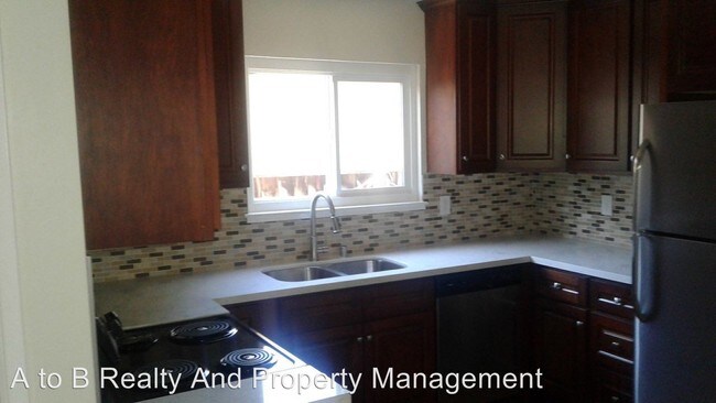
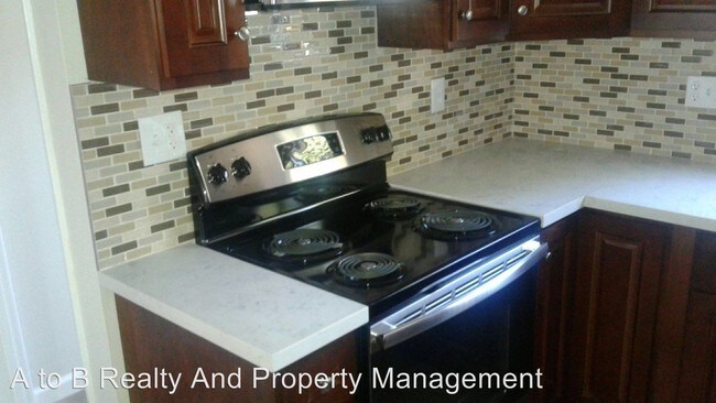
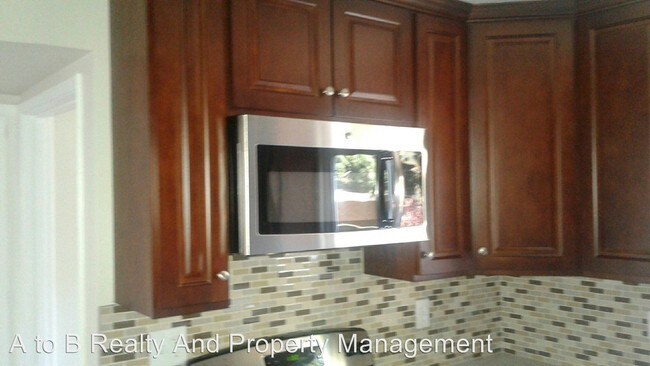
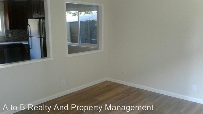
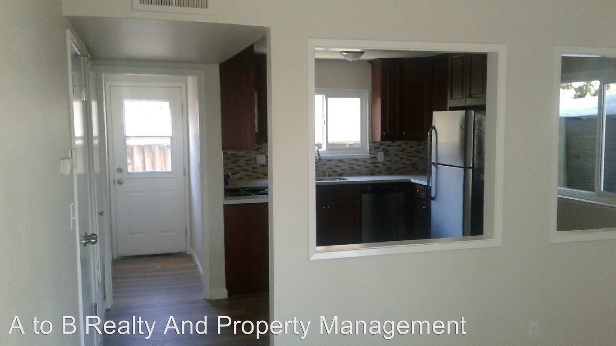
(408) 626-4800 - 2247 Cecil Ave, San Jose, CA 95128 - This property won't last! Unit fully remodeled, new appliances, paint and flooring. We have a 2 bedroom 1 bath unit upstairs available now with close access to Valley Fair, Santana Row, highway 880 and 280 It comes with a microwave, electric stove and dishwasher. 1 car garage and 1 assigned parking spot. Washer and dryer hookup only. No A/C 12-month lease Rent: $2,250 Security Deposit: $2,250 Tenant to pay for PG&E NO PETS NO SMOKING NO SECTION 8 Please email for showing or contact our office for application process or any general questions. Bob@atobpropertymanagement.com BRE# 01264949 (RLNE4252541)
2247 Cecil Ave is a condo located in Santa Clara County and the 95128 ZIP Code. This area is served by the San Jose Unified School District attendance zone.
2247 Cecil Ave,
San Jose,
CA
95128
Burbank is one of San Jose’s many “urban islands,” small unincorporated communities that are completely surrounded by San Jose and technically aren’t a part of the city. Burbank has a strong sense of community with an active neighborhood association. The neighborhood has mid-range to upscale rentals and residents here don’t have to pay city taxes. Housing options in Burbank include quaint bungalows, craftsmen-style houses, and mid-rise apartments.
Burbank is certainly a great option for renters seeking an area with a small-town atmosphere, but residents also enjoy the advantages of the neighborhood’s central location. Burbank is convenient to several restaurants and shopping centers including Westfield Valley Fair and Santana Row. San Jose City College is located directly south of Burbank while Santa Clara University is about two miles north for those who want to be close to campus. Burbank is only three miles west of Downtown San Jose as well.
Learn more about living in BurbankBelow are rent ranges for similar nearby apartments
Education
| Colleges & Universities | Distance | ||
|---|---|---|---|
| Colleges & Universities | Distance | ||
| Walk: | 19 min | 1.0 mi | |
| Drive: | 6 min | 2.9 mi | |
| Drive: | 9 min | 3.9 mi | |
| Drive: | 13 min | 8.2 mi |
2247 Cecil Ave is within 19 minutes or 1.0 miles from San Jose City College. It is also near Santa Clara University and San Jose State University.
Schools


Public Elementary School
Grades K-5
715 Students
Nearby
Public Elementary & Middle School
Grades K-8
426 Students
Attendance Zone
Public High School
Grades 9-12
1,350 Students
Attendance Zone
Private Elementary, Middle & High School
Grades K-12
Nearby
Private Elementary & Middle School
Grades PK-8
345 Students
Nearby
School data provided by
 The GreatSchools Rating helps parents compare schools within a state based on a variety of school quality indicators and provides a helpful picture of how effectively each school serves all of its students. Ratings are on a scale of 1 (below average) to 10 (above average) and can include test scores, college readiness, academic progress, advanced courses, equity, discipline and attendance data. We also advise parents to visit schools, consider other information on school performance and programs, and consider family needs as part of the school selection process.
View GreatSchools Rating Methodology
Data provided by GreatSchools.org © 2026. All rights reserved.
View GreatSchools Rating Methodology
Data provided by GreatSchools.org © 2026. All rights reserved.
Transportation options available in San Jose include Fruitdale Station, located 1.8 miles from 2247 Cecil Ave. 2247 Cecil Ave is near Norman Y Mineta San Jose International, located 3.4 miles or 7 minutes away, and Metro Oakland International, located 37.2 miles or 46 minutes away.
| Transit / Subway | Distance | ||
|---|---|---|---|
| Transit / Subway | Distance | ||
| Drive: | 3 min | 1.8 mi | |
| Drive: | 4 min | 1.8 mi | |
| Drive: | 5 min | 2.0 mi | |
|
|
Drive: | 4 min | 2.0 mi |
| Drive: | 6 min | 2.6 mi |
| Commuter Rail | Distance | ||
|---|---|---|---|
| Commuter Rail | Distance | ||
| Drive: | 4 min | 1.9 mi | |
| Drive: | 5 min | 2.0 mi | |
| Drive: | 5 min | 2.4 mi | |
| Drive: | 6 min | 2.5 mi | |
| Drive: | 6 min | 2.7 mi |
| Airports | Distance | ||
|---|---|---|---|
| Airports | Distance | ||
|
Norman Y Mineta San Jose International
|
Drive: | 7 min | 3.4 mi |
|
Metro Oakland International
|
Drive: | 46 min | 37.2 mi |
Walkability Near 2247 Cecil Ave San Jose, CA 95128
Getting Around
 What do Walkability, Transit, Drivability, and Bikeability mean?
Walkability measures the walking distance to day-to-day needs.
Transit measures access to public transportation.
Drivability measures congestion, parking availability, and access to major roads.
Bikeability measures the suitability for cycling.
How It Works
What do Walkability, Transit, Drivability, and Bikeability mean?
Walkability measures the walking distance to day-to-day needs.
Transit measures access to public transportation.
Drivability measures congestion, parking availability, and access to major roads.
Bikeability measures the suitability for cycling.
How It Works
Very Walkable
Walkability
80
/ 100
Some Public Transit
Transit
50
/ 100
Very Drivable
Drivability
80
/ 100
Moderately Bikeable
Bikeability
60
/ 100
Scores provided by
-
Soundscore™
-
/ 100
Traffic
-Airport
-Businesses
-Scores provided by
HowLoud What is a Sound Score Rating? A Sound Score Rating aggregates noise caused by vehicle traffic, airplane traffic and local sources. How It WorksTime and distance from 2247 Cecil Ave.
| Shopping Centers | Distance | ||
|---|---|---|---|
| Shopping Centers | Distance | ||
| Walk: | 5 min | 0.3 mi | |
| Walk: | 12 min | 0.7 mi | |
| Walk: | 13 min | 0.7 mi |
2247 Cecil Ave has 3 shopping centers within 0.7 mile, which is about a 13-minute walk. The miles and minutes will be for the farthest away property.
| Parks and Recreation | Distance | ||
|---|---|---|---|
| Parks and Recreation | Distance | ||
|
Guadalupe River Park and Gardens
|
Drive: | 5 min | 2.4 mi |
|
Children's Discovery Museum of San Jose
|
Drive: | 5 min | 2.5 mi |
|
McEnery Park
|
Drive: | 6 min | 2.5 mi |
|
The Tech Museum of Innovation
|
Drive: | 7 min | 3.0 mi |
|
Orchard City Green
|
Drive: | 5 min | 3.3 mi |
2247 Cecil Ave has 5 parks within 3.3 miles, including Guadalupe River Park and Gardens, Children's Discovery Museum of San Jose, and McEnery Park.
| Hospitals | Distance | ||
|---|---|---|---|
| Hospitals | Distance | ||
| Walk: | 15 min | 0.8 mi | |
| Drive: | 9 min | 5.6 mi | |
| Drive: | 10 min | 5.8 mi |
2247 Cecil Ave has 3 hospitals within 5.8 miles, the nearest is Santa Clara Valley Medical Center which is 0.8 mile away and a 15 minute walk.
| Military Bases | Distance | ||
|---|---|---|---|
| Military Bases | Distance | ||
| Drive: | 21 min | 14.7 mi | |
| Drive: | 57 min | 44.6 mi | |
| Drive: | 58 min | 44.8 mi |
2247 Cecil Ave has 3 military bases within 44.8 miles, the nearest is Ames Research Center which is 14.7 miles away and a 21 minute drive.
You May Also Like
Similar Rentals Nearby


What Are Walk Score®, Transit Score®, and Bike Score® Ratings?
Walk Score® measures the walkability of any address. Transit Score® measures access to public transit. Bike Score® measures the bikeability of any address.
What is a Sound Score Rating?
A Sound Score Rating aggregates noise caused by vehicle traffic, airplane traffic and local sources.
2247 Cecil Ave
San Jose, CA 95128