
Venue Residences
3688 Overland Ave,
Los Angeles, CA 90034
$3,550 - $5,995
1-2 Beds
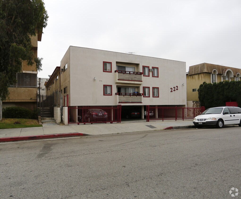
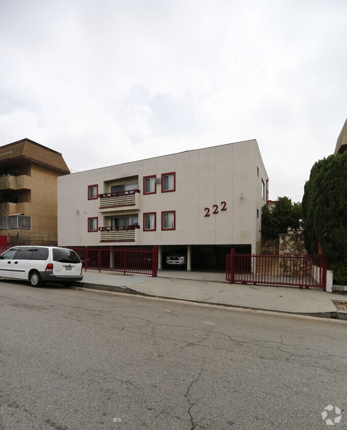

Find your new apartment at 222 S Reno St in Los Angeles, CA. This community is located in the Rampart Village area of Los Angeles. Let the professional leasing staff show you everything this community has in store. Contact us today to learn more about our community and find your new place at 222 S Reno St.
222 S Reno St is an apartment community located in Los Angeles County and the 90057 ZIP Code. This area is served by the Los Angeles Unified Rocp School District attendance zone.
Located directly south of US-101, Rampart Village is a quaint town that boasts diversity and affordability. Situated in West Lake outside of Downtown Los Angeles, Rampart Village houses various apartments that range from affordable to upscale, depending on location.
Residents enjoy the neighborhood’s green space at Lafayette Park, housing a recreation center that offers indoor and outdoor features like a playground, tennis courts, soccer field, skate park, and more! For more outdoor recreational amenities, travel just five miles north to discover Griffith Park.
This famous outdoor space features hiking trails, views of LA’s skyline, the Los Angeles Zoo, the Greek Theatre, numerous museums, and a public golf course. As a resident of Rampart Village, you’ll enjoy nearby attractions such as Dodger Stadium and Chinatown, both just four miles east of the neighborhood.
Learn more about living in Rampart VillageCompare neighborhood and city base rent averages by bedroom.
| Rampart Village | Los Angeles, CA | |
|---|---|---|
| Studio | $1,448 | $1,711 |
| 1 Bedroom | $1,811 | $2,180 |
| 2 Bedrooms | $2,383 | $3,017 |
| 3 Bedrooms | $2,722 | $4,259 |
| Colleges & Universities | Distance | ||
|---|---|---|---|
| Colleges & Universities | Distance | ||
| Walk: | 19 min | 1.0 mi | |
| Drive: | 3 min | 1.6 mi | |
| Drive: | 5 min | 2.3 mi | |
| Drive: | 6 min | 3.1 mi |


Transportation options available in Los Angeles include Wilshire/Vermont Station, located 0.8 mile from 222 S Reno St. 222 S Reno St is near Bob Hope, located 12.4 miles or 21 minutes away, and Los Angeles International, located 15.0 miles or 26 minutes away.
| Transit / Subway | Distance | ||
|---|---|---|---|
| Transit / Subway | Distance | ||
|
|
Walk: | 16 min | 0.8 mi |
|
|
Drive: | 2 min | 1.1 mi |
|
|
Drive: | 3 min | 1.2 mi |
|
|
Drive: | 3 min | 1.6 mi |
|
|
Drive: | 4 min | 1.9 mi |
| Commuter Rail | Distance | ||
|---|---|---|---|
| Commuter Rail | Distance | ||
|
|
Drive: | 7 min | 3.3 mi |
|
|
Drive: | 9 min | 3.4 mi |
|
|
Drive: | 11 min | 5.2 mi |
| Drive: | 11 min | 7.3 mi | |
|
|
Drive: | 16 min | 9.4 mi |
| Airports | Distance | ||
|---|---|---|---|
| Airports | Distance | ||
|
Bob Hope
|
Drive: | 21 min | 12.4 mi |
|
Los Angeles International
|
Drive: | 26 min | 15.0 mi |
Scores provided by
Traffic
-Airport
-Businesses
-Scores provided by
HowLoud What is a Sound Score Rating? A Sound Score Rating aggregates noise caused by vehicle traffic, airplane traffic and local sources. How It WorksTime and distance from 222 S Reno St.
| Shopping Centers | Distance | ||
|---|---|---|---|
| Shopping Centers | Distance | ||
| Walk: | 7 min | 0.4 mi | |
| Walk: | 12 min | 0.6 mi | |
| Walk: | 13 min | 0.7 mi |
| Parks and Recreation | Distance | ||
|---|---|---|---|
| Parks and Recreation | Distance | ||
|
MacArthur Park Lake
|
Walk: | 19 min | 1.0 mi |
|
Vista Hermosa Natural Park
|
Drive: | 4 min | 1.9 mi |
|
Echo Park Lake
|
Drive: | 4 min | 2.0 mi |
|
Chavez Ravine Arboretum
|
Drive: | 7 min | 3.2 mi |
|
Elysian Park
|
Drive: | 12 min | 4.4 mi |
| Hospitals | Distance | ||
|---|---|---|---|
| Hospitals | Distance | ||
| Walk: | 6 min | 0.4 mi | |
| Walk: | 13 min | 0.7 mi | |
| Drive: | 3 min | 1.4 mi |
| Military Bases | Distance | ||
|---|---|---|---|
| Military Bases | Distance | ||
| Drive: | 25 min | 17.6 mi |
What Are Walk Score®, Transit Score®, and Bike Score® Ratings?
Walk Score® measures the walkability of any address. Transit Score® measures access to public transit. Bike Score® measures the bikeability of any address.
What is a Sound Score Rating?
A Sound Score Rating aggregates noise caused by vehicle traffic, airplane traffic and local sources.


