
The Vitagraph
1277 E 14th St,
Brooklyn, NY 11230
$3,295 - $4,304
2-3 Beds
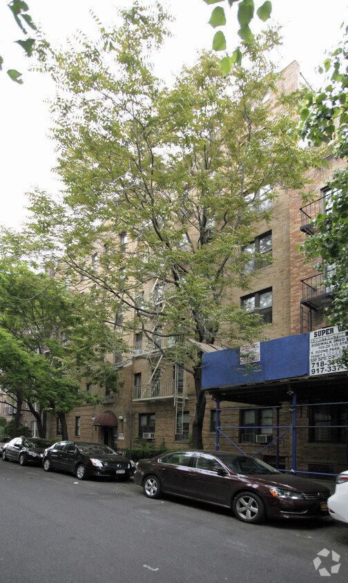
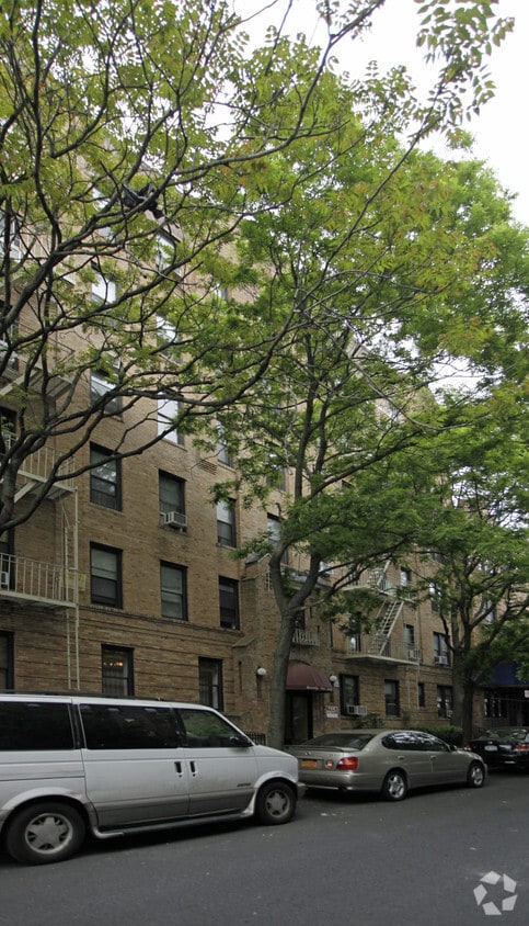

Experience Brooklyn living at 2219 64th St. Located in Brooklyn's 11204 Zip code, living at this community gives you a number of nearby experiences. Be sure to come for a visit to check out the apartment floorplan options. The leasing team is ready for you to come by for a tour. Get a head start on moving now. Contact or stop by the 2219 64th St leasing office to find out the availability today.
2219 64th St is an apartment community located in Kings County and the 11204 ZIP Code. This area is served by the New York City Geographic District #21 attendance zone.
Bensonhurst may only stretch 25 blocks, but it’s filled with activity, diversity, and a lively community. This neighborhood is known for being home at one point or another to an array of celebrities, including Larry King, the Three Stooges, and Joey Fatone, and it’s been used as the setting for several movies and television shows. Bensonhurst is as unique as it is dynamic. Located in Southwest Brooklyn, Bensonhurst sits at the southern tip of the borough, just four blocks from the bay. Apartments in Bensonhurst are highly sought-after due to reasonable rents and larger floor plans. The neighborhood also offers good schools, easy access to Manhattan via the D-train or N-train, and a variety of historic sites.
Learn more about living in BensonhurstCompare neighborhood and city base rent averages by bedroom.
| Bensonhurst | Brooklyn, NY | |
|---|---|---|
| Studio | $1,361 | $2,684 |
| 1 Bedroom | $1,618 | $3,005 |
| 2 Bedrooms | $1,786 | $3,936 |
| 3 Bedrooms | $1,867 | $4,889 |
| Colleges & Universities | Distance | ||
|---|---|---|---|
| Colleges & Universities | Distance | ||
| Drive: | 8 min | 3.3 mi | |
| Drive: | 11 min | 4.7 mi | |
| Drive: | 11 min | 5.0 mi | |
| Drive: | 15 min | 6.8 mi |

Transportation options available in Brooklyn include Bay Parkway (N Line), located 0.2 mile from 2219 64th St. 2219 64th St is near John F Kennedy International, located 14.4 miles or 25 minutes away, and Newark Liberty International, located 20.7 miles or 35 minutes away.
| Transit / Subway | Distance | ||
|---|---|---|---|
| Transit / Subway | Distance | ||
|
|
Walk: | 4 min | 0.2 mi |
|
|
Walk: | 7 min | 0.4 mi |
|
|
Walk: | 10 min | 0.5 mi |
|
|
Walk: | 10 min | 0.6 mi |
|
|
Walk: | 11 min | 0.6 mi |
| Commuter Rail | Distance | ||
|---|---|---|---|
| Commuter Rail | Distance | ||
|
|
Drive: | 15 min | 6.2 mi |
|
|
Drive: | 14 min | 6.3 mi |
|
|
Drive: | 16 min | 7.9 mi |
|
|
Drive: | 18 min | 8.5 mi |
|
|
Drive: | 20 min | 9.1 mi |
| Airports | Distance | ||
|---|---|---|---|
| Airports | Distance | ||
|
John F Kennedy International
|
Drive: | 25 min | 14.4 mi |
|
Newark Liberty International
|
Drive: | 35 min | 20.7 mi |
Scores provided by
Traffic
-Airport
-Businesses
-Scores provided by
HowLoud What is a Sound Score Rating? A Sound Score Rating aggregates noise caused by vehicle traffic, airplane traffic and local sources. How It WorksTime and distance from 2219 64th St.
| Shopping Centers | Distance | ||
|---|---|---|---|
| Shopping Centers | Distance | ||
| Drive: | 4 min | 1.9 mi | |
| Drive: | 5 min | 2.1 mi | |
| Drive: | 6 min | 2.5 mi |
| Parks and Recreation | Distance | ||
|---|---|---|---|
| Parks and Recreation | Distance | ||
|
New York Aquarium
|
Drive: | 7 min | 3.0 mi |
|
Calvert Vaux Park
|
Drive: | 7 min | 3.0 mi |
|
Dyker Beach Park
|
Drive: | 8 min | 3.5 mi |
|
Leon S. Kaiser Park
|
Drive: | 8 min | 3.6 mi |
|
Sunset Park
|
Drive: | 9 min | 3.7 mi |
| Hospitals | Distance | ||
|---|---|---|---|
| Hospitals | Distance | ||
| Drive: | 5 min | 2.1 mi | |
| Drive: | 7 min | 3.0 mi | |
| Drive: | 7 min | 3.1 mi |
| Military Bases | Distance | ||
|---|---|---|---|
| Military Bases | Distance | ||
| Drive: | 10 min | 4.1 mi | |
| Drive: | 23 min | 8.3 mi | |
| Drive: | 19 min | 8.7 mi |
What Are Walk Score®, Transit Score®, and Bike Score® Ratings?
Walk Score® measures the walkability of any address. Transit Score® measures access to public transit. Bike Score® measures the bikeability of any address.
What is a Sound Score Rating?
A Sound Score Rating aggregates noise caused by vehicle traffic, airplane traffic and local sources.

2219 64th St
Brooklyn, NY 11204


