
Isle House
39 Bruton St,
San Francisco, CA 94130
$3,050 - $6,998
Studio - 3 Beds

Sq footage not tracked or recorded. Input as estimate only, owner agent does not confirm accuracy. Applicant to confirm sq footage. City of Oakland Alameda County Adam's Point Cross streets are Perkins St. and Vernon St. Highly desirable location: Approximately 1.1 miles to 19th Street BART Lake Merritt is 3 blocks away Walking distance to Grand Ave shops, theater and restaurants, Saturday Farmer’s Market, Lake Park, Downtown Oakland and Jack London Square Also close to Piedmont Ave shops and restaurants Walking distance to Whole Foods Market Minutes to San Francisco, Berkeley, Hayward, and San Leandro Quick access to major highways 580, 80, 880, 24, and 13 Bus stops for AC Transit nearby on Grand Ave. Walk to Casual Carpool at the intersection of Grand Ave. and Perkins St.
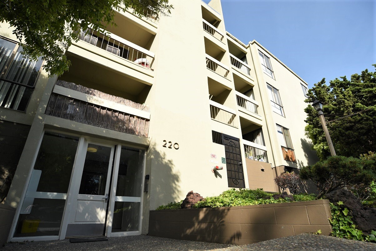
220 Perkins St is an apartment community located in Alameda County and the 94610 ZIP Code. This area is served by the Oakland Unified attendance zone.
Adams Point is a family-friendly locale that maintains an urban flair and embodies the eclectic vibe Oakland is known for. The neighborhood features a unique collection of rental options ranging from Art Deco apartments to craftsman and Edwardian houses. Vibrant murals and some of “Oakland’s Gnomes,” anonymously painted garden gnomes on wooden planks on the bottom of utility poles, are sprinkled across the neighborhood. Along with access to excellent schools, Adams Point is best known for being home to Oakland’s crown jewel, Lake Merritt. The lake provides residents with over three miles of continuous waterfront parks and green spaces. Lakeside Park houses Children’s Fairyland, a fairytale themed amusement park with rides and a puppet show. The Pergola is one of the city’s cultural spaces hosting everything from drum circles to yoga sessions. Residents can also be seen on paddleboats and Venetian gondolas gliding across the lake or visiting farmers markets.
Learn more about living in Adams Point| Colleges & Universities | Distance | ||
|---|---|---|---|
| Colleges & Universities | Distance | ||
| Walk: | 16 min | 0.8 mi | |
| Drive: | 5 min | 1.5 mi | |
| Drive: | 6 min | 2.6 mi | |
| Drive: | 9 min | 3.5 mi |


Transportation options available in Oakland include 19Th St Oakland Station, located 1.1 miles from 220 Perkins St. 220 Perkins St is near Metro Oakland International, located 10.3 miles or 17 minutes away, and San Francisco International, located 23.0 miles or 35 minutes away.
| Transit / Subway | Distance | ||
|---|---|---|---|
| Transit / Subway | Distance | ||
|
|
Walk: | 20 min | 1.1 mi |
|
|
Drive: | 4 min | 1.4 mi |
|
|
Drive: | 4 min | 1.5 mi |
|
|
Drive: | 4 min | 1.9 mi |
|
|
Drive: | 8 min | 4.0 mi |
| Commuter Rail | Distance | ||
|---|---|---|---|
| Commuter Rail | Distance | ||
|
|
Drive: | 6 min | 2.3 mi |
|
|
Drive: | 7 min | 4.0 mi |
|
|
Drive: | 10 min | 6.1 mi |
| Drive: | 16 min | 10.6 mi | |
| Drive: | 17 min | 10.6 mi |
| Airports | Distance | ||
|---|---|---|---|
| Airports | Distance | ||
|
Metro Oakland International
|
Drive: | 17 min | 10.3 mi |
|
San Francisco International
|
Drive: | 35 min | 23.0 mi |
Time and distance from 220 Perkins St.
| Shopping Centers | Distance | ||
|---|---|---|---|
| Shopping Centers | Distance | ||
| Drive: | 3 min | 1.3 mi | |
| Drive: | 3 min | 1.5 mi | |
| Drive: | 4 min | 1.6 mi |
| Parks and Recreation | Distance | ||
|---|---|---|---|
| Parks and Recreation | Distance | ||
|
Rotary Nature Center
|
Walk: | 10 min | 0.6 mi |
|
Morcom Rose Garden
|
Walk: | 11 min | 0.6 mi |
|
Lakeside Park
|
Walk: | 12 min | 0.6 mi |
|
Lakeside Park Garden Center
|
Walk: | 12 min | 0.7 mi |
|
Juan Bautista de Anza National Historic Trail
|
Drive: | 5 min | 1.6 mi |
| Hospitals | Distance | ||
|---|---|---|---|
| Hospitals | Distance | ||
| Walk: | 15 min | 0.8 mi | |
| Drive: | 3 min | 1.1 mi | |
| Drive: | 4 min | 2.0 mi |
| Military Bases | Distance | ||
|---|---|---|---|
| Military Bases | Distance | ||
| Drive: | 14 min | 4.9 mi | |
| Drive: | 13 min | 5.0 mi |
What Are Walk Score®, Transit Score®, and Bike Score® Ratings?
Walk Score® measures the walkability of any address. Transit Score® measures access to public transit. Bike Score® measures the bikeability of any address.
What is a Sound Score Rating?
A Sound Score Rating aggregates noise caused by vehicle traffic, airplane traffic and local sources
220 Perkins St
Oakland, CA 94610


