$2,395
/ Month
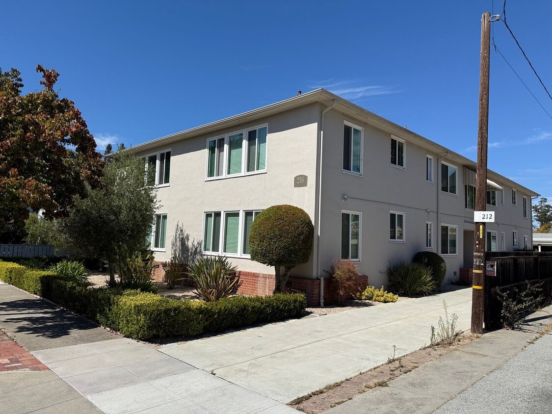
216 Anita Rd Unit 3
Burlingame, CA 94010
Today
Favorites
650-692-0573
-
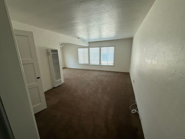
Bedrooms
1
-
Bathrooms
1
-
Square Feet
750 sq ft
-
Available
Available Now
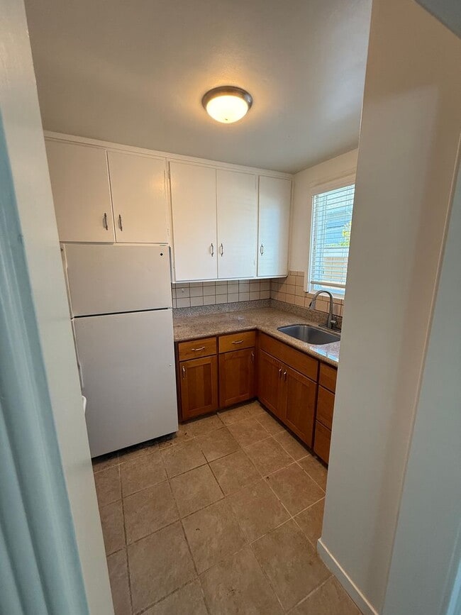
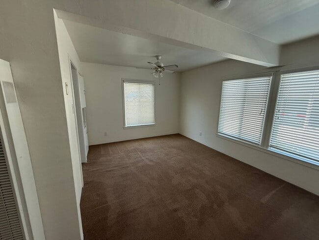
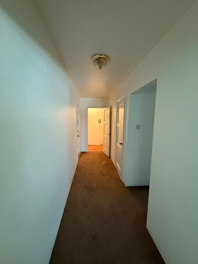
216 Anita Rd Unit 3

Favorites
About This Home
$2,395 deposit,
Available Now
216 Anita Rd is a multi-family home in Burlingame, CA 94010. This property was built in 1948. Nearby schools include Washington Elementary School, Burlingame High School and Pacific Rim International School. The closest grocery stores are The Gourmet Corner, Kwik & Convenient Market and Safeway. Nearby coffee shops include The Original Royal Donut, Tpumps and European Coffee House & Cafe. Nearby restaurants include Sam's Italian Sandwich Co, Christie's Restaurant and SAKAE Sushi & Grill. 216 Anita Rd is near Washington Park, Victoria Park and Pershing Park.
216 Anita Rd is an apartment community located in San Mateo County and the 94010 ZIP Code.
* Price shown is base rent and may not include non-optional fees and utilities. Price, availability, fees, and any applicable rent special are subject to change without notice.
* Square footage definitions vary. Displayed square footage is approximate.
Contact
- Listed by Mid | Mid Peninsula Management, Inc.
- Phone Number
- Contact
Location
Get Directions
Lyon Hoag is primarily a residential neighborhood, full of attractive homes, manicured lawns, and vibrant greenery. Several public and private schools around the community give parents convenient options for their children’s education. Poplar Creek Golf Course and Coyote Point Marina are practically right next door, providing great opportunities for outdoor recreation.
Downtown Burlingame is close at hand, giving residents a terrific selection of shopping, dining, and nightlife just down the street—many more cafes are clustered all around the neighborhood as well. Easy access to BART rail service and the 101 makes it a breeze to reach San Francisco and Silicon Valley, whether for work or leisure.
Learn more about living in Lyon Hoag
Education
| Colleges & Universities | Distance | ||
|---|---|---|---|
| Colleges & Universities | Distance | ||
| Drive: | 10 min | 5.4 mi | |
| Drive: | 17 min | 9.7 mi | |
| Drive: | 22 min | 14.1 mi | |
| Drive: | 23 min | 16.2 mi |
216 Anita Rd Unit 3 is within 10 minutes or 5.4 miles from College of San Mateo. It is also near Skyline College and Canada College.
Transportation options available in Burlingame include Millbrae Bart Station, located 3.4 miles from 216 Anita Rd Unit 3. 216 Anita Rd Unit 3 is near San Francisco International, located 5.0 miles or 10 minutes away, and Metro Oakland International, located 27.6 miles or 36 minutes away.
| Transit / Subway | Distance | ||
|---|---|---|---|
| Transit / Subway | Distance | ||
|
|
Drive: | 7 min | 3.4 mi |
|
|
Drive: | 7 min | 3.4 mi |
| Drive: | 9 min | 4.6 mi | |
|
|
Drive: | 10 min | 4.8 mi |
|
|
Drive: | 10 min | 5.0 mi |
| Commuter Rail | Distance | ||
|---|---|---|---|
| Commuter Rail | Distance | ||
| Walk: | 4 min | 0.2 mi | |
| Walk: | 5 min | 0.3 mi | |
| Drive: | 3 min | 1.6 mi | |
| Drive: | 4 min | 1.8 mi | |
| Drive: | 6 min | 3.2 mi |
| Airports | Distance | ||
|---|---|---|---|
| Airports | Distance | ||
|
San Francisco International
|
Drive: | 10 min | 5.0 mi |
|
Metro Oakland International
|
Drive: | 36 min | 27.6 mi |
Time and distance from 216 Anita Rd Unit 3.
| Shopping Centers | Distance | ||
|---|---|---|---|
| Shopping Centers | Distance | ||
| Walk: | 9 min | 0.5 mi | |
| Walk: | 11 min | 0.6 mi | |
| Walk: | 12 min | 0.7 mi |
216 Anita Rd Unit 3 has 3 shopping centers within 0.7 mile, which is about a 12-minute walk. The miles and minutes will be for the farthest away property.
| Parks and Recreation | Distance | ||
|---|---|---|---|
| Parks and Recreation | Distance | ||
|
Coyote Point Recreational Area
|
Drive: | 5 min | 1.7 mi |
|
CuriOdyssey
|
Drive: | 5 min | 1.8 mi |
|
Japanese Tea Garden (San Mateo)
|
Drive: | 4 min | 2.0 mi |
|
Bayside Park
|
Drive: | 4 min | 2.1 mi |
|
San Mateo Arboretum
|
Drive: | 5 min | 2.5 mi |
216 Anita Rd Unit 3 has 5 parks within 2.5 miles, including Coyote Point Recreational Area, CuriOdyssey, and Japanese Tea Garden (San Mateo).
| Hospitals | Distance | ||
|---|---|---|---|
| Hospitals | Distance | ||
| Drive: | 5 min | 2.9 mi | |
| Drive: | 10 min | 5.9 mi | |
| Drive: | 15 min | 8.7 mi |
216 Anita Rd Unit 3 has 3 hospitals within 8.7 miles, the nearest is Peninsula Medical Center which is 2.9 miles away and a 5 minute drive.
| Military Bases | Distance | ||
|---|---|---|---|
| Military Bases | Distance | ||
| Drive: | 47 min | 29.9 mi |
216 Anita Rd Unit 3 is 29.9 miles and a 47 minute drive from Alameda/US Naval Air Station San Francisco.
You May Also Like
Similar Rentals Nearby


What Are Walk Score®, Transit Score®, and Bike Score® Ratings?
Walk Score® measures the walkability of any address. Transit Score® measures access to public transit. Bike Score® measures the bikeability of any address.
What is a Sound Score Rating?
A Sound Score Rating aggregates noise caused by vehicle traffic, airplane traffic and local sources

216 Anita Rd
Burlingame, CA 94010