$1,300
/ Month
215 Cross St Unit #1
Elsmere, KY 41018
2 Weeks Ago
|
Edit
Favorites
215 Cross St Unit #1

Favorites
Check Back Soon for Upcoming Availability
| Beds | Baths | Average SF |
|---|---|---|
| 2 Bedrooms 2 Bedrooms 2 Br | 1 Bath 1 Bath 1 Ba | 669 SF |
Fees and Policies
The fees below are based on community-supplied data and may exclude additional fees and utilities.
- Parking
-
Garage--
Details
Utilities Included
-
Gas
-
Water
-
Electricity
-
Heat
-
Trash Removal
-
Sewer
-
Air Conditioning
Property Information
-
2 units
About This Property
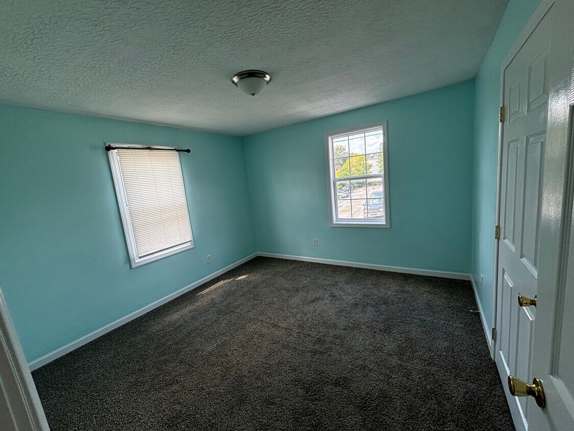
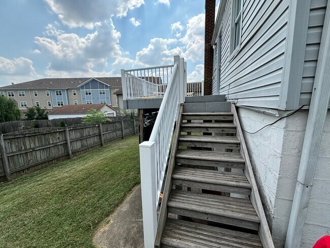
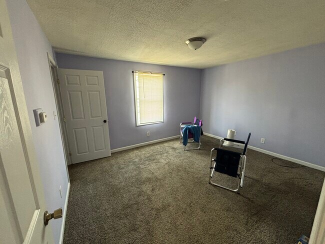
Section 8 accepted. Two bedroom with one bath and a shared backyard. Great location, only minutes from grocery stores, a gym and restaurants. All utilities included except for internet.
215 Cross St is an apartment community located in Kenton County and the 41018 ZIP Code. This area is served by the Erlanger-Elsmere Independent attendance zone.
Apartment Features
- Washer/Dryer Hookup
- Air Conditioning
- Dishwasher
Location
Get Directions
Northern Kentucky is a sprawling region located just south of Cincinnati, Ohio. The Ohio River hugs the northern, eastern, and western portions of the region, serving as a scenic destination for all kinds of outdoor recreation throughout the year. Florence, Dayton, Newport, Covington, Burlington, and Highland Heights are among the many communities included in the Northern Kentucky region.
Each community in Northern Kentucky offers its own unique identity and sense of character. The rentals in the area are just as diverse as Northern Kentucky itself, ranging from luxury apartments to charming houses and everything in between. Getting around the region is a breeze with convenience to Interstates 71, 75, 275, and 471.
Learn more about living in Northern KentuckyBelow are rent ranges for similar nearby apartments
Amenities
- Washer/Dryer Hookup
- Air Conditioning
- Dishwasher
Expenses
Utilities Included
Gas, Water, Electricity, Heat, Trash Removal, Sewer, Air Conditioning
Included
Education
| Colleges & Universities | Distance | ||
|---|---|---|---|
| Colleges & Universities | Distance | ||
| Drive: | 7 min | 2.7 mi | |
| Drive: | 16 min | 9.7 mi | |
| Drive: | 22 min | 14.0 mi | |
| Drive: | 29 min | 17.0 mi |
215 Cross St Unit #1 is within 7 minutes or 2.7 miles from Thomas More College. It is also near College of Mount St. Joseph and Northern Kentucky University.
Schools


Public Elementary School
Grades PK-5
270 Students
Nearby
Public Elementary School
Grades K-5
230 Students
Attendance Zone
Public Middle School
Grades 6-8
539 Students
Attendance Zone
Public High School
Grades 9-12
697 Students
Attendance Zone
Private Elementary & Middle School
Grades PK-8
399 Students
Nearby
Private Elementary School
Grades PK-6
22 Students
Nearby
School data provided by
 The GreatSchools Rating helps parents compare schools within a state based on a variety of school quality indicators and provides a helpful picture of how effectively each school serves all of its students. Ratings are on a scale of 1 (below average) to 10 (above average) and can include test scores, college readiness, academic progress, advanced courses, equity, discipline and attendance data. We also advise parents to visit schools, consider other information on school performance and programs, and consider family needs as part of the school selection process.
View GreatSchools Rating Methodology
Data provided by GreatSchools.org © 2026. All rights reserved.
View GreatSchools Rating Methodology
Data provided by GreatSchools.org © 2026. All rights reserved.
Transportation options available in Elsmere include The Banks Station, 2Nd & Main, located 9.9 miles from 215 Cross St Unit #1. 215 Cross St Unit #1 is near Cincinnati/Northern Kentucky International, located 5.8 miles or 16 minutes away.
| Transit / Subway | Distance | ||
|---|---|---|---|
| Transit / Subway | Distance | ||
| Drive: | 15 min | 9.9 mi | |
| Drive: | 16 min | 10.0 mi | |
| Drive: | 16 min | 10.0 mi | |
| Drive: | 17 min | 10.1 mi | |
| Drive: | 17 min | 10.2 mi |
| Commuter Rail | Distance | ||
|---|---|---|---|
| Commuter Rail | Distance | ||
|
|
Drive: | 18 min | 10.9 mi |
| Airports | Distance | ||
|---|---|---|---|
| Airports | Distance | ||
|
Cincinnati/Northern Kentucky International
|
Drive: | 16 min | 5.8 mi |
Time and distance from 215 Cross St Unit #1.
| Shopping Centers | Distance | ||
|---|---|---|---|
| Shopping Centers | Distance | ||
| Walk: | 6 min | 0.3 mi | |
| Walk: | 8 min | 0.4 mi | |
| Walk: | 16 min | 0.8 mi |
215 Cross St Unit #1 has 3 shopping centers within 0.8 mile, which is about a 16-minute walk. The miles and minutes will be for the farthest away property.
| Parks and Recreation | Distance | ||
|---|---|---|---|
| Parks and Recreation | Distance | ||
|
John G. & Phyllis W. Smale Riverfront Park
|
Drive: | 15 min | 9.9 mi |
|
Boone County Arboretum
|
Drive: | 19 min | 10.9 mi |
|
Wilson Commons
|
Drive: | 19 min | 12.1 mi |
|
Imago Earth Center
|
Drive: | 21 min | 13.2 mi |
|
Embshoff Woods
|
Drive: | 25 min | 14.8 mi |
215 Cross St Unit #1 has 5 parks within 14.8 miles, including John G. & Phyllis W. Smale Riverfront Park, Embshoff Woods, and Boone County Arboretum.
| Hospitals | Distance | ||
|---|---|---|---|
| Hospitals | Distance | ||
| Drive: | 5 min | 2.7 mi | |
| Drive: | 7 min | 3.4 mi | |
| Drive: | 8 min | 3.7 mi |
215 Cross St Unit #1 has 3 hospitals within 3.7 miles, the nearest is St. Elizabeth Florence which is 2.7 miles away and a 5 minute drive.
| Military Bases | Distance | ||
|---|---|---|---|
| Military Bases | Distance | ||
| Drive: | 84 min | 64.4 mi | |
| Drive: | 90 min | 69.4 mi | |
| Drive: | 93 min | 72.7 mi |
215 Cross St Unit #1 has 3 military bases within 72.7 miles, the nearest is Gentile Air Force Station which is 64.4 miles away and a 84 minute drive.
You May Also Like
Similar Rentals Nearby


What Are Walk Score®, Transit Score®, and Bike Score® Ratings?
Walk Score® measures the walkability of any address. Transit Score® measures access to public transit. Bike Score® measures the bikeability of any address.
What is a Sound Score Rating?
A Sound Score Rating aggregates noise caused by vehicle traffic, airplane traffic and local sources

215 Cross St
Elsmere, KY 41018