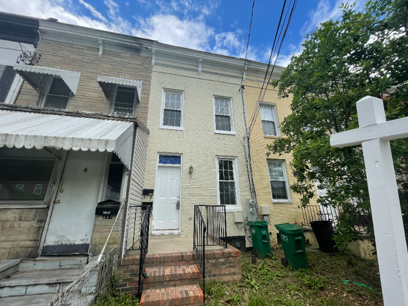
215 9th St Unit A
Laurel, MD 20707
-
Bedrooms
1
-
Bathrooms
1
-
Square Feet
800 sq ft
-
Available
Available Now
Highlights
- Pets Allowed
- Fenced Lot

About This Home
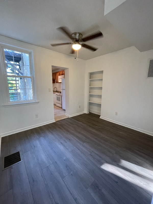
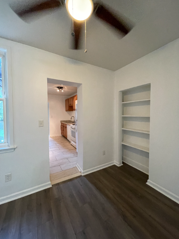
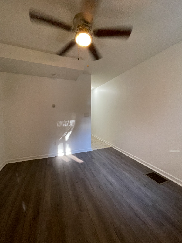
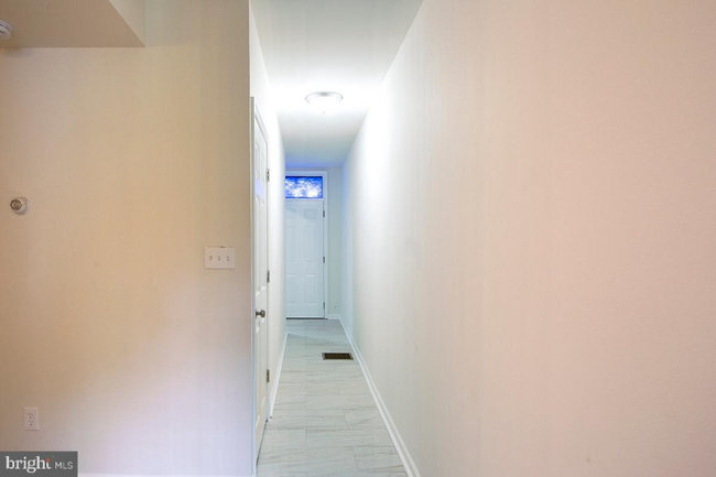
Property Id: 627280 Private 1 bedroom apartment WITH A DEN in basement. One bedroom is on main level, den in basement, can be used as a bedroom/office if needed. Hardwood flooring. Square footage is approximately 800sqft. Off street parking directly in front of home. Small backyard with deck. Very nice kitchen with space for small table. Washer & dryer located in basement and space for extra storage. Water included in rent. Tenant responsible for gas & electric.
215 9th St is an apartment community located in Prince George's County and the 20707 ZIP Code.
Fees and Policies
The fees listed below are community-provided and may exclude utilities or add-ons. All payments are made directly to the property and are non-refundable unless otherwise specified. Use the Cost Calculator to determine costs based on your needs.
-
One-Time Basics
-
Due at Move-In
-
Security Deposit - RefundableCharged per unit.$1,450
-
-
Due at Move-In
-
Dogs
-
Allowed
-
-
Cats
-
Allowed
-
Property Fee Disclaimer: Based on community-supplied data and independent market research. Subject to change without notice. May exclude fees for mandatory or optional services and usage-based utilities.
Details
Utilities Included
-
Water
Features
Washer/Dryer
Dishwasher
Microwave
Refrigerator
- Washer/Dryer
- Dishwasher
- Disposal
- Microwave
- Oven
- Refrigerator
- Tile Floors
- Fenced Lot
Contact
- Phone Number
- Contact
-
Source

Laurel sits at the geographic midpoint between Washington, D.C., and Baltimore, a position that shapes nearly everything about daily life here. Founded as a mill town along the Patuxent River in the early 19th century, the city has evolved into a well-connected community with a strong presence of government and technology employers. Fort Meade, the National Security Agency, and Johns Hopkins Applied Physics Laboratory are all located nearby, making Laurel a practical base for professionals working in defense and research. The historic Main Street district anchors the city's identity with brick storefronts, the Laurel Museum, and independently owned businesses. Neighborhoods like Laurel Lakes, Russett, and Montpelier each carry a distinct character, ranging from lakefront recreation areas to tree-lined residential streets. Capitol Technology University and the Laurel College Center also contribute an educational dimension to the community.
Learn more about living in Laurel- Washer/Dryer
- Dishwasher
- Disposal
- Microwave
- Oven
- Refrigerator
- Tile Floors
- Fenced Lot
| Colleges & Universities | Distance | ||
|---|---|---|---|
| Colleges & Universities | Distance | ||
| Drive: | 18 min | 10.4 mi | |
| Drive: | 18 min | 10.5 mi | |
| Drive: | 21 min | 11.1 mi | |
| Drive: | 23 min | 15.5 mi |
Transportation options available in Laurel include Greenbelt, Green/Yellow Line Center Platform, located 10.9 miles from 215 9th St Unit A. 215 9th St Unit A is near Baltimore/Washington International Thurgood Marshall, located 17.6 miles or 25 minutes away, and Ronald Reagan Washington Ntl, located 25.9 miles or 42 minutes away.
| Transit / Subway | Distance | ||
|---|---|---|---|
| Transit / Subway | Distance | ||
| Drive: | 16 min | 10.9 mi | |
| Drive: | 23 min | 11.3 mi | |
|
|
Drive: | 17 min | 11.4 mi |
| Commuter Rail | Distance | ||
|---|---|---|---|
| Commuter Rail | Distance | ||
| Drive: | 3 min | 1.3 mi | |
| Drive: | 7 min | 2.8 mi | |
|
Muirkirk Marc Sb
|
Drive: | 8 min | 4.5 mi |
|
|
Drive: | 11 min | 5.0 mi |
|
|
Drive: | 15 min | 7.3 mi |
| Airports | Distance | ||
|---|---|---|---|
| Airports | Distance | ||
|
Baltimore/Washington International Thurgood Marshall
|
Drive: | 25 min | 17.6 mi |
|
Ronald Reagan Washington Ntl
|
Drive: | 42 min | 25.9 mi |
Scores provided by
Traffic
-Airport
-Businesses
-Scores provided by
HowLoud What is a Sound Score Rating? A Sound Score Rating aggregates noise caused by vehicle traffic, airplane traffic and local sources. How It WorksTime and distance from 215 9th St Unit A.
| Shopping Centers | Distance | ||
|---|---|---|---|
| Shopping Centers | Distance | ||
| Walk: | 9 min | 0.5 mi | |
| Walk: | 18 min | 0.9 mi | |
| Drive: | 3 min | 1.3 mi |
| Parks and Recreation | Distance | ||
|---|---|---|---|
| Parks and Recreation | Distance | ||
|
Fairland Regional Park
|
Drive: | 9 min | 4.3 mi |
|
Patuxent Research Refuge - North Tract
|
Drive: | 14 min | 6.4 mi |
|
Patuxent Research Refuge - South Tract
|
Drive: | 16 min | 8.2 mi |
|
Maydale Conservation Park and Nature Center
|
Drive: | 15 min | 8.6 mi |
|
Browns Bridge Recreation Area
|
Drive: | 16 min | 8.6 mi |
| Hospitals | Distance | ||
|---|---|---|---|
| Hospitals | Distance | ||
| Drive: | 6 min | 2.3 mi | |
| Drive: | 13 min | 8.4 mi | |
| Drive: | 19 min | 11.7 mi |
| Military Bases | Distance | ||
|---|---|---|---|
| Military Bases | Distance | ||
| Drive: | 15 min | 7.9 mi | |
| Drive: | 28 min | 16.3 mi | |
| Drive: | 36 min | 22.1 mi |
215 9th St Unit A Photos
Nearby Apartments
Within 50 Miles of 215 9th St Laurel, MD 20707
-
Aspen at Lake Trail
5764 Stevens Forest Rd
Columbia, MD 21045
$1,560 - $2,545
1-3 Br 7.2 mi
-
Franklin Park At Greenbelt Station
6220 Springhill Dr
Greenbelt, MD 20770
$1,437 - $2,728
1-3 Br 7.6 mi
-
University View
8204 Baltimore Ave
College Park, MD 20740
$1,099 - $2,299
1-4 Br 8.9 mi
-
Arrive Silver Spring
8750 Georgia Ave
Silver Spring, MD 20910
$1,650 - $2,500
1-2 Br 12.0 mi
-
Southgate Apartments & Townhomes
362 Klagg Ct
Glen Burnie, MD 21061
$1,303 - $2,199
1-3 Br 12.7 mi
-
The Charles
7342 Wisconsin Ave
Bethesda, MD 20814
$2,602 - $10,222 Total Monthly Price
1-2 Br 15.3 mi

215 9th St
Laurel, MD 20707