
$2,350
/ Month
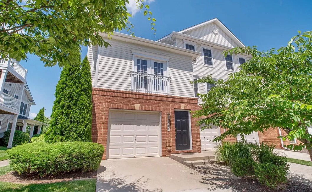
2052 Astilbe Way
Odenton, MD 21113
2 Weeks Ago
Favorites
2052 Astilbe Way

Favorites
Check Back Soon for Upcoming Availability
| Beds | Baths | Average SF |
|---|---|---|
| 2 Bedrooms 2 Bedrooms 2 Br | 2 Baths 2 Baths 2 Ba | 1,610 SF |
Fees and Policies
The fees below are based on community-supplied data and may exclude additional fees and utilities.
- Dogs Allowed
-
Fees not specified
- Cats Allowed
-
Fees not specified
About This Property
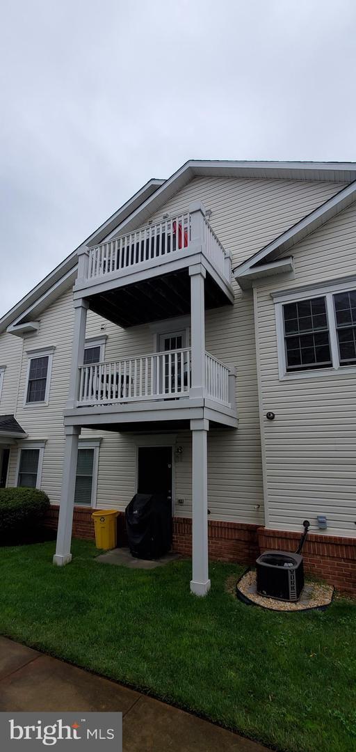
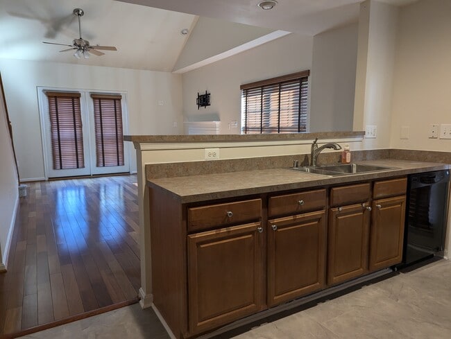
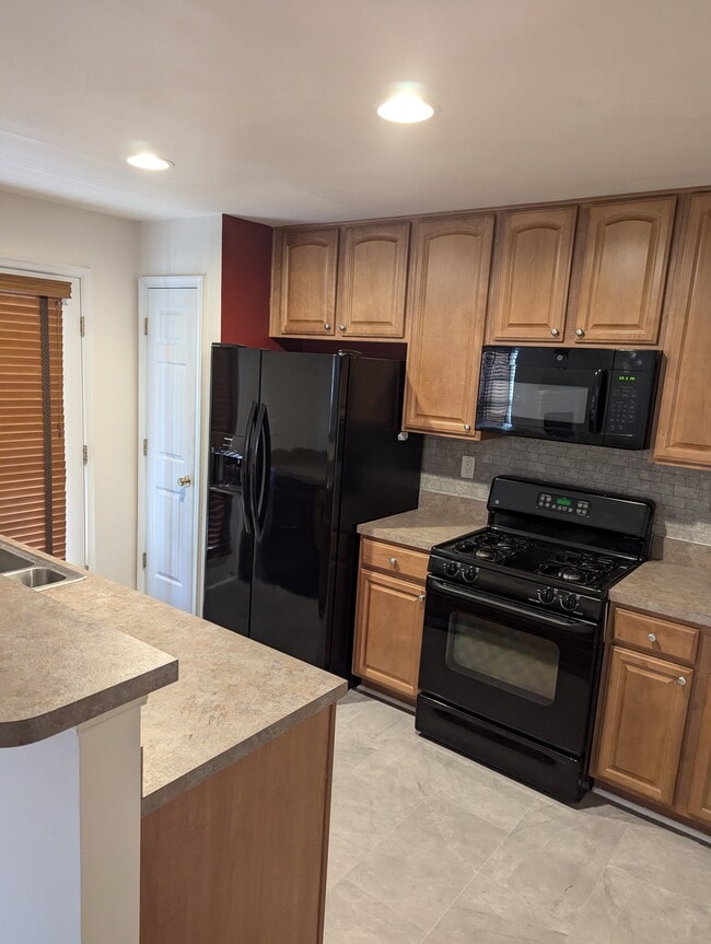
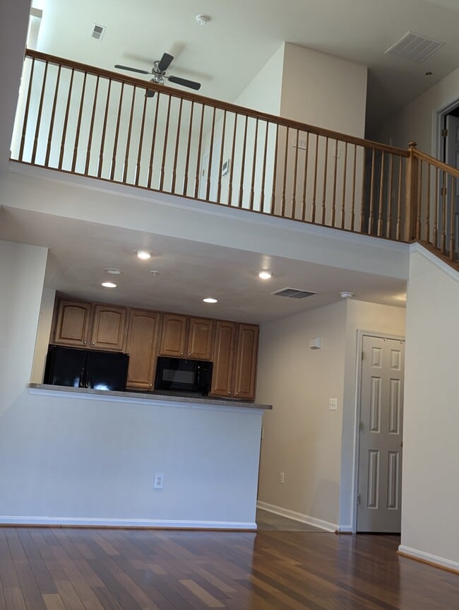
This two-bedroom, two-bath townhome is waiting for its next tenants to call it home. Located in the sought-after community of Seven Oaks, this three-level townhouse has a one-car garage two spacious bedrooms, and two full bathrooms. The living room, kitchen, and master bedroom are on the second floor with a walkout deck right off the kitchen. The master bedroom has an ensuite bathroom with a soaking tub and a walk-in closet. The second bedroom can be found on the third floor of the townhouse with a walk-in closet and a private bathroom. A loft on the third floor is perfect for an office with a small walkout deck. The kitchen has a dishwasher, microwave, range/oven, and refrigerator New carpet in the bedrooms, loft, and stairs. Astilbe Way is a commuter's dream with Fort Meade/NSA a 3-minute drive and quick access to major highways and public transportation, perfect for your commute to DC, Baltimore, Annapolis, and more. This townhouse is available for a 12-month or 24-month lease, making it an excellent opportunity for those seeking a long-term rental. Schedule a showing today and experience this property's comfort and convenience. You must have a credit score of 670 to apply **Application fee is nonrefundable** Showings are only available on Saturdays & Sundays
2052 Astilbe Way is a townhome located in Anne Arundel County and the 21113 ZIP Code. This area is served by the Anne Arundel County Public Schools attendance zone.
Townhome Features
- Washer/Dryer
- Washer/Dryer Hookup
- Dishwasher
Location
Get Directions
Situated in Anne Arundel County, Odenton is centrally located between Annapolis, Washington D.C., and Baltimore. The city is continuously growing in population, largely due to its proximity to Fort George G. Meade military base and the developing Piney Orchard neighborhood.
In Odenton, you’ll discover a lot of great shopping centers like Waugh Chapel Towne Centre. Hikers will enjoy the plethora of trails that reside within the community, including Little Patuxent River Trail, Wild Turkey Way, and Merganser Pond Trail, among others. Midland Park is a large green space just minutes from Bowie State University. This Baltimore suburb contains highly rated public schools, plus access to Interstate 97 and Odenton Station.
Learn more about living in Odenton
Amenities
- Washer/Dryer
- Washer/Dryer Hookup
- Dishwasher
Education
| Colleges & Universities | Distance | ||
|---|---|---|---|
| Colleges & Universities | Distance | ||
| Drive: | 24 min | 14.3 mi | |
| Drive: | 25 min | 14.8 mi | |
| Drive: | 28 min | 15.3 mi | |
| Drive: | 27 min | 15.9 mi |
2052 Astilbe Way is within 24 minutes or 14.3 miles from UMBC. It is also near CCBC Cantonsville and Anne Arundel Community College.
Schools


Public Elementary School
Grades PK-5
508 Students
Attendance Zone
Public Middle School
Grades 6-8
878 Students
Attendance Zone
Public High School
Grades 9-12
2,330 Students
Attendance Zone
Private Elementary, Middle & High School
Grades 2-12
7 Students
Nearby
Private Elementary, Middle & High School
Grades PK-12
181 Students
Nearby
School data provided by
 The GreatSchools Rating helps parents compare schools within a state based on a variety of school quality indicators and provides a helpful picture of how effectively each school serves all of its students. Ratings are on a scale of 1 (below average) to 10 (above average) and can include test scores, college readiness, academic progress, advanced courses, equity, discipline and attendance data. We also advise parents to visit schools, consider other information on school performance and programs, and consider family needs as part of the school selection process.
View GreatSchools Rating Methodology
Data provided by GreatSchools.org © 2025. All rights reserved.
View GreatSchools Rating Methodology
Data provided by GreatSchools.org © 2025. All rights reserved.
Transportation options available in Odenton include Dorsey, located 7.8 miles from 2052 Astilbe Way. 2052 Astilbe Way is near Baltimore/Washington International Thurgood Marshall, located 9.0 miles or 18 minutes away, and Ronald Reagan Washington Ntl, located 31.3 miles or 50 minutes away.
| Transit / Subway | Distance | ||
|---|---|---|---|
| Transit / Subway | Distance | ||
|
|
Drive: | 15 min | 7.8 mi |
|
|
Drive: | 17 min | 8.9 mi |
|
|
Drive: | 19 min | 9.3 mi |
|
|
Drive: | 17 min | 9.6 mi |
|
|
Drive: | 18 min | 9.9 mi |
| Commuter Rail | Distance | ||
|---|---|---|---|
| Commuter Rail | Distance | ||
|
|
Drive: | 6 min | 2.5 mi |
|
|
Drive: | 12 min | 5.6 mi |
|
|
Drive: | 13 min | 7.8 mi |
| Drive: | 15 min | 7.8 mi | |
| Drive: | 15 min | 7.8 mi |
| Airports | Distance | ||
|---|---|---|---|
| Airports | Distance | ||
|
Baltimore/Washington International Thurgood Marshall
|
Drive: | 18 min | 9.0 mi |
|
Ronald Reagan Washington Ntl
|
Drive: | 50 min | 31.3 mi |
Time and distance from 2052 Astilbe Way.
| Shopping Centers | Distance | ||
|---|---|---|---|
| Shopping Centers | Distance | ||
| Walk: | 13 min | 0.7 mi | |
| Walk: | 17 min | 0.9 mi | |
| Drive: | 5 min | 2.2 mi |
2052 Astilbe Way has 3 shopping centers within 2.2 miles, which is about a 5-minute walk. The miles and minutes will be for the farthest away property.
| Parks and Recreation | Distance | ||
|---|---|---|---|
| Parks and Recreation | Distance | ||
|
Patuxent Research Refuge - North Tract
|
Drive: | 12 min | 5.5 mi |
|
Kinder Farm Park
|
Drive: | 23 min | 11.5 mi |
|
Patuxent Research Refuge - South Tract
|
Drive: | 25 min | 13.7 mi |
2052 Astilbe Way has 3 parks within 13.7 miles, including Patuxent Research Refuge - North Tract, Kinder Farm Park, and Patuxent Research Refuge - South Tract.
| Hospitals | Distance | ||
|---|---|---|---|
| Hospitals | Distance | ||
| Drive: | 17 min | 8.8 mi | |
| Drive: | 22 min | 11.5 mi |
2052 Astilbe Way is 8.8 miles from University of Maryland Baltimore Washington Medical Center, and is convenient to other hospitals, including Laurel Regional Medical Center.
| Military Bases | Distance | ||
|---|---|---|---|
| Military Bases | Distance | ||
| Drive: | 6 min | 2.4 mi |
2052 Astilbe Way is 2.4 miles and a 6 minute drive from Fort George Meade.
You May Also Like
Similar Rentals Nearby


What Are Walk Score®, Transit Score®, and Bike Score® Ratings?
Walk Score® measures the walkability of any address. Transit Score® measures access to public transit. Bike Score® measures the bikeability of any address.
What is a Sound Score Rating?
A Sound Score Rating aggregates noise caused by vehicle traffic, airplane traffic and local sources
2052 Astilbe Way
Odenton, MD 21113