
Fourth and U
2020 4th St,
Berkeley, CA 94710
$2,502 - $3,398
1-2 Beds

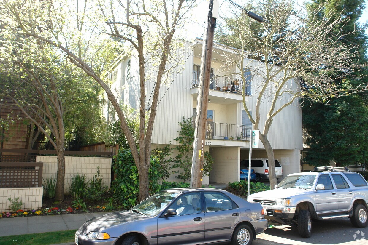
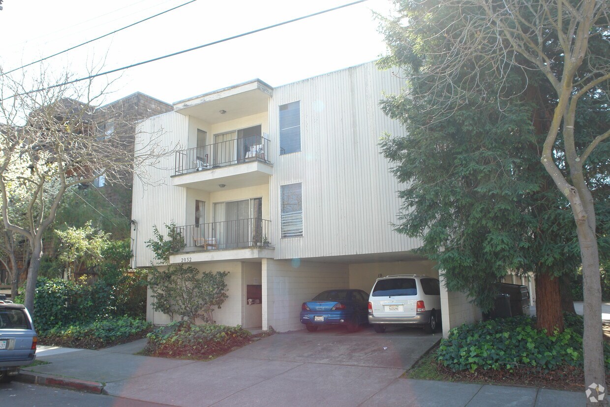
Experience Berkeley living at 2030-2032 Delaware St. Situated in Berkeley's 94709 area, living at this community offers a number of nearby experiences to check out. The team of leasing professionals will be ready to help you find the perfect apartment. Make sure you to see the available floorplan options. At 2030-2032 Delaware St you're right at home. Stop by the community today.
2030-2032 Delaware St is an apartment community located in Alameda County and the 94709 ZIP Code. This area is served by the Berkeley Unified School District attendance zone.
High Speed Internet Access
Refrigerator
Smoke Free
Heating
North Berkeley is one of the most sought-after neighborhoods in East Bay and is located along the northern border of the University of California, Berkeley. Renters with fur babies will enjoy the proximity to various parks including Live Oak Park and Ohlone Dog Park. The neighborhood is a hub for entertainment and gourmet dining, with a myriad of eateries. Renters with various taste palates will appreciate these diverse restaurants.
North Berkeley is home to the Berkley Art Center, a focal point for artistic exploration and community building. North Berkley lies just north Downtown Berkeley, six miles north of Downtown Oakland, and 14 miles northwest of San Francisco, making for an easy commute to these various cities. Luxury apartments, houses, and condos are available for rent.
Learn more about living in North BerkeleyCompare neighborhood and city base rent averages by bedroom.
| North Berkeley | Berkeley, CA | |
|---|---|---|
| Studio | $2,021 | $2,107 |
| 1 Bedroom | $2,117 | $2,300 |
| 2 Bedrooms | $3,018 | $3,331 |
| 3 Bedrooms | $4,374 | $4,283 |
| Colleges & Universities | Distance | ||
|---|---|---|---|
| Colleges & Universities | Distance | ||
| Walk: | 8 min | 0.4 mi | |
| Walk: | 23 min | 1.2 mi | |
| Drive: | 12 min | 4.0 mi | |
| Drive: | 14 min | 5.6 mi |


Transportation options available in Berkeley include Downtown Berkeley, located 0.4 mile from 2030-2032 Delaware St. 2030-2032 Delaware St is near Metro Oakland International, located 14.6 miles or 26 minutes away, and San Francisco International, located 25.2 miles or 41 minutes away.
| Transit / Subway | Distance | ||
|---|---|---|---|
| Transit / Subway | Distance | ||
|
|
Walk: | 7 min | 0.4 mi |
|
|
Walk: | 15 min | 0.8 mi |
|
|
Drive: | 5 min | 1.6 mi |
|
|
Drive: | 10 min | 3.1 mi |
|
|
Drive: | 9 min | 3.3 mi |
| Commuter Rail | Distance | ||
|---|---|---|---|
| Commuter Rail | Distance | ||
|
|
Drive: | 7 min | 2.5 mi |
| Drive: | 10 min | 3.4 mi | |
|
|
Drive: | 15 min | 6.4 mi |
| Drive: | 16 min | 8.4 mi | |
| Drive: | 23 min | 12.8 mi |
| Airports | Distance | ||
|---|---|---|---|
| Airports | Distance | ||
|
Metro Oakland International
|
Drive: | 26 min | 14.6 mi |
|
San Francisco International
|
Drive: | 41 min | 25.2 mi |
Scores provided by
Traffic
-Airport
-Businesses
-Scores provided by
HowLoud What is a Sound Score Rating? A Sound Score Rating aggregates noise caused by vehicle traffic, airplane traffic and local sources. How It WorksTime and distance from 2030-2032 Delaware St.
| Shopping Centers | Distance | ||
|---|---|---|---|
| Shopping Centers | Distance | ||
| Walk: | 4 min | 0.2 mi | |
| Walk: | 6 min | 0.3 mi | |
| Walk: | 13 min | 0.7 mi |
| Parks and Recreation | Distance | ||
|---|---|---|---|
| Parks and Recreation | Distance | ||
|
Habitot Children's Museum
|
Walk: | 9 min | 0.5 mi |
|
Museum of Vertebrate Zoology
|
Walk: | 11 min | 0.6 mi |
|
UC Berkeley Museum of Paleontology
|
Walk: | 12 min | 0.6 mi |
|
Essig Museum of Entomology
|
Walk: | 12 min | 0.6 mi |
|
University and Jepson Herbaria
|
Walk: | 12 min | 0.6 mi |
| Hospitals | Distance | ||
|---|---|---|---|
| Hospitals | Distance | ||
| Drive: | 6 min | 1.9 mi | |
| Drive: | 8 min | 2.8 mi | |
| Drive: | 11 min | 3.9 mi |
| Military Bases | Distance | ||
|---|---|---|---|
| Military Bases | Distance | ||
| Drive: | 11 min | 3.6 mi | |
| Drive: | 20 min | 8.2 mi | |
| Drive: | 22 min | 11.2 mi |
Pets Allowed Fitness Center In Unit Washer & Dryer Stainless Steel Appliances Business Center Package Service Elevator
What Are Walk Score®, Transit Score®, and Bike Score® Ratings?
Walk Score® measures the walkability of any address. Transit Score® measures access to public transit. Bike Score® measures the bikeability of any address.
What is a Sound Score Rating?
A Sound Score Rating aggregates noise caused by vehicle traffic, airplane traffic and local sources.
2030-2032 Delaware St
Berkeley, CA 94709


