

$3,950 / Month
2029 N Kenmore St
Arlington, VA 22207
2 Weeks Ago
Favorites
2029 N Kenmore St

Favorites
Check Back Soon for Upcoming Availability
| Beds | Baths | Average SF |
|---|---|---|
| 4 Bedrooms 4 Bedrooms 4 Br | 3 Baths 3 Baths 3 Ba | — |
About This Property
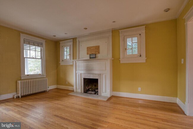
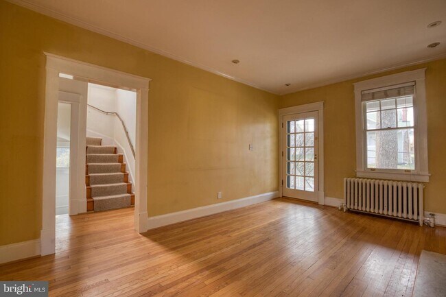
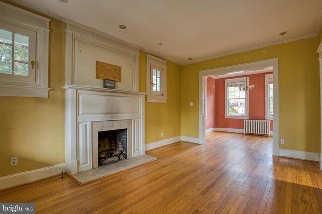
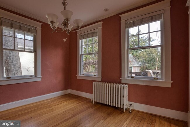
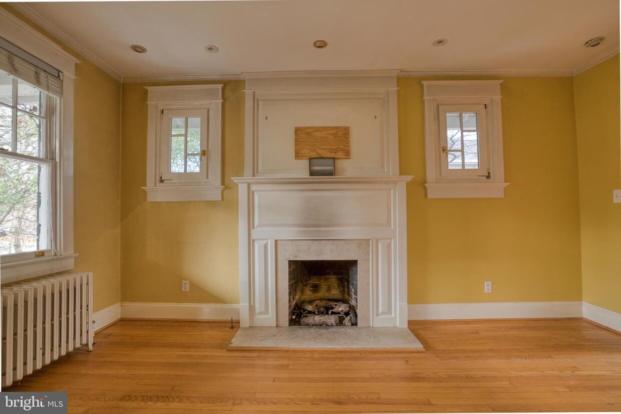
Great 4BD/3BA bungalow with convenient Cherrydale location, close to Gtown/DC & Arlington w/restaurants/shops! Renovated Kitchen w/ Stainless & Gourmet Gas stove, Wood floors, Inviting front porch, Large deck w/table space, Off street pkg for 3 cars, Spacious Fenced lot great for entertaining! Pets case by case. Minutes to 66, the Pentagon, and DCA airport. Bonus heated office in the back.
2029 N Kenmore St is a house located in Arlington County and the 22207 ZIP Code. This area is served by the Arlington County Public Schools attendance zone.
House Features
- Basement
Location
Get Directions
Located less than two miles north of Arlington, Cherrydale is a picturesque neighborhood centered on the Five Points intersection, where Old Dominion Drive, Lee Highway, Military Road, and Quincy Street meet. Cherrydale’s past dates back to its founding in 1893, and the neighborhood still contains an array of historic homes that have since been luxuriously renovated.
Cherrydale boasts a variety of rental offerings, from elegant houses to modern apartments, on tranquil tree-lined streets. Although the neighborhood is largely residential, the Cherrydale community enjoys access to a host of shops and restaurants on Old Dominion Drive. Several popular parks are convenient to the neighborhood, including Hayes Park, Quincy Park, and Potomac Overlook Regional Park. Commuting from Cherrydale is a breeze with access to Interstate 66 and several nearby Metro stations.
Learn more about living in CherrydaleBelow are rent ranges for similar nearby apartments
| Beds | Average Size | Lowest | Typical | Premium |
|---|---|---|---|---|
| Studio Studio Studio | 520 Sq Ft | $1,923 | $2,476 | $3,034 |
| 1 Bed 1 Bed 1 Bed | 726 Sq Ft | $1,120 | $2,465 | $3,598 |
| 2 Beds 2 Beds 2 Beds | 1056 Sq Ft | $1,400 | $3,117 | $4,671 |
| 3 Beds 3 Beds 3 Beds | 1428 Sq Ft | $3,045 | $3,679 | $5,614 |
| 4 Beds 4 Beds 4 Beds | 2676 Sq Ft | $4,750 | $4,975 | $5,200 |
Amenities
- Basement
Education
| Colleges & Universities | Distance | ||
|---|---|---|---|
| Colleges & Universities | Distance | ||
| Drive: | 4 min | 1.1 mi | |
| Drive: | 4 min | 1.9 mi | |
| Drive: | 7 min | 3.3 mi | |
| Drive: | 8 min | 4.2 mi |
2029 N Kenmore St is within 4 minutes or 1.1 miles from George Mason Univ., Arlington. It is also near Marymount University and Georgetown University.
Schools


Public Elementary School
Grades PK-5
539 Students
Attendance Zone
Public Middle School
Grades 6-8
1,053 Students
Nearby
Public High School
Grades 9-12
2,715 Students
Attendance Zone
Private Elementary, Middle & High School
Grades 1-12
378 Students
Nearby
Private Elementary & Middle School
Grades PK-8
467 Students
Nearby
School data provided by
 The GreatSchools Rating helps parents compare schools within a state based on a variety of school quality indicators and provides a helpful picture of how effectively each school serves all of its students. Ratings are on a scale of 1 (below average) to 10 (above average) and can include test scores, college readiness, academic progress, advanced courses, equity, discipline and attendance data. We also advise parents to visit schools, consider other information on school performance and programs, and consider family needs as part of the school selection process.
View GreatSchools Rating Methodology
Data provided by GreatSchools.org © 2025. All rights reserved.
View GreatSchools Rating Methodology
Data provided by GreatSchools.org © 2025. All rights reserved.
Transportation options available in Arlington include Virginia Square-Gmu, located 1.1 miles from 2029 N Kenmore St. 2029 N Kenmore St is near Ronald Reagan Washington Ntl, located 6.5 miles or 13 minutes away, and Washington Dulles International, located 23.2 miles or 36 minutes away.
| Transit / Subway | Distance | ||
|---|---|---|---|
| Transit / Subway | Distance | ||
|
|
Drive: | 3 min | 1.1 mi |
| Drive: | 4 min | 1.2 mi | |
|
|
Drive: | 3 min | 1.3 mi |
|
|
Drive: | 4 min | 1.9 mi |
|
|
Drive: | 4 min | 2.0 mi |
| Commuter Rail | Distance | ||
|---|---|---|---|
| Commuter Rail | Distance | ||
|
|
Drive: | 10 min | 5.2 mi |
|
|
Drive: | 10 min | 6.1 mi |
|
|
Drive: | 11 min | 6.1 mi |
|
|
Drive: | 10 min | 6.1 mi |
|
|
Drive: | 12 min | 6.3 mi |
| Airports | Distance | ||
|---|---|---|---|
| Airports | Distance | ||
|
Ronald Reagan Washington Ntl
|
Drive: | 13 min | 6.5 mi |
|
Washington Dulles International
|
Drive: | 36 min | 23.2 mi |
Time and distance from 2029 N Kenmore St.
| Shopping Centers | Distance | ||
|---|---|---|---|
| Shopping Centers | Distance | ||
| Walk: | 1 min | 0.1 mi | |
| Walk: | 6 min | 0.3 mi | |
| Walk: | 7 min | 0.4 mi |
2029 N Kenmore St has 3 shopping centers within 0.4 mile, which is about a 7-minute walk. The miles and minutes will be for the farthest away property.
| Parks and Recreation | Distance | ||
|---|---|---|---|
| Parks and Recreation | Distance | ||
|
Cherry Valley Park
|
Walk: | 10 min | 0.5 mi |
|
David M. Brown Planetarium
|
Walk: | 14 min | 0.7 mi |
|
Fort C.F. Smith Park & Historic Site
|
Drive: | 3 min | 1.2 mi |
|
Donaldson Run Park
|
Drive: | 4 min | 1.5 mi |
|
Potomac Overlook Regional Park
|
Drive: | 4 min | 1.5 mi |
2029 N Kenmore St has 5 parks within 1.5 miles, including Cherry Valley Park, David M. Brown Planetarium, and Fort C.F. Smith Park & Historic Site.
| Hospitals | Distance | ||
|---|---|---|---|
| Hospitals | Distance | ||
| Drive: | 4 min | 1.9 mi | |
| Drive: | 5 min | 2.2 mi | |
| Drive: | 7 min | 3.5 mi |
2029 N Kenmore St has 3 hospitals within 3.5 miles, the nearest is Capital Hospice which is 1.9 miles away and a 4 minute drive.
| Military Bases | Distance | ||
|---|---|---|---|
| Military Bases | Distance | ||
| Drive: | 7 min | 3.5 mi |
2029 N Kenmore St is 3.5 miles and a 7 minute drive from Fort Myer.
You May Also Like
Similar Rentals Nearby


What Are Walk Score®, Transit Score®, and Bike Score® Ratings?
Walk Score® measures the walkability of any address. Transit Score® measures access to public transit. Bike Score® measures the bikeability of any address.
What is a Sound Score Rating?
A Sound Score Rating aggregates noise caused by vehicle traffic, airplane traffic and local sources
2029 N Kenmore St
Arlington, VA 22207