$850 / Month
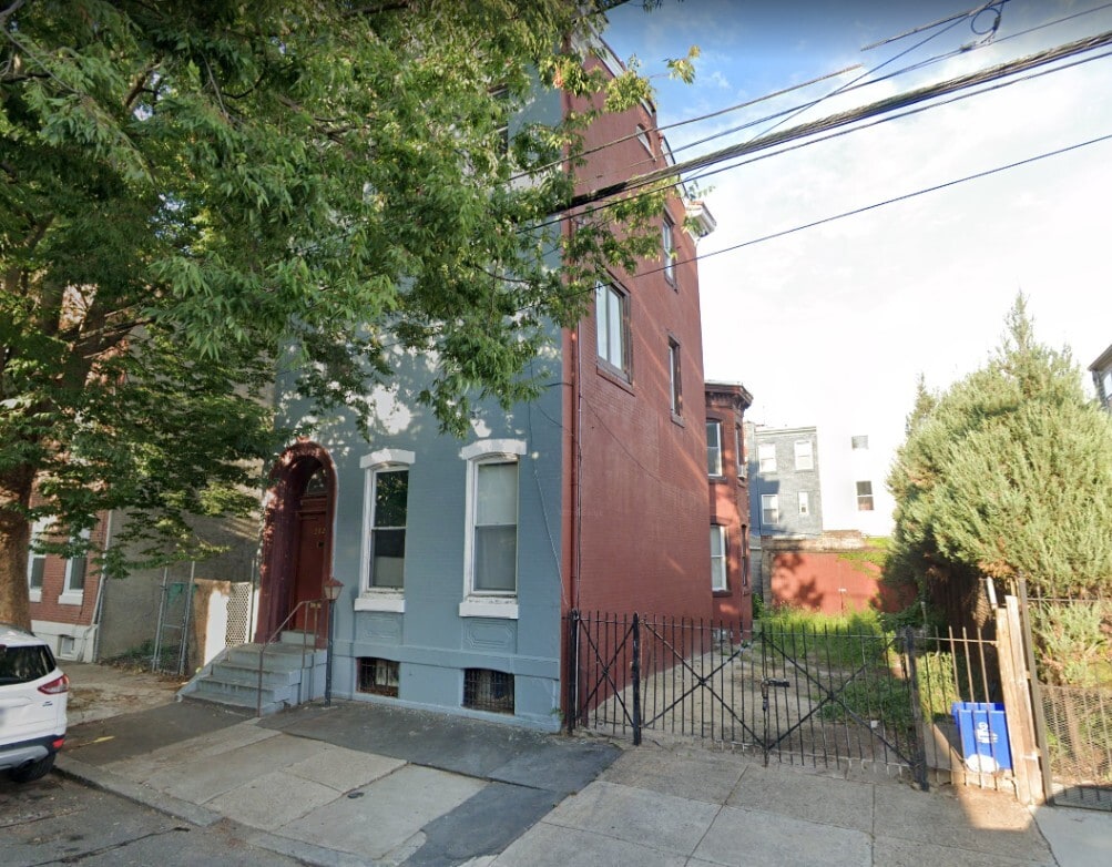
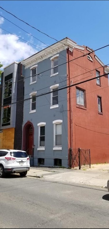
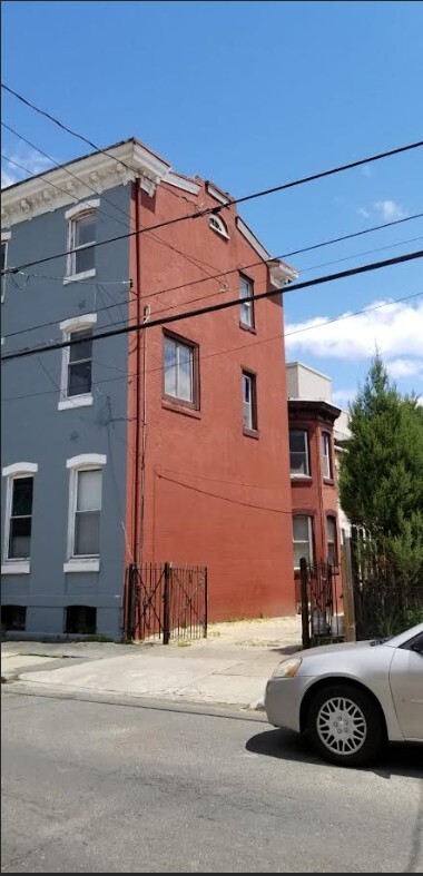
2029 N Howard St Unit #1
Philadelphia, PA 19122
Today
Favorites
484-563-2104
-
Bedrooms
1
-
Bathrooms
1
-
Square Feet
800 sq ft
-
Available
Available Now
2029 N Howard St Unit #1

Favorites
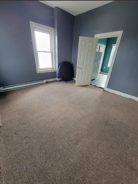
About This Home
12 Month Lease,
$850 deposit,
Available Now
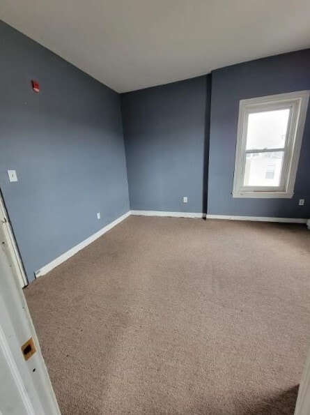
Nice apartment The one that is available is 2nd floor.
2029 N Howard St is an apartment community located in Philadelphia County and the 19122 ZIP Code.
* Price shown is base rent and may not include non-optional fees and utilities.
Price, availability, fees, and any applicable rent special are subject to change without notice.
* Square footage definitions vary. Displayed square footage is approximate.
Apartment Features
- Kitchen
- Bay Window
Fees and Policies
The fees below are based on community-supplied data and may exclude additional fees and utilities.
- Parking
-
Garage--
Details
Utilities Included
-
Water
Property Information
-
4 units
Contact
- Phone Number
- Contact
Location
Get Directions
Not to be confused with Northeast Philadelphia, North Philadelphia East encompasses the smaller subsets of Ludlow, Yorktown, West Kensington, Poplar, and Callowhill. This composite area runs from the Vine Street Expressway, stretching north to Erie Avenue. Broad Street acts as its eastern border, and the western edge runs a jagged line separating North Philadelphia East from the nearby Kensington, Port Richmond, and Fishtown neighborhoods. With such a long stretch of city, the neighborhood offers a diverse blend of important city landmarks, such as renowned musical venues the Electric Factory and Union Transfer, and Temple University, North Philadelphia's premiere site of higher learning.
Learn more about living in North Philadelphia East
Education
| Colleges & Universities | Distance | ||
|---|---|---|---|
| Colleges & Universities | Distance | ||
| Drive: | 5 min | 1.9 mi | |
| Drive: | 7 min | 2.6 mi | |
| Drive: | 8 min | 3.3 mi | |
| Drive: | 10 min | 3.3 mi |
2029 N Howard St Unit #1 is within 5 minutes or 1.9 miles from Temple University, Main Campus. It is also near Temple Univ., Health Center and C.C. of Philadelphia.
Transportation options available in Philadelphia include Berks, located 0.2 mile from 2029 N Howard St Unit #1. 2029 N Howard St Unit #1 is near Philadelphia International, located 14.7 miles or 25 minutes away, and Trenton Mercer, located 31.9 miles or 48 minutes away.
| Transit / Subway | Distance | ||
|---|---|---|---|
| Transit / Subway | Distance | ||
|
|
Walk: | 4 min | 0.2 mi |
|
|
Walk: | 6 min | 0.3 mi |
|
|
Walk: | 14 min | 0.8 mi |
| Walk: | 16 min | 0.9 mi | |
| Drive: | 4 min | 1.2 mi |
| Commuter Rail | Distance | ||
|---|---|---|---|
| Commuter Rail | Distance | ||
|
|
Drive: | 4 min | 1.2 mi |
|
|
Drive: | 5 min | 1.8 mi |
|
|
Drive: | 5 min | 2.1 mi |
|
|
Drive: | 7 min | 2.5 mi |
|
|
Drive: | 8 min | 3.2 mi |
| Airports | Distance | ||
|---|---|---|---|
| Airports | Distance | ||
|
Philadelphia International
|
Drive: | 25 min | 14.7 mi |
|
Trenton Mercer
|
Drive: | 48 min | 31.9 mi |
Time and distance from 2029 N Howard St Unit #1.
| Shopping Centers | Distance | ||
|---|---|---|---|
| Shopping Centers | Distance | ||
| Drive: | 3 min | 1.2 mi | |
| Drive: | 4 min | 1.4 mi | |
| Drive: | 4 min | 1.5 mi |
2029 N Howard St Unit #1 has 3 shopping centers within 1.5 miles, which is about a 4-minute drive. The miles and minutes will be for the farthest away property.
| Parks and Recreation | Distance | ||
|---|---|---|---|
| Parks and Recreation | Distance | ||
|
Wagner Free Institute of Science
|
Drive: | 6 min | 2.3 mi |
|
Edgar Allan Poe Nat'l Historic Site
|
Drive: | 6 min | 2.4 mi |
|
Great Egg Harbor River
|
Drive: | 7 min | 2.7 mi |
|
Lower Delaware National Wild and Scenic River
|
Drive: | 7 min | 2.7 mi |
|
Independence National Historical Park
|
Drive: | 7 min | 2.9 mi |
2029 N Howard St Unit #1 has 5 parks within 2.9 miles, including Wagner Free Institute of Science, Edgar Allan Poe Nat'l Historic Site, and Great Egg Harbor River.
| Hospitals | Distance | ||
|---|---|---|---|
| Hospitals | Distance | ||
| Drive: | 5 min | 2.0 mi | |
| Drive: | 7 min | 2.7 mi | |
| Drive: | 7 min | 2.9 mi |
2029 N Howard St Unit #1 has 3 hospitals within 2.9 miles, the nearest is St. Christopher's Hospital for Children which is 2.0 miles away and a 5 minute drive.
| Military Bases | Distance | ||
|---|---|---|---|
| Military Bases | Distance | ||
| Drive: | 16 min | 9.1 mi |
2029 N Howard St Unit #1 is 9.1 miles and a 16 minute drive from Philadelphia Naval Busi Center.
Amenities
- Kitchen
- Bay Window
2029 N Howard St Unit #1 Photos
What Are Walk Score®, Transit Score®, and Bike Score® Ratings?
Walk Score® measures the walkability of any address. Transit Score® measures access to public transit. Bike Score® measures the bikeability of any address.
What is a Sound Score Rating?
A Sound Score Rating aggregates noise caused by vehicle traffic, airplane traffic and local sources

2029 N Howard St
Philadelphia, PA 19122