
Groove Lofts
608 2nd Ave S,
Minneapolis, MN 55402
$1,675 - $2,280 Plus Fees
Studio - 4 Beds
Bedrooms
1 - 2 bd
Bathrooms
1 ba
Square Feet
715 - 820 sq ft
Located in the Uptown’s Wedge neighborhood, this building is newly remodeled. The exterior grounds, interior common areas, and apartment units have ALL experienced remodeling or upgrades. Upgraded apartments have hardwood floors in the kitchen, dinette, and entryway as well as new lighting fixtures and mirrored-closet doors. It also has quick access to Uptown and Downtown Minneapolis, I-94, Hiawatha Light Rail Line, and main bus routes.
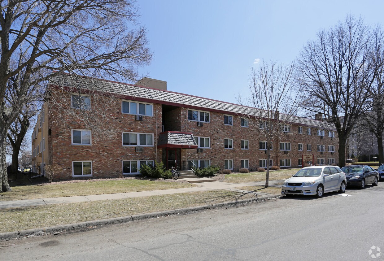
2017 Pillsbury Avenue is an apartment community located in Hennepin County and the 55404 ZIP Code. This area is served by the Minneapolis Public School Dist. attendance zone.
24 Hour Access
Security System
Public Transportation
Renters Insurance Program
Air Conditioning
Tub/Shower
Freezer
Ceiling Fans
Known as "The International Neighborhood," Whittier holds true to its reputation with residents representing more than 30 countries and 25 spoken languages. Unsurprisingly, this melting pot also boasts a world-class selection of international cuisine and an eclectic shopping experience that draws residents from all over the city. Housing the Minneapolis College of Art and Design, the Minneapolis Institute of Arts, and the Children's Theatre Company, this vibrant neighborhood has a culture all its own.
Located just south of downtown Minneapolis along Interstate 35W, Whittier draws residents with its treasure trove of affordable apartments and easy access to the Twin Cities.
Learn more about living in WhittierCompare neighborhood and city base rent averages by bedroom.
| Whittier | Minneapolis, MN | |
|---|---|---|
| Studio | $896 | $1,145 |
| 1 Bedroom | $1,079 | $1,421 |
| 2 Bedrooms | $1,446 | $2,126 |
| 3 Bedrooms | $1,705 | $2,408 |
| Colleges & Universities | Distance | ||
|---|---|---|---|
| Colleges & Universities | Distance | ||
| Drive: | 3 min | 1.1 mi | |
| Drive: | 4 min | 1.3 mi | |
| Drive: | 4 min | 1.4 mi | |
| Drive: | 6 min | 2.8 mi |

Transportation options available in Minneapolis include Nicollet Mall Station, located 1.5 miles from 2017 Pillsbury Avenue. 2017 Pillsbury Avenue is near Minneapolis-St Paul International/Wold-Chamberlain, located 10.7 miles or 21 minutes away.
| Transit / Subway | Distance | ||
|---|---|---|---|
| Transit / Subway | Distance | ||
|
|
Drive: | 5 min | 1.5 mi |
|
|
Drive: | 5 min | 1.7 mi |
|
|
Drive: | 6 min | 1.8 mi |
|
|
Drive: | 5 min | 1.9 mi |
|
|
Drive: | 6 min | 1.9 mi |
| Commuter Rail | Distance | ||
|---|---|---|---|
| Commuter Rail | Distance | ||
|
|
Drive: | 7 min | 2.1 mi |
|
|
Drive: | 15 min | 9.3 mi |
|
|
Drive: | 17 min | 10.6 mi |
|
|
Drive: | 30 min | 20.5 mi |
|
|
Drive: | 31 min | 22.1 mi |
| Airports | Distance | ||
|---|---|---|---|
| Airports | Distance | ||
|
Minneapolis-St Paul International/Wold-Chamberlain
|
Drive: | 21 min | 10.7 mi |
Scores provided by
Traffic
BusyAirport
CalmBusinesses
ActiveScores provided by
HowLoud What is a Sound Score Rating? A Sound Score Rating aggregates noise caused by vehicle traffic, airplane traffic and local sources. How It WorksTime and distance from 2017 Pillsbury Avenue.
| Shopping Centers | Distance | ||
|---|---|---|---|
| Shopping Centers | Distance | ||
| Walk: | 7 min | 0.4 mi | |
| Walk: | 13 min | 0.7 mi | |
| Drive: | 3 min | 1.1 mi |
| Parks and Recreation | Distance | ||
|---|---|---|---|
| Parks and Recreation | Distance | ||
|
Washburn Fair Oaks Park
|
Walk: | 9 min | 0.5 mi |
|
Stevens Square Park
|
Walk: | 9 min | 0.5 mi |
|
Whittier Park
|
Walk: | 12 min | 0.6 mi |
|
Loring Park
|
Walk: | 13 min | 0.7 mi |
|
Clinton Field Park
|
Walk: | 14 min | 0.7 mi |
| Hospitals | Distance | ||
|---|---|---|---|
| Hospitals | Distance | ||
| Drive: | 4 min | 1.4 mi | |
| Drive: | 5 min | 1.7 mi | |
| Drive: | 5 min | 1.7 mi |
| Military Bases | Distance | ||
|---|---|---|---|
| Military Bases | Distance | ||
| Drive: | 16 min | 7.7 mi |
High-Speed Internet Laundry Facilities
Pets Allowed Fitness Center Pool Dishwasher Refrigerator Clubhouse Maintenance on site
Pets Allowed Fitness Center Pool Dishwasher Refrigerator Kitchen
Pets Allowed Fitness Center Pool Dishwasher Refrigerator Kitchen In Unit Washer & Dryer
Pets Allowed Pool Dishwasher Microwave Granite Countertops
What Are Walk Score®, Transit Score®, and Bike Score® Ratings?
Walk Score® measures the walkability of any address. Transit Score® measures access to public transit. Bike Score® measures the bikeability of any address.
What is a Sound Score Rating?
A Sound Score Rating aggregates noise caused by vehicle traffic, airplane traffic and local sources.

2017 Pillsbury Ave S
Minneapolis, MN 55404


