


$1,100
/ Month
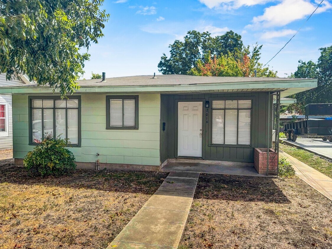
2016 W Olmos Dr Unit 2016
San Antonio, TX 78201
Favorites
210-930-4440
-
Bedrooms
2
-
Bathrooms
1
-
Square Feet
791 sq ft
-
Available
Available Now
2016 W Olmos Dr Unit 2016

Favorites
Contact
- Listed by GSG Property Management | GSG Property Management
- Phone Number
- Contact
Location
Get Directions
Los Angeles Heights-Keystone is located about four miles northwest of Downtown San Antonio and is bordered on its eastern edge by I-10, making this neighborhood a great option for commuters. This densely-populated neighborhood offers wooded residential areas filled with bungalows and ranch-style homes. The commercial zones include West Avenue and Fredericksburg Road. Here, you’ll find a variety of shops and restaurants, including local favorites like De Wese’s Tip Top Café and Original Donut Shop.
Residents of Los Angeles Heights-Keystone enjoy easy access to nearby colleges, including San Antonio College, St. Mary’s University, and Our Lady of the Lake University. The neighborhood is also convenient to Ingram Park Mall, the San Antonio Aquarium, University Hospital, the San Antonio Zoo, and North Star Mall.
Learn more about living in Los Angeles Heights-Keystone
Education
| Colleges & Universities | Distance | ||
|---|---|---|---|
| Colleges & Universities | Distance | ||
| Drive: | 6 min | 3.6 mi | |
| Drive: | 9 min | 4.3 mi | |
| Drive: | 9 min | 4.3 mi | |
| Drive: | 10 min | 4.7 mi |
2016 W Olmos Dr Unit 2016 is within 6 minutes or 3.6 miles from San Antonio College. It is also near St. Mary's University and Our Lady of the Lake Univ..
Getting Around
 What do Walkability, Transit, Drivability, and Bikeability mean?
Walkability measures the walking distance to day-to-day needs.
Transit measures access to public transportation.
Drivability measures congestion, parking availability, and access to major roads.
Bikeability measures the suitability for cycling.
How It Works
What do Walkability, Transit, Drivability, and Bikeability mean?
Walkability measures the walking distance to day-to-day needs.
Transit measures access to public transportation.
Drivability measures congestion, parking availability, and access to major roads.
Bikeability measures the suitability for cycling.
How It Works
Moderately Walkable
Walkability
70
/ 100
Some Public Transit
Transit
40
/ 100
Exceptionally Drivable
Drivability
100
/ 100
Fairly Bikeable
Bikeability
40
/ 100
Scores provided by
Active
Soundscore™
74
/ 100
Traffic
ActiveAirport
CalmBusinesses
ActiveScores provided by
HowLoud What is a Sound Score Rating? A Sound Score Rating aggregates noise caused by vehicle traffic, airplane traffic and local sources. How It WorksYou May Also Like
Similar Rentals Nearby


What Are Walk Score®, Transit Score®, and Bike Score® Ratings?
Walk Score® measures the walkability of any address. Transit Score® measures access to public transit. Bike Score® measures the bikeability of any address.
What is a Sound Score Rating?
A Sound Score Rating aggregates noise caused by vehicle traffic, airplane traffic and local sources.
2016 W Olmos Dr
San Antonio, TX 78201