1 / 9


| Beds | Baths | Average SF |
|---|---|---|
| 2 Bedrooms 2 Bedrooms 2 Br | 1 Bath 1 Bath 1 Ba | — |
The fees below are based on community-supplied data and may exclude additional fees and utilities.
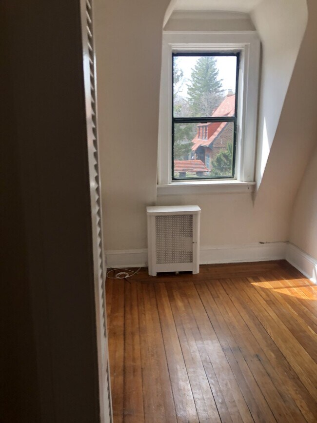
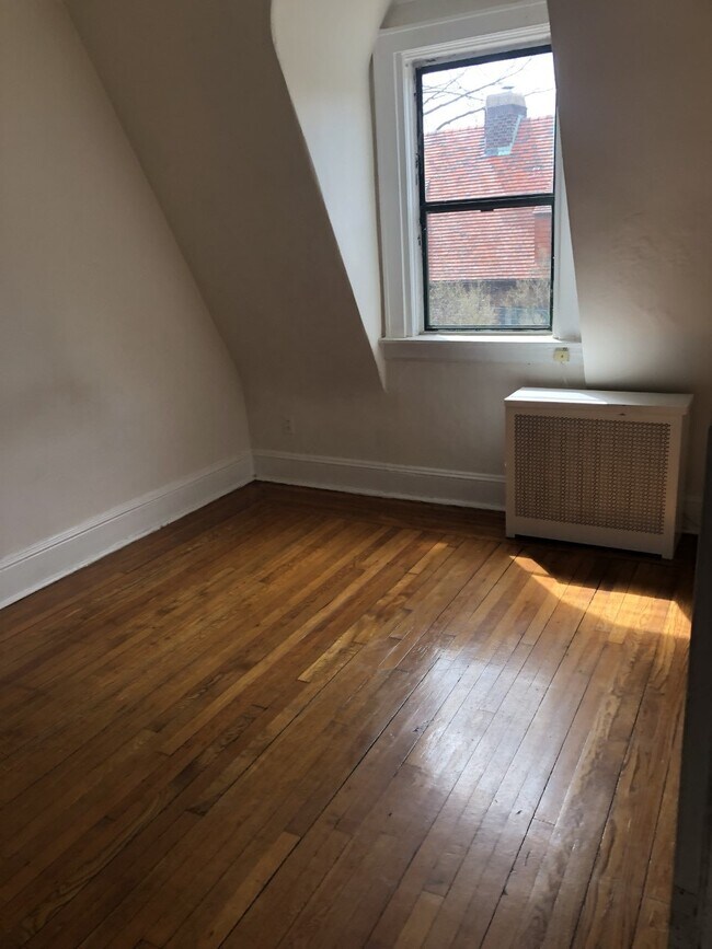
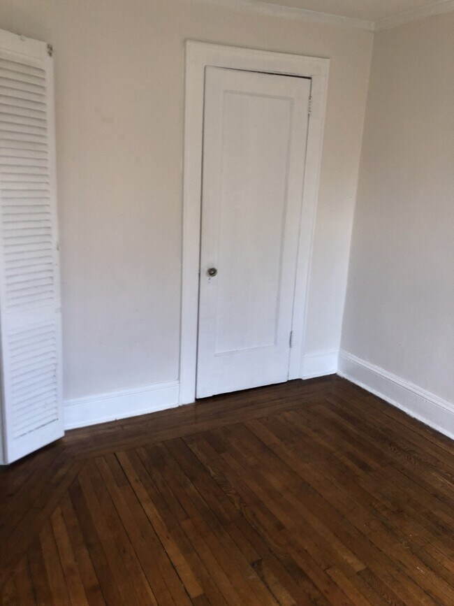
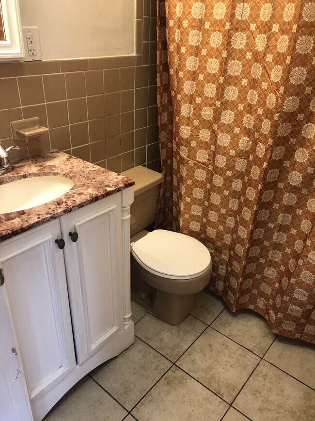
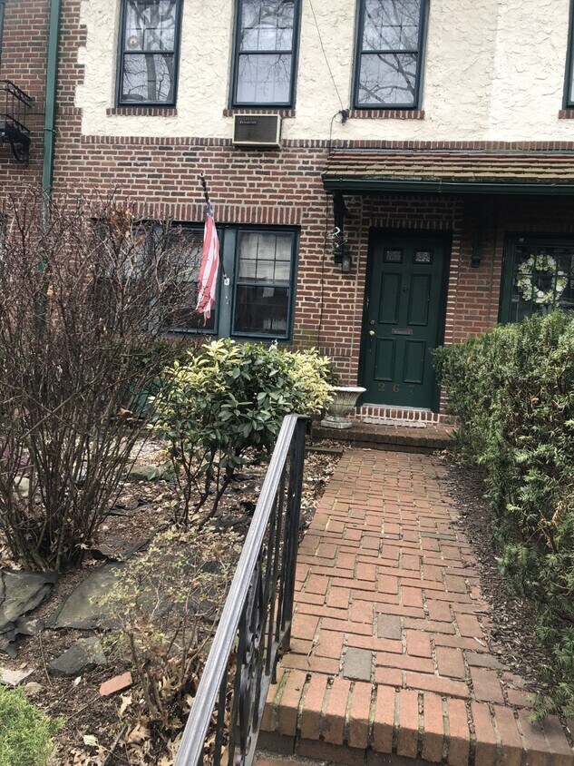
Charming, third-floor unit in two-family townhouse. Two bedrooms, one bath; living room has wood-burning fireplace. Centrally located in exclusive Forest Hills Gardens. Private street parking with sticker. Close to all--Express subway (E, F, M, R) and buses, LIRR station, Austin Street shopping and dining and the famed West Side Tennis Club and Stadium.
2-67 Burns St is a townhome located in Queens County and the 11375 ZIP Code. This area is served by the New York City Geographic District #28 attendance zone.
Live like royalty in the borough that has some of the best cuisine, entertainment, and attractions in the city. Queens is a sprawling New York City borough, covering 109 square miles — the most land of all the city’s boroughs.
If you’re looking for a borough where you can get a little more bang for your buck, Queens has a much lower cost of living compared to Manhattan — by more than 56 percent. Groceries, entertainment, and even transportation costs are lower in Queens, making it an attractive borough for those who want to enjoy everything New York City has to offer, but at a lower price tag.
Like most of NYC, getting around Queens is a breeze. There are more than 80 rail stations, and the borough is extremely walkable and bike-friendly. It’s also home to John F. Kennedy International Airport and LaGuardia Airport. For those with cars, Queens provides easy access to I-678, I-495, and I-295.
When you live in Queens, you aren’t in a concrete jungle.
Learn more about living in Queens| Beds | Average Size | Lowest | Typical | Premium |
|---|---|---|---|---|
| Studio Studio Studio | 525-526 Sq Ft | $1,072 | $2,533 | $6,422 |
| 1 Bed 1 Bed 1 Bed | 737 Sq Ft | $1,245 | $2,938 | $9,750 |
| 2 Beds 2 Beds 2 Beds | 1166-1167 Sq Ft | $999 | $3,984 | $19,703 |
| 3 Beds 3 Beds 3 Beds | 1869-1870 Sq Ft | $999 | $6,066 | $18,635 |
| 4 Beds 4 Beds 4 Beds | 1469-1481 Sq Ft | $1,019 | $3,488 | $14,999 |
| Colleges & Universities | Distance | ||
|---|---|---|---|
| Colleges & Universities | Distance | ||
| Drive: | 8 min | 3.1 mi | |
| Drive: | 9 min | 3.5 mi | |
| Drive: | 7 min | 3.6 mi | |
| Drive: | 13 min | 6.5 mi |


Transportation options available in Queens include 75 Avenue, located 0.7 mile from 2-67 Burns St. 2-67 Burns St is near LaGuardia, located 7.0 miles or 14 minutes away, and John F Kennedy International, located 7.4 miles or 12 minutes away.
| Transit / Subway | Distance | ||
|---|---|---|---|
| Transit / Subway | Distance | ||
|
|
Walk: | 13 min | 0.7 mi |
|
|
Walk: | 15 min | 0.8 mi |
|
|
Drive: | 3 min | 1.3 mi |
|
|
Drive: | 5 min | 1.4 mi |
|
|
Drive: | 3 min | 1.4 mi |
| Commuter Rail | Distance | ||
|---|---|---|---|
| Commuter Rail | Distance | ||
|
|
Walk: | 13 min | 0.7 mi |
|
|
Walk: | 14 min | 0.8 mi |
|
|
Drive: | 6 min | 2.4 mi |
|
|
Drive: | 10 min | 4.2 mi |
|
|
Drive: | 10 min | 4.4 mi |
| Airports | Distance | ||
|---|---|---|---|
| Airports | Distance | ||
|
LaGuardia
|
Drive: | 14 min | 7.0 mi |
|
John F Kennedy International
|
Drive: | 12 min | 7.4 mi |
Time and distance from 2-67 Burns St.
| Shopping Centers | Distance | ||
|---|---|---|---|
| Shopping Centers | Distance | ||
| Drive: | 4 min | 1.3 mi | |
| Drive: | 4 min | 1.4 mi | |
| Drive: | 4 min | 1.6 mi |
| Parks and Recreation | Distance | ||
|---|---|---|---|
| Parks and Recreation | Distance | ||
|
Forest Park - Brooklyn-Queens
|
Drive: | 5 min | 2.1 mi |
|
Queens Zoo
|
Drive: | 9 min | 2.6 mi |
|
Rufus King Park
|
Drive: | 7 min | 2.7 mi |
|
Juniper Valley Park
|
Drive: | 8 min | 3.1 mi |
|
Flushing Meadows Corona Park
|
Drive: | 9 min | 3.9 mi |
| Hospitals | Distance | ||
|---|---|---|---|
| Hospitals | Distance | ||
| Drive: | 4 min | 1.9 mi | |
| Drive: | 6 min | 2.5 mi | |
| Drive: | 12 min | 3.7 mi |
| Military Bases | Distance | ||
|---|---|---|---|
| Military Bases | Distance | ||
| Drive: | 17 min | 9.4 mi | |
| Drive: | 32 min | 14.1 mi |


What Are Walk Score®, Transit Score®, and Bike Score® Ratings?
Walk Score® measures the walkability of any address. Transit Score® measures access to public transit. Bike Score® measures the bikeability of any address.
What is a Sound Score Rating?
A Sound Score Rating aggregates noise caused by vehicle traffic, airplane traffic and local sources
2-67 Burns St
Queens, NY 11375

